Log in
All resources
Create a design
27,441 Free Images of Maps
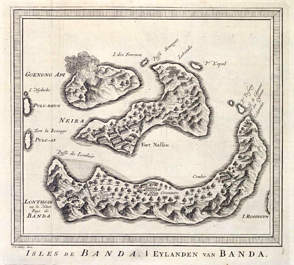
maps by jakob van der schley
jakob van der schley
engraving on paper
koninklijke bibliotheek
bibliothèque nationale de france
maps of paris from the david rumsey historical map collection
atlas map
maps by willem and johannes blaeu
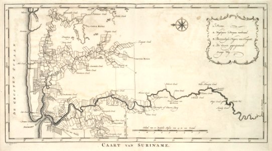
maps of the west-indische compagnie
atlas des anciens plans de paris by imprimerie nationale, 1900 from the david rumsey historical map collection
midden-delfland in the 18th century
maps of midden-delfland
19th-century solar eclipse maps
solar eclipse of 1900 may 28
18th-century maps of tunisia
gulf of tunis
illuminated manuscripts in the museo correr
pietro vesconte
civitates orbis terrarvm, liber primvs (1577)
maps of munich by braun & hogenberg
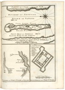
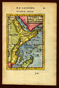
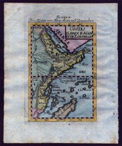
maps of the senegal river
1747 maps of africa
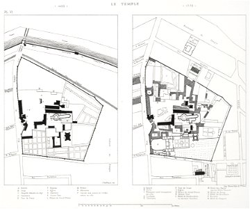
sixth map of paris from traité de la police
maps of paris from paris musées
maps of ingolstadt by braun & hogenberg
maps of munich by braun & hogenberg
maps by willem and johannes blaeu
old maps of deventer
maps of the golden horde
fra mauro map details
maps by willem and johannes blaeu
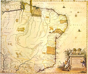
maps of captaincies of brazil
carte de la mer mediterranée (1764) by roux
eran laor cartographic collection
vue (en relief et à vol d'oiseau) de paris by jacques-alphonse testard
maps of paris from bibliothèque nationale de france
maps by jodocus hondius
maps by petrus bertius
old maps of manhattan, new york city
1851 maps
19th-century maps of seine-et-marne
maps of the forest of fontainebleau
regierungsbezirk hildesheim
copper engravings
cornell: persuasive cartography: the pj mode collection
works by james montgomery flagg
maps in the library of congress
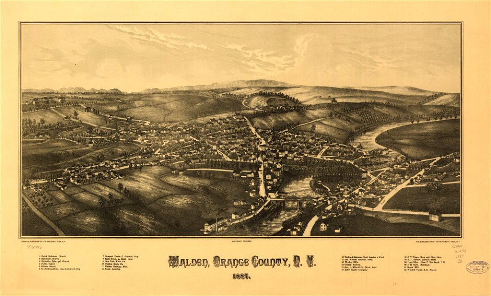
1887 maps of new york (state)
maps showing 19th-century history
arctic expeditions
maps from the mechanical curator collection available to georeference
maps from the mechanical curator collection
voyage dans la russie méridionale et la crimée (1840-1842) par anatolii nikolaevich demidov
1853 maps of russia
maps of battles
1862 maps
maps of the electorate of cologne
coats of arms on maps
old maps of brussels
jacobus harrewijn
maps of the west-indische compagnie
1770 maps
maps of the west-indische compagnie
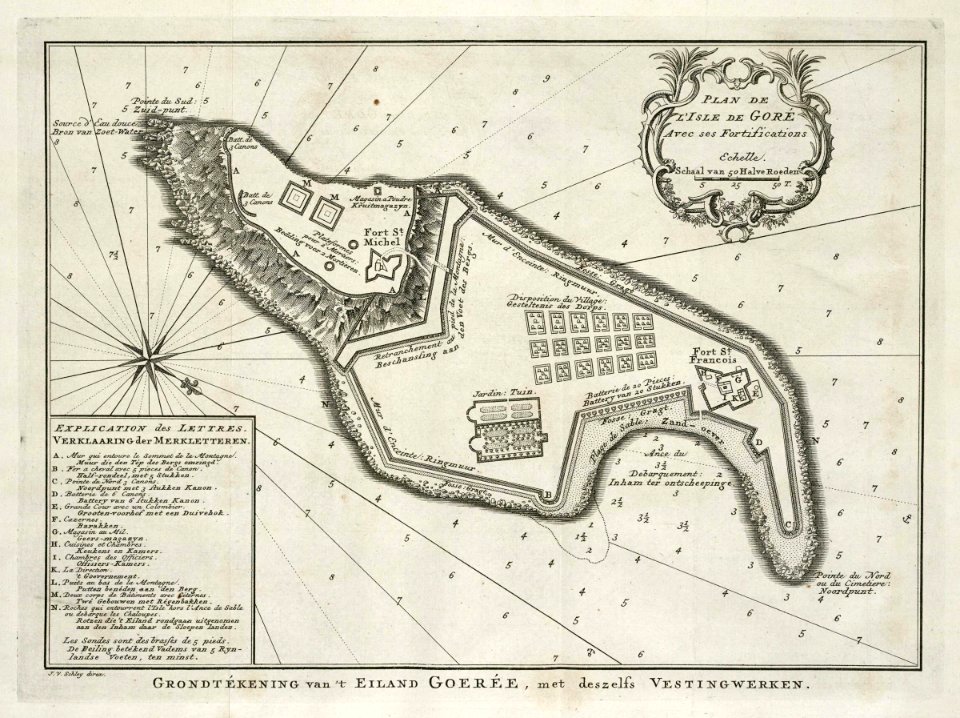
old maps of gorée
maps of paris from the david rumsey historical map collection
maps of paris by caspar merian
curt teich postcard archives
map postcards
victor levasseur - maps of the world
1850s maps of oceania
maps of the world without antarctica
1820s maps of the world
latin-language maps
1911 maps
17th-century maps of the eastern mediterranean
1690s maps of turkey
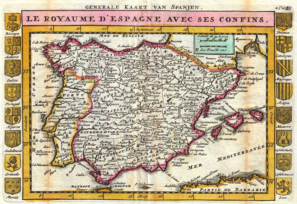
maps of spain by tomas lopez
1780 maps of spain
portsmouth earthworks maps
squier and davis images
old maps of seville
1788 maps of spain
cornelius aurelius world map
1916 maps
book illustrations by robida
1879 illustrations
gemeente atlas van nederland - south holland
maps of krimpen aan den ijssel
maps from the earth and its inhabitants, vol. v
maps of skaftafell
atlas maior, vol 10 (spain and africa) - joan blaeu, 1667 - bl 114.h(star).10
1667 maps
atlas maior, vol 5 (england) - joan blaeu, 1667 - bl 114.h(star).5
old county maps of caernarfonshire
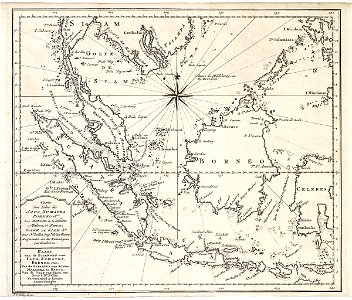
old maps of the dutch east india company - malaysia
maps of the dutch east india company - indonesia
maps of the dutch east india company - indonesia
1750s maps of indonesia
old maps of the dutch east india company
1750 maps
maps of the dutch east india company - indonesia
18th-century maps of sumatra
atlas sive cosmographicae (gerardus mercator, 1596)
16th-century maps of colombia
old maps of 's-hertogenbosch
empel en meerwijk
maps of the west-indische compagnie
old maps of dutch brazil
dutch baroque architecture
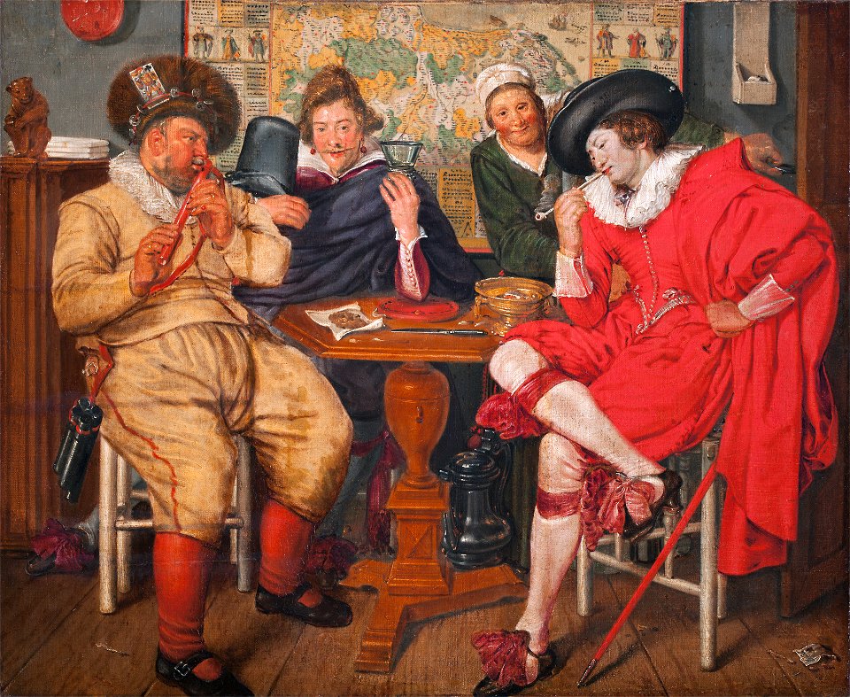
willem pietersz. buytewech
maps by jodocus hondius
1628 maps
lithographs of paris
floor plans of paris
maps of the ottoman empire by mercator-hondius
map
1780s maps of south america
maps in the british museum
maps of landkreis elbe-elster
old maps of saxony
giovanni camocio
martino rota
maps by jacob van deventer
old maps of holland
guide joanne espagne et portugal-1915
1915 maps
map of bruges by marcus gheeraerts (i)
drawings in the groeningemuseum
maps in the british museum
maps by thomas kitchin
lawrence h. slaughter collection of english maps, charts, globes, books and atlases
1640s maps of the americas
maps of brest, france by antoine aveline
17th-century maps of brest
sanborn maps of manhattan published in 1905
irt sixth avenue line stations
maps of the senegal river
1750 maps
isaiah thomas (publisher)
1812 maps
zehn karten und ansichten den schlachtfelden des amerikanischen unabhängigkeitskreiges in den staaten pennsylvanien und new york
maps in the library of congress
counties of england in art
1590 engravings
maps by willem and johannes blaeu
old maps of gouda
portrait paintings by andrea appiani
neoclassicism
1590s maps of the levant
ptolemy's 4th asian map
maps of cairo by braun & hogenberg
great sphinx of giza in art
collections of generallandesarchiv karlsruhe
hagenbach
charles c. wood taylor
carlos wood
maps by jakob van der schley
old maps of kollam
maps of paris from bibliothèque nationale de france
maps of paris by jean lattré
atlas des anciens plans de paris by imprimerie nationale, 1900 from the david rumsey historical map collection
maps of paris from the david rumsey historical map collection
atlas des anciens plans de paris by imprimerie nationale, 1900 from the david rumsey historical map collection
maps of paris from the david rumsey historical map collection
atlas des anciens plans de paris by imprimerie nationale, 1900 from the david rumsey historical map collection
maps of paris from the david rumsey historical map collection
atlas des anciens plans de paris by imprimerie nationale, 1900 from the david rumsey historical map collection
maps of paris from the david rumsey historical map collection
1823 maps of new york city
circular maps
old maps of the eastern mediterranean
catalan atlas
1740s maps of the iberian peninsula
daniel de la feuille
alexis-hubert jaillot
henri sengre
bologna ptolemy
1477 maps
old maps of western pomerania
coats of arms on maps
guide joanne espagne et portugal-1906
french-language maps of spain
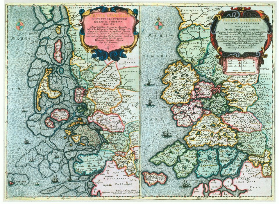
maps of schleswig-holstein in the atlas maior
maps by johannes mejer
maps from the mechanical curator collection available to georeference
maps from the mechanical curator collection
maps from the earth and its inhabitants, vol. xi
africa in the 1890s
algeria in the 1880s
old maps of algeria
istanbul in the 1600s
matteo florimi
old maps of the canton of valais
1693 maps
1898 covers of puck magazine
drawings of scissors
maps made in the 17th century
1640s maps of palestine
maps by pieter van der keere
details of old maps
guide joanne normandie-1912
1912 maps of france
old maps of zanzibar
zanzibar in art
old maps of zanzibar
zanzibar in art
island of california on world maps
1680s maps of the world
maps of the west-indische compagnie
1770 maps
2101 - 2200 of 27,441
Next page
/ 275