Log in
All resources
Create a design
27,441 Free Images of Maps
maps from university of amsterdam special collections
copperplate print
special collections of the university of amsterdam
eran laor cartographic collection
bologna ptolemy
1477 maps
maps by jakob van der schley
jakob van der schley
gemeente atlas van nederland - south holland
1860s maps of south holland
siege of lingen 1605
maps of lingen (ems)
gemeente atlas van nederland - south holland
maps of 's-gravenzande
gemeente atlas van nederland - south holland
1860s maps of south holland
collections of the kriminalmuseum rothenburg ob der tauber
old maps of rothenburg ob der tauber
maps from university of amsterdam special collections
atlas der neederlanden
maps from university of amsterdam special collections
atlas der neederlanden
maps from university of amsterdam special collections
atlas der neederlanden
17th-century maps of the malay archipelago
archipelagus orientalis
19th-century maps of the black sea
1870s maps of the caucasus
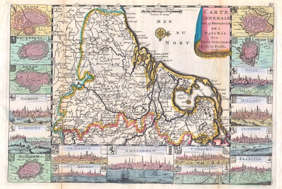
1710s maps of the netherlands
18th-century maps of belgium
maps from the earth and its inhabitants, vol. xi
1891 maps of africa
upper guelders
atlas van loon
fra mauro map details
maps of colchis
maps from the earth and its inhabitants, vol. xi
french west africa
engravings of topographia braunschweig lüneburg
baroque
1529 maps of iran
1529 maps
carte de la mer mediterranée (1764) by roux
eran laor cartographic collection
carte de la mer mediterranée (1764) by roux
eran laor cartographic collection
carte de la mer mediterranée (1764) by roux
eran laor cartographic collection
18th-century maps of western europe
jean étienne guettard
maps from the mechanical curator collection
through the subarctic forest (1896) by pike
18th-century maps of central america
1760s maps of the caribbean
maps by john cary
1801 maps
old maps of cities in texas
1892 in waco, texas
gemeente atlas van nederland - south holland
maps of zuidland
plan routier de la ville et faubourg de paris by jean lattré
maps of paris from bibliothèque nationale de france
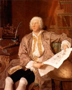
18th-century portrait paintings in tate britain
male portrait paintings by francis cotes
1470s maps of the world
latin-language maps
1470s maps of africa
1477 maps
old maps of westerwolde
old maps of drenthe
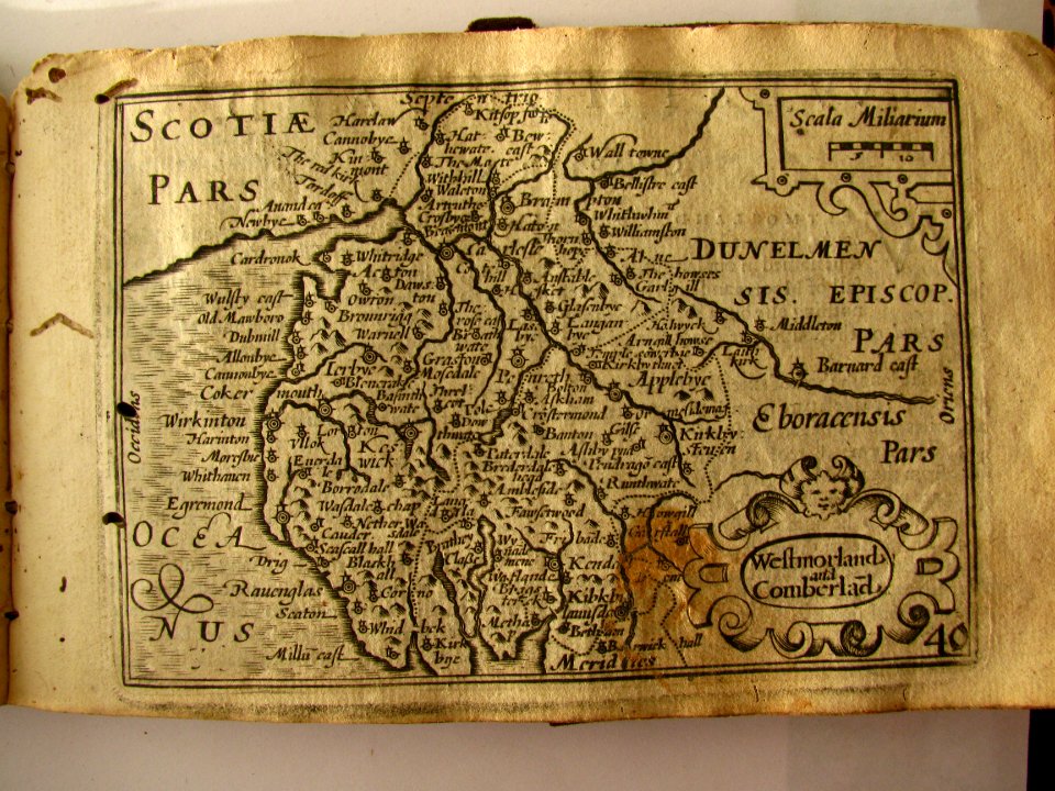
maps of the history of scotland
wars of the united kingdom
maps in the rijksmuseum amsterdam
published by frans buffa & zonen
maps in the rijksmuseum amsterdam
published by frans buffa & zonen
victor levasseur - maps of france
1847 maps
maps in the museo correr
crema in art
montgomery, alabama in the 1880s
maps in the library of congress
hoogheemraadschap rijnland map, 2nd edition, 1687
old maps of haarlem
maps of paris from bibliothèque nationale de france
sheet 10 of the turgot map of paris
maps in the library of congress
old maps of anniston, alabama
eric (xii) of sweden (erik magnusson)
maps of the history of sweden
maps of the dutch east india company - thailand
old maps of ayutthaya
maps of the dutch east india company - indonesia
maps by jakob van der schley
gemeente atlas van nederland - south holland
1860s maps of south holland
the odyssey (butler)
maps of the odyssey
jan karel donatus van beecq
hernán cortés
maps of spain by tomas lopez
1762 maps of spain
miniature speed atlas (1627) pieter van den keere
county maps of england by john speed
miniature speed atlas (1627) pieter van den keere
county maps of england by john speed
old maps of cambridge
1690 maps of england
maps from the earth and its inhabitants, vol. vii
old maps of jiangsu
maps from the earth and its inhabitants, vol. vii
agricultural maps of china
old maps of trinidad and tobago
animals on maps
media from the national library of finland
classicism
1470s maps of the world
latin-language maps
hendrik van langren map of south asia
1590s maps of cyprus
maps of paris from the david rumsey historical map collection
baroque
description de l'universe
1680s maps of england
maps of paris from the david rumsey historical map collection
baroque
admiralty charts region b: england wales ireland english channel southern north sea
admiralty charts 1401-1600
map of the circle of the rhineland by sanson
1670s maps of hesse
korte beschryvinghe (1686)
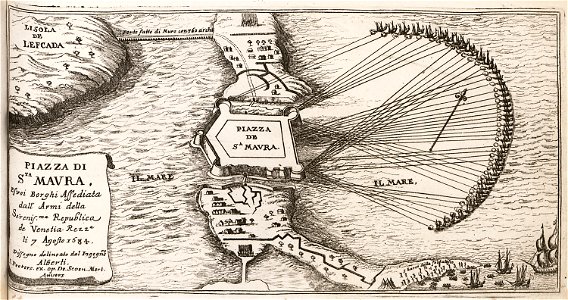
old maps of santa maura
hendrik van langren map of south asia
1596 maps of asia
18th-century engravings
viborg maps
maps in the library of congress
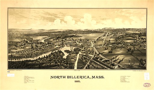
1887 maps of massachusetts
maps of the west-indische compagnie
1757 maps
old maps of san antonio, texas
maps by henry wellge
eran laor cartographic collection
french-language maps
fra mauro map by sector
vlachs
count carl gustaf tessin (nm 5535)
rococo
west seram regency
johannes nessel
maps of the duchy of limburg
1645 maps of belgium
18th-century maps of gibraltar
daniel de la feuille
glaciers and glaciation (1910)
maps of glacier bay
ptolemy's 3rd african map
1477 maps
robert hermann schomburgk
maps by john arrowsmith
maps of plymouth, massachusetts
william wood
maps of hamburg by braun & hogenberg
maps of hamburg-altstadt
province of frosinone
papal states
19th-century satirical maps
1882 maps of europe
eran laor cartographic collection
john cary
maps of ingolstadt by braun & hogenberg
maps of munich by braun & hogenberg
gemeente atlas van nederland - utrecht
ruwiel
19th-century maps of the black sea
1870s maps of the caucasus
atlas der neederlanden deel ii: holland 1. zuid-holland
maps from university of amsterdam special collections
maps from university of amsterdam special collections
atlas der neederlanden
latin-language maps
bologna ptolemy
hendrik van langren map of south asia
renaissance
media from the national library of finland
classicism
maps by willem and johannes blaeu
old maps of culemborg
camps topographiques de la campagne de mdcclvii, en westphalie
bornum (hannover)
charts and maps of the royal museums greenwich
1777 maps
john rocque's 1746 map of london
details of old maps of london
1720s maps of the caribbean
maps by pieter mortier
19th-century maps of the black sea
g. h. swanston
maps from the earth and its inhabitants, vol. iv
maps of river trent
maps, prints and photographs in royal danish library
old maps of kiel
topographical paintings in the amsterdam museum
jan micker
academic art,rococo revival
joint issues 2011
1480s maps of constantinople
romanticism
guide joanne espagne et portugal-1915
1915 maps
2001 - 2100 of 27,441
Next page
/ 275