Log in
All resources
Create a design
Blaeu1640, Joan Blaeu, 1640
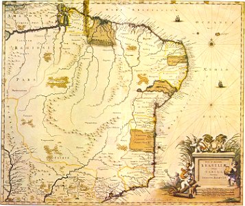
Nova et accurata brasiliae totius tabula made in 1640 by joan blaeu. The captaincies on the brazilian coast are shown, in an organization different from that established in the first half of the 16th century. Date: 1640.
Download
Edit image
Published by:
Creazilla
Author:
Joan Blaeu
Source:
commons.wikimedia.org
Loading...
0 downloads
Print it
Copy image
Loading...
maps by willem and johannes blaeu
maps of captaincies of brazil
1640 maps of brazil
maps of old administrative divisions of brazil
1640 in brazil
captaincy of paraíba
joan blaeu
MORE LIKE THIS