Log in
All resources
Create a design
353 Free Artworks of 1770 Maps
bibliothèque nationale de france
maps of the west-indische compagnie
french-language maps
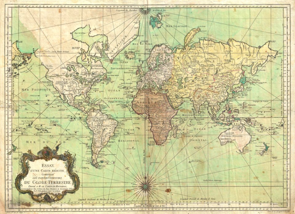
1770s maps of the world
geography
maps in portrait paintings
carte de la moldavie pour servir à l'histoire militaire de la guerre entre les russes et les turcs - levés par l'etat-major sous la direction de f.g. de bawz... echelle de 10 heures de moldavie, 50... - btv1b53100577d
leonard schenk jansz.
oil on canvas
elementarwerk
william i of the netherlands (joseph paelinck - rijksmuseum amsterdam)
1819 portrait paintings of men
kaart van het baljuwschap kennemerland
maps in the rijksmuseum amsterdam
elementarwerk
1774 maps
1770 maps
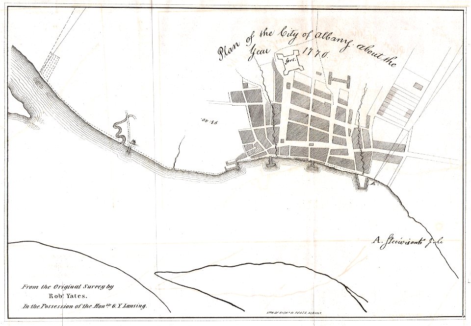
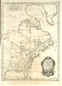
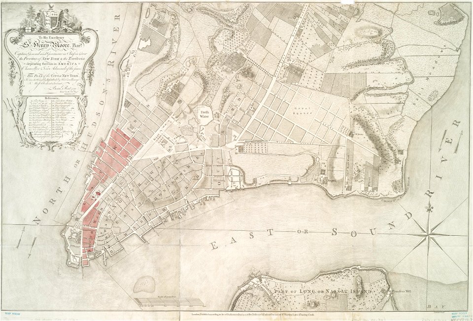
new york
french-language maps
1770 maps
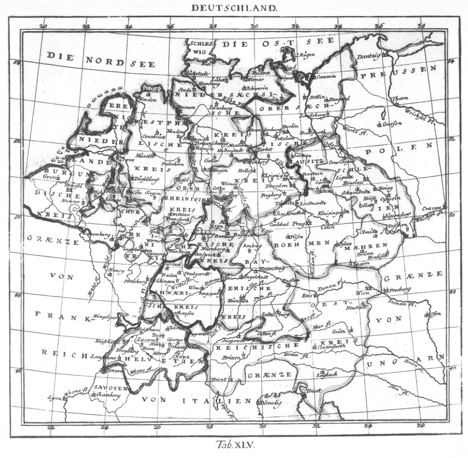
german-language maps
1770 maps
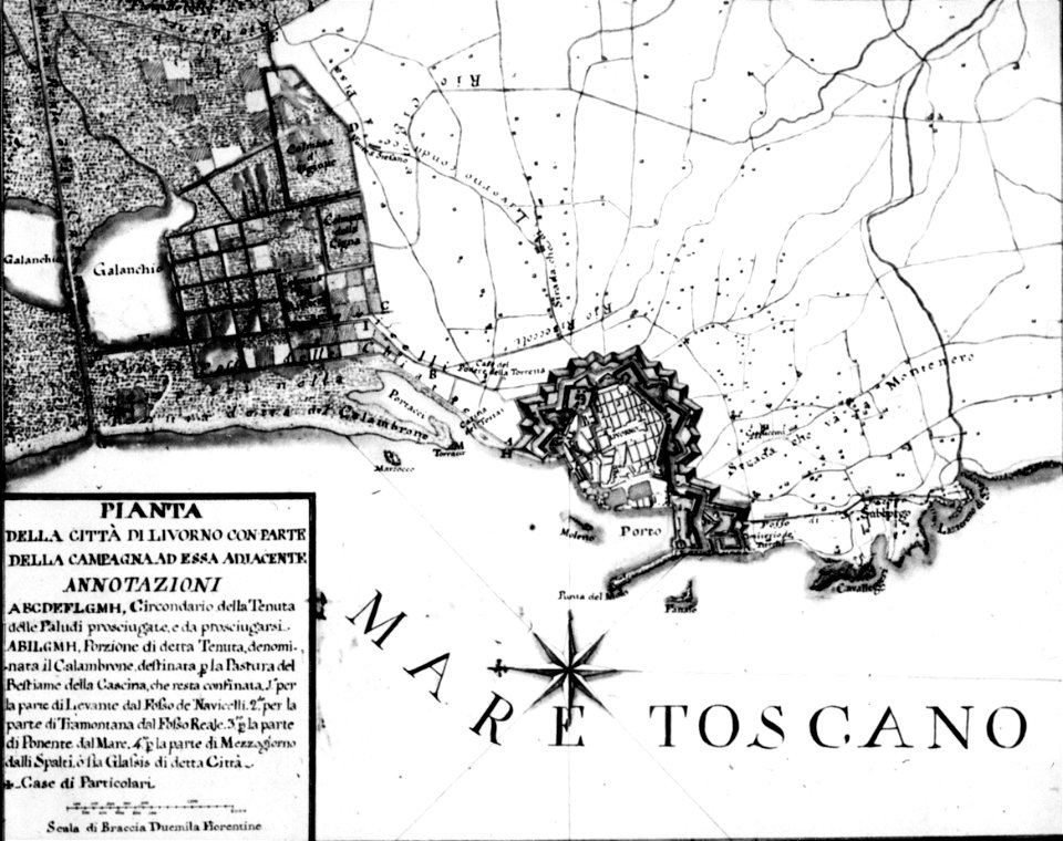
old maps of livorno
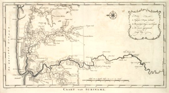
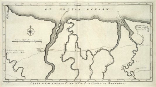
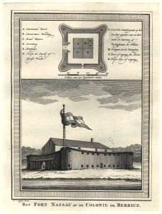
old maps of suriname
1770
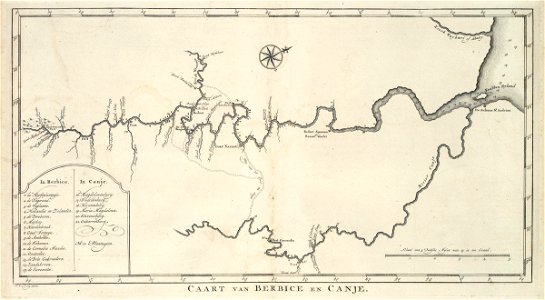
maps of the west-indische compagnie
1770
maps of the west-indische compagnie
1770
maps of the west-indische compagnie
1770
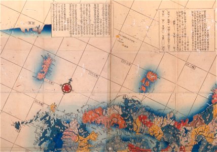
old maps of japan
1770s maps
maps of the west-indische compagnie
1770s
old maps of suriname
1770
old maps of south africa
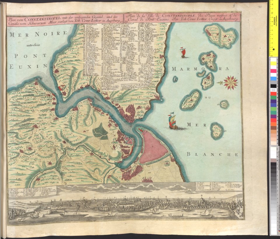
tobias conrad lotter
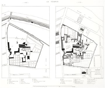
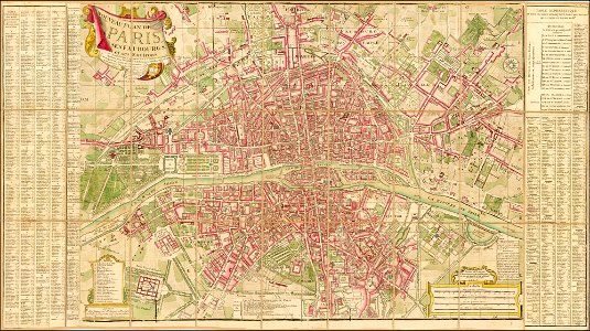
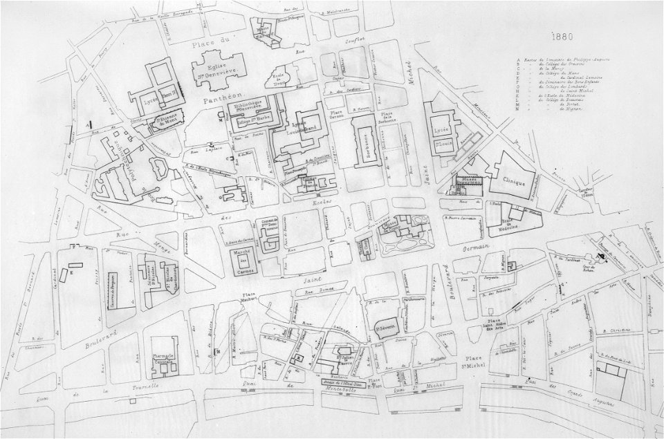
lithographs of paris
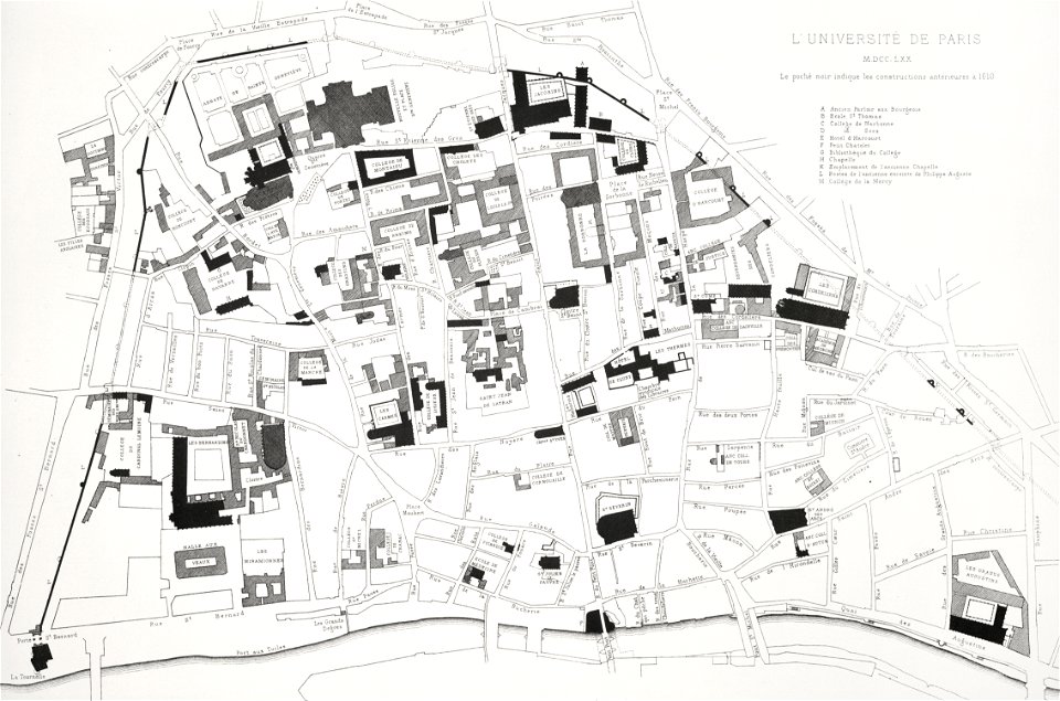
université de paris
italian-language maps
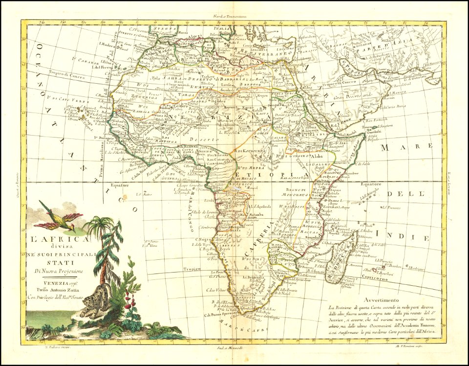
maps by antonio zatta
vienna
glacis
lithographs of paris
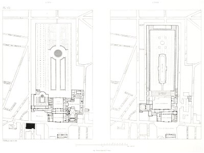
floor plans of paris
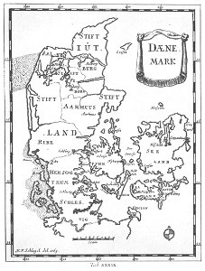
1770s maps of denmark
elementarwerk
1770s maps of the world
elementarwerk
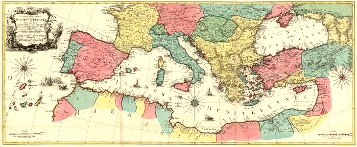
maps by jacques-nicolas bellin
jacques-nicolas bellin
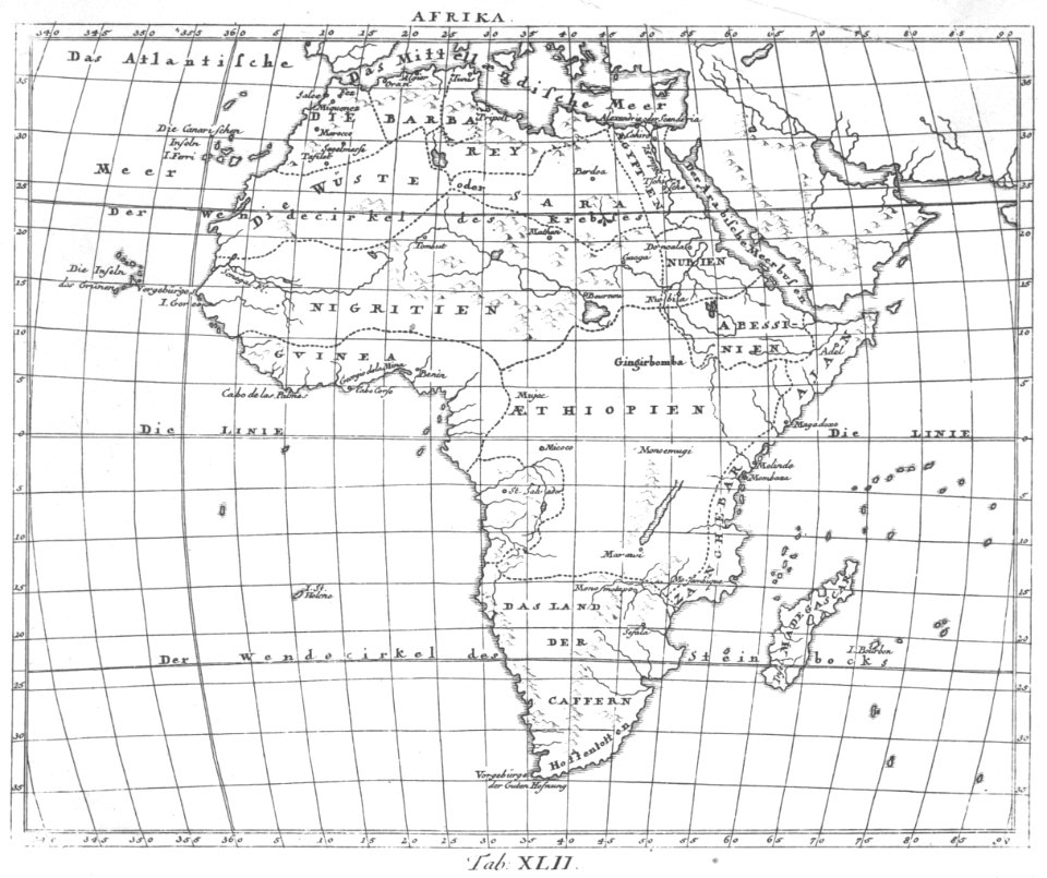
1770s maps of africa
elementarwerk
maps of the west-indische compagnie
1770s
prints by giovanni battista piranesi
old maps of rome
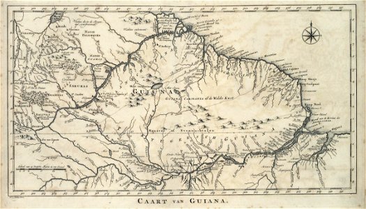
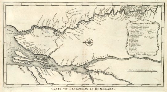
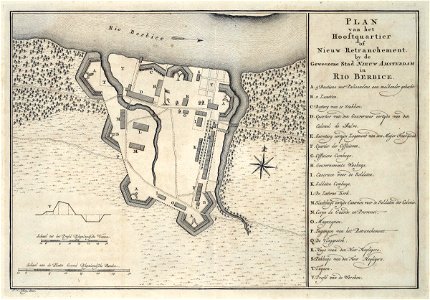
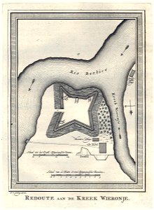
guyana
1770
maps of the west-indische compagnie
1770
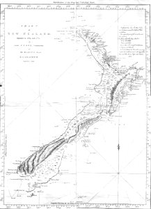
new zealand
geography
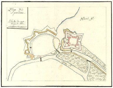
city walls of berlin-spandau
moll's map collection
tobias conrad lotter
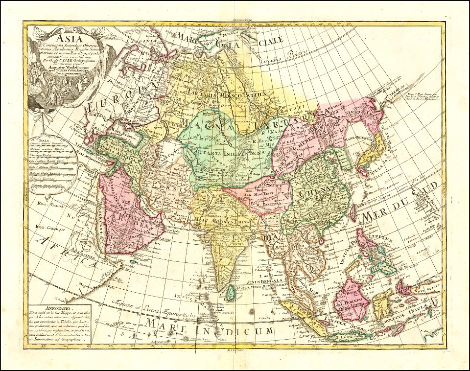
1770 maps of asia
fires in new york (state)
new york city
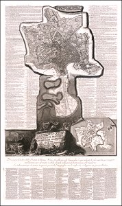
maps of paris from the barry lawrence ruderman antique maps inc.
18th-century maps of paris
lithographs of paris
université de paris
engravings of palais royal by theodor hoffbauer
lithographs of paris
west-indische compagnie
1770
lithographs of paris
floor plans of paris
prints from the peace palace library
1770s maps of the world
fort nieuw amsterdam
1770
historical maps of lüneburg
ludwig albrecht gebhardi
national museums of scotland
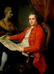
jean preudhomme
dutch 18th-century paintings in the rijksmuseum amsterdam
august christian hauck
18th-century portrait paintings of men, artist missing
portrait paintings in the albertina
dutch 18th-century paintings in the rijksmuseum amsterdam
august christian hauck
portrait paintings of sitting men with legs crossed
inkwells in art
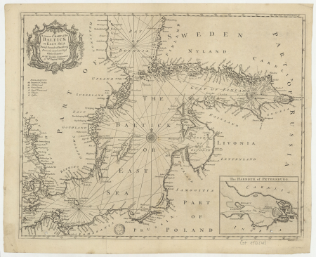
18th-century maps of the baltic sea
1770s maps of sweden
maps from university of amsterdam special collections
atlas der neederlanden
maps by guillaume delisle
philippe buache
collections of the national library of israel
louis-joseph mondhare
1774 maps of asia
baroque painting
1770s maps of portugal
1770 maps of spain
old maps of bouvet island
bouvet island
old maps of hannover
1757 in hannover
maps by thomas kitchin
1770 maps of africa
1770s maps of china
1779 maps
jakobsbergs gård, järfälla municipality
maps of järfälla
maps of spain by tomas lopez
1770 maps of spain
plan routier de la ville et faubourg de paris by jean lattré
maps of paris from bibliothèque nationale de france
18th-century maps of the black sea
maps by louis brion de la tour
plan routier de la ville et faubourg de paris by jean lattré
maps of paris from bibliothèque nationale de france
1770s maps of the caribbean
maps by thomas kitchin
maps of the basque autonomous community
1770 maps of spain
hofgartentor (würzburg)
maps of baroque gardens
maps of paris by louis-joseph mondhare
maps of paris from paris musées
maps of álava-araba
1770 maps of spain
maps by louis brion de la tour
french-language maps of europe
château de selles-sur-cher
carl johan cronstedt
geneviève brossard de beaulieu
jean-françois de la pérouse
zehn karten und ansichten den schlachtfelden des amerikanischen unabhängigkeitskreiges in den staaten pennsylvanien und new york
maps in the library of congress
1770s maps of baden-württemberg
bishopric of constance
1770s maps of algeria
maps by tomas lopez
maps of the world with orthographic projection
maps of the world without antarctica
rococo,neoclassicism
elementarwerk
old maps of the peloponnese
maps of the peloponnese
manual of the corporation of the city of new york (1858)
battle of long island
armillary spheres in art
1770s maps of the world
maps by jakob van der schley
old maps of southeast asia
maps from university of amsterdam special collections
atlas der neederlanden
1770s maps of the world
maps by tomas lopez
1770s maps of the americas
maps by tomas lopez
1770s maps of the americas
maps by tomas lopez
confluence of the huai and yellow rivers (xu yang)
xu yang
drawings by jan brandes in the rijksmuseum amsterdam
old maps of doetinchem
maps by louis brion de la tour
french-language maps
1770s maps of palestine
willem albert bachiene
eran laor cartographic collection
pierre françois tardieu
chinese paintings in the metropolitan museum of art
entering suzhou and the grand canal
carte de la moldavie pour servir à l'histoire militaire de la guerre entre les russes et les turcs - levés par l'etat-major sous la direction de f.g. de bawz... echelle de 10 heures de moldavie, 50... - btv1b53100577d
leonard schenk jansz.
carte de la moldavie pour servir à l'histoire militaire de la guerre entre les russes et les turcs - levés par l'etat-major sous la direction de f.g. de bawz... echelle de 10 heures de moldavie, 50... - btv1b53100577d
leonard schenk jansz.
carte de la moldavie pour servir à l'histoire militaire de la guerre entre les russes et les turcs - levés par l'etat-major sous la direction de f.g. de bawz... echelle de 10 heures de moldavie, 50... - btv1b53100577d
leonard schenk jansz.
carte de la moldavie pour servir à l'histoire militaire de la guerre entre les russes et les turcs - levés par l'etat-major sous la direction de f.g. de bawz... echelle de 10 heures de moldavie, 50... - btv1b53100577d
leonard schenk jansz.
carte de la moldavie pour servir à l'histoire militaire de la guerre entre les russes et les turcs - levés par l'etat-major sous la direction de f.g. de bawz... echelle de 10 heures de moldavie, 50... - btv1b53100577d
leonard schenk jansz.
carte de la moldavie pour servir à l'histoire militaire de la guerre entre les russes et les turcs - levés par l'etat-major sous la direction de f.g. de bawz... echelle de 10 heures de moldavie, 50... - btv1b53100577d
leonard schenk jansz.
bibliothèque nationale de france
maps by thomas kitchin
18th-century maps of kent
maps by thomas kitchin
illustration
maps
illustration
maps
illustration
maps
illustration
maps
eran laor cartographic collection
louis-joseph mondhare
illustration
maps
1 - 100 of 353
Next page
/ 4


![Map of the Islands of Japan and the peninsula of Korea: with the coasts of China from Peking to Canton / by N. Bellin; J. v. Schley direx, Jakob van der Schley, [1773]](https://cdn.creazilla.com/illustrations/10000188400/map-of-the-islands-of-japan-and-the-peninsula-of-korea-with-the-coasts-of-china-from-peking-to-canton-by-n-bellin-j-v-schley-direx-jakob-van-der-schley-1773-md.jpg)


![[Ten maps and views of the battlefields of the American Revolutionary War in the states of Pennsylvania and New York], 1777](https://cdn.creazilla.com/illustrations/10001017178/ten-maps-and-views-of-the-battlefields-of-the-american-revolutionary-war-in-the-states-of-pennsylvania-and-new-york-1777-md.jpg)


![Persian and Indian Ocean Coastline Map (1740), Jakob van der Schley, [1773]](https://cdn.creazilla.com/illustrations/10001597328/persian-and-indian-ocean-coastline-map-1740-jakob-van-der-schley-1773-sm.jpg)