Map of Sumatra, Java, Borneo and Malaysia, Jakob van der Schley, 1747

Map of Sumatra, Java, Borneo and Malaysia, Jakob van der Schley, 1747

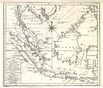
Map of sumatra, java, borneo and malaysia. Kaart van de eilanden van iava, sumatra, borneo, enz; van de straaten van sunda, malakka en banda; van de golf van siam, enz. Carte des isles de java, sumatra borneo &a. Les detroits de la sunde, malaca, et banca, golfe de siam &a. Date: 1747. Dimensions: height: 21.5 cm (8.4 in); width: 18 cm (7 in). Medium: engraving on paper. Collection: Koninklijke Bibliotheek. AMH-7928-KB Map of Sumatra, Java, Borneo and Malaysia
Edit image
Published by:
Creazilla
Author: Jacques-Nicolas BellinSource: commons.wikimedia.org

Loading...

1 download
Loading...
maps of the dutch east india company - indonesiaold maps of the dutch east india company - malaysia18th-century maps of the malay archipelagomaps by jakob van der schley1740s maps of indonesiaengraving on paperkoninklijke bibliotheekjakob van der schley

MORE LIKE THIS

Creazilla logo
Over 10 million free graphic resources for content creators and designers.
© 2018 - 2025 Creazilla
Our resourcesAll imagesPhotosDigital illustrationsClipartIconsPNG ImagesEmojisSilhouettesTraditional Art3D ModelsVectorsFontsColor namesColor palettesGradientsAudioAnimationVideosTemplates
InformationAbout CreazillaTerms of useTech teamPrivacy policyLicence Information
FeedbackContact Us