Log in
All resources
Create a design
256 Free Artworks of Old Maps Of Holland
gemeente atlas van nederland - north holland
1860s maps of north holland
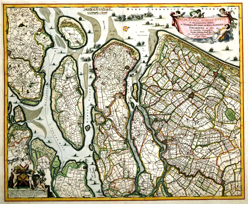
old maps of delfland
nicolaas samuel crucquius
gemeente atlas van nederland - south holland
1860s maps of south holland
old maps of the hague
maps from university of amsterdam special collections
atlas der neederlanden
atlas der neederlanden deel iii: holland 2. zuid-holland
overwintering on nova zembla by willem barentsz, 1596-1597
maps in the rijksmuseum amsterdam
overwintering on nova zembla by willem barentsz, 1596-1597
maps in the rijksmuseum amsterdam
kaart van het baljuwschap kennemerland
maps in the rijksmuseum amsterdam
maps of polders in north holland
old maps of north holland
old maps of south holland
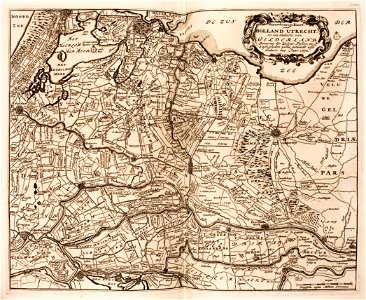
old maps of utrecht
pillars of hercules in heraldry
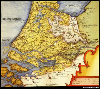
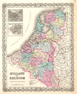
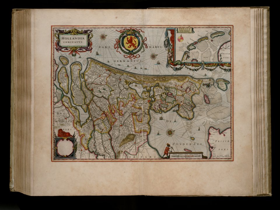
old maps of holland
amelisweerd
zuiderzee
prestedelijke bijlmermeer
old maps of amsterdam
maps in the rijksmuseum amsterdam
sloten (amsterdam)
amsterdam
ij
old maps of north holland
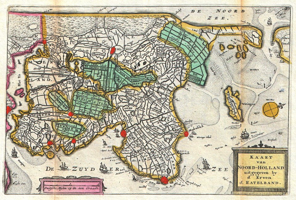
johannes ratelband
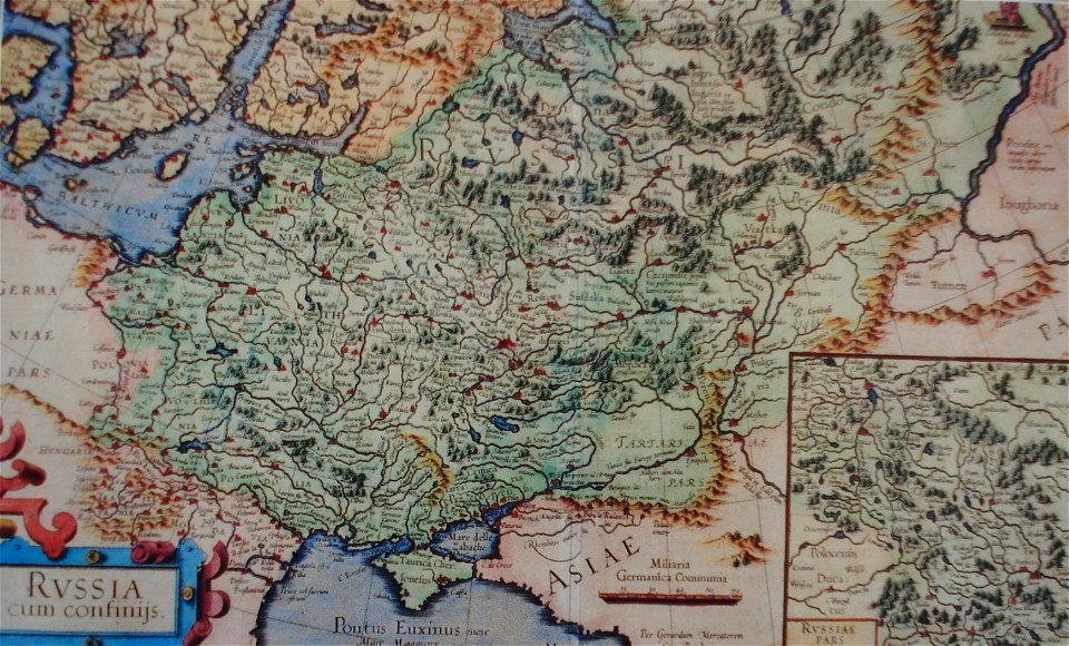
old maps of the tsardom of russia
red ruthenia
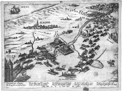
old maps of the hague
siege of leiden
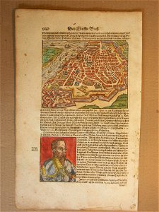
cosmographia (1600) by sebastian münster
old map
old maps of zeeland
old maps of holland
old maps of luxembourg
1855 maps
old maps of north brabant
old maps of south holland
maps with cartouches
old maps of zeeland
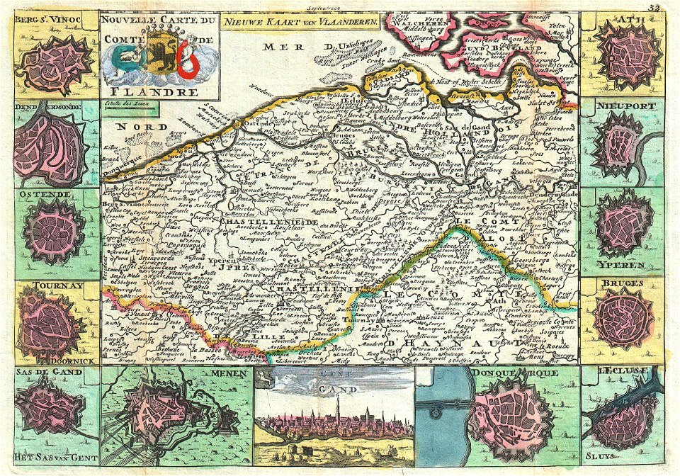
maps of the county of flanders
johannes ratelband
old maps of south holland
merwede
joan blaeu
old map
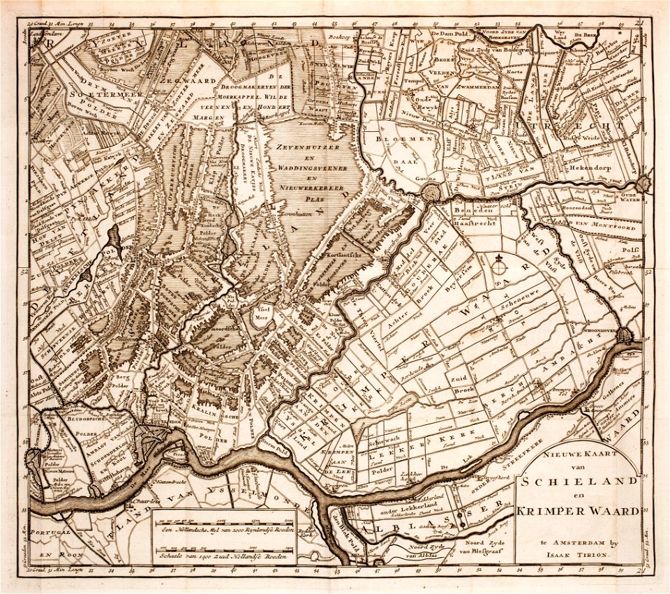
prints from isaak tirion hedendaegsche historie at the peace palace library
old maps of south holland
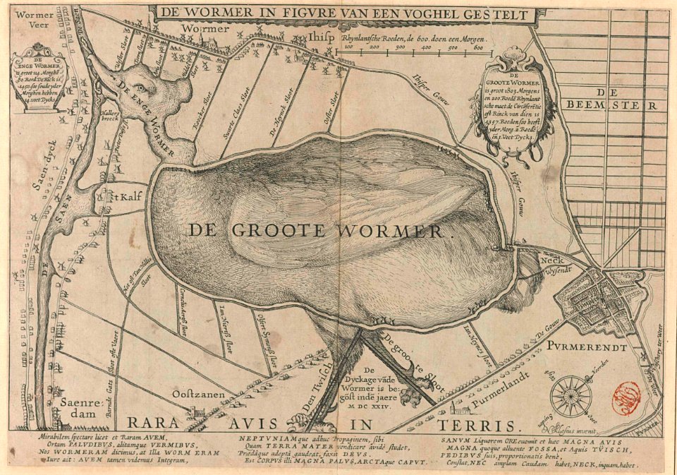
animal shape
purmerend
maps in the rijksmuseum amsterdam
old maps of haarlem
1760s maps of the netherlands
old maps of south holland
old maps of heemskerk
atlas maior
maps from university of amsterdam special collections
atlas der neederlanden
old maps of heemstede, north holland
old maps of haarlem
old maps of haarlem
thomas thomasz.
nicolaas samuel crucquius
old maps of delfland
gemeente atlas van nederland - north holland
maps of aalsmeer
maps of nieuwkoop
aarlanderveen
adriaan justus enschedé
old maps of haarlem
maps from university of amsterdam special collections
atlas der neederlanden
gemeente atlas van nederland - south holland
old maps of katwijk, south holland
nicolaas samuel crucquius
old maps of delfland
maps of polders in south holland
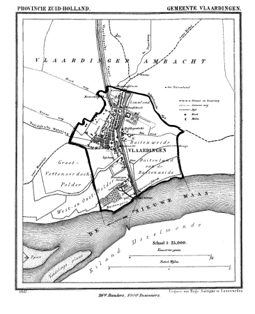
old maps of vlaardingen
old maps of zeeland
old maps of holland
maps by willem and johannes blaeu
atlas van loon
willem cornelis van baarsel
old maps of haarlem
maps from university of amsterdam special collections
atlas der neederlanden
windmills in hoorn, north holland
post mills in north holland
gemeente atlas van nederland - south holland
1860s maps of south holland
gemeente atlas van nederland - south holland
maps of wateringen
maps from university of amsterdam special collections
atlas der neederlanden
gemeente atlas van nederland - south holland
1860s maps of south holland
maps from university of amsterdam special collections
atlas der neederlanden
gemeente atlas van nederland - south holland
old maps of brielle
gemeente atlas van nederland - south holland
old maps of dordrecht
gemeente atlas van nederland - south holland
maps of 's-gravenzande
gemeente atlas van nederland - south holland
1860s maps of south holland
gemeente atlas van nederland - north holland
old maps of beverwijk
maps from university of amsterdam special collections
atlas der neederlanden
gemeente atlas van nederland - south holland
old maps of vlaardingen
gemeente atlas van nederland - north holland
old maps of alkmaar
gemeente atlas van nederland - north holland
old maps of haarlem
old maps of north holland
old maps of kennemerland
old maps of north holland
maps of west friesland
maps from university of amsterdam special collections
atlas der neederlanden
gemeente atlas van nederland - south holland
old maps of gorinchem
gemeente atlas van nederland - south holland
1860s maps of south holland
gemeente atlas van nederland - north holland
maps of schermer
gemeente atlas van nederland - north holland
19th-century maps of den helder
maps from university of amsterdam special collections
atlas der neederlanden
gemeente atlas van nederland - north holland
old maps of amsterdam
gemeente atlas van nederland - south holland
maps of south holland
gemeente atlas van nederland - north holland
old maps of heemstede, north holland
maps of polders in south holland
old maps of the hague
portolan charts by willem and johannes blaeu
old maps of holland
maps of waterways in the netherlands
de zegepraalende vecht
gemeente atlas van nederland - north holland
old maps of hoorn, north holland
maps of polders in south holland
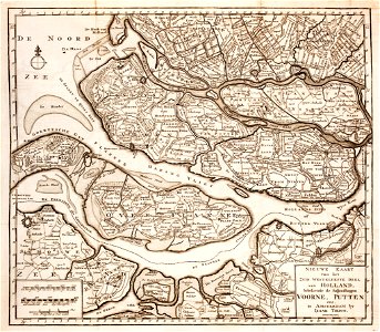
old maps of westland
maps from university of amsterdam special collections
atlas der neederlanden
gemeente atlas van nederland - north holland
old maps of alkmaar
gemeente atlas van nederland - south holland
old maps of delft
gemeente atlas van nederland - north holland
old maps of haarlem
media from regionaal archief alkmaar
old maps of koedijk
gemeente atlas van nederland - south holland
old maps of eiland van dordrecht
gemeente atlas van nederland - north holland
old maps of haarlem
gemeente atlas van nederland - north holland
old maps of enkhuizen
gemeente atlas van nederland - north holland
old maps of purmerend
gemeente atlas van nederland - north holland
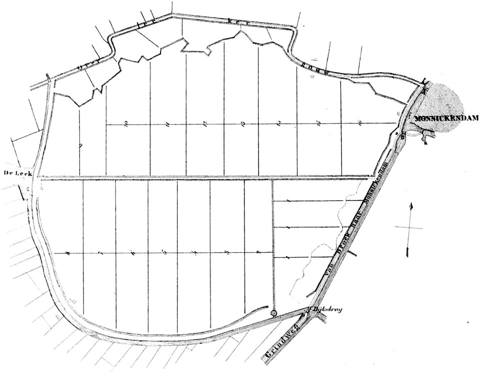
old maps of monnickendam
gemeente atlas van nederland - north holland
old maps of hoorn, north holland
midden-delfland in the 18th century
maps of midden-delfland
gemeente atlas van nederland - south holland
old maps of the hague
gemeente atlas van nederland - south holland
old maps of brielle
maps of polders in south holland
old maps of delfland
media from regionaal archief alkmaar
old maps of schagen
gemeente atlas van nederland - south holland
old maps of gouda
gemeente atlas van nederland - south holland
old maps of leiden
gemeente atlas van nederland - south holland
old maps of gouda
nicolaas samuel crucquius
old maps of delfland
maps by willem and johannes blaeu
old maps of amsterdam
gemeente atlas van nederland - north holland
old maps of haarlem
old maps of koedijk
old maps of alkmaar
maps by isaak tirion
old maps of holland
maps of polders in south holland
old maps of delfland
maps from university of amsterdam special collections
atlas der neederlanden
gemeente atlas van nederland - north holland
old maps of beverwijk
maps by christian sgrothen
old maps of north holland
1 - 100 of 256
Next page
/ 3