Log in
All resources
Create a design
26,489 Free Artworks of Map
latin-language maps
bibliothèque nationale de france
joan blaeu
frans hogenberg
eran laor cartographic collection
maps by willem and johannes blaeu
ships on maps
maps of paris from bibliothèque nationale de france
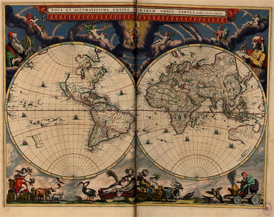
atlas novus (blaeu)
koninklijke bibliotheek
maps of paris from the princeton university library
18th-century maps of paris
italian-language maps
giacomo franco
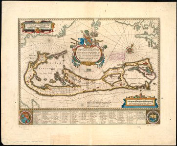
old maps of bermuda from the norman b. leventhal map center
1662 maps
maps from the earth and its inhabitants, vol. iv
ecclesiastical maps
maps of paris from bibliothèque nationale de france
proletarian literature
atlas novus (blaeu)
ships on maps
maps of the history of palestine
1880s maps of palestine
french-language maps of europe
1890s maps of vienna
16th-century copper engravings
history of brouwershaven
cornelis huyberts
guillaume sanson
17th-century double hemisphere world maps
nuevo atlas o teatro mundo
17th-century maps of sweden
1660s maps of norway
maps by jan janssonius
1650s maps of romania
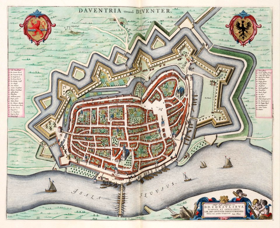
old maps of deventer
atlas van loon
guide joanne normandie-1912
1912 maps of france
the odyssey (butler)
maps of trapani
maps of the dutch east india company - mozambique
1747 maps of africa
maps of the west-indische compagnie
1665
maps by willem and johannes blaeu
1638 maps of asia
maps in the library of congress
old maps of yunnan
atlas van der hagen (volume 3)
atlas van der hagen
maps from the earth and its inhabitants, vol. vi
1891 maps of georgia
gemeente atlas van nederland - north holland
old maps of beverwijk
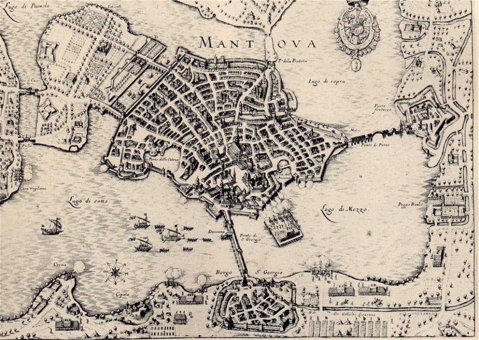
history of mantua
baroque
sieges of the eighty years' war
conflicts in 1583
old maps of brabant
1666 in belgium
miniature speed atlas (1627) pieter van den keere
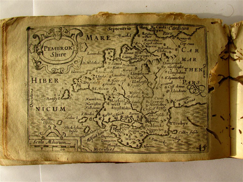
maps of wales by john speed
historical images of chamonix
maps of glaciers
16th-century maps of istria
1569 maps
carte de barbarie, nigritie, guinée par guillaume delisle (1707)
maps in the library of congress
maps by willem and johannes blaeu
dutch-language maps
1670s maps of the iberian peninsula
hugo allardt
1720 in sweden
1774 in sweden
atlas van der hagen (volume 4)
atlas van der hagen
atlas van der hagen (volume 4)
atlas van der hagen
eran laor cartographic collection
thesaurus philopoliticus
eran laor cartographic collection
latin-language maps
maps of dunkerque by braun & hogenberg
eran laor cartographic collection
gemeente atlas van nederland - south holland
1860s maps of south holland
eran laor cartographic collection
latin-language maps
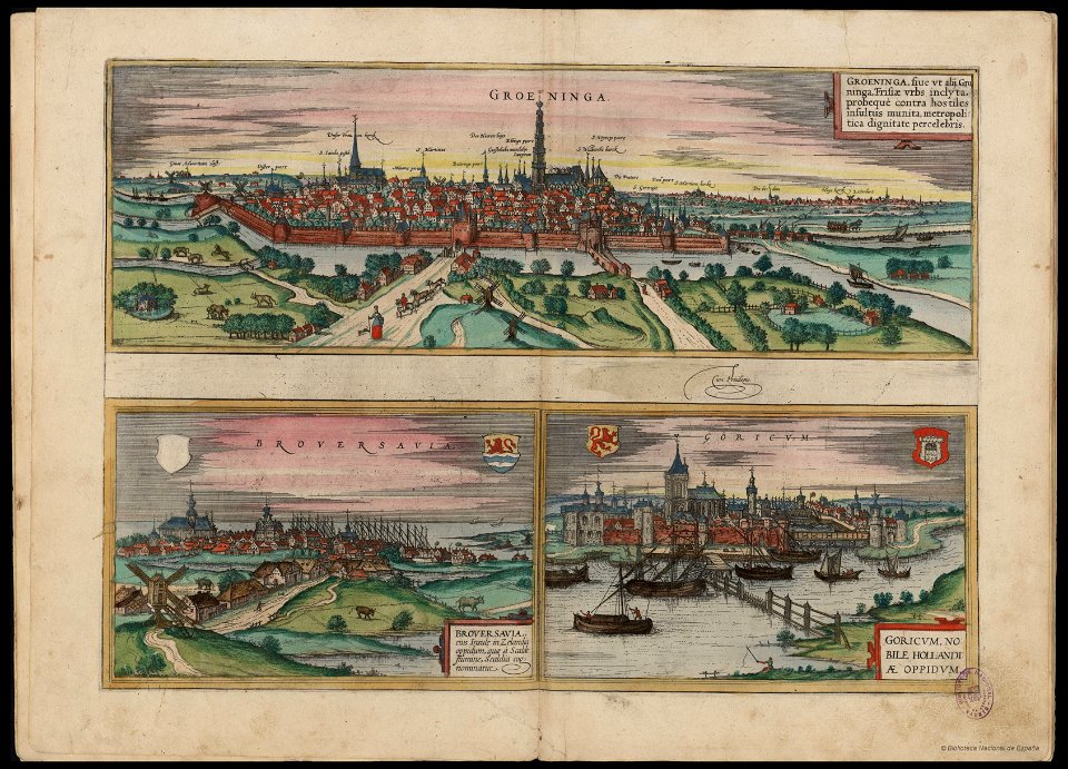
maps of groningen by braun & hogenberg
eran laor cartographic collection
maps by willem and johannes blaeu
1640 maps
description de l'universe
old maps of turkey
maps in the library of congress
1887 maps of massachusetts
atlas des anciens plans de paris by imprimerie nationale, 1900 from the david rumsey historical map collection
maps of paris from the david rumsey historical map collection
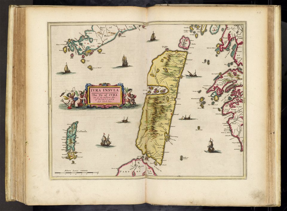
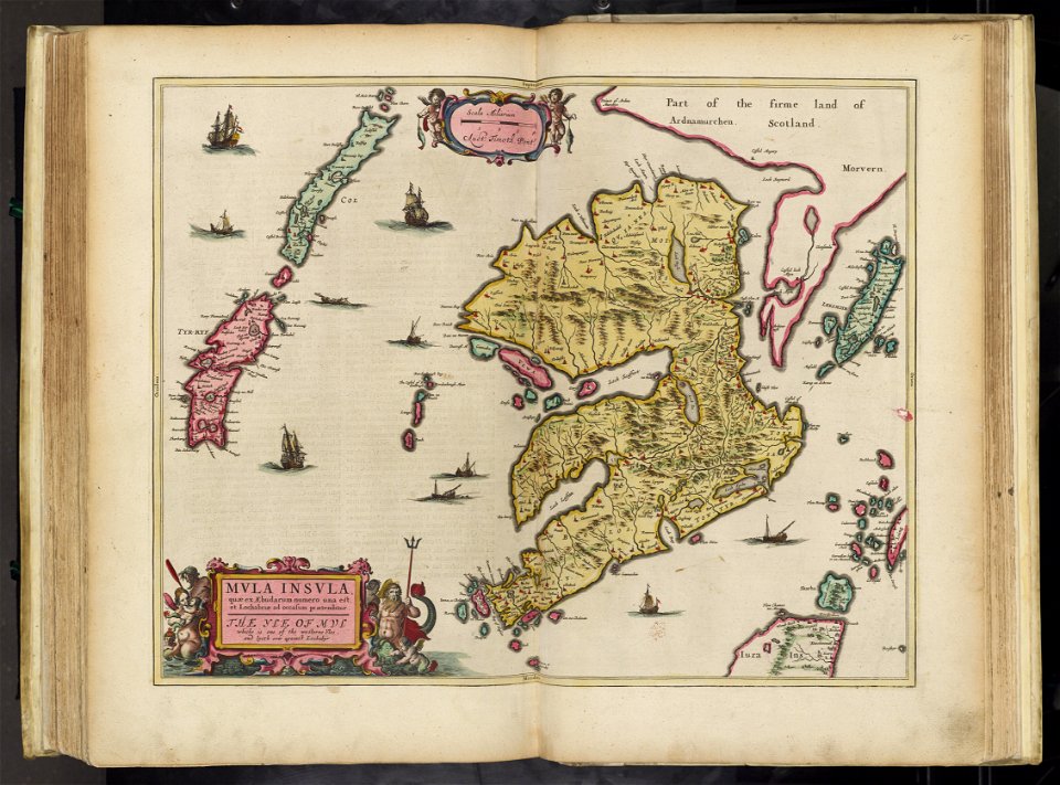
old maps of the hebrides
maps of jura, scotland
maps of the isle of mull
old maps of the hebrides
17th-century maps of the black sea
maps by willem and johannes blaeu
enskede slakthus
slakthusområdet
english-language maps
maps by john cary
lithographs of paris
floor plans of paris
books in the rijksmuseum amsterdam
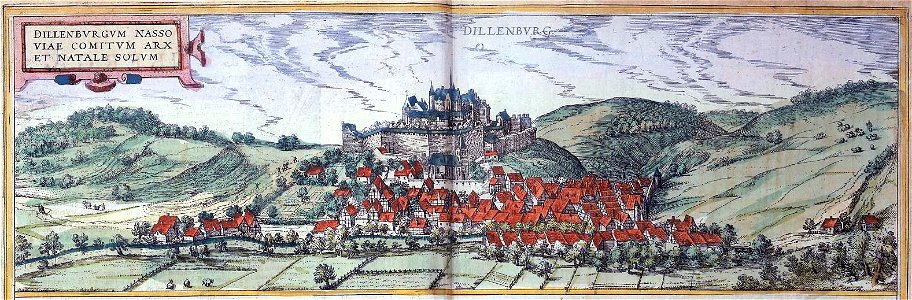
schloss dillenburg
guide joanne normandie-1912
1912 maps of france
maps by jacques-nicolas bellin
old maps of new france
description de l'universe
1680s maps of armenia
guide joanne normandie-1912
1912 maps of france
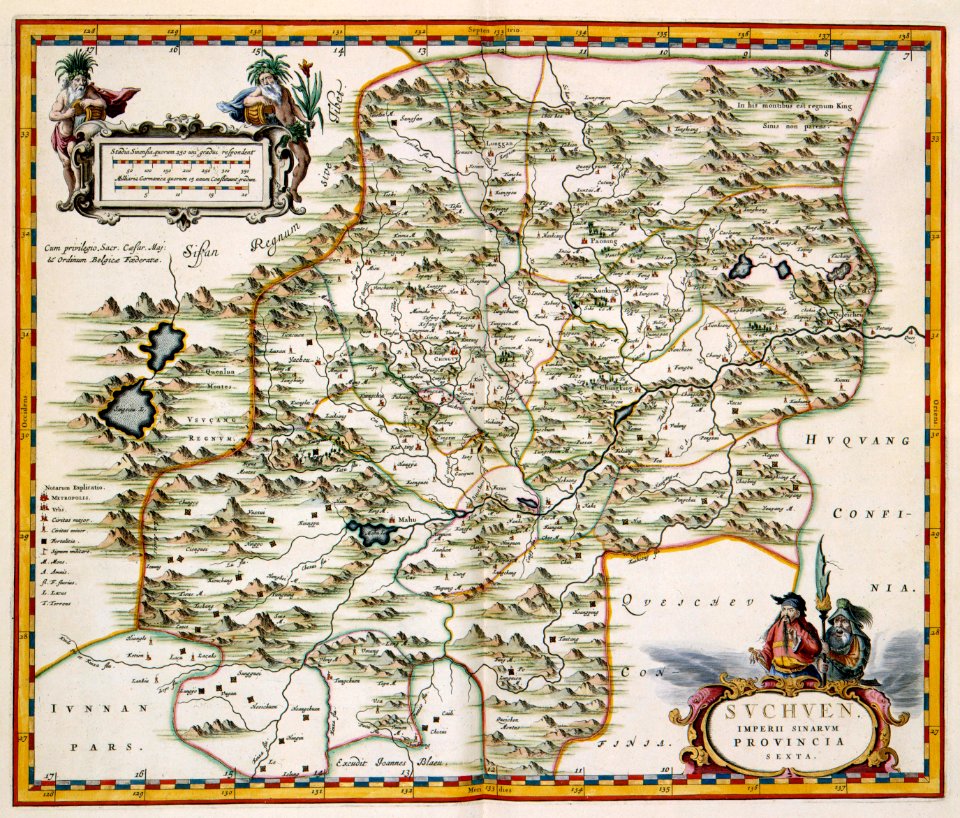
novus atlas sinensis
old maps of sichuan
17th-century maps of cumberland
old county maps of cumberland
maps of the dutch east india company - indonesia
18th-century maps of the moluccas
synopsis universae philologiae
1710s maps of the world
maps of the west-indische compagnie
1665
old maps of the bay of gibraltar
18th-century maps of gibraltar
old maps of wales
hugh hughes
latin-language maps
german renaissance
latin-language maps
german renaissance
prints in the stadsarchief amsterdam
map of amsterdam, 1544
maps of the bely gorod
baroque
maps of paris from bibliothèque nationale de france
1870s maps of paris
gemeente atlas van nederland - south holland
maps of noordeloos
old maps of westerwolde
maps of vlagtwedde
1490s maps of the holy roman empire
german renaissance
maps of the russo-japanese war
vladimir taburin
history of neudenau
nicolaus person
maps from the mechanical curator collection
1887 maps of sudan
maps of mechelen by braun & hogenberg
eran laor cartographic collection
panoramic maps of seville by braun & hogenberg
eran laor cartographic collection
map of ancient assyria by philippe de la rué
maps
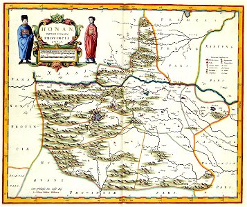
1860s maps of china
1863 maps of asia
maps by willem and johannes blaeu
maps of livonia
lawrence h. slaughter collection of english maps, charts, globes, books and atlases
nypl lionel pincus and princess firyal map division
maps by girolamo ruscelli
1570s maps of india
maps by john cary
1801 maps
jan van der straet - inferno
mannerism
1620s maps of france
old maps of provence
maps by willem and johannes blaeu
maps of ijsselstein
17th-century maps of pomerania
coats of arms on maps
18th-century maps of japan
1744 maps of asia
17th-century maps of pomerania
coats of arms on maps
maps of paris from the david rumsey historical map collection
maps of paris by caspar merian
maps of paris from bibliothèque nationale de france
maps of paris by braun & hogenberg
eran laor cartographic collection
maps by tomas lopez
maps in the library of congress
1664 maps
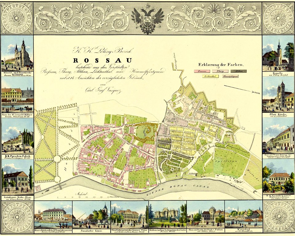
1830 vienna map series by carl graf vasquez
old maps of alsergrund
media from accademia delle scienze di torino
1577 engravings
media from accademia delle scienze di torino
1575 engravings
media from accademia delle scienze di torino
1577 engravings
media from accademia delle scienze di torino
1577 engravings
vue (en relief et à vol d'oiseau) de paris by jacques-alphonse testard
maps of paris from bibliothèque nationale de france
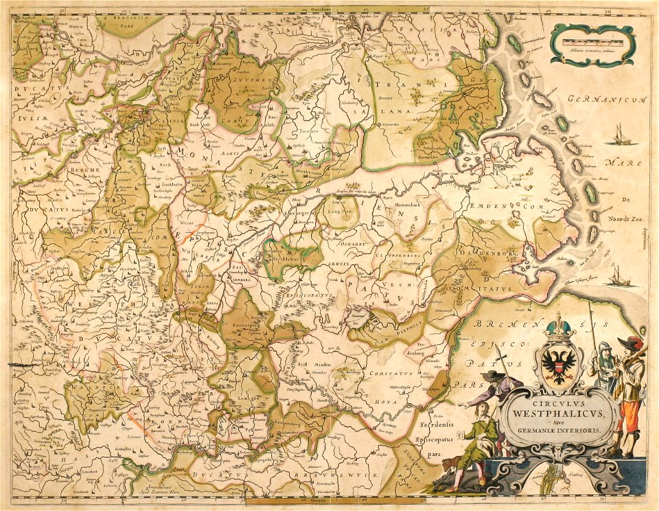
1640s maps of the netherlands
coats of arms on maps
brooklyn bridge – city hall (irt lexington avenue line)
city hall (irt lexington avenue line)
1801 - 1900 of 26,489
Next page
/ 265