Log in
All resources
Create a design
26,489 Free Artworks of Map
atlas map
bibliothèque nationale de france
maps of paris from bibliothèque nationale de france
turgot map of paris, bibliothèque nationale de france
maps in the library of congress
david rumsey historical map collection
maps of paris from the david rumsey historical map collection
atlas des anciens plans de paris by imprimerie nationale, 1900 from the david rumsey historical map collection
town maps by l. r. burleigh
l. r. burleigh
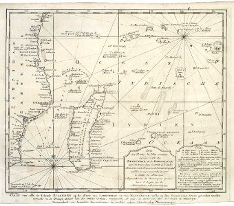
old maps of the dutch east india company - africa
maps of the dutch east india company - madagascar
charts and maps of the royal museums greenwich
1777 maps of new york (state)
frontispieces from england
maps by william faden
maps of djurgården
djurgårdsslätten
maps of paris in the 1790s
1792 maps
1690s maps of grand duchy of lithuania
maps by carolus allard
maps by willem and johannes blaeu
1640s maps of the ottoman empire
maps in the library of congress
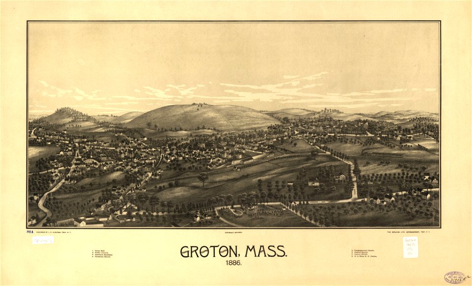
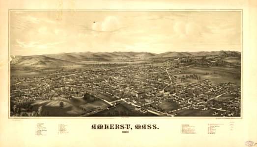
1886 maps of massachusetts
maps in the library of congress
1886 maps of massachusetts
maps of williamstown, massachusetts
maps in the library of congress
maps in the library of congress
1886 maps of vermont
maps in the library of congress
old maps of new hampshire
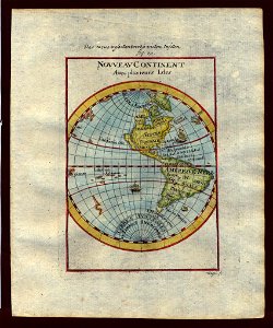
old maps of the western hemisphere
1710s maps of the world
maps of paris from the barry lawrence ruderman antique maps inc.
maps of paris by louis-joseph mondhare
synopsis universae philologiae
1740s maps of the world
old maps of flanders
copper engravings
gemeente atlas van nederland - limburg
19th-century maps of maastricht
gemeente atlas van nederland - south holland
1860s maps of south holland
cartouches by willem and johannes blaeu
dutch-language maps
old maps showing history
1820s maps of europe
maps by jean-baptiste bourguignon d'anville
maps by thomas kitchin
maps of paris in the 1610s
baroque
maps by john cary
1799 maps
old maps of regions of france
pierre françois tardieu
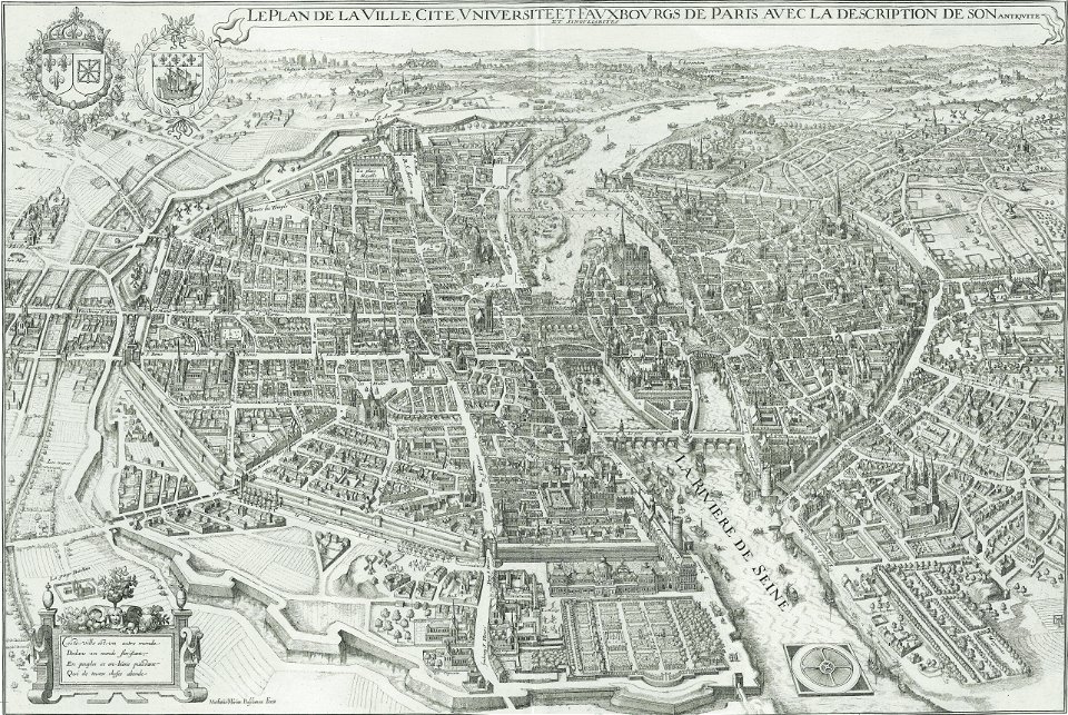
turgot map of paris, bibliothèque nationale de france
maps of paris from bibliothèque nationale de france
turgot map of paris, bibliothèque nationale de france
maps of paris from bibliothèque nationale de france
18th-century maps of havana
1730s maps of cuba
turgot map of paris, bibliothèque nationale de france
maps of paris from bibliothèque nationale de france
turgot map of paris, bibliothèque nationale de france
maps of paris from bibliothèque nationale de france
turgot map of paris, bibliothèque nationale de france
maps of paris from bibliothèque nationale de france
turgot map of paris, bibliothèque nationale de france
maps of paris from bibliothèque nationale de france
turgot map of paris, bibliothèque nationale de france
maps of paris from bibliothèque nationale de france
turgot map of paris, bibliothèque nationale de france
maps of paris from bibliothèque nationale de france
turgot map of paris, bibliothèque nationale de france
maps of paris from bibliothèque nationale de france
turgot map of paris, bibliothèque nationale de france
maps of paris from bibliothèque nationale de france
turgot map of paris, bibliothèque nationale de france
maps of paris from bibliothèque nationale de france
turgot map of paris, bibliothèque nationale de france
maps of paris from bibliothèque nationale de france
turgot map of paris, bibliothèque nationale de france
maps of paris from bibliothèque nationale de france
turgot map of paris, bibliothèque nationale de france
maps of paris from bibliothèque nationale de france
turgot map of paris, bibliothèque nationale de france
maps of paris from bibliothèque nationale de france
turgot map of paris, bibliothèque nationale de france
maps of paris from bibliothèque nationale de france
turgot map of paris, bibliothèque nationale de france
maps of paris from bibliothèque nationale de france
turgot map of paris, bibliothèque nationale de france
maps of paris from bibliothèque nationale de france
turgot map of paris, bibliothèque nationale de france
maps of paris from bibliothèque nationale de france
turgot map of paris, bibliothèque nationale de france
maps of paris from bibliothèque nationale de france
carte de barbarie, nigritie, guinée par guillaume delisle (1707)
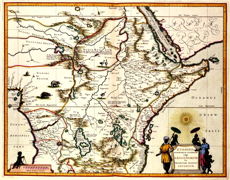
1718 maps of africa
maps in the library of congress
old maps of new jersey
maps of the west-indische compagnie
1757 maps
maps by john cary
1796 maps
maps of the west-indische compagnie
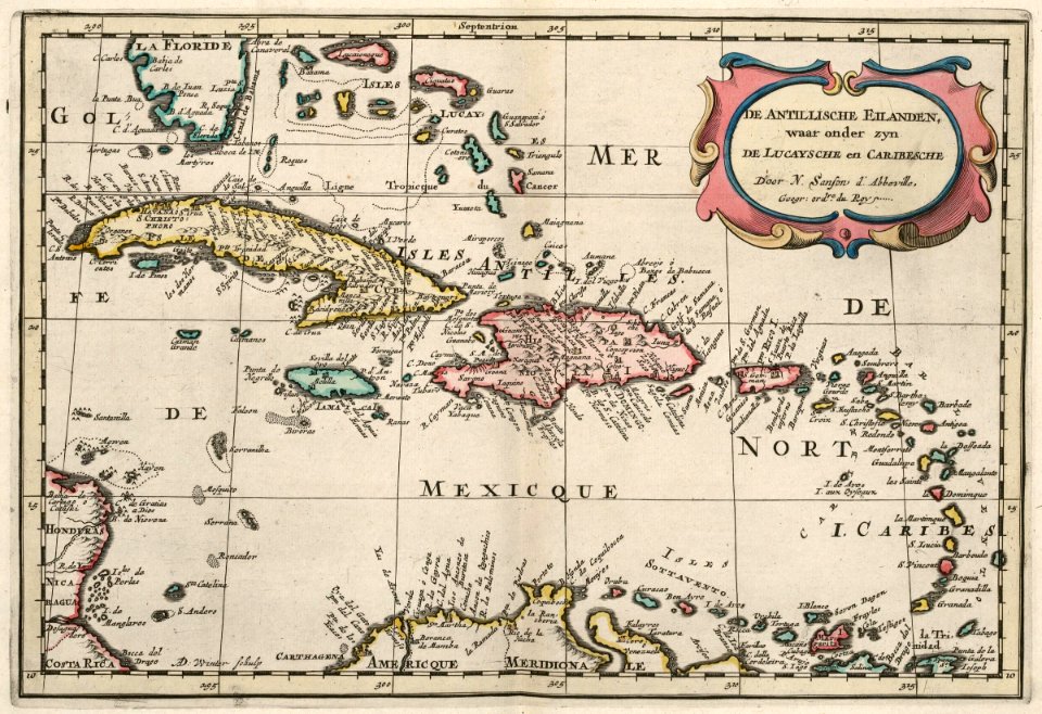
1700s maps of the caribbean
maps of paris from bibliothèque nationale de france
maps of paris by john rocque
maps by henry winkles
maps by john rapkin
maps from the earth and its inhabitants, vol. ix
maps indicating exploration
18th-century maps of the mediterranean sea
1745 maps
maps from the earth and its inhabitants, vol. v
maps of railway lines in norway
old maps of algiers
maps from gallica
galicia (spain) in the 1390s
galicia in portolan charts
dienst der publieke werken
old maps of amsterdam
plan de la ville et faubourg de paris, divisé en ses 48 sections by mondhare & jean
maps of paris from bibliothèque nationale de france
maps in the library of congress
old maps of france
maps by willem and johannes blaeu
maps of rotterdam by berckenrode
16th-century maps of slovenia
maps of carniola
17th-century maps of cambridgeshire
old county maps of cambridgeshire
windmills in hoorn, north holland
post mills in north holland
18th-century maps of the middle east
description de l'universe
classicism
1482 maps
1820s maps of indonesia
old maps of east timor
maps by thomas kitchin
andrew dury
1580s maps of the world
1598 maps
old maps of virginia in the american civil war
battle of hampton roads
15th-century maps of russia
fra mauro map details
1375 maps of africa
catalan atlas
maps by daniel stoopendaal
biblical maps
germany-poland border
potsdam conference
portrait paintings by georg david matthieu (house of mecklenburg)
paintings in schloss ludwigslust
atlas maior, vol 5 (england) - joan blaeu, 1667 - bl 114.h(star).5
old county maps of montgomeryshire
atlas maior, vol 5 (england) - joan blaeu, 1667 - bl 114.h(star).5
old county maps of denbighshire
maps of paris from the david rumsey historical map collection
maps of paris by caspar merian
old maps of douarnenez
old maps of brest
atlas maior, vol 5 (england) - joan blaeu, 1667 - bl 114.h(star).5
old county maps of bedfordshire
atlas maior, vol 5 (england) - joan blaeu, 1667 - bl 114.h(star).5
old county maps of worcestershire
old maps of the dutch east india company - africa
1635 maps of africa
watercolor drawings by johannes vingboons
tobago
atlas des anciens plans de paris by imprimerie nationale, 1900 from the david rumsey historical map collection
maps of paris from the david rumsey historical map collection
maps of paris from the david rumsey historical map collection
romanticism
atlas des anciens plans de paris by imprimerie nationale, 1900 from the david rumsey historical map collection
maps of paris from the david rumsey historical map collection
maps of paris from the david rumsey historical map collection
romanticism
atlas des anciens plans de paris by imprimerie nationale, 1900 from the david rumsey historical map collection
maps of paris from the david rumsey historical map collection
atlas des anciens plans de paris by imprimerie nationale, 1900 from the david rumsey historical map collection
maps of paris from the david rumsey historical map collection
maps of nieuw nederland
nicolaes visscher ii
maps of paris from bibliothèque nationale de france
maps of paris by louis-joseph mondhare
instituto geográfico nacional (españa)
old maps of galicia (spain)
maps of paris from bibliothèque nationale de france
16th-century maps of paris
maps from university of amsterdam special collections
atlas der neederlanden
maps from university of amsterdam special collections
atlas der neederlanden
maps from university of amsterdam special collections
atlas der neederlanden
old maps of cities in asturias
1777 maps of spain
maps of the history of denmark
old maps of scandinavia
copper engravings
old maps of goes
chicago and the midwest, newberry library
maps by rand mcnally
1701 - 1800 of 26,489
Next page
/ 265