Log in
All resources
Create a design
91 Free Artworks of Maps By Jan Janssonius
maps made in the 17th century
atlantis magni tomus quartus (biblioteca comunale di trento)
maps in the rijksmuseum amsterdam
maps by jan luyken
atlantis magni tomus quintus (biblioteca comunale di trento)
prints by frans hogenberg in the rijksmuseum amsterdam
frans hogenberg
atlantis magni tomus secundus (biblioteca comunale di trento)
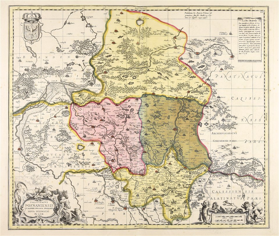
national library of poland
prints by jan luyken in the rijksmuseum amsterdam
maps made in the 17th century
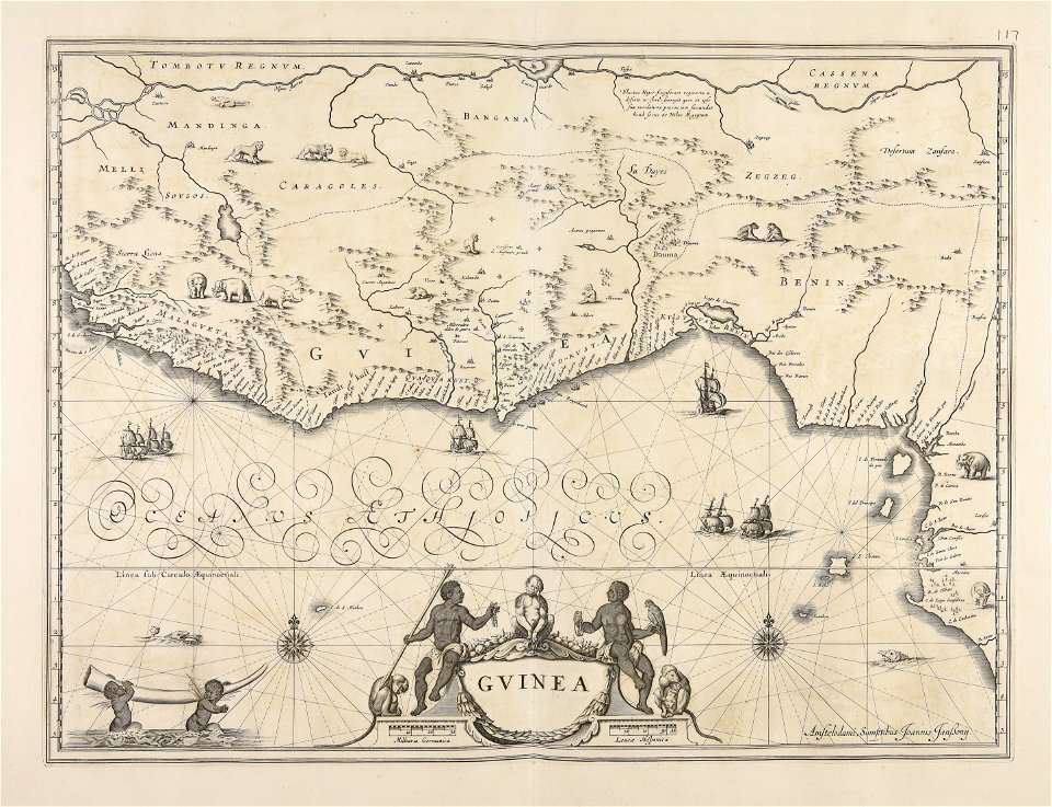
old maps of guinea
maps made in the 17th century
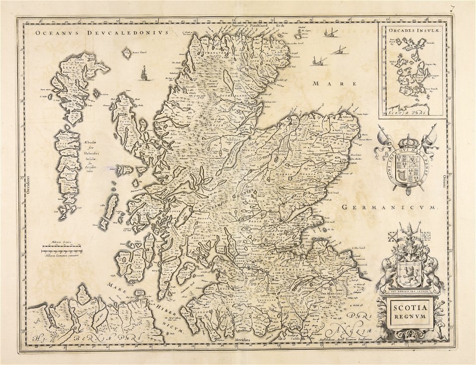
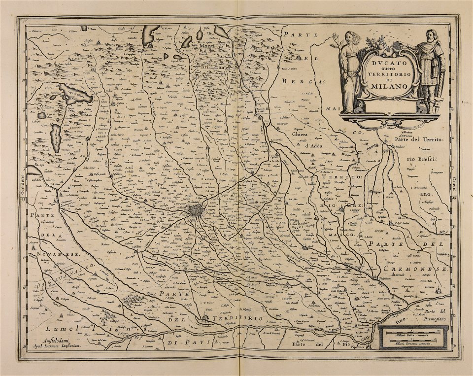
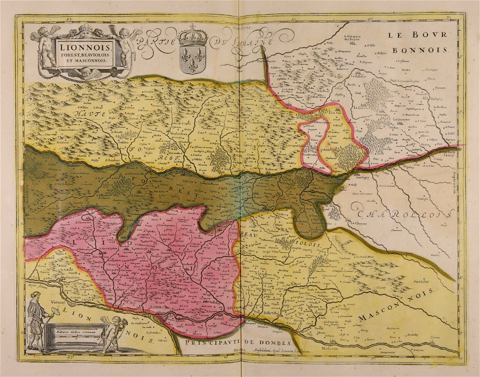
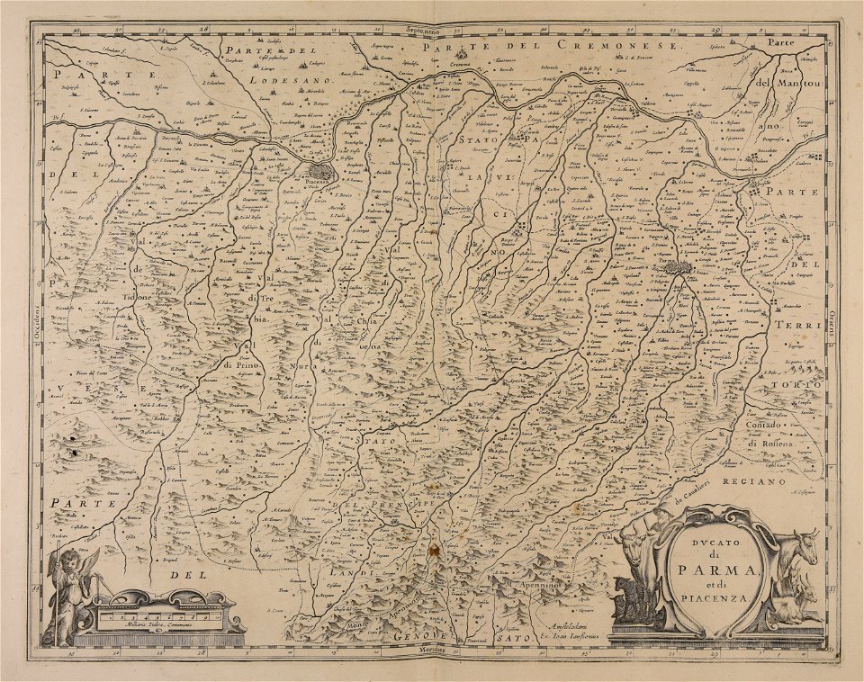
jan janssonius
maps made in the 17th century
jan janssonius
maps made in the 17th century
jan janssonius
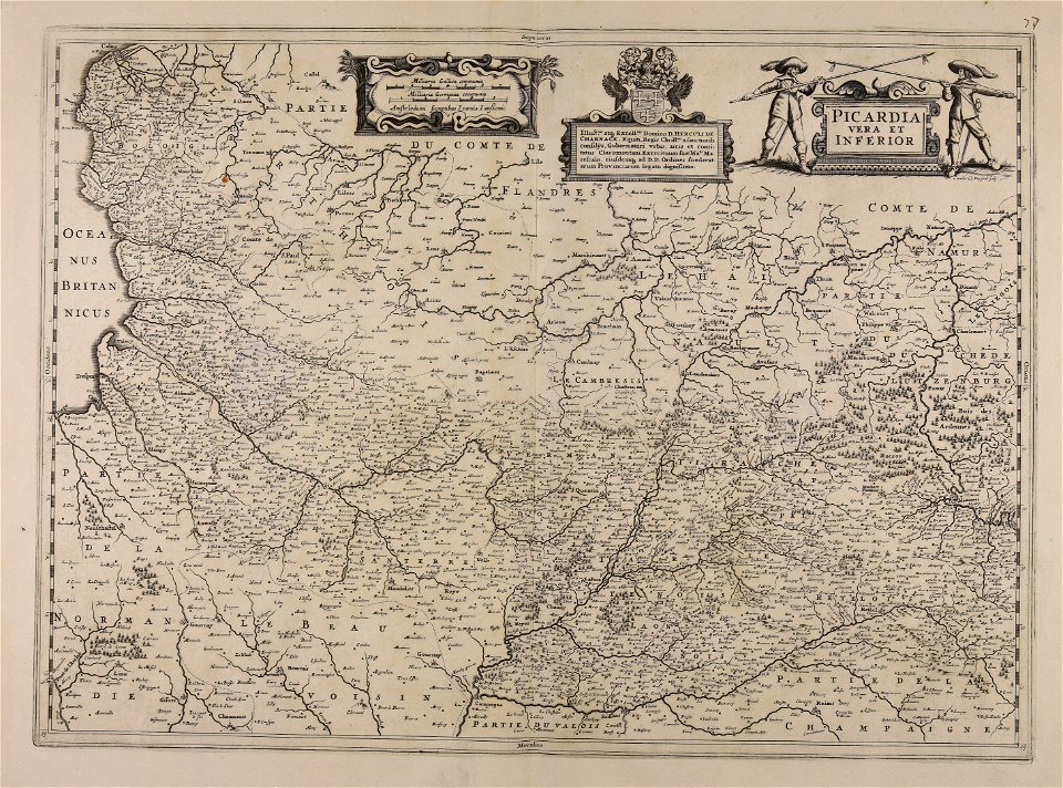
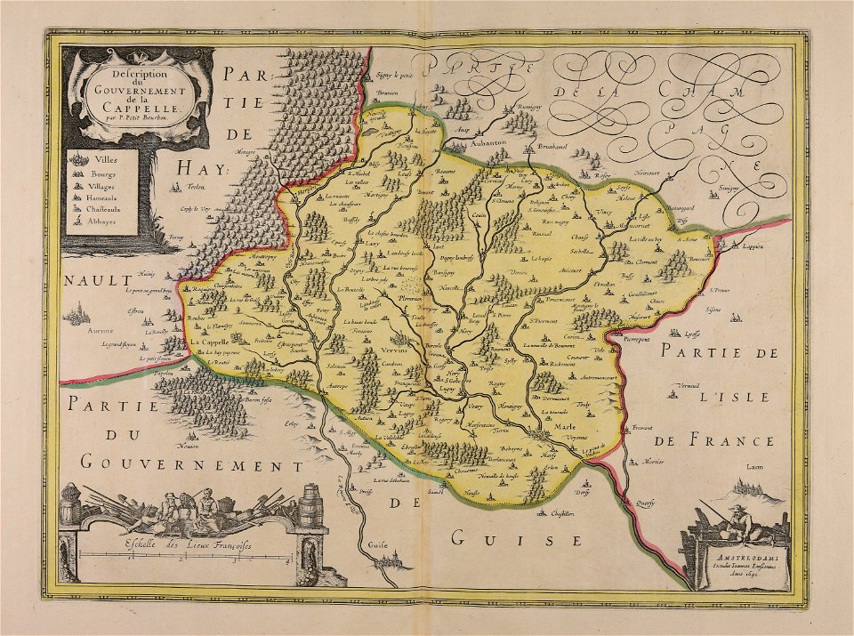
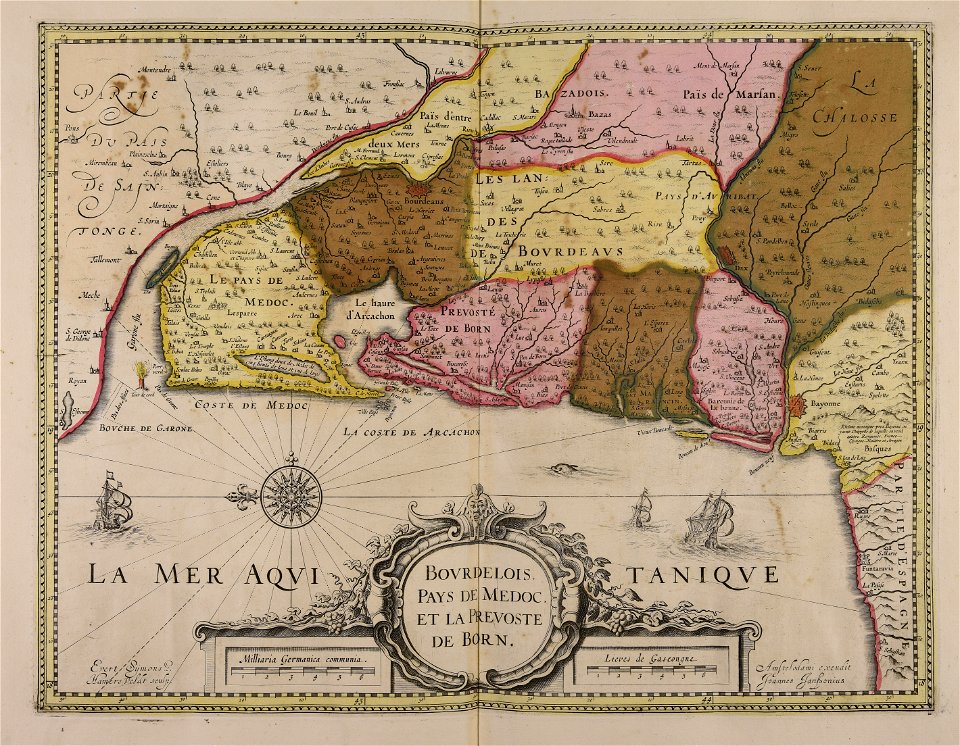
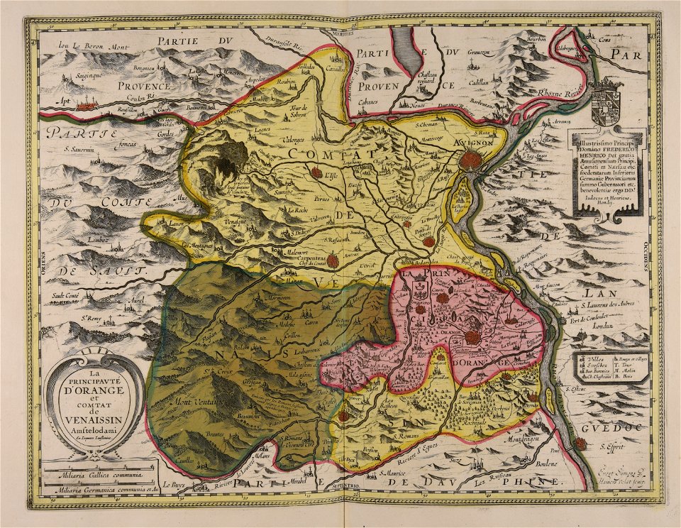
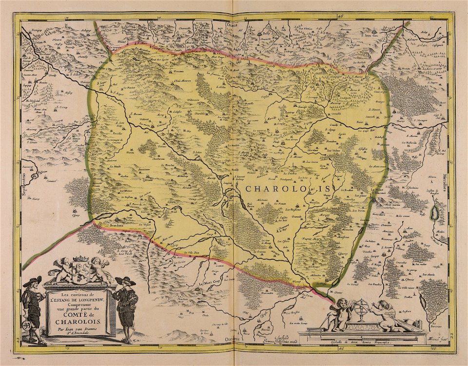
1640s maps of france
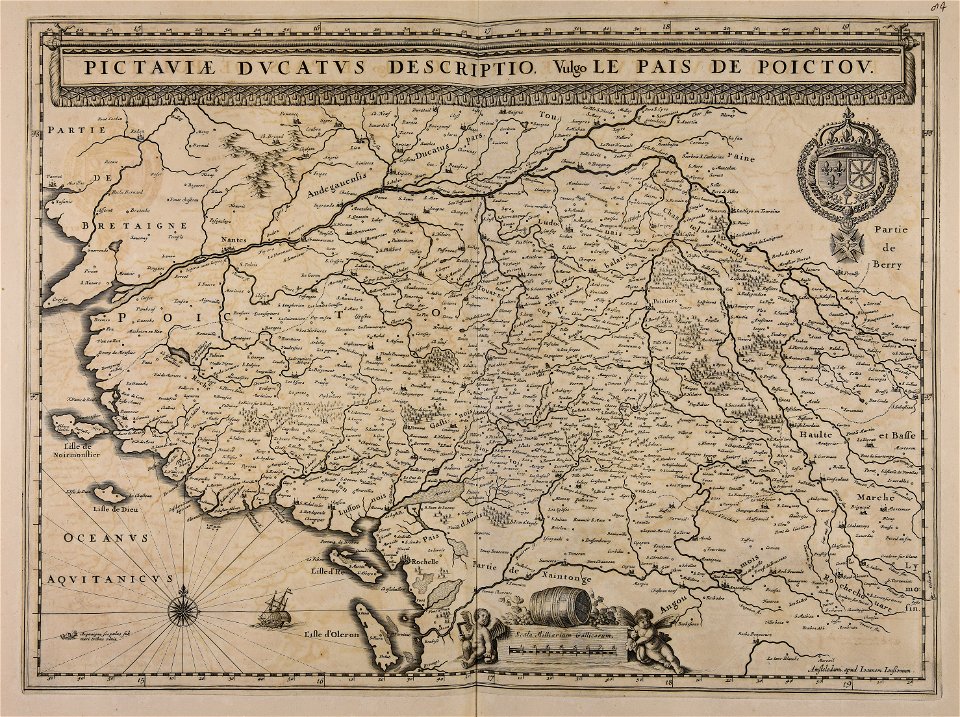
jan janssonius
maps made in the 17th century
jan janssonius
atlantis magni tomus quartus (biblioteca comunale di trento)
jan janssonius
maps made in the 17th century
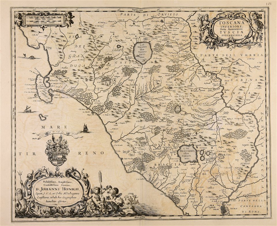
jan janssonius
maps made in the 17th century
jan janssonius
maps made in the 17th century
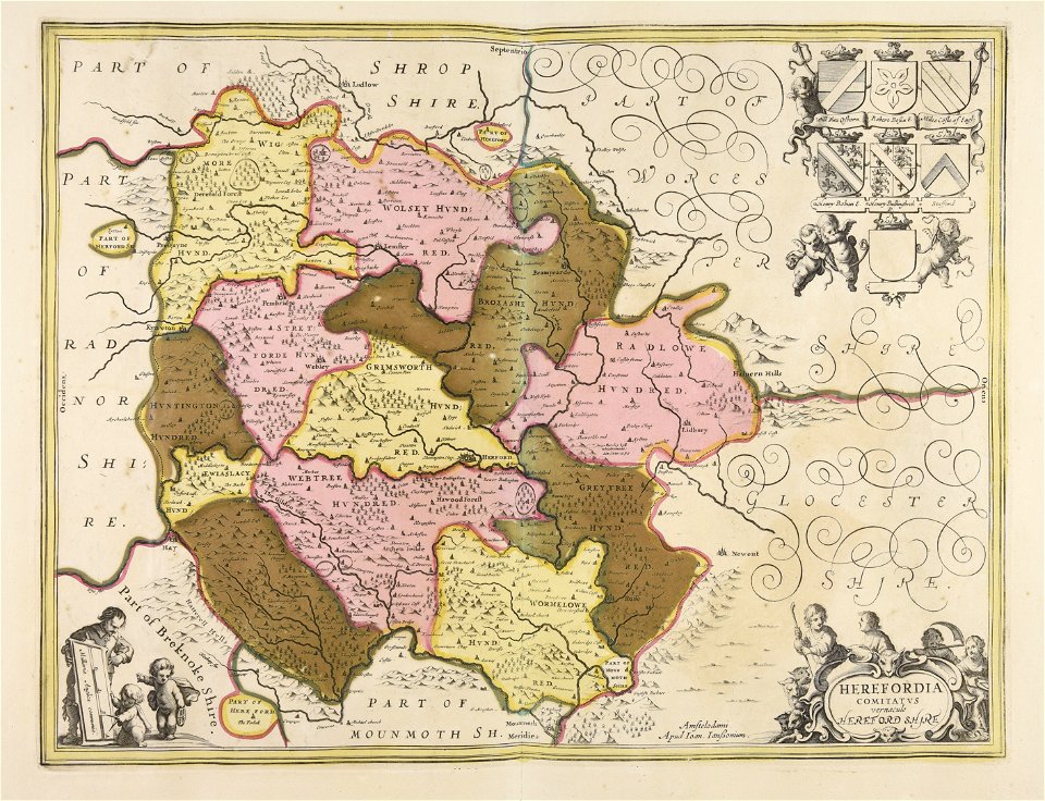
jan janssonius
maps made in the 17th century
jan janssonius
maps made in the 17th century
jan janssonius
maps made in the 17th century
jan janssonius
maps made in the 17th century
jan janssonius
maps made in the 17th century
jan janssonius
maps made in the 17th century
jan janssonius
maps made in the 17th century
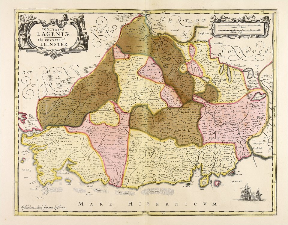
leinster
maps made in the 17th century
jan janssonius
maps made in the 17th century
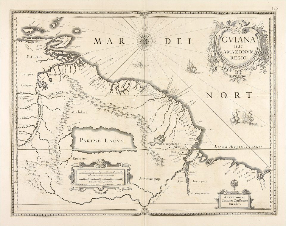
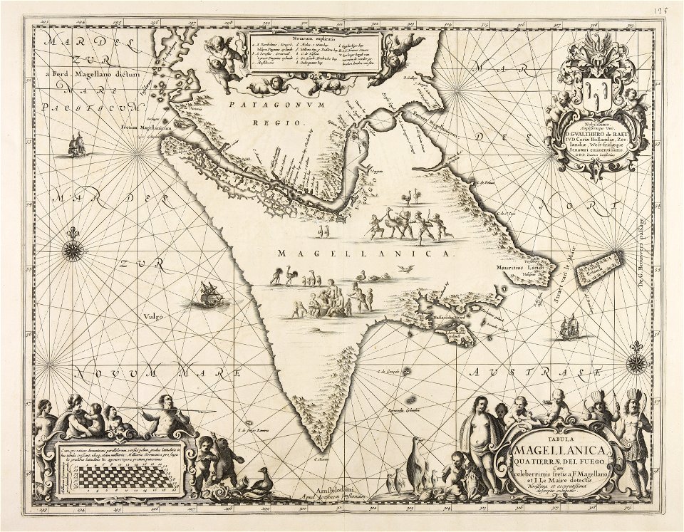
guiana
maps made in the 17th century
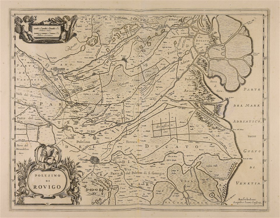
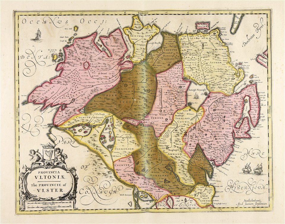
ulster
maps made in the 17th century
jan janssonius
maps made in the 17th century
jan janssonius
maps made in the 17th century
jan janssonius
maps made in the 17th century
jan janssonius
maps made in the 17th century
jan janssonius
maps made in the 17th century
jan janssonius
maps made in the 17th century
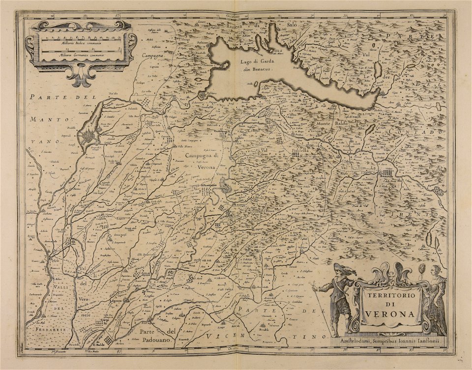
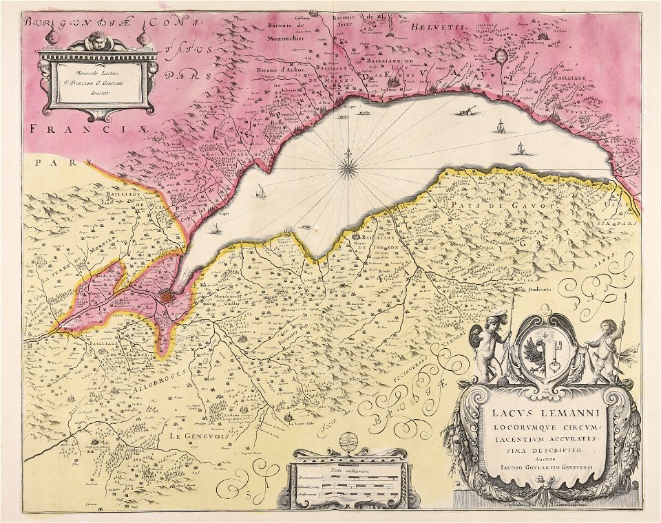
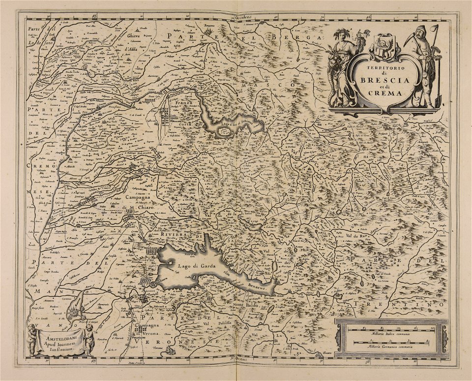
lake garda
maps made in the 17th century
jan janssonius
maps made in the 17th century
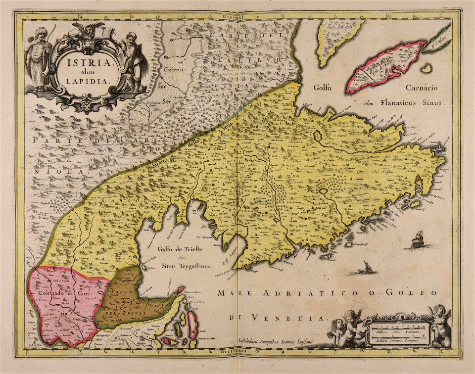
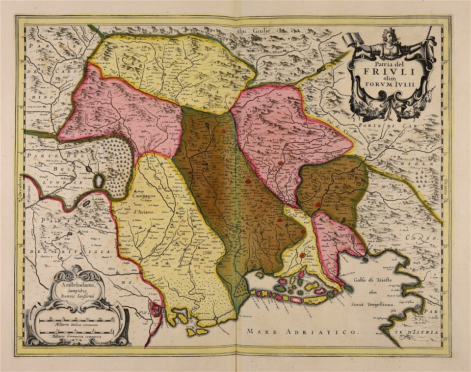
istria
maps made in the 17th century
jan janssonius
dutch 17th-century prints in the rijksmuseum amsterdam
jan janssonius
maps made in the 17th century
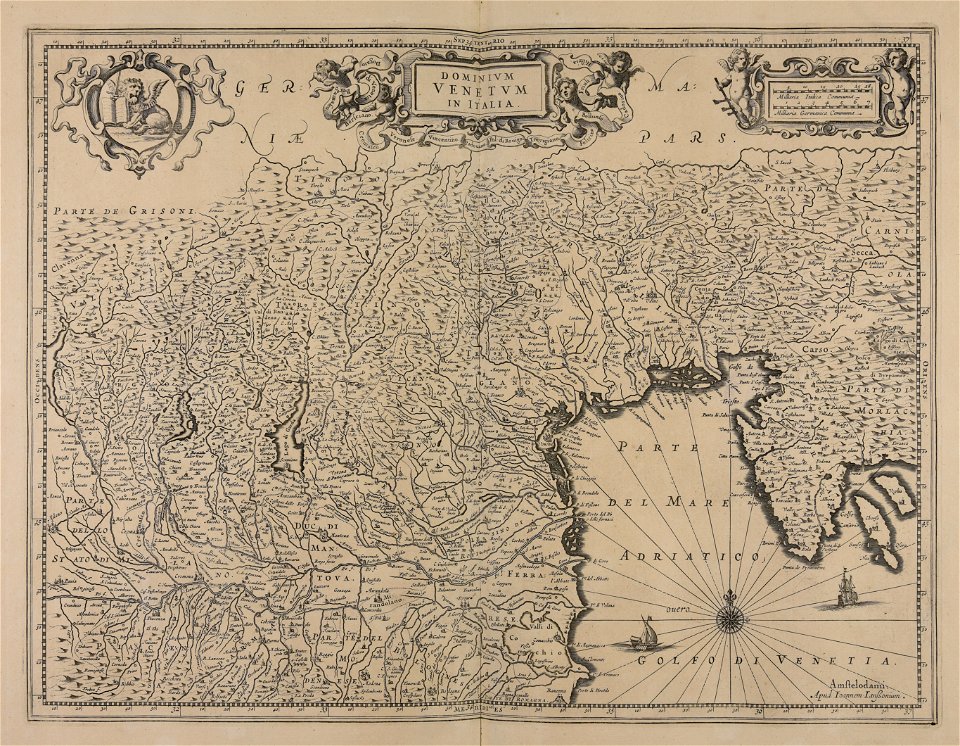
friuli-venezia giulia
maps made in the 17th century
jan janssonius
maps made in the 17th century
jan janssonius
atlantis magni tomus quartus (biblioteca comunale di trento)
jan janssonius
maps made in the 17th century
jan janssonius
maps made in the 17th century
jan janssonius
maps made in the 17th century
jan janssonius
maps made in the 17th century
jan janssonius
maps made in the 17th century
jan janssonius
maps made in the 17th century
giappone
maps made in the 17th century
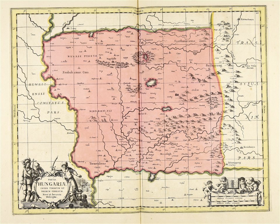
ungheria
maps made in the 17th century
jan janssonius
maps made in the 17th century
jan janssonius
maps made in the 17th century
jan janssonius
maps of amersfoort by braun & hogenberg
maps by jan janssonius
17th-century maps of the black sea
maps by willem and johannes blaeu
maps by hendrik hondius the younger
cartouches by jan janssonius
maps made in the 17th century
old maps of gelderland
atlas ou representation du monde universel t. 2 (1633)
maps by jan janssonius
map of ghent by jan blaeu
17th-century maps of the mediterranean sea
copper engravings
national museum of maps and rare books, bucharest
maps of the lower danube
maps by jodocus hondius
old maps of virginia
eran laor cartographic collection
old maps of canaan
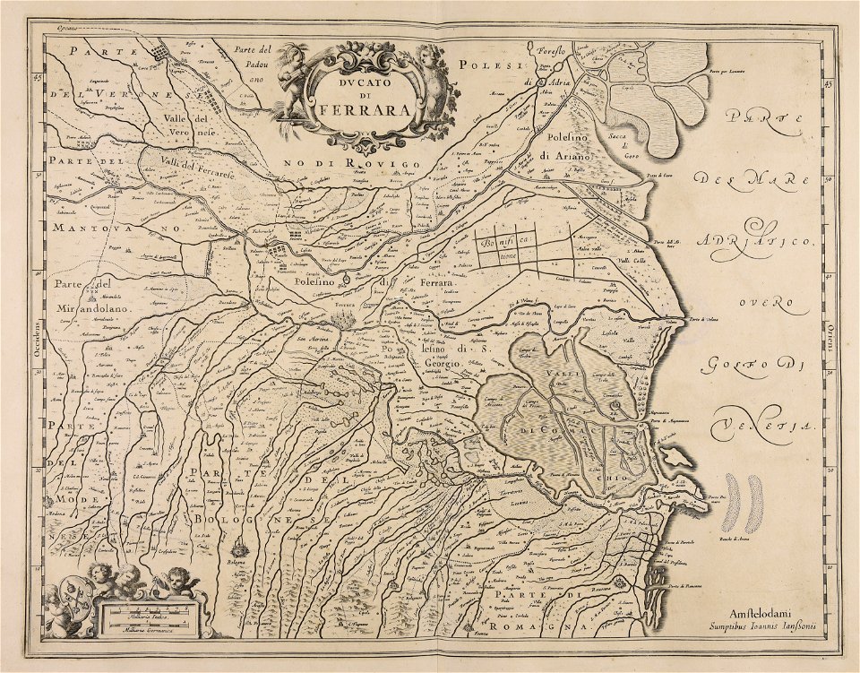
maps by jan janssonius
1640s maps of africa
maps by jan janssonius
1650s maps of romania
stedenboeken van de wereld by johannes janssonius 1657
map of ghent by jan blaeu
maps in the library of congress
animals on maps
maps by willem and johannes blaeu
old maps of the danube
maps by jan janssonius
jodocus hondius
17th-century maps of istanbul
maps by jan janssonius
17th-century maps of southeast asia
maps by jodocus hondius
atlas ou representation du monde universel t. 2 (1633)
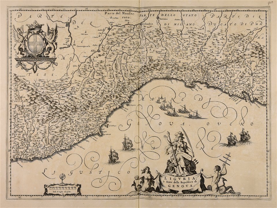
old maps of the republic of genoa
maps of barbary coast by mercator-hondius
maps by jan janssonius
atlas ou representation du monde universel t. 2 (1633)
old maps of nuremberg
prints by frans hogenberg in the rijksmuseum amsterdam
maps in the rijksmuseum amsterdam
maps by pieter van der keere
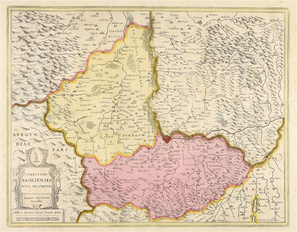
old maps of basel
atlas ou representation du monde universel t. 2 (1633)
maps by jan janssonius
atlas ou representation du monde universel t. 2 (1633)
maps by jan janssonius
atlas ou representation du monde universel t. 2 (1633)
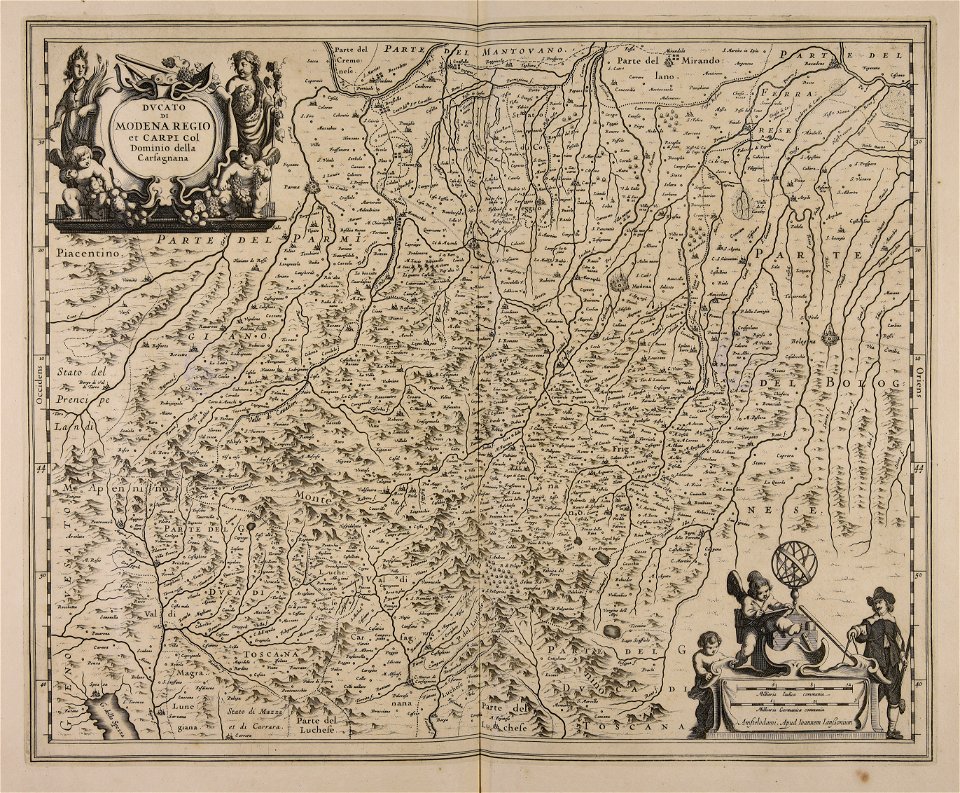
maps of the duchy of mantua
prints by frans hogenberg in the rijksmuseum amsterdam
maps in the rijksmuseum amsterdam
prints by frans hogenberg in the rijksmuseum amsterdam
maps in the rijksmuseum amsterdam
prints by frans hogenberg in the rijksmuseum amsterdam
maps in the rijksmuseum amsterdam
maps by jan janssonius
atlas novus (blaeu)
prints by frans hogenberg in the rijksmuseum amsterdam
maps in the rijksmuseum amsterdam
prints by frans hogenberg in the rijksmuseum amsterdam
prints by jan luyken in the rijksmuseum amsterdam
17th-century maps of cambridgeshire
old county maps of cambridgeshire
prints by frans hogenberg in the rijksmuseum amsterdam
prints by jan luyken in the rijksmuseum amsterdam
prints by frans hogenberg in the rijksmuseum amsterdam
maps in the rijksmuseum amsterdam
atlas ou representation du monde universel t. 1 (1633)
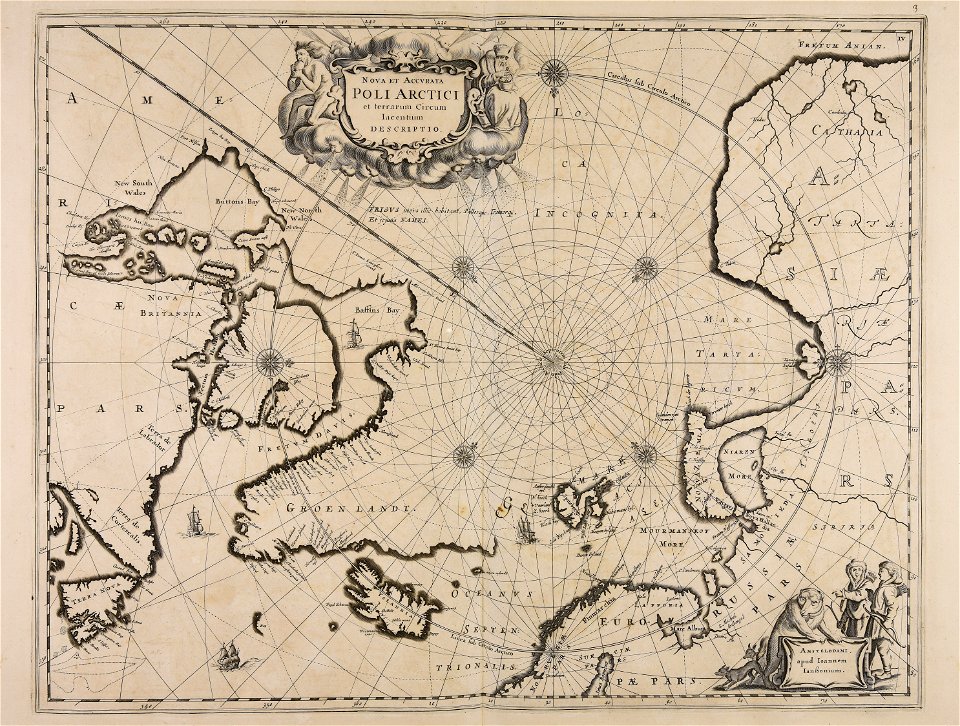
17th-century maps of scandinavia
prints by frans hogenberg in the rijksmuseum amsterdam
maps in the rijksmuseum amsterdam
maps of 's-hertogenbosch by braun & hogenberg
atlas beudeker
maps of bergen op zoom by braun & hogenberg
atlas beudeker
maps in the rijksmuseum amsterdam
old maps of vlissingen
prints by frans hogenberg in the rijksmuseum amsterdam
maps by jan luyken
maps in the rijksmuseum amsterdam
old maps of south holland
maps of emden by braun & hogenberg
atlas beudeker
prints by jan luyken in the rijksmuseum amsterdam
maps in the rijksmuseum amsterdam
dutch 17th-century prints in the rijksmuseum amsterdam
capture of wesel 1629
dutch 17th-century prints in the rijksmuseum amsterdam
capture of wesel 1629
1 - 91 of 91
/ 1


![Gerardi Mercatoris and I. Hondii Atlas or Representation of the Universal World, and of the Parts of It, Made in Tables and Very Ample Descriptions. [t. 2].](https://cdn.creazilla.com/illustrations/10001063637/gerardi-mercatoris-and-i-hondii-atlas-or-representation-of-the-universal-world-and-of-the-parts-of-it-made-in-tables-and-very-ample-descriptions-t-2-sm.webp)


![Gerardi Mercatoris and I. Hondii Atlas or Representation of the Universal World, and of the Parts of It, Made in Tables and Very Ample Descriptions. [t. 2].](https://cdn.creazilla.com/illustrations/10000735247/gerardi-mercatoris-and-i-hondii-atlas-or-representation-of-the-universal-world-and-of-the-parts-of-it-made-in-tables-and-very-ample-descriptions-t-2-sm.webp)
![Barbarie [Barbaria, Carthaginensis Sinus, Aegyptus], 1633](https://cdn.creazilla.com/illustrations/10001157360/barbarie-barbaria-carthaginensis-sinus-aegyptus-1633-md.jpg)
![Gerardi Mercatoris and I. Hondii Atlas or Representation of the Universal World, and of the Parts of It, Made in Tables and Very Ample Descriptions. [t. 2].](https://cdn.creazilla.com/illustrations/10001133003/gerardi-mercatoris-and-i-hondii-atlas-or-representation-of-the-universal-world-and-of-the-parts-of-it-made-in-tables-and-very-ample-descriptions-t-2-sm.webp)


![Gerardi Mercatoris and I. Hondii Atlas or Representation of the Universal World, and of the Parts of It, Made in Tables and Very Ample Descriptions. [t. 2].](https://cdn.creazilla.com/illustrations/10001295296/gerardi-mercatoris-and-i-hondii-atlas-or-representation-of-the-universal-world-and-of-the-parts-of-it-made-in-tables-and-very-ample-descriptions-t-2-sm.webp)
![Gerardi Mercatoris and I. Hondii Atlas or Representation of the Universal World, and of the Parts of It, Made in Tables and Very Ample Descriptions. [t. 2].](https://cdn.creazilla.com/illustrations/10000306998/gerardi-mercatoris-and-i-hondii-atlas-or-representation-of-the-universal-world-and-of-the-parts-of-it-made-in-tables-and-very-ample-descriptions-t-2-sm.webp)
![Gerardi Mercatoris and I. Hondii Atlas or Representation of the Universal World, and of the Parts of It, Made in Tables and Very Ample Descriptions. [t. 2].](https://cdn.creazilla.com/illustrations/10001224485/gerardi-mercatoris-and-i-hondii-atlas-or-representation-of-the-universal-world-and-of-the-parts-of-it-made-in-tables-and-very-ample-descriptions-t-2-sm.webp)


![Gerardi Mercatoris and I. Hondii Atlas or Representation of the Universal World, and of the Parts of It, Made in Tables and Descriptions Very Ample, and Exact: Divided into Two Volumes [...]. [t. 1].](https://cdn.creazilla.com/illustrations/10001541341/gerardi-mercatoris-and-i-hondii-atlas-or-representation-of-the-universal-world-and-of-the-parts-of-it-made-in-tables-and-descriptions-very-ample-and-exact-divided-into-two-volumes-t-1-md.jpg)


