Log in
All resources
Create a design
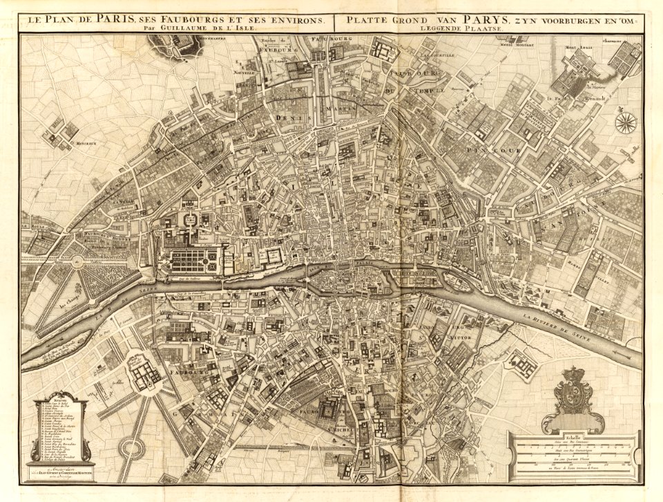
115 Free Artworks of 18th Century Maps Of Paris
bibliothèque nationale de france
atlas map
turgot map of paris, bibliothèque nationale de france
maps of paris from bibliothèque nationale de france
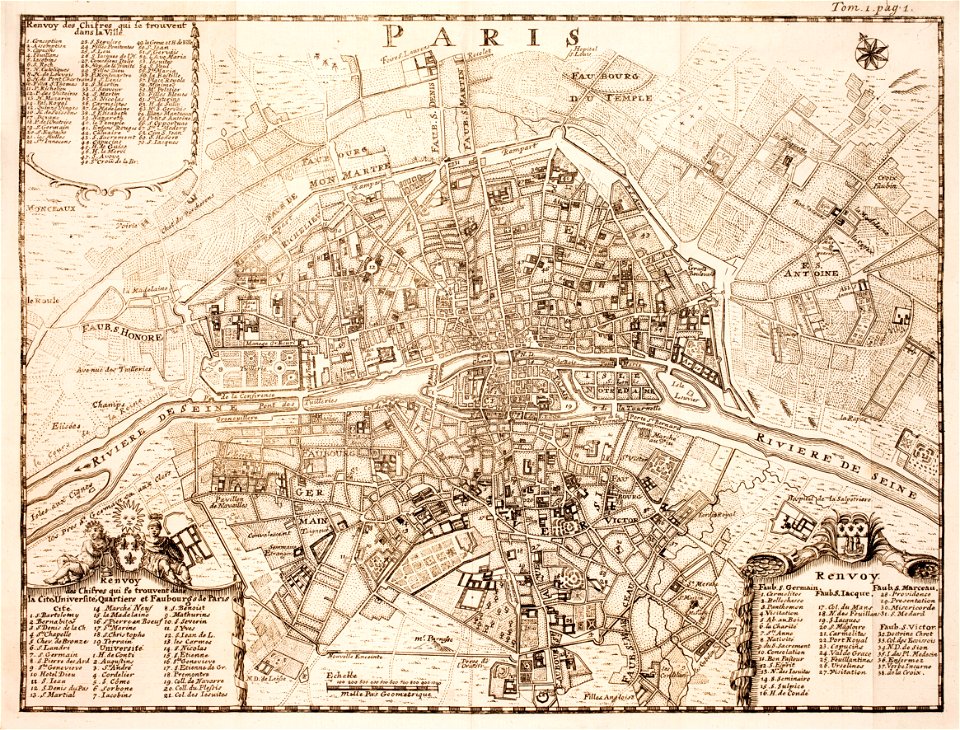
map of paris by jouvin de rochefort (boutier 112)
maps of paris from the david rumsey historical map collection
david rumsey historical map collection
maps of paris in the 1750s
atlas des anciens plans de paris by imprimerie nationale, 1900 from the david rumsey historical map collection
robert cordier (engraver)
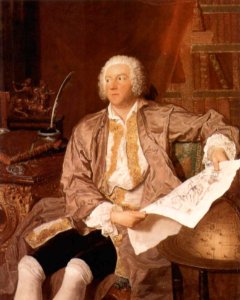
paintings in the musée des arts décoratifs
paintings by pierre-antoine baudouin
maps of paris in the 1760s
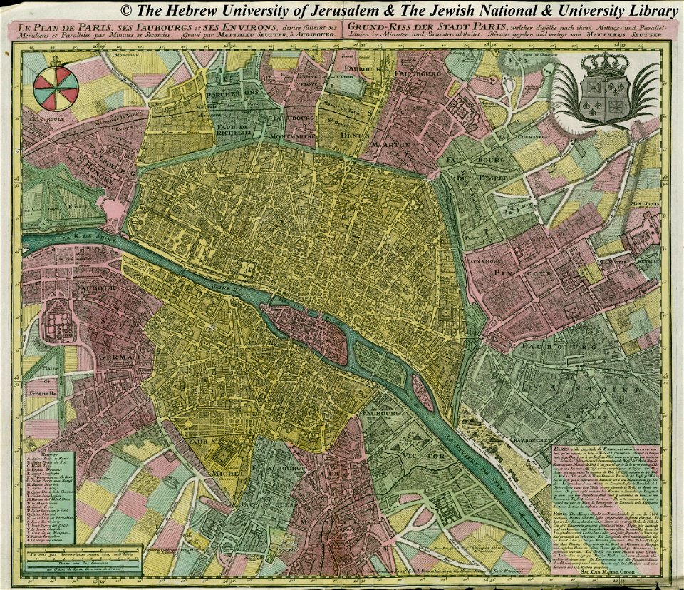
maps by matthäus seutter
maps by matthäus seutter
copyfraud
maps of paris from the david rumsey historical map collection
1854 maps
maps of paris from the barry lawrence ruderman antique maps inc.
18th-century maps of paris
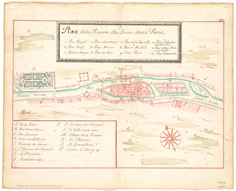
seine river in paris
1760 maps
seine river in paris
1760 maps
david rumsey historical map collection
covens en mortier
18th-century maps of paris
maps of paris in the 1740s
18th-century maps of hispaniola
hispaniola
carl gustaf tessin
paris
old submaps of paris 1er arrondissement
paris in the 18th century
turgot map of paris, norman b. leventhal map center
sheet 19 of the turgot map of paris
maps of paris in the 1790s
1797 maps
old maps of île-de-france
1785 maps of france
maps of paris from the princeton university library
18th-century maps of paris
maps of paris from the university of wisconsin-milwaukee libraries
18th-century maps of paris
maps of paris in the 1790s
1792 maps
old submaps of paris 1er arrondissement
plans of the palais-royal
turgot map of paris, bibliothèque nationale de france
maps of paris from bibliothèque nationale de france
turgot map of paris, bibliothèque nationale de france
maps of paris from bibliothèque nationale de france
turgot map of paris, bibliothèque nationale de france
maps of paris from bibliothèque nationale de france
turgot map of paris, bibliothèque nationale de france
maps of paris from bibliothèque nationale de france
turgot map of paris, bibliothèque nationale de france
maps of paris from bibliothèque nationale de france
turgot map of paris, bibliothèque nationale de france
maps of paris from bibliothèque nationale de france
turgot map of paris, bibliothèque nationale de france
maps of paris from bibliothèque nationale de france
turgot map of paris, bibliothèque nationale de france
maps of paris from bibliothèque nationale de france
turgot map of paris, bibliothèque nationale de france
maps of paris from bibliothèque nationale de france
turgot map of paris, bibliothèque nationale de france
maps of paris from bibliothèque nationale de france
turgot map of paris, bibliothèque nationale de france
maps of paris from bibliothèque nationale de france
turgot map of paris, bibliothèque nationale de france
maps of paris from bibliothèque nationale de france
turgot map of paris, bibliothèque nationale de france
maps of paris from bibliothèque nationale de france
turgot map of paris, bibliothèque nationale de france
maps of paris from bibliothèque nationale de france
turgot map of paris, bibliothèque nationale de france
maps of paris from bibliothèque nationale de france
turgot map of paris, bibliothèque nationale de france
maps of paris from bibliothèque nationale de france
turgot map of paris, bibliothèque nationale de france
maps of paris from bibliothèque nationale de france
turgot map of paris, bibliothèque nationale de france
maps of paris from bibliothèque nationale de france
turgot map of paris, bibliothèque nationale de france
maps of paris from bibliothèque nationale de france
turgot map of paris, bibliothèque nationale de france
maps of paris from bibliothèque nationale de france
maps of paris from bibliothèque nationale de france
proletarian literature
atlas des anciens plans de paris by imprimerie nationale, 1900 from the david rumsey historical map collection
maps of paris from the david rumsey historical map collection
atlas des anciens plans de paris by imprimerie nationale, 1900 from the david rumsey historical map collection
maps of paris from the david rumsey historical map collection
atlas des anciens plans de paris by imprimerie nationale, 1900 from the david rumsey historical map collection
maps of paris from the david rumsey historical map collection
atlas des anciens plans de paris by imprimerie nationale, 1900 from the david rumsey historical map collection
maps of paris from the david rumsey historical map collection
atlas des anciens plans de paris by imprimerie nationale, 1900 from the david rumsey historical map collection
maps of paris from the david rumsey historical map collection
proletarian literature
plan de jaillot (1713)
maps of paris from the david rumsey historical map collection
map of paris by jouvin de rochefort (boutier 133)
robert cordier (engraver)
maps by guillaume sanson
atlas des anciens plans de paris by imprimerie nationale, 1880 from bhvp
map of paris by jouvin de rochefort (boutier 112)
alexis-hubert jaillot
henri sengre
atlas des anciens plans de paris by imprimerie nationale, 1880 from bhvp
proletarian literature
atlas des anciens plans de paris by imprimerie nationale, 1880 from bhvp
map of paris by jouvin de rochefort (boutier 112)
atlas des anciens plans de paris by imprimerie nationale, 1880 from bhvp
18th-century maps of paris
atlas des anciens plans de paris by imprimerie nationale, 1880 from bhvp
map of paris by jouvin de rochefort (boutier 112)
recueil d'antiquités égyptiennes, étrusques, greques et romaines (1752)
18th-century maps of paris
atlas géographique des quatre parties du monde (delisle)
18th-century maps of the iberian peninsula
bibliothèque nationale de france
noviciat des jésuites (paris)
maps of brest from bibliothèque nationale de france
lithographs of brest, france
18th-century maps of veneto
1700s maps of slovenia
recueil d'antiquités égyptiennes, étrusques, greques et romaines (1752)
18th-century maps of paris
1739 maps of france
plan de turgot
1739 maps of france
louis bretez
old maps of the republic of genoa
maps of the duchy of milan
1739 maps of france
plan de turgot
french-language maps of asia
1750s maps of asia
map collection of leibniz-institut für länderkunde
dheulland map of paris
dheulland map of paris
map collection of leibniz-institut für länderkunde
dheulland map of paris
map collection of leibniz-institut für länderkunde
dheulland map of paris
18th-century maps of veneto
1700s maps of slovenia
old maps of vermandois
maps of somme river
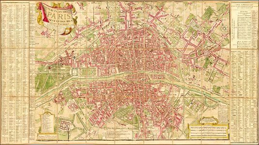
plan de roussel - derivative files
maps in the library of congress
1800 maps of the atlantic ocean
1800s maps of the americas
18th-century maps of veneto
1700s maps of slovenia
turgot map of paris, bibliothèque nationale de france
architectural drawing sheets
18th-century maps of bretagne
robert cordier (engraver)
18th-century maps of morocco
1700s maps of algeria
maps by louis brion de la tour
18th-century maps of tartary
maps in the rijksmuseum amsterdam
maps by pieter mortier
maps by jean-baptiste bourguignon d'anville
18th-century maps of western europe
biblioteca di storia e cultura del piemonte "giuseppe grosso"
1700s maps of liguria
recueil d'antiquités égyptiennes, étrusques, greques et romaines (1756)
18th-century maps of paris
géographie générale; physique, politique et économique (1876)
18th-century maps of alpes-maritimes
considérations géographiques et physiques sur les nouvelles découvertes au nord de la grande mer
1755 maps of north america
18th-century maps of western europe
1754 maps of europe
carte de la mer méditerranée en trois feuilles (dheulland et al.)
18th-century maps of the western mediterranean
carte de la mer méditerranée en trois feuilles (dheulland et al.)
18th-century maps of the eastern mediterranean
carte de moscovie by guillaume de l'isle (1706)
bibliothèque nationale de france
atlas géographique des quatre parties du monde (delisle)
18th-century double hemisphere world maps
considérations géographiques et physiques sur les nouvelles découvertes au nord de la grande mer
1750s maps of the russian empire
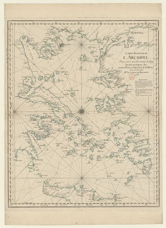
18th-century maps of the aegean sea
jean-fréderic phélypeaux
1779 maps of the united states
1770s maps of the caribbean
carte particulière des postes de france dediée au roy par son très humble, tres-obéssant, tres-fidele sujet et serviteur - hubert jaillot.... 20 petites lieues de france (1 - 1 800 000 environ) - btv1b8492995r
bibliothèque nationale de france
carte particulière des postes de france dediée au roy par son très humble, tres-obéssant, tres-fidele sujet et serviteur - hubert jaillot.... 20 petites lieues de france (1 - 1 800 000 environ) - btv1b8492995r
bibliothèque nationale de france
18th-century double hemisphere world maps
1760s maps of the world
recueil d'antiquités égyptiennes, étrusques, greques et romaines (1752)
18th-century maps of périgueux
considérations géographiques et physiques sur les nouvelles découvertes au nord de la grande mer
isla de los estados
carte de moscovie by guillaume de l'isle (1706)
bibliothèque nationale de france
carte de moscovie by guillaume de l'isle (1706)
bibliothèque nationale de france
jean-fréderic phélypeaux
guillaume dheulland
1 - 100 of 115
Next page
/ 2


![The Course of the Somme in the vicinity of which course are situated, the Ponthieu, the Amienois, the Santerre and the Vermandois / By N. de Fer... Scale of Three Hours of Travel [=1: 139 200 ]; H. Van Loon sculp, Herman van Loon, 1709](https://cdn.creazilla.com/illustrations/10000794475/the-course-of-the-somme-in-the-vicinity-of-which-course-are-situated-the-ponthieu-the-amienois-the-santerre-and-the-vermandois-by-n-de-fer-scale-of-three-hours-of-travel-1-139-200-h-van-loon-sculp-herman-van-loon-1709-md.jpg)