Log in
All resources
Create a design
675 Free Artworks of Ships On Maps
drawings and watercolours of the royal museums greenwich
latin-language maps
maps in the royal collection of the united kingdom
prints in the royal collection of the united kingdom
maps with cartouches
coats of arms on maps
1590 maps
maps by abraham ortelius
atlas van der hagen
compass roses on maps
works after map of amsterdam, 1544
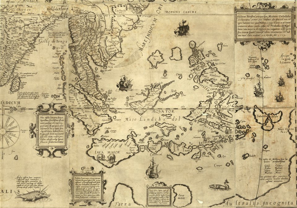
ships on maps
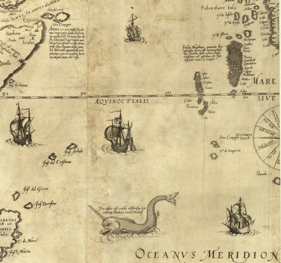
itinerario (jan huygen van linschoten)
latin-language maps
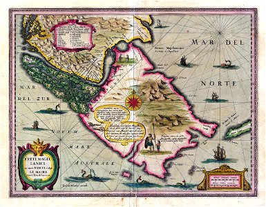
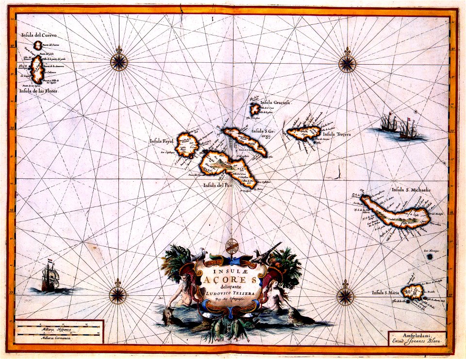
old maps of spitsbergen
old maps of the arctic
maps in the library of congress
maps by jodocus hondius
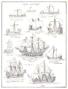
old ships
maps
1758
1756
1758
1711
1862
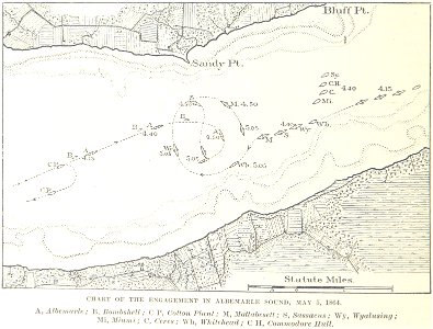
1864
maps with cartouches
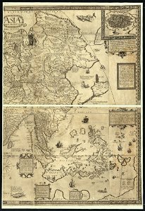
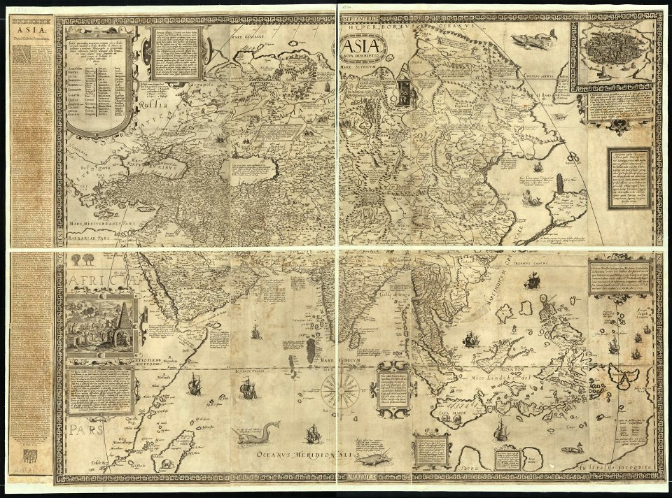
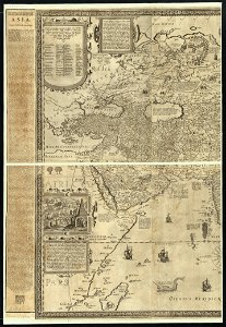
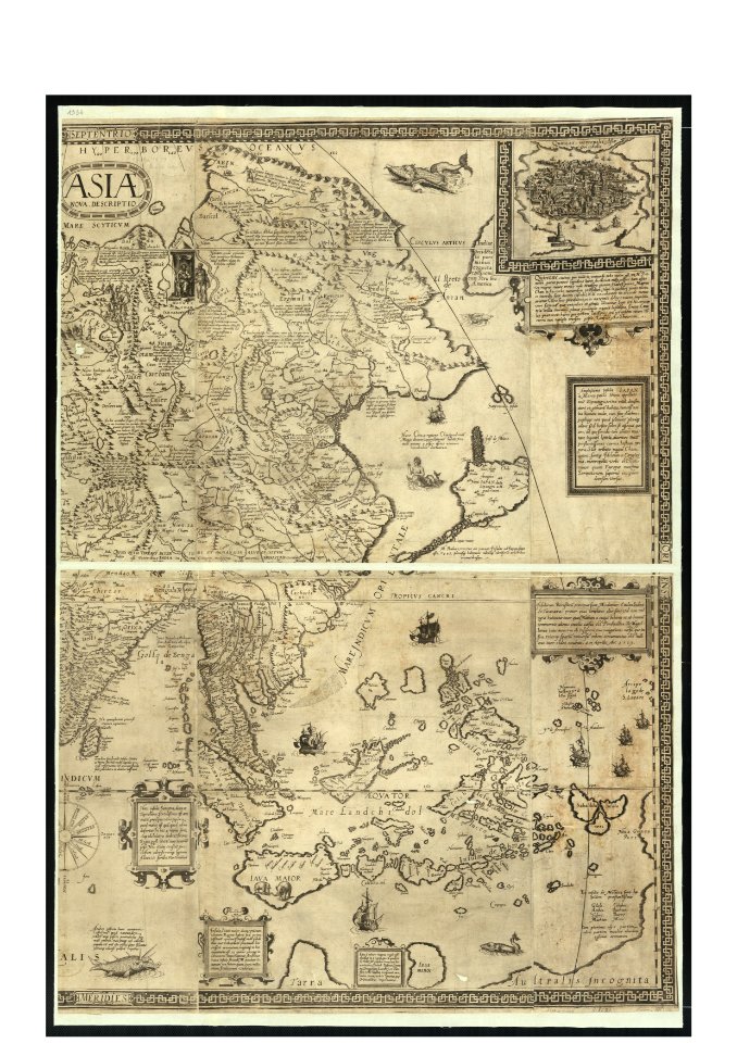
old maps of asia
maps with cartouches
ships on maps
maps by abraham ortelius
ships on maps
maps with cartouches
braun & hogenberg
ships on maps
1590 maps
pictorial maps
ships of japan
old maps of guinea
copper engraving
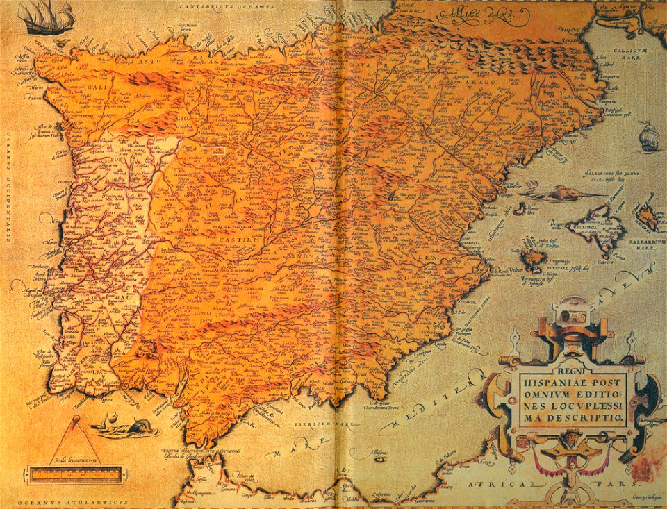
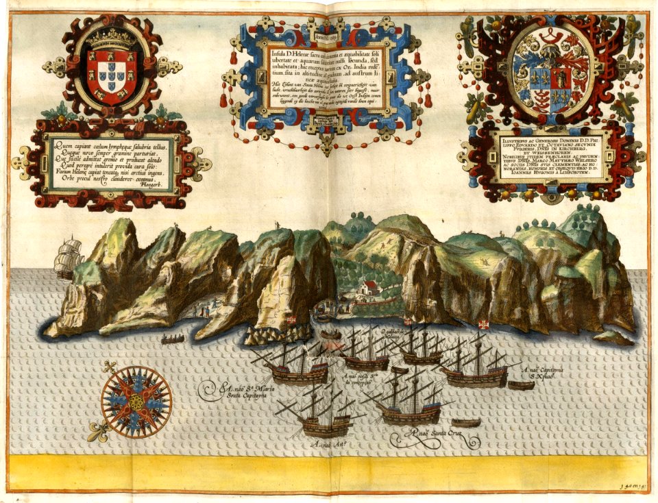
old maps of the iberian peninsula
ships on maps
coats of arms on maps
ships on maps
old maps of asia
ships on maps
history of the french navy
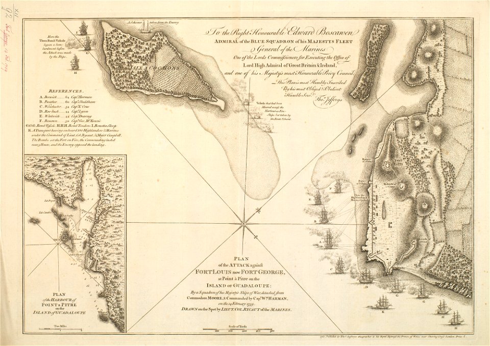
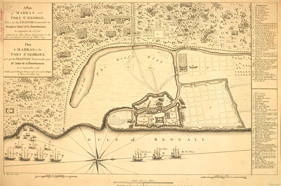
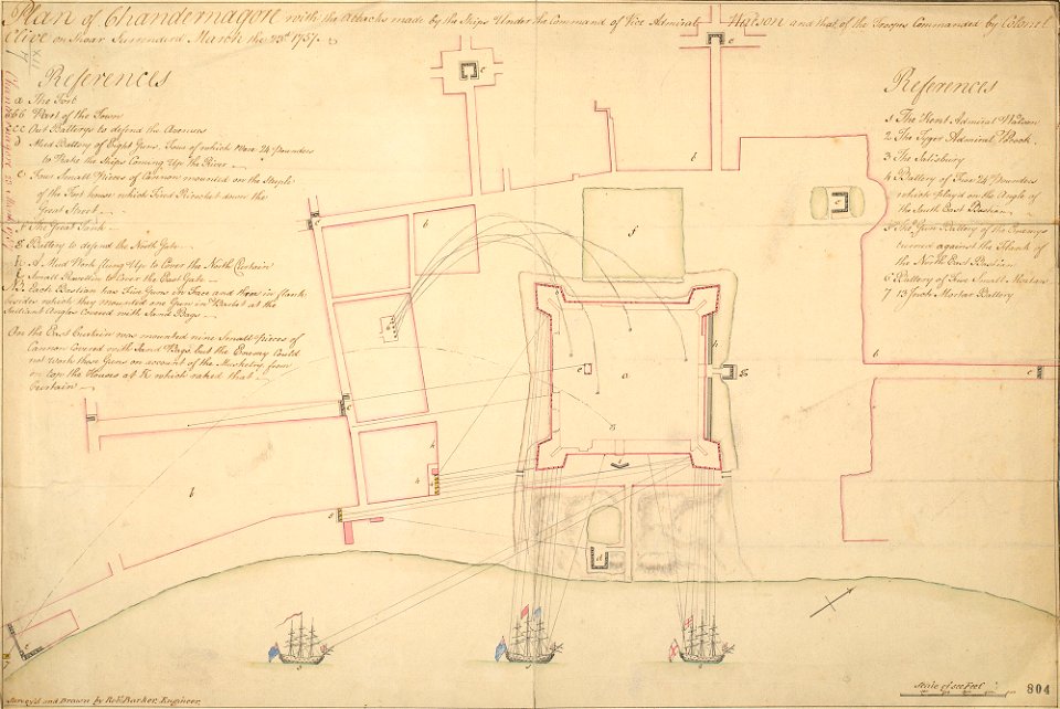
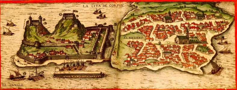
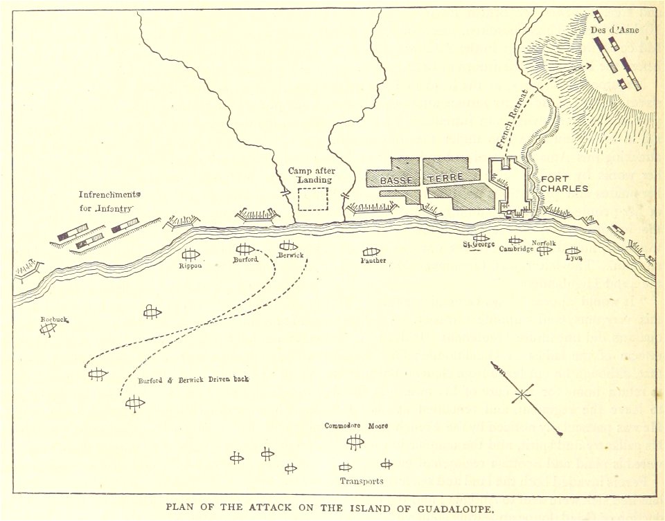
fort st. george
old maps of asia
ships on maps
maps in the royal collection of the united kingdom
1746
ships on maps
spain
ships on maps
1628 maps
johann baptist homann
ships on maps
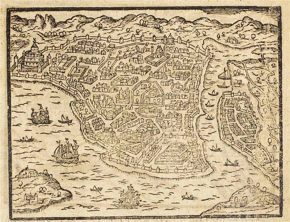
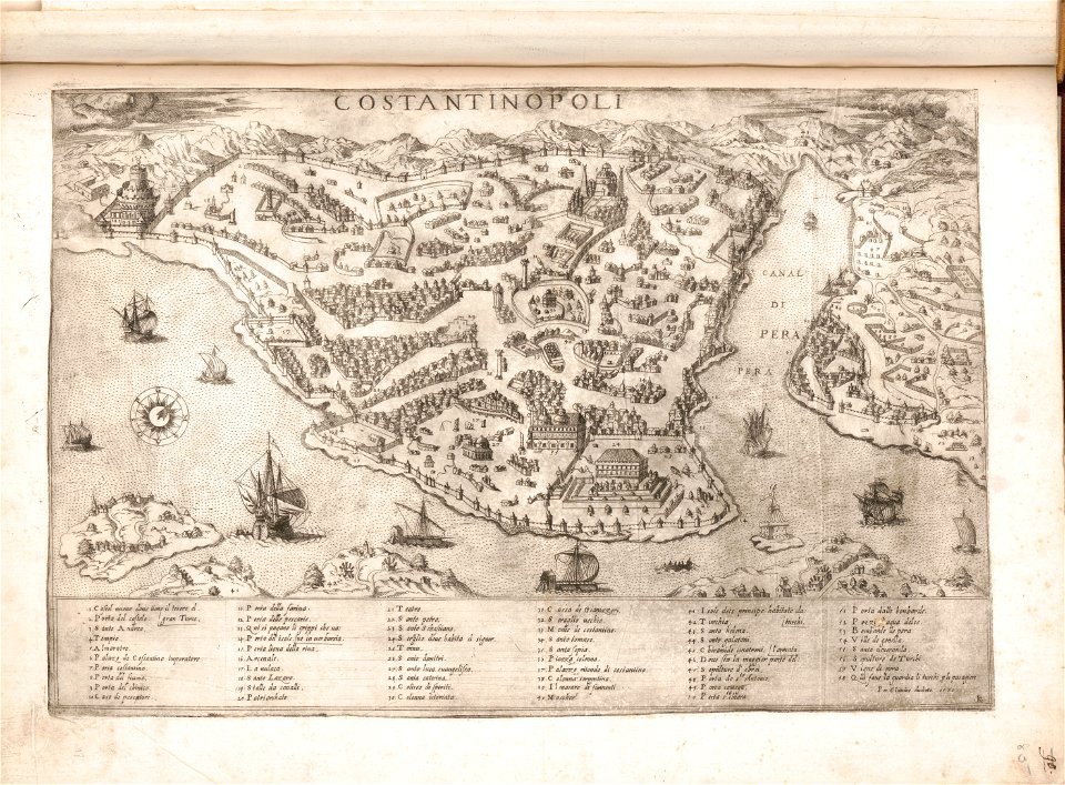
old maps of istanbul
ships on maps
drawings in the stadsarchief amsterdam
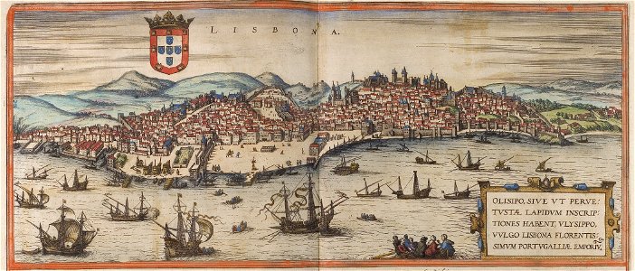
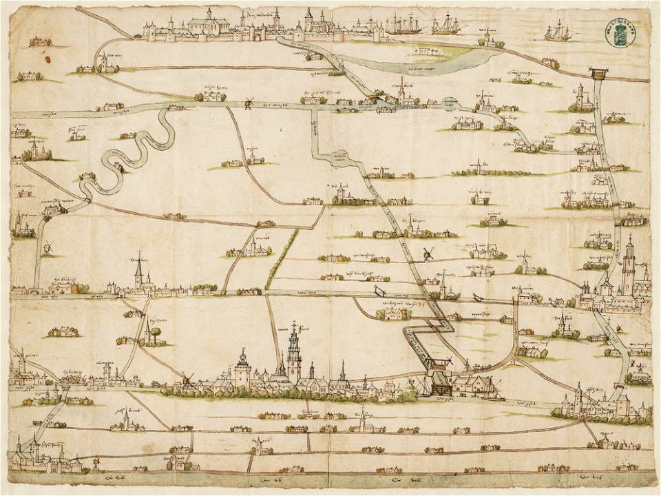
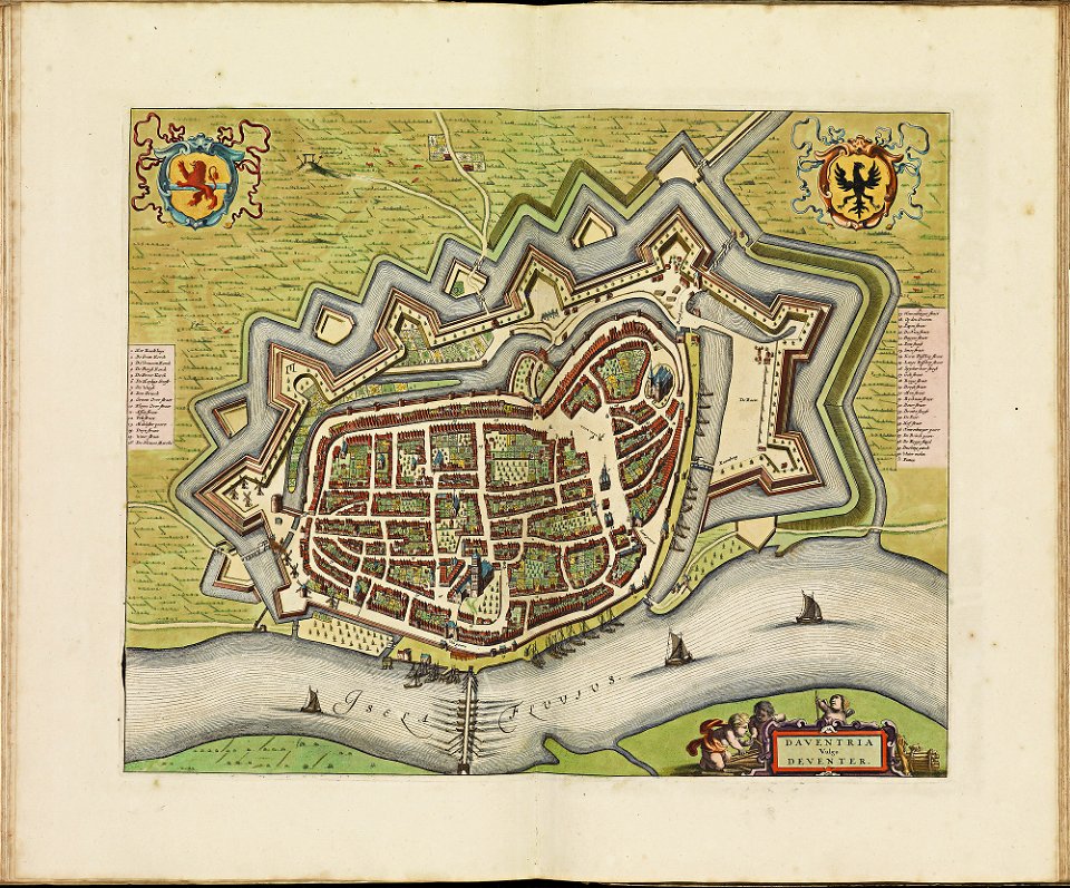
old maps of amsterdam
latin-language maps
ships on maps
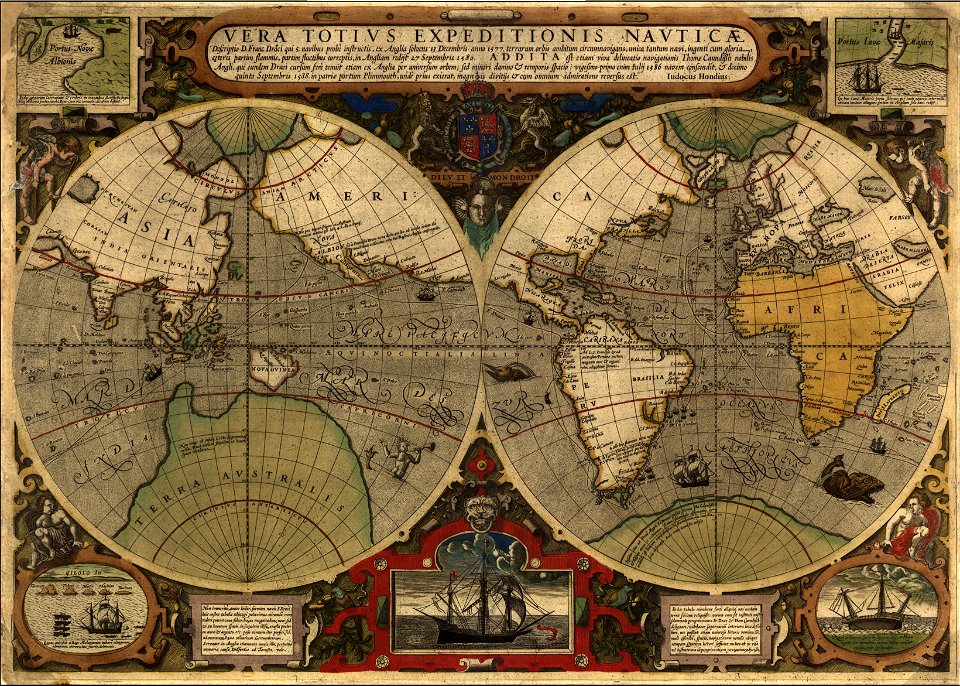
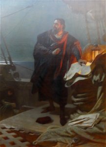
francis drake
1577
windmills in art
bridge of arts
maps made in the 17th century
ships on maps
pieter van der keere
ships on maps
drainage basin maps of north america
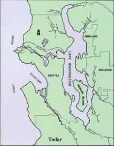
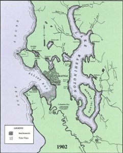
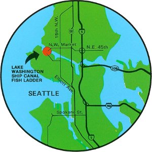
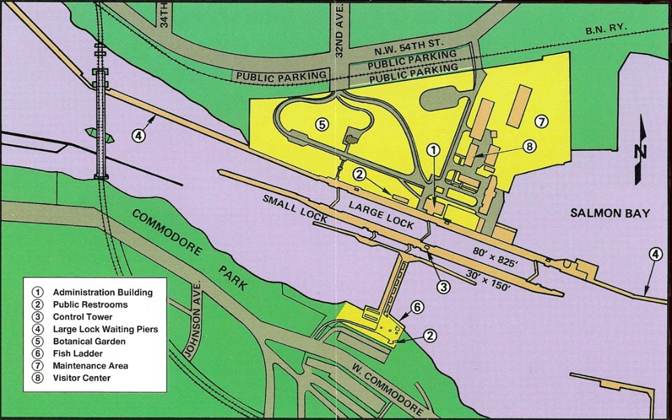
lake washington ship canal
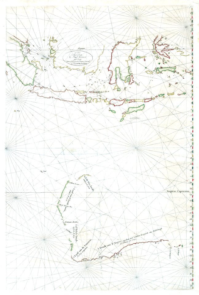
old maps of the indian ocean
ships on maps
itinerarium hierosolymitanum et syriacum..., 1619
ships on maps
lake washington ship canal
1902 maps
dutch 17th-century prints in the rijksmuseum amsterdam
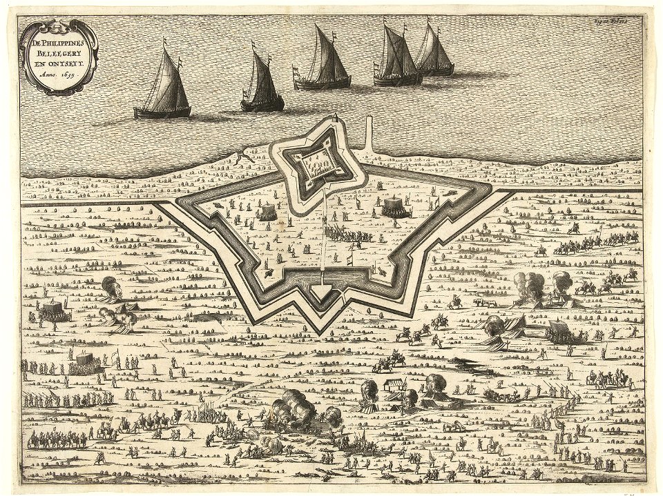
old maps of the philippines
fish ladders in the united states
1996 maps
maps
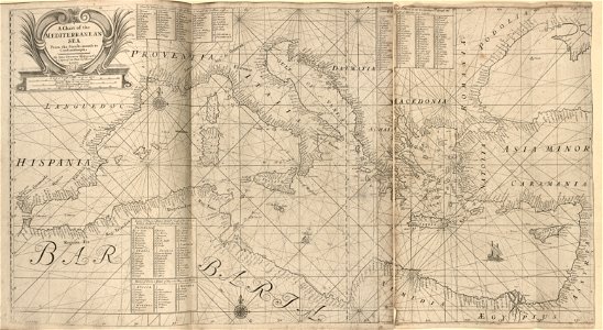
sea
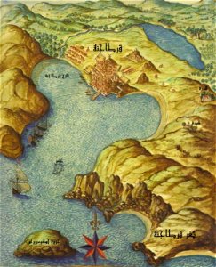
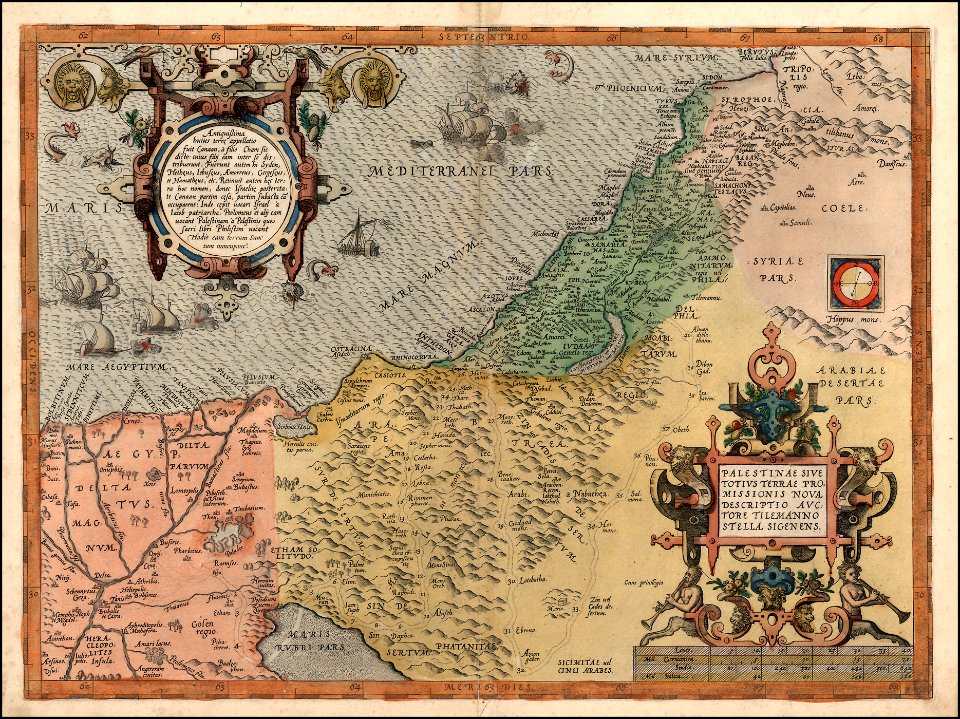
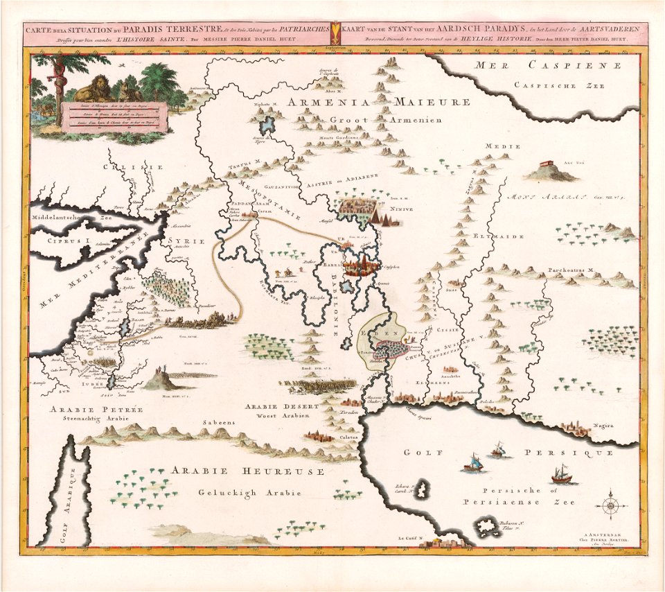
maps of midian
ships on maps
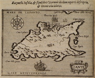
levante
sodom
old maps of france
1730
clothing of russia
ships on maps
old maps of greenland
old maps of iceland
maps with cartouches
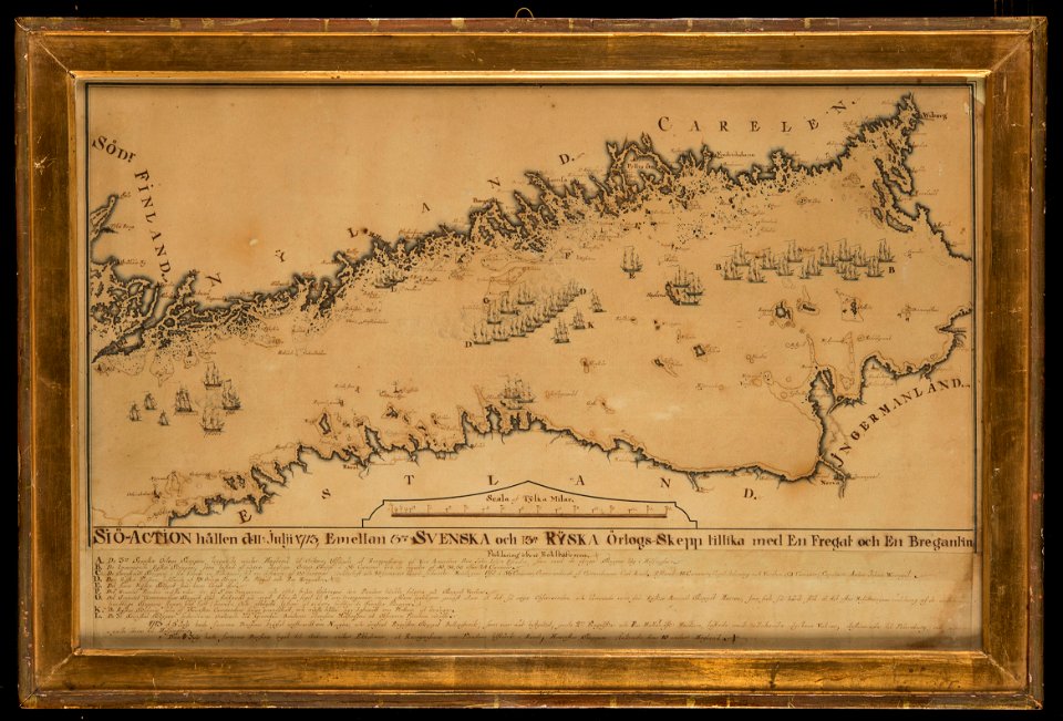
finland
braun & hogenberg
ships on maps
maps with cartouches
ships on maps
17th-century fortress plans
coats of arms on maps
coats of arms on maps
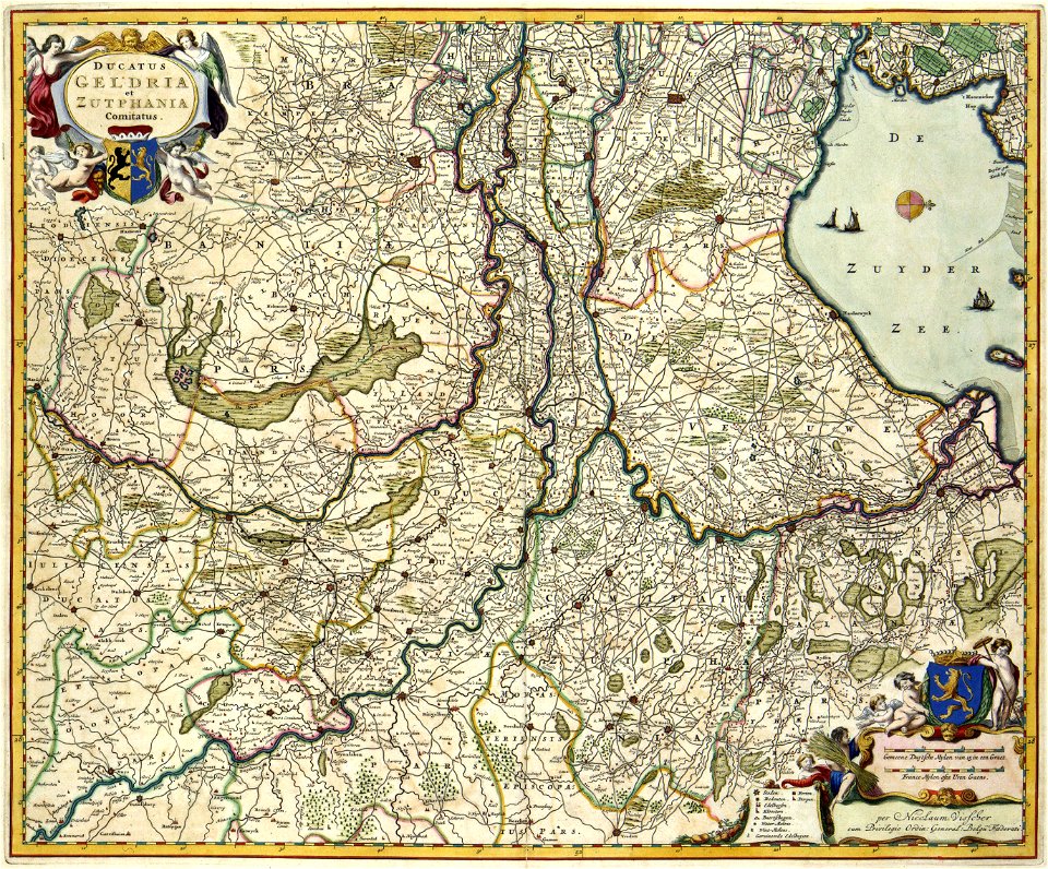
guelder
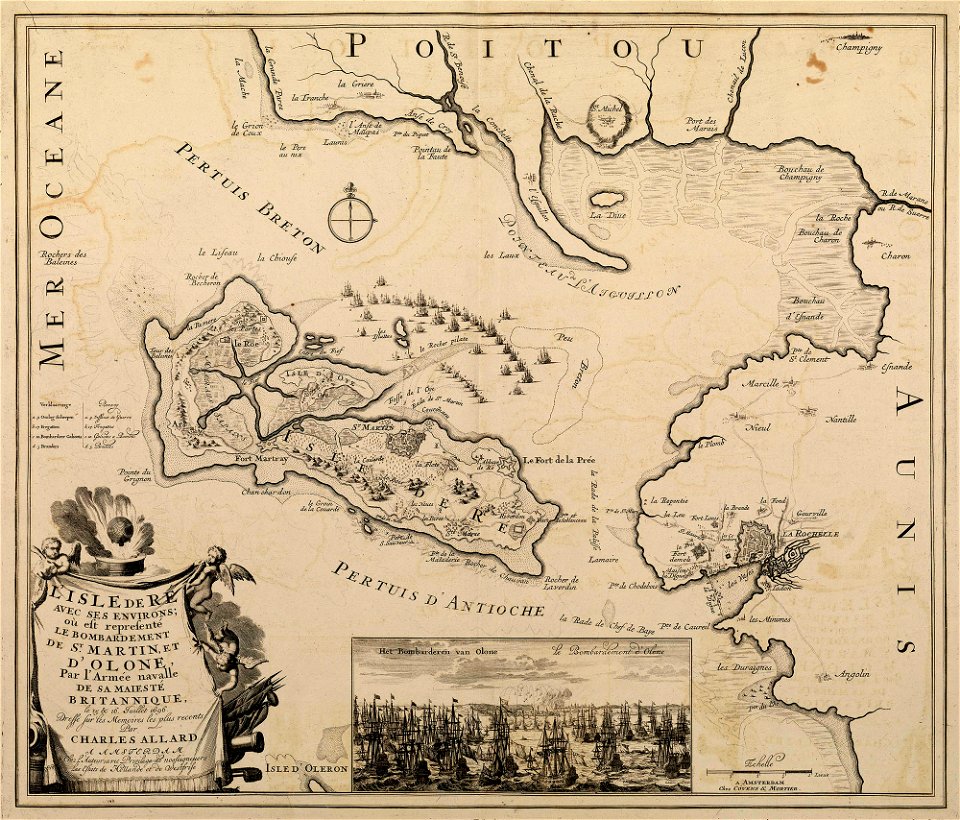
sainte-marie-de-ré
bombardment
pieter van den keere
pieter van der keere
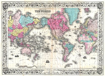
political maps of the world
1852
1842
1837
latin-language maps
ships on maps
maps in the library of congress
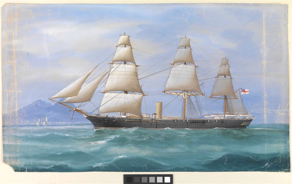
sailing ships of spain
drawings of sailing ships
carracks in art
maps with cartouches
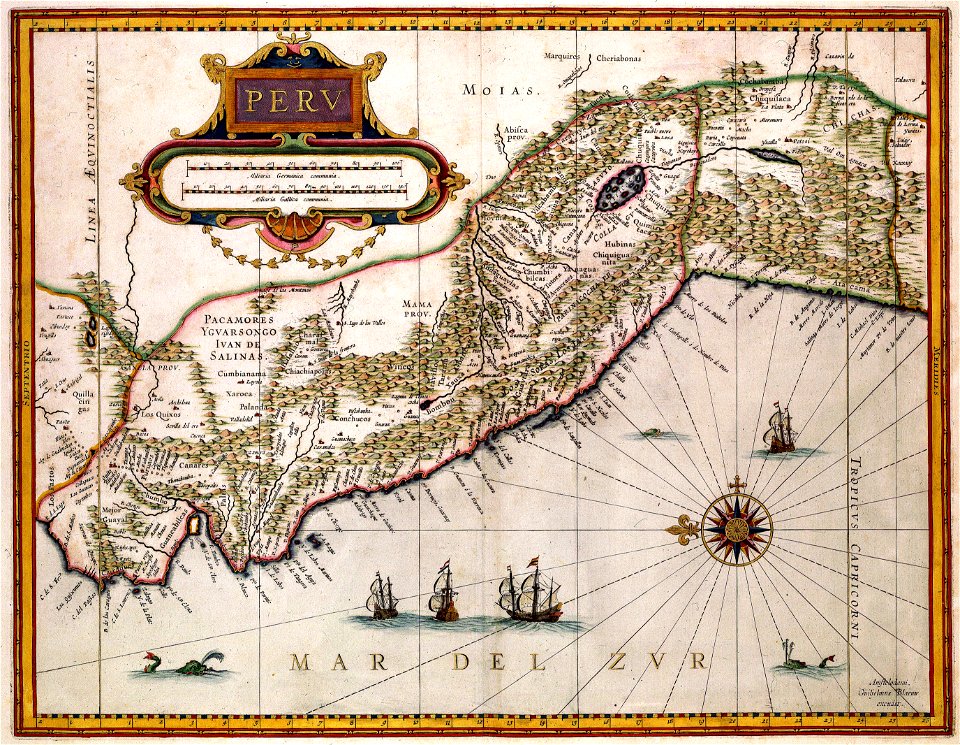
old maps of peru
works by giovanni giacomo de rossi
sailing ships of the netherlands
maps by willem and johannes blaeu
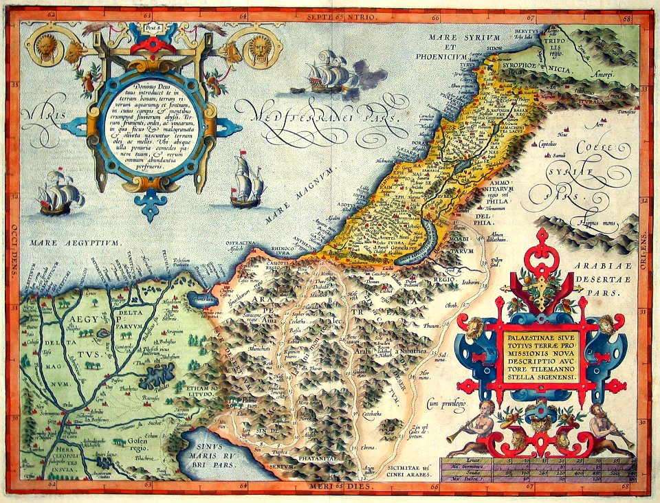
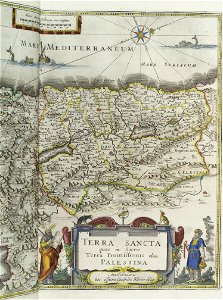
old maps of israel
printing
1848
london
1841
itinerarium hierosolymitanum et syriacum..., 1619
ships on maps
1842
1839
historical coats of arms of denmark
royal coats of arms of sweden
medieval
maps
works by giovanni giacomo de rossi
sailing ships of the netherlands
printing
1797
1758
1753
old maps of the world
1880 maps
old maps of australia
western australia
1842
1837
ballard locks
fish ladder
printing
1869
cornell university library
garden of eden
claes jansz. visscher (ii)
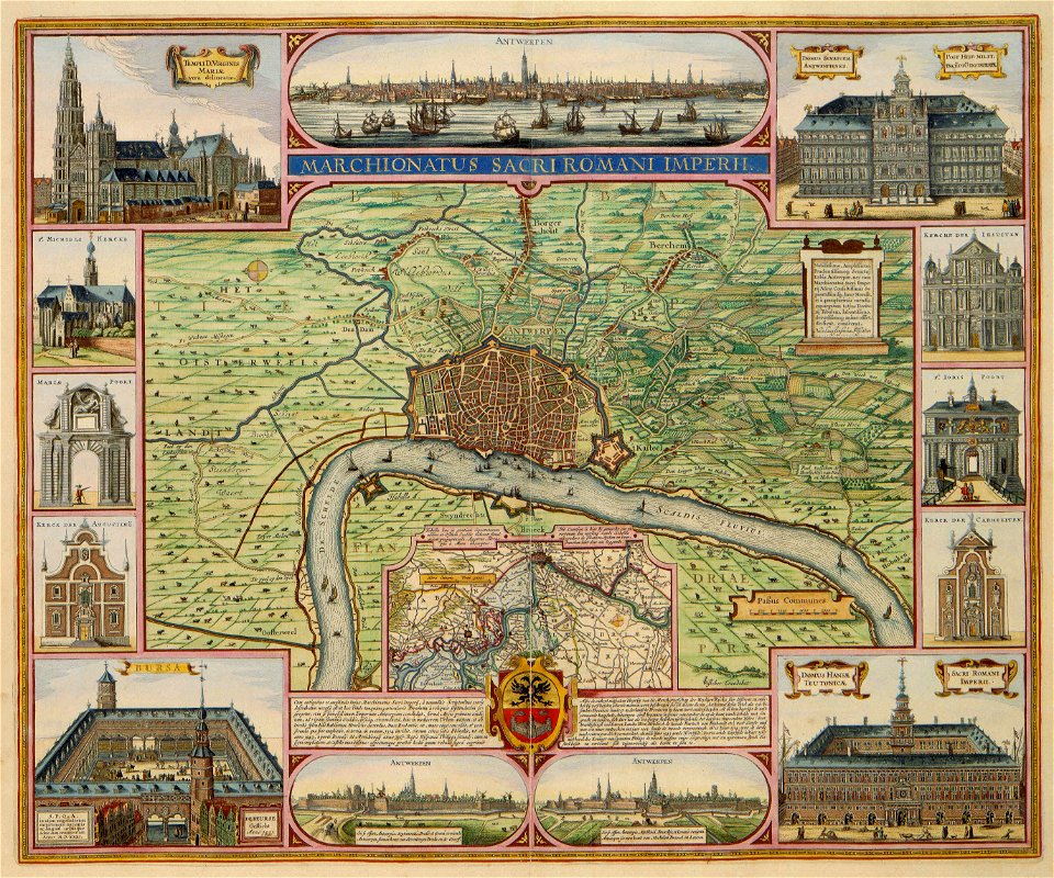
antwerp
printing
1807
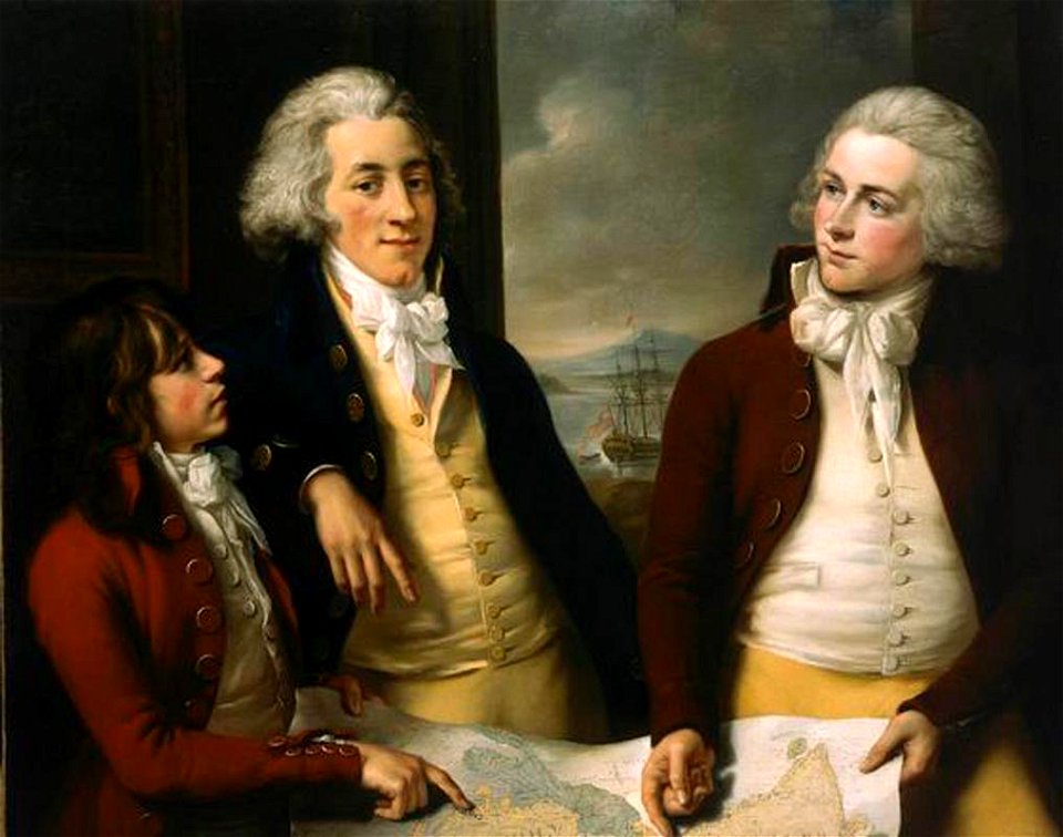
lady hamilton
emma
copper engraving
ships on maps
printing
1863
ships on maps
brunsbüttel
prints in the royal collection of the united kingdom
maps of battles of the thirty years' war
printing
1781
printing
1772
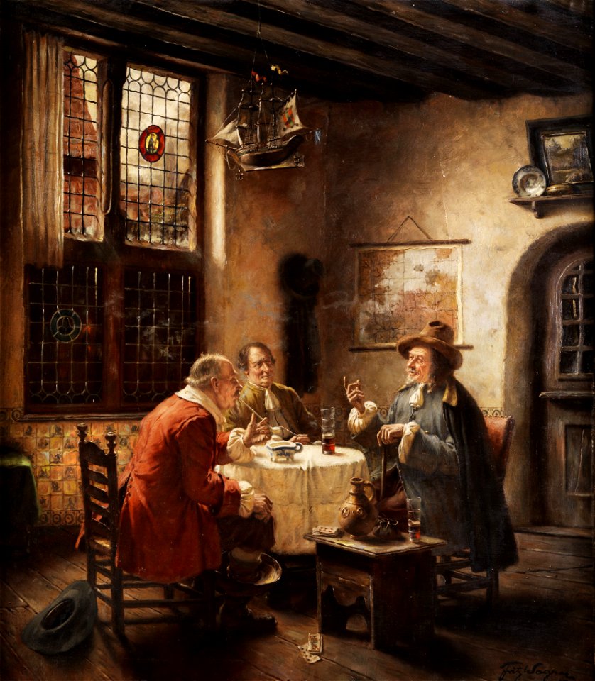
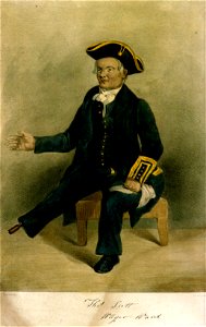
smoking men in art
maps in art
slave ships
printing
sailing ships of the netherlands
1665
greenwich pensioners
printing
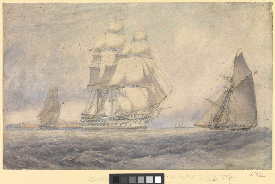
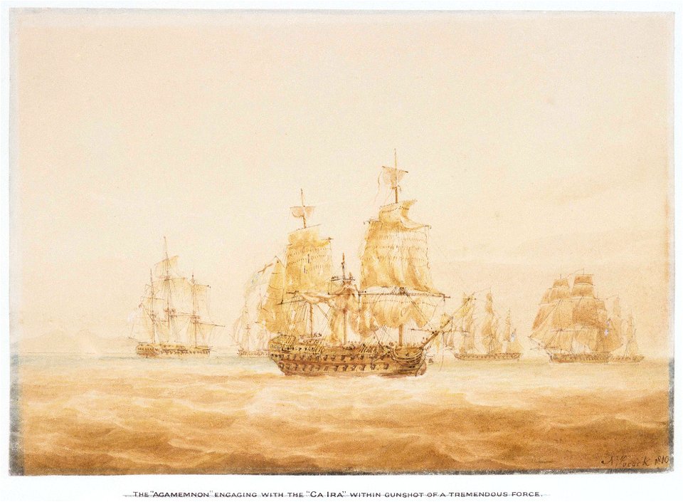
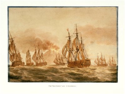
hms victory (ship
printing
university of toronto wenceslas hollar digital collection
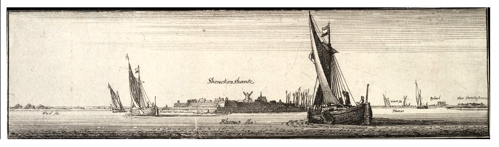
sailing barge
itinerario (jan huygen van linschoten)
latin-language maps
river
roads
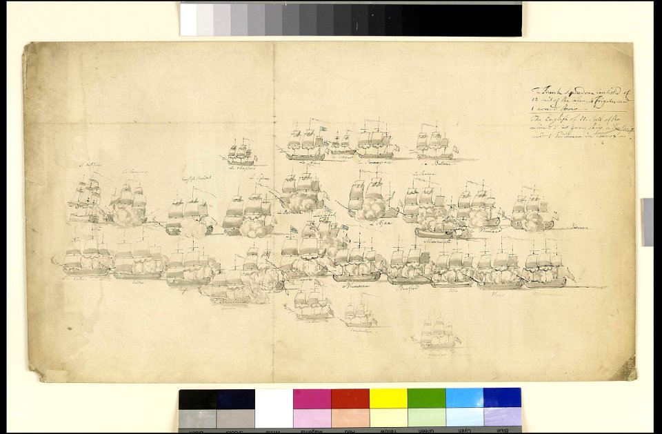
naval battles involving sweden
russo-swedish war (1788–1790)
sailing ships of portugal
1596
ekeren
lillo
british east india company
london
maps in the library of congress
ships on maps
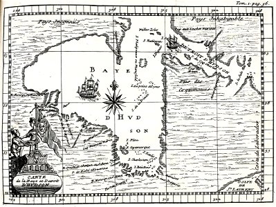
hudson bay
1693
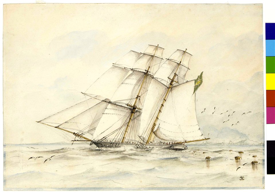
19th-century portrait paintings in germany
19th-century sailing ships in paintings
old constellation maps
maps by samuel dunn
itinerario (jan huygen van linschoten)
latin-language maps
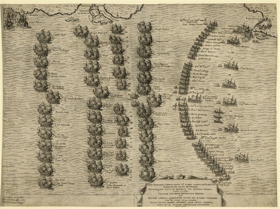
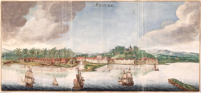
heraklion venetian walls
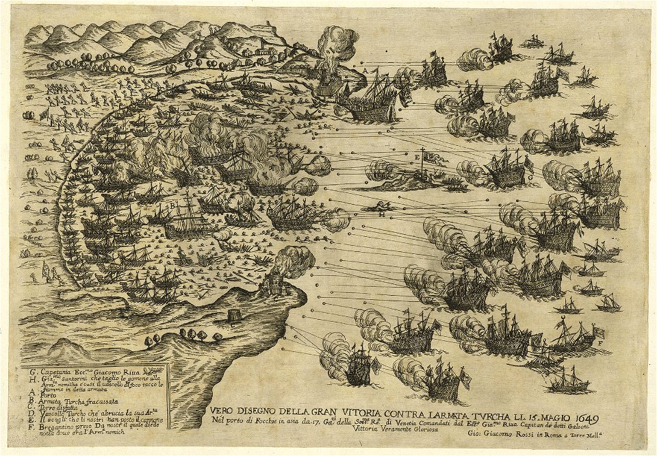
1651 in candia
1 - 100 of 675
Next page
/ 7