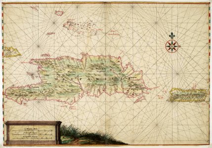
Map of Hispaniola and Puerto Rico, Johannes Vingboons, circa 1665
Title in the leupe catalogue (na): kaart van de kusten van st. Domingo, portorico en de oostelijke bahama-eilanden. Map of hispaniola and puerto rico. Remarks: the chart is contained in the vingboons atlas. This chart closely resembles national archives, inv. Nr. Velh0619. 60. Date: circa 1665. Dimensions: height: 72 cm (28.3 in); width: 50 cm (19.6 in). Medium: watercolour on paper. Collection: Nationaal Archief. AMH-6759-NA Map of Hispaniola and Puerto Rico