Log in
All resources
Create a design
27,441 Free Images of Maps
bibliothèque nationale de france
maps by willem and johannes blaeu
maps in the library of congress
copper engraving print
koninklijke bibliotheek
gemeente atlas van nederland - south holland
joan blaeu
latin-language maps
guide joanne normandie-1912
1912 maps of france
istván széchenyi
thonet furniture
maps in the library of congress
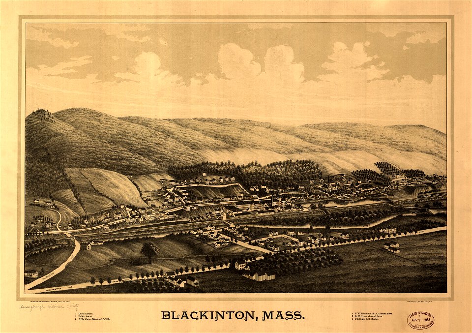
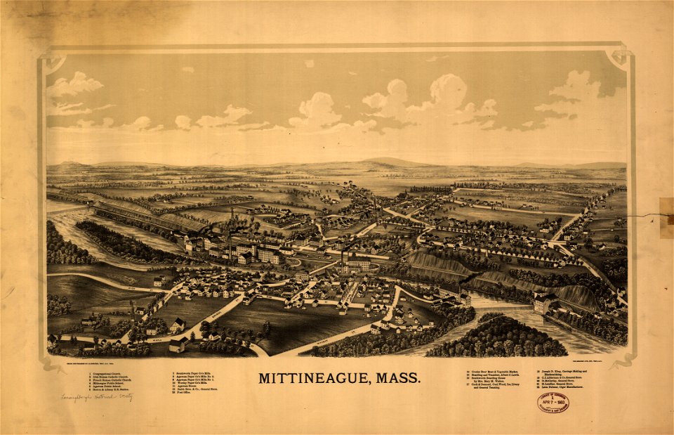
1889 maps of massachusetts
maps in the library of congress
1889 maps of massachusetts
hoogheemraadschap rijnland map, 2nd edition, 1687
gemeenlandshuis zwanenburg in art
walter riemer (illustrator)
pictorial maps of germany
fra mauro map
1459
maps by nicolaes visscher i
atlas van der hagen
atlas maior, vol 12 (america) - joan blaeu, 1667 - bl 114.h(star).12
1667 maps of north america
1660s maps of spain
1667 maps
tourism advertising posters of germany
german-language maps of germany
eran laor cartographic collection
joan blaeu
africa and its inhabitants, vol. ii
charles eugène perron
siege of steenwijk 1592
maps of steenwijk
old maps of saxony
pieter schenk (ii)
maps made in the 17th century
old maps of sicily
18th-century maps of korea
nouvel atlas de la chine
17th-century maps of frankfurt am main
maps by willem and johannes blaeu
18th-century celestial maps
1708 maps
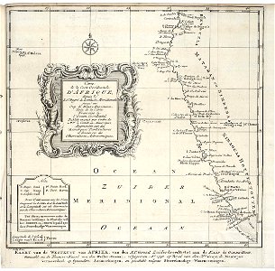
hendrik van langren map of south asia
1590s maps of the levant
hendrik van langren map of south asia
renaissance
old maps of the london underground
maps by macdonald gill
the hague in the 1830s
old maps of the hague
maps of flanders by gerardus mercator
maps in the phoebus foundation
gemeente atlas van nederland - south holland
19th-century maps of rotterdam
1910s maps of bosnia and herzegovina
1910s maps of croatia
1573 maps of europe
christian sgrothen
maps by willem and johannes blaeu
old maps of gironde
historisk atlas (stockholm, norstedt & söner, 1880)
old maps of the polish-lithuanian commonwealth
maps from the earth and its inhabitants, vol. x
1890s maps of sudan
historisk atlas (stockholm, norstedt & söner, 1880)
old maps of the carolingian empire
propaganda map
1529 maps
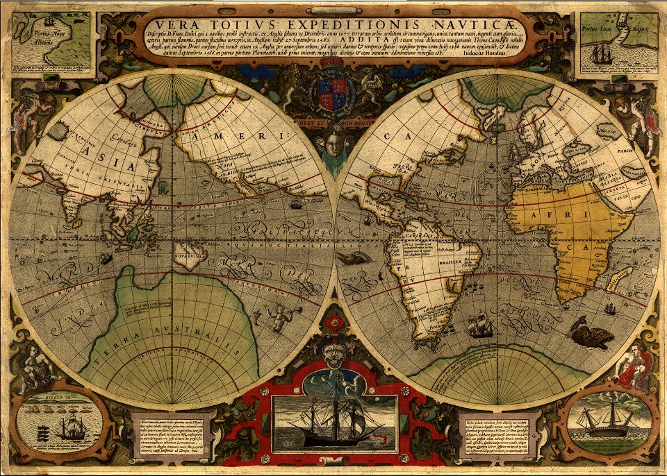
maps by jodocus hondius
1590s maps of the world
maps from the earth and its inhabitants, vol. iv
maps of lewis, scotland
lawrence h. slaughter collection of english maps, charts, globes, books and atlases
nypl lionel pincus and princess firyal map division
maps from the earth and its inhabitants, vol. ix
exploration of arabia
maps of the dutch east india company - south africa
old maps of the dutch east india company
maps in the library of congress
1780s maps of the caribbean
guide joanne normandie-1912
1912 maps of france
sicilia (galleria delle carte geografiche)
1580s maps of sicily
guide joanne normandie-1912
1912 maps of france
suecia antiqua et hodierna, volume 1
17th-century maps of sweden
maps by edward wright
molyneux globes
maps of paris from paris musées
dheulland map of paris
avenionensis ditio et venaisinus comitatus (galleria delle carte geografiche)
old maps of avignon
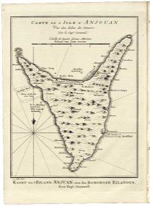
old maps of anjouan
1747 maps
lawrence h. slaughter collection of english maps, charts, globes, books and atlases
nypl lionel pincus and princess firyal map division
den danske hærs historie til nutiden og den norske hærs historie indtil 1814
maps from the mechanical curator collection
maps of kraków
planty
a map of the british empire in america with the french and spanish settlements adjacent thereto
maps in the library of congress
maps of spain by tomas lopez
1761 maps of spain
map of the upper rhenian circle by sanson
maps by nicolas sanson
charles-françois beautemps-beaupré
maps from gallica
maps of the kingdom of córdoba (crown of castile)
maps of spain by tomas lopez
1852 maps of france
old maps of isère
maps of spain by tomas lopez
1761 maps of spain
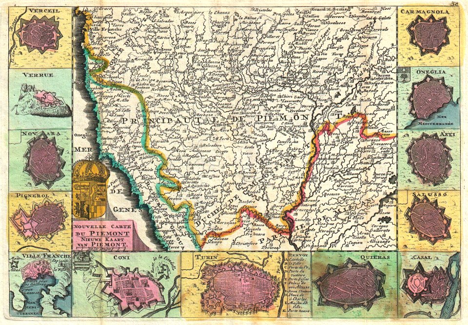
18th-century maps of piedmont
daniel de la feuille
maps by pieter van der keere
ships on maps
old maps of bordelais
maps of médoc
maps in the library of congress
1780s maps of cuba
maps by pieter mortier
old maps of genoa
st. helena - a physical, historical, and topographical description of the island (1875) by melliss
maps from the mechanical curator collection
ice-bound on kolguev (1895) by trevor-battye
maps from the mechanical curator collection
17th-century maps of the aegean sea
17th-century maps of greece
maps by john cary
1799 maps
gemeente atlas van nederland - south holland
maps of westmaas
monsters on maps
ships on maps
atlas novus (blaeu)
1640s maps of paris
monsters on maps
ships on maps
1640s maps of asia
stefano scolari
maps by willem and johannes blaeu
old maps of bolsward
chicago and the midwest, newberry library
old maps of chicago
sicilia (galleria delle carte geografiche)
maps of bivona
maps from university of amsterdam special collections
atlas der neederlanden
maps of the dutch east india company - south africa
1682
maps of the west-indische compagnie
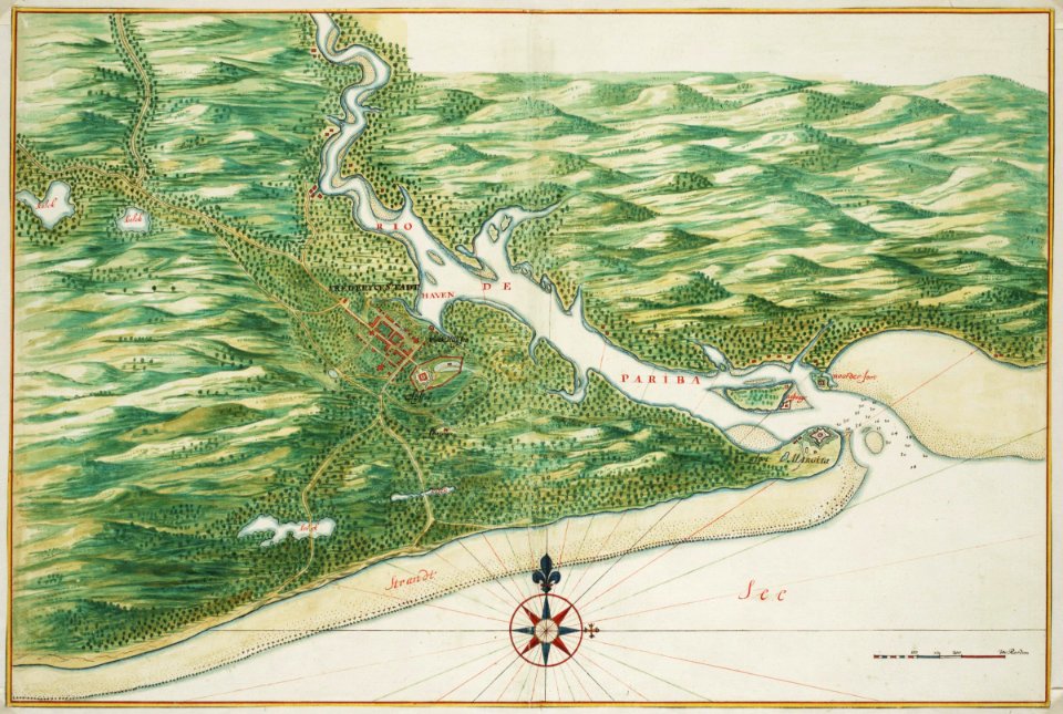
old maps of dutch brazil
maps of the west-indische compagnie
old maps of dutch brazil
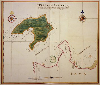
panaitan island
1660s maps
gemeente atlas van nederland - north holland
old maps of amsterdam
17th-century maps of prussia
baroque
1804 maps of europe
maps by john cary
16th-century maps of augsburg
1549 in augsburg
19th-century maps of nigeria
maps of niger delta
maps of impact craters on mars
arago (martian crater)
maps from the earth and its inhabitants, vol. xii
1710s maps of africa
wanderings, south and east (1882)
old maps of polynesia
maps from the earth and its inhabitants, vol. iv
linguistic maps of wales
maps from the earth and its inhabitants, vol. vii
floods in china
maps from the earth and its inhabitants, vol. v
maps of sea ice
ismailïa. a narrative of the expedition to central africa for the suppression of the slave trade (1874)
1874 maps of africa
maps from the earth and its inhabitants, vol. xiii
maps of orange free state
maps from the earth and its inhabitants, vol. xiv
19th-century maps of borneo
africa and its inhabitants, vol. ii
charles eugène perron
eran laor cartographic collection
sanson maps of asia
maps by takeshiro matsuura
maps of the kuril islands
copper engravings
1619 engravings
17th-century maps of jerusalem
1657 maps
guide joanne normandie-1912
1912 maps of france
gemeente atlas van nederland - south holland
maps of ameide
gemeente atlas van nederland - south holland
maps of haastrecht
maps of emden by braun & hogenberg
1576 in lower saxony
3601 - 3700 of 27,441
Next page
/ 275