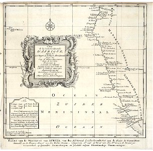
Map of the west coast of Africa, from 11 degrees south latitude to the Cape of Good Hope, Jakob van der Schley, circa 1747
Map of the west coast of africa, from 11 degrees south latitude to the cape of good hope. Kaart van de westkust van afrika, van den xi. E graad zuiderbreedte tot aan de kaap de goede-hoop. Carte / de la coste occidentale / d'afrique, / depuis le / xi. E degré de latitude meridionale / jusqu'au / cap de bonne esperance. The abbreviations used are set out and explained bottom left. The map has been copied from a french chart dating back to 1738. Date: circa 1747. Dimensions: height: 28 cm (11 in); width: 27.5 cm (10.8 in). Medium: engraving on paper. Collection: Koninklijke Bibliotheek. AMH-7883-KB Map of the west coast of Africa, from 11 degrees south latitude to the Cape of Good Hope