Log in
All resources
Create a design
27,441 Free Images of Maps
koninklijke bibliotheek
maps by willem and johannes blaeu
maps in the library of congress
engraving on paper
paper
eran laor cartographic collection
baroque
maps of the west-indische compagnie
maps from the mechanical curator collection
maps in the british museum
maps from university of amsterdam special collections
atlas der neederlanden
maps from university of amsterdam special collections
atlas der neederlanden
maps from university of amsterdam special collections
atlas der neederlanden
old maps of flanders
1635 maps
maps of paris by braun & hogenberg
1572 in paris
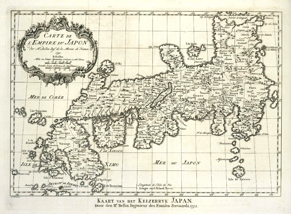
maps of the dutch east india company - japan
1750s maps of japan
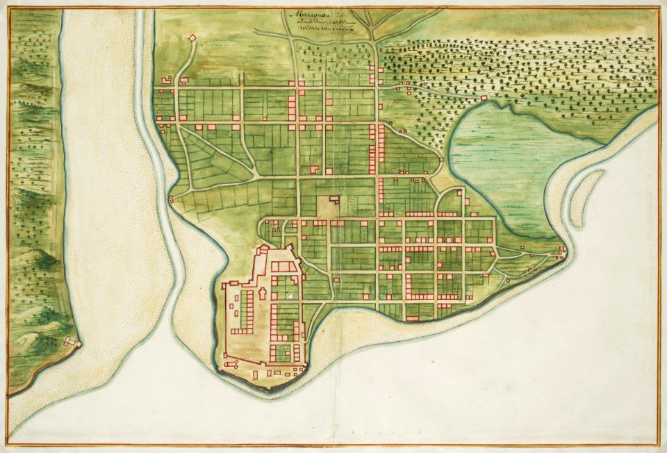
1899 maps of south america
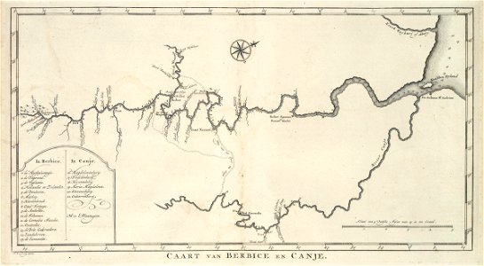
old maps of suriname
maps of upper palatinate
old maps of bavaria
atlas van der hagen (volume 4)
atlas van der hagen
eran laor cartographic collection
johann christoph haffner
maps by guillaume delisle
1745 maps
merian plan of paris - derivative files
baroque
gemeente atlas van nederland - north holland
maps of schermer
images of places from encyclopædia britannica
old maps of edinburgh
maps by willem and johannes blaeu
maps of barbary coast
maps of the land of oz
1914 maps
1907 maps of the world
maps by girolamo porro
maps of the west-indische compagnie
old maps of dutch brazil
pierre antoine tardieu
maps from gallica
crystal palace in sydenham
1860s maps of london
17th-century maps of bourgogne
17th-century maps of france
gemeente atlas van nederland - south holland
1860s maps of south holland
cartes de franz schrader
1894 maps of france
siege of philippsburg (1676)
17th-century fortress plans
jakobsbergs gård, järfälla municipality
maps of järfälla
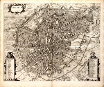
maps of brussels city walls
old maps of brussels
old maps of lake constance
baroque
17th-century maps of puerto rico
description de l'universe
turgot map of paris, kyoto university library – derivative files
église saint-sulpice on old maps
maps of the mysterious island
russian-language maps
map of bruges by marcus gheeraerts (i)
drawings in the groeningemuseum
arthur gray (philatelist)
1913 stamps of australia
maps of the dutch east india company - iran
old maps of the dutch east india company
maps of the west-indische compagnie
1770 maps
maps of the west-indische compagnie
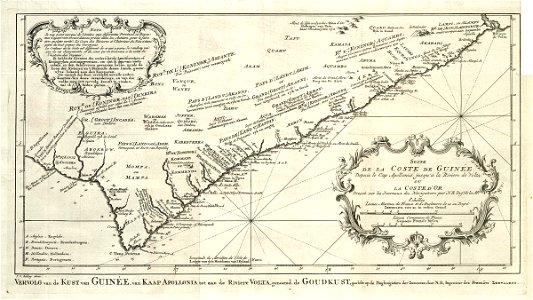
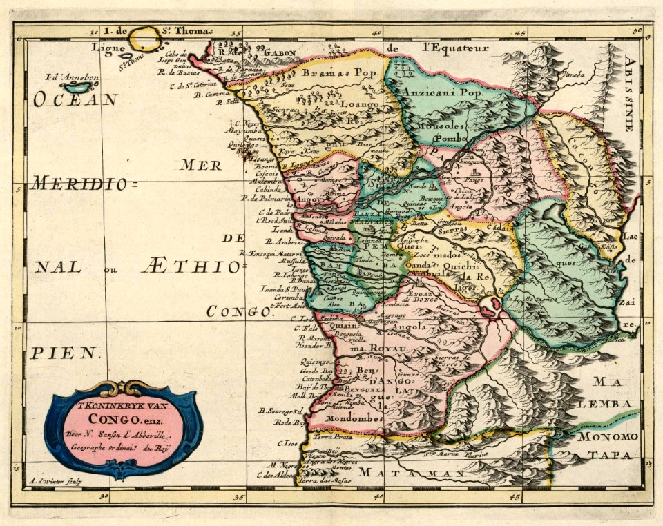
old maps of the dutch gold coast
19th-century double hemisphere world maps
maps by alexandre vuillemin
1665 maps of ukraine
1665 maps
den danske hærs historie til nutiden og den norske hærs historie indtil 1814
maps from the mechanical curator collection
guide joanne espagne et portugal-1915
1915 maps
old maps of the dutch east india company
1680
maps in the library of congress
1877 maps of the united states
maps of goa by braun & hogenberg
maps of diu by braun & hogenberg
tourism advertising posters of germany
spanish-language maps
maps by willem and johannes blaeu
old maps of emden
tourism advertising posters of germany
french-language maps of germany
la piazza di san marco in venezia, by quadri and moretti (1831)
19th-century maps of venice
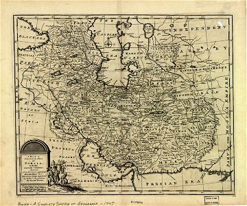
1747 persia map by emanuel bowen
maps in the library of congress
brazilian paintings in the museu antônio parreiras
antônio rafael pinto bandeira
17th-century maps of sumatra
maps by gerard valck
maps by richard william seale
1740s maps of south america
maps from the mechanical curator collection available to georeference
maps from the mechanical curator collection
maps from the mechanical curator collection
1887 maps of sudan
old maps of the new kingdom of granada
maps by willem and johannes blaeu
maps from the earth and its inhabitants, vol. xii
africa in the 1890s
topographia bohemiae moraviae et silesiae (merian)
baroque
eran laor cartographic collection
pierre aveline
nouvelle géographie universelle, vol. xii
charles eugène perron
maps in the library of congress
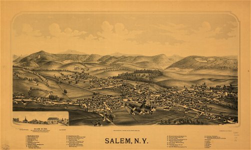
1889 maps of new york (state)
maps in the library of congress
1887 maps of new york (state)
maps in the library of congress
1841 maps of massachusetts
maps in the library of congress
1885 maps of new york (state)
maps in the british museum
german renaissance
18th-century maps of korea
nouvel atlas de la chine
old county maps of oxfordshire
bodleian maps collection
1895 sanborn fire insurance map from new orleans, orleans parish, louisiana
maps in the library of congress
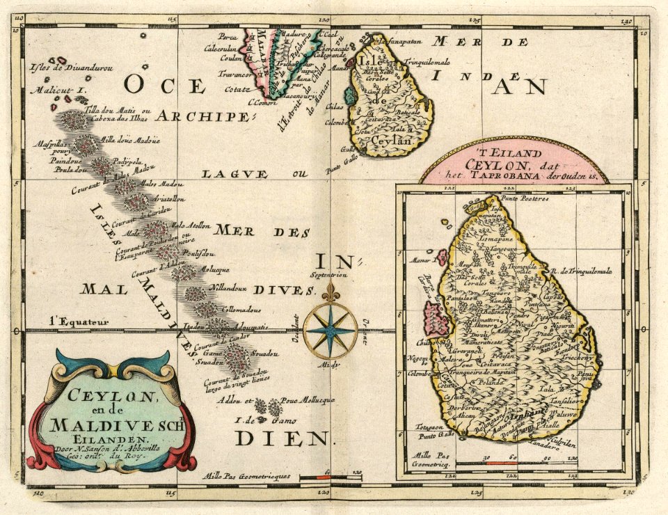
maps of the dutch east india company - sri lanka
maps of the dutch east india company - maldives
maps of the west-indische compagnie
1705
old maps of the tuamotus
old maps of polynesia
hummelmora torp
hummelmora hage
maps of the history of the caucasus under russian rule
1800s maps of the caucasus
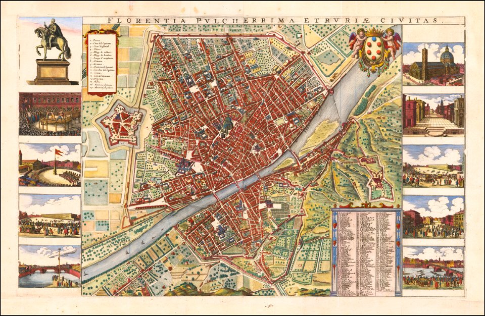
old maps of florence
baroque
historisk atlas (stockholm, norstedt & söner, 1880)
maps showing 5th-century bc history
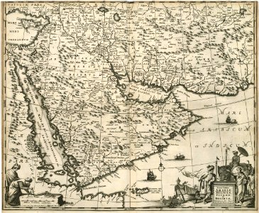
17th-century maps of the near east
maps by willem and johannes blaeu
gemeente atlas van nederland - north brabant
demen
lawrence h. slaughter collection of english maps, charts, globes, books and atlases
pre-raphaelite brotherhood
maps by willem and johannes blaeu
maps of gulf of khambhat
maps of the cape of good hope
old maps of cape peninsula
eran laor cartographic collection
emanuel bowen
maps by jodocus hondius
maps by petrus bertius
maps by wilhelm maximilian carpelan
19th-century maps of stockholm
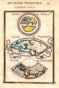
pomponius mela
posidonius
maps made in the 17th century
nivernais (ducato)
maps from géographie illustrée de la france et de ses colonies
orientalist painting
guide joanne normandie-1912
1912 maps of france
guide joanne normandie-1912
1912 maps of france
kaart van het hoogheemraadschap van schieland, 1611-1635
maps of delfshaven
1794 rocque wall map of ireland
county clare
eran laor cartographic collection
jacques-philippe le bas
map collection of leibniz-institut für ost- und südosteuropaforschung
18th-century maps of siberia
19th-century maps of england and wales
maps in the british museum
maps in the british museum
james basire
glaciers and glaciation (1910)
hubbard glacier
maps in the british museum
james basire
maps from the mechanical curator collection
1855 maps
guide joanne espagne et portugal-1915
1915 maps
maps of paris from the university of wisconsin-milwaukee libraries
plan de roussel
gemeente atlas van nederland - south holland
maps of krimpen aan de lek
old maps of french guiana
old maps of cayenne
cartes de franz schrader
1894 maps of france
gemeente atlas van nederland - south holland
1860s maps of south holland
3501 - 3600 of 27,441
Next page
/ 275