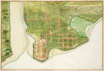
Map of Sao Luis de Marranhao, Johannes Vingboons, circa 1665
Title in the leupe catalogue (na) plattegrond van "maragnon in zuid-america ten westen van brasiel" (st. Luiz de maranhao). Map of sao luis de marranhao. Maragnan in zuid america ten westen van brasiel. Remarks: the chart forms part of the vingboons atlas. Cf. Koninklijke bibliotheek, 1043 b 14 after p. 224 no. 52. Date: circa 1665. Dimensions: height: 64 cm (25.1 in); width: 42 cm (16.5 in). Medium: watercolour on paper. Collection: Nationaal Archief. AMH-6766-NA Map of Sao Luis de Marranhao