Log in
All resources
Create a design
27,441 Free Images of Maps
maps from university of amsterdam special collections
atlas der neederlanden
copperplate print
special collections of the university of amsterdam
atlas der neederlanden deel iii: holland 2. zuid-holland
old maps of delfland
nicolaas samuel crucquius
bibliothèque nationale de france
emanuel bowen
eran laor cartographic collection
historical images of the hôtel d'angoulême lamoignon
turgot map of paris – derivative files
maps by willem and johannes blaeu
old maps of the republic of genoa
historical images of the moscow kremlin
17th-century maps of moscow
description de l'universe
1719 maps of turkey
17th-century maps of the mediterranean sea
description de l'universe
16th-century double hemisphere world maps
1590s maps of the world
1748 maps of the netherlands
1740s maps of belgium
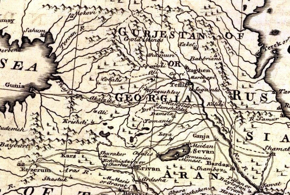
1747 persia map by emanuel bowen
details of old maps
1747 persia map by emanuel bowen
details of old maps
histoire universelle depuis le commencement du monde
maps of gulf of khambhat
histoire universelle depuis le commencement du monde
maps of gulf of khambhat
maps from university of amsterdam special collections
atlas der neederlanden
guide joanne espagne et portugal-1915
1915 maps
turgot map of paris, kyoto university library
sheet 4 of the turgot map of paris
maps of territories in the lower saxony circle
maps by john cary
coats of arms verteidigungsbezirkskommandos (bundeswehr)
hermannsdenkmal
old maps of delft
1649
maps of liège in the 17th century
baroque
1858 van de velde maps of palestine and jerusalem
eran laor cartographic collection
henricus hondius ii, nova totius terrarum orbis geographica ac hydrographica tabula, 1630
eran laor cartographic collection
maps from the earth and its inhabitants, vol. xiv
maps of the sunda strait
henricus hondius ii, nova totius terrarum orbis geographica ac hydrographica tabula, 1630
eran laor cartographic collection
henricus hondius ii, nova totius terrarum orbis geographica ac hydrographica tabula, 1630
eran laor cartographic collection
henricus hondius ii, nova totius terrarum orbis geographica ac hydrographica tabula, 1630
eran laor cartographic collection
18th-century maps of panama
war of jenkins' ear
atlas maior, vol 6 (scotland and ireland) - joan blaeu, 1667 - bl 114.h(star).6
1667 maps
maps of rivers of equatorial guinea
komo (river)
1660s maps of spain
1667 maps
maps by willem and johannes blaeu
old maps of zwolle
zehn karten und ansichten den schlachtfelden des amerikanischen unabhängigkeitskreiges in den staaten pennsylvanien und new york
maps in the library of congress
zehn karten und ansichten den schlachtfelden des amerikanischen unabhängigkeitskreiges in den staaten pennsylvanien und new york
maps in the library of congress
synopsis universae philologiae
classicism
hamburger stadtentwässerung
1864 maps of hamburg
gemeente atlas van nederland - south holland
old maps of eiland van dordrecht
16th-century maps of southeast asia
maps by girolamo porro
maps in the british museum
udenheim
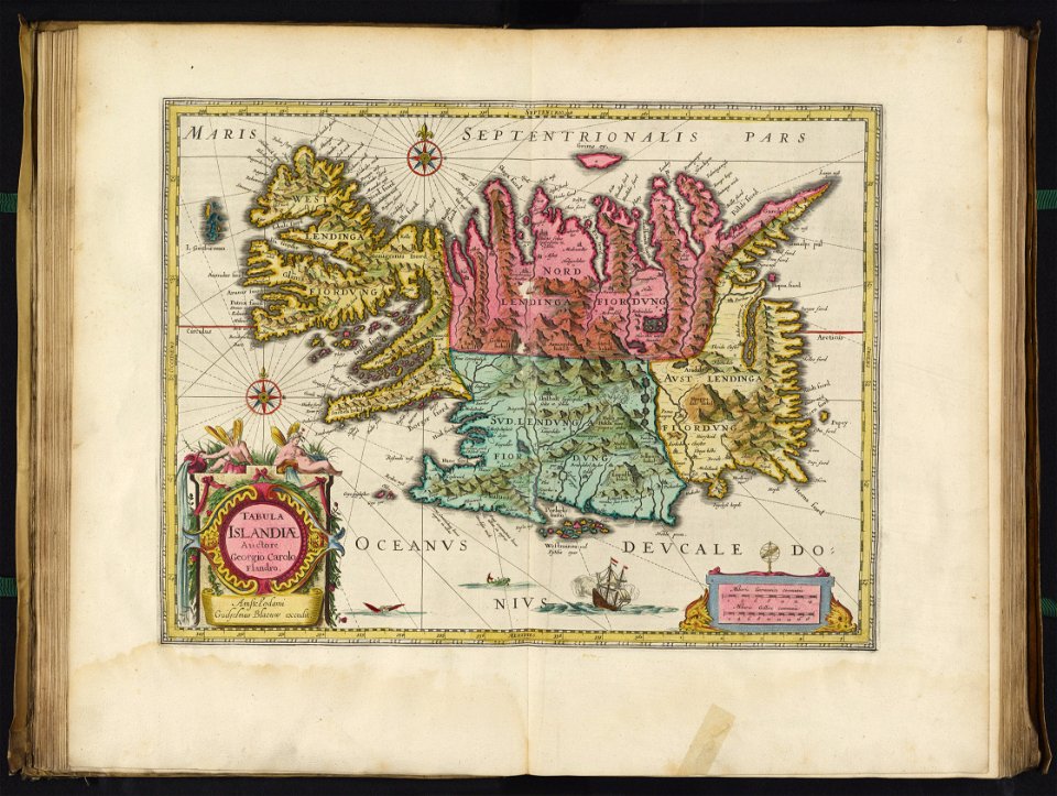
david rumsey historical map collection
17th-century maps of iceland
topographia braunschweig lüneburg (merian)
baroque
topographia braunschweig lüneburg (merian)
baroque
gemeente atlas van nederland - utrecht
maps of houten
miniature speed atlas (1627) pieter van den keere
old county maps of cheshire
tourism advertising posters of germany
1935 maps of germany
africa and its inhabitants, vol. ii
charles eugène perron
tourism advertising posters of germany
french-language maps of germany
old maps of north brabant
1645 maps of belgium
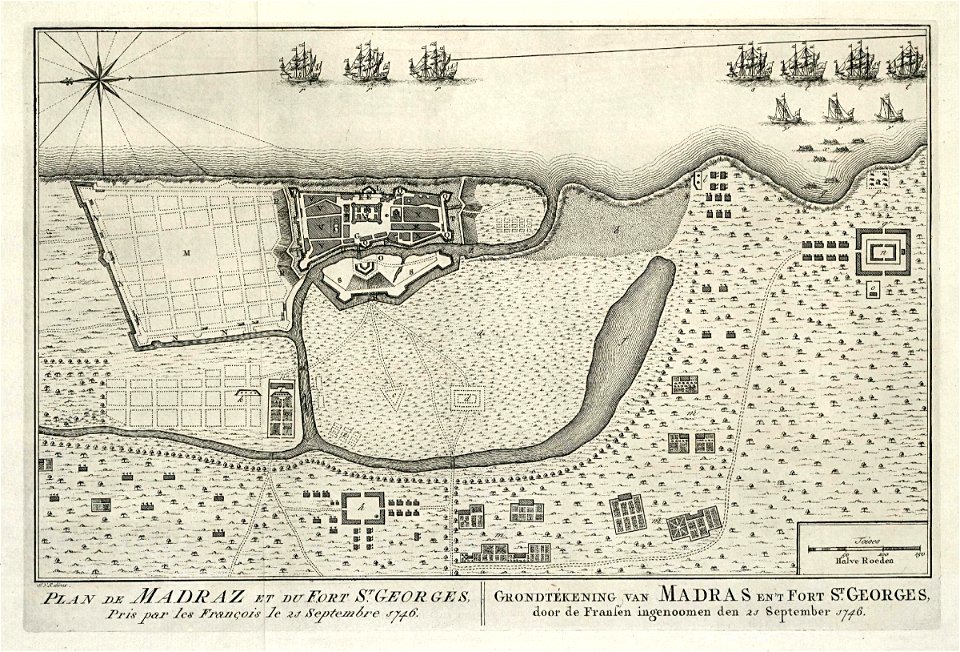
maps of the dutch east india company - india
1756 maps
historisk atlas (stockholm, norstedt & söner, 1880)
19th-century maps of the british isles
fra mauro map
sea of japan naming dispute
18th-century maps of japan
maps of san juan, puerto rico
atlas blaeu-van der hem
maps by pieter schenk (i)
maps by gerard valck
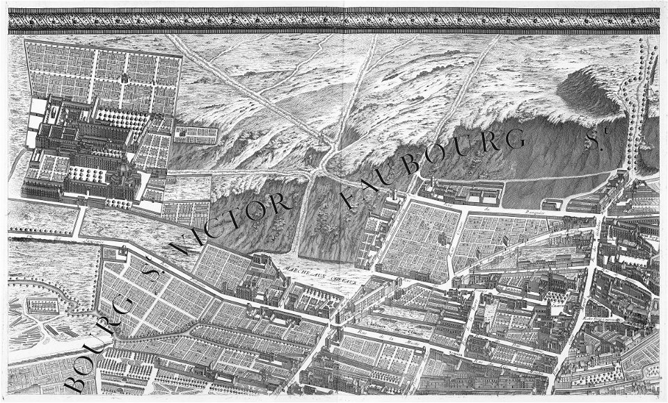
turgot map of paris, kyoto university library
sheet 3 of the turgot map of paris
maps from the earth and its inhabitants, vol. xii
maps of africa
1590s maps of the world
maps by girolamo porro
maps from the earth and its inhabitants, vol. vi
georgia in the 1890s
curt teich postcard archives
map postcards
gemeente atlas van nederland - north holland
maps of amstelveen
maps in the library of congress
1747 maps of new jersey
old maps of manchuria
general atlas (1773)
dutch paintings in the museo thyssen-bornemisza
genre paintings by nicolaes maes
maps in the british museum
battle of fontenoy
maps by tobias conrad lotter
maps by tobias lobeck
eran laor cartographic collection
pierre françois tardieu
tresor des cartes geographiques (1659)
1650s maps of india
17th-century maps of france
maps of touraine
maps from gallica
maps of tlemcen
german-language maps from ios map collection
1910s maps of the balkans
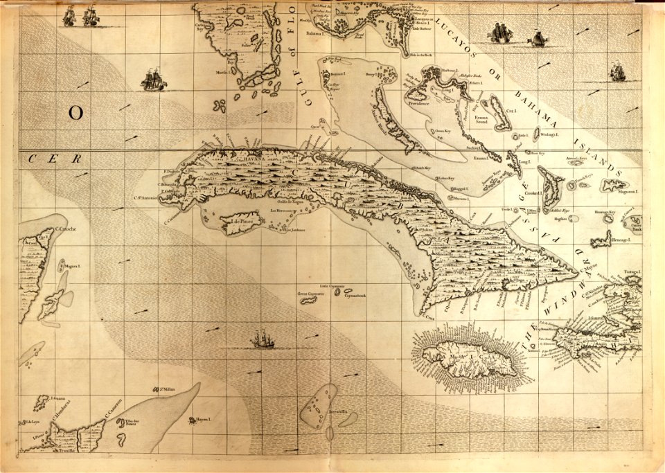
a map of the british empire in america with the french and spanish settlements adjacent thereto
maps in the library of congress
gemeente atlas van nederland - south holland
19th-century maps of rotterdam
kingdom of serbia (1718–1739)
1730s maps of serbia
map of amsterdam, 1544
ink and paper
hoogheemraadschap rijnland map, 2nd edition, 1687
linen
maps by nicolaes visscher i
1630s maps of pernambuco
the holy land, syria, idumea, arabia, egypt, and nubia, volume 3
1840s maps of palestine
maps of spain by tomas lopez
maps of zamora
maps of the kingdom of seville
maps of spain by tomas lopez
maps of the kingdom of seville
maps of spain by tomas lopez
map of the upper rhenian circle by sanson
maps by nicolas sanson
maps of the kingdom of seville
maps of spain by tomas lopez
maps of the kingdom of córdoba (crown of castile)
maps of spain by tomas lopez
maps of the kingdom of seville
maps of spain by tomas lopez
maps by emanuel bowen
1747 maps of africa
maps from the mechanical curator collection available to georeference
maps from the mechanical curator collection
maps from the mechanical curator collection available to georeference
maps from the mechanical curator collection
anthonis van den wijngaerde
old maps of barcelona
maps from university of amsterdam special collections
atlas der neederlanden
maps from university of amsterdam special collections
atlas der neederlanden
maps from university of amsterdam special collections
atlas der neederlanden
maps from university of amsterdam special collections
atlas der neederlanden
maps from university of amsterdam special collections
atlas der neederlanden
maps from university of amsterdam special collections
atlas der neederlanden
maps from university of amsterdam special collections
atlas der neederlanden
maps from university of amsterdam special collections
atlas der neederlanden
maps from university of amsterdam special collections
atlas der neederlanden
maps from university of amsterdam special collections
atlas der neederlanden
maps from university of amsterdam special collections
atlas der neederlanden
maps from university of amsterdam special collections
atlas der neederlanden
maps from university of amsterdam special collections
atlas der neederlanden
maps from university of amsterdam special collections
atlas der neederlanden
maps from university of amsterdam special collections
atlas der neederlanden
3401 - 3500 of 27,441
Next page
/ 275