Log in
All resources
Create a design
27,441 Free Images of Maps
maps by willem and johannes blaeu
coats of arms on maps
eran laor cartographic collection
joan blaeu
koninklijke bibliotheek
maps with figures
bibliothèque nationale de france
national library of israel
library of congress
engraving on paper
map of the german empire by louis stanislas d'arcy de la rochette
1782 maps of the holy roman empire
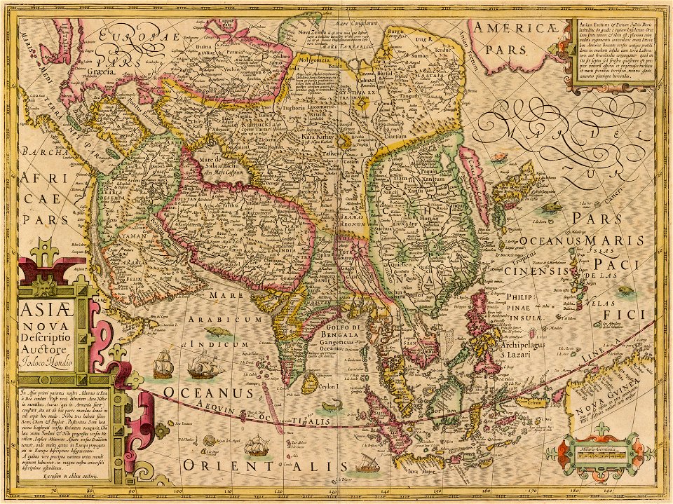
atlas maior, vol 11 (asia) - joan blaeu, 1667 - bl 114.h(star).11
1667 maps
maps by willem and johannes blaeu
copper engravings
maps in the biblioteca nacional de españa
maps by tomas lopez
maps by pieter pourbus
1570s maps
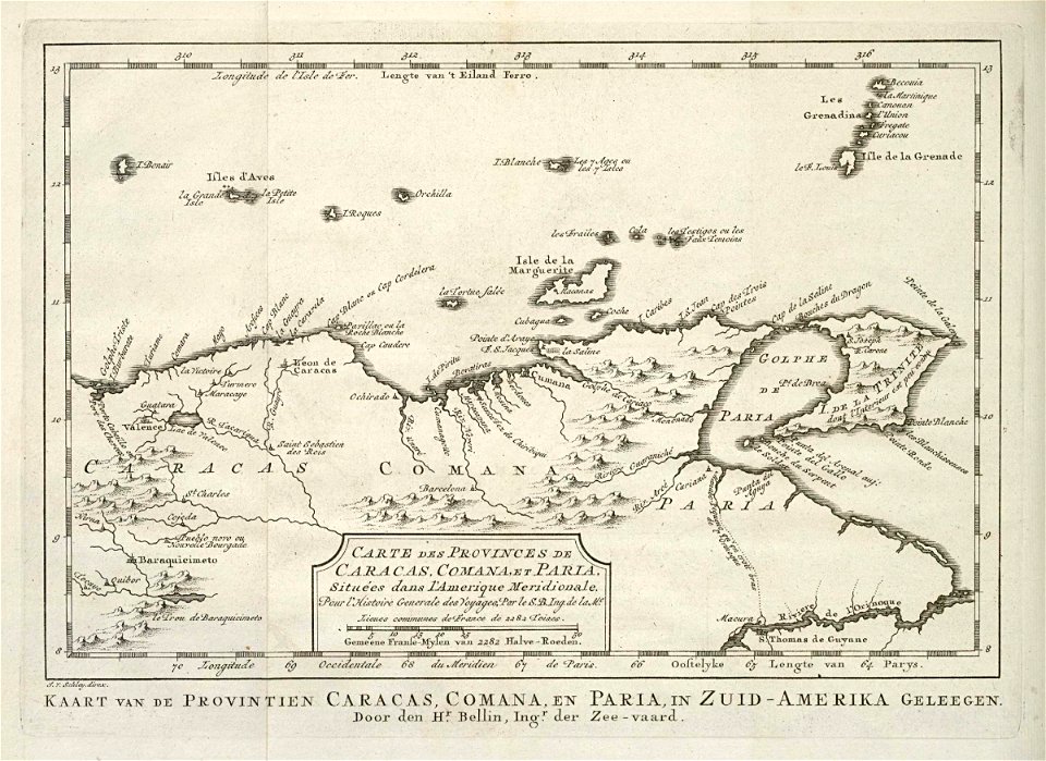
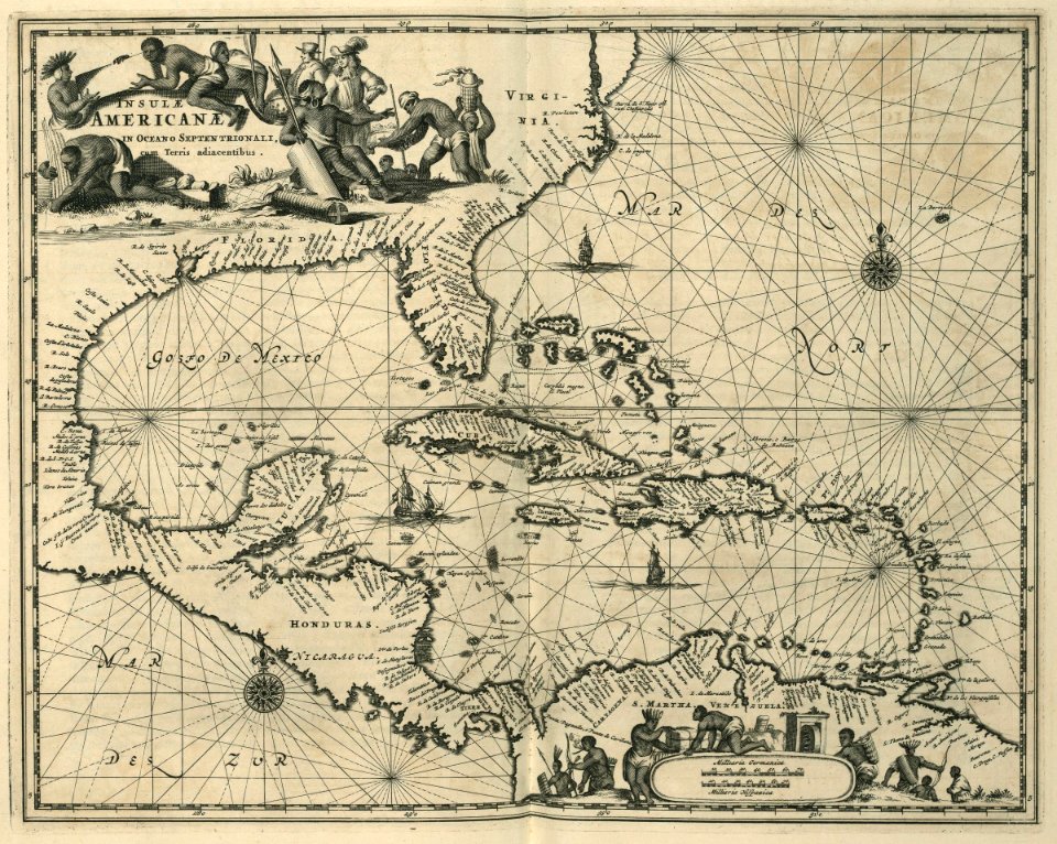
maps of the west-indische compagnie
1682
maps by pieter van der keere
maps by abraham ortelius
18th-century maps of japan
works after jan goeree
old maps of the county of ravensberg
duchy of cleves
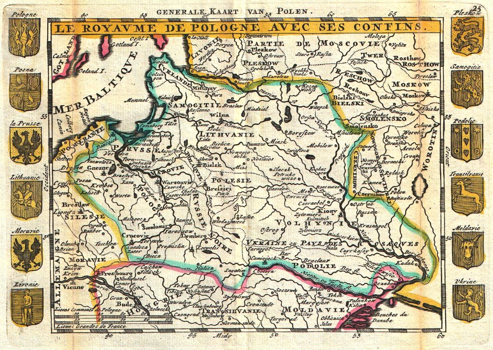
old maps of the polish-lithuanian commonwealth
17th-century maps of prussia
18th-century maps of the sea of marmara
18th-century maps of the dardanelles
1600s maps of mecklenburg-vorpommern
maps of rügen by eilhard lubinus
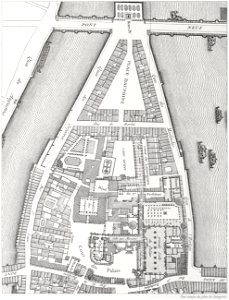
enceinte of philippe-auguste on old maps
1610s maps of paris
media from the national library of finland
classicism
maps by john cary
1799 maps
rail transport maps of hamburg
berliner bahnhof (hamburg)
maps from university of amsterdam special collections
atlas der neederlanden
carte de la mer mediterranée (1764) by roux
eran laor cartographic collection
the geographical distribution of animals (book)
zoogeography
old maps of seville
1788 maps
maps of exeter by braun & hogenberg
hooker (alias vowell) arms
maps of the west-indische compagnie
1768 maps
maps of midden-delfland
foppenpolder
old maps of roermond
upper guelders
maps by willem and johannes blaeu
1630s maps of the world
17th-century maps of frankfurt am main
maps by willem and johannes blaeu
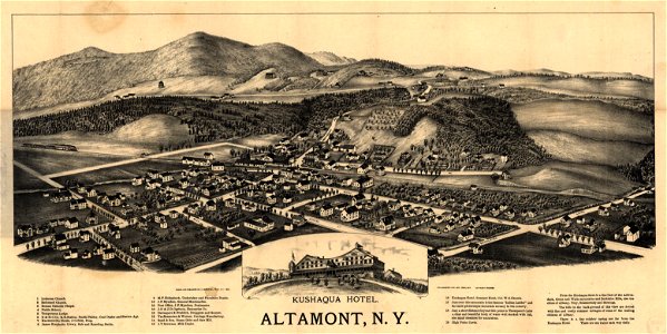
maps by henry wellge
denison, texas
old maps of cities in texas
1886 drawings
old maps of poland
1747 maps
maps from the mechanical curator collection available to georeference
maps from the mechanical curator collection
symbol
maps
maps of the west-indische compagnie
1671
maps in the rijksmuseum amsterdam
published by frans buffa & zonen
1687 maps of ukraine
jacob von sandrart
maps by willem and johannes blaeu
1627 maps
maps facing east
anton wied
eran laor cartographic collection
maps by tomas lopez
maps in the british museum
maps facing southeast
john spilsbury
puzzle maps
19th-century maps of bohemia
19th-century maps of silesia
gemeente atlas van nederland - south holland
1860s maps of south holland
old maps of zwartsluis
zwarte water
jodocus hondius ii, nova totius terrarum orbis geographica ac hydrographica tabula, 1636
eran laor cartographic collection
jodocus hondius ii, nova totius terrarum orbis geographica ac hydrographica tabula, 1636
eran laor cartographic collection
jodocus hondius ii, nova totius terrarum orbis geographica ac hydrographica tabula, 1636
eran laor cartographic collection
jodocus hondius ii, nova totius terrarum orbis geographica ac hydrographica tabula, 1636
eran laor cartographic collection
old county maps of lancashire
copper engravings
castoro sei (ship, 1978)
andreas möller
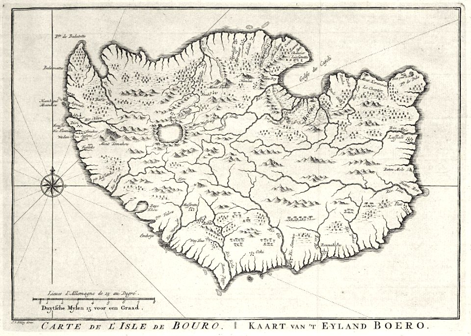
maps of the dutch east india company - indonesia
1750s maps of indonesia
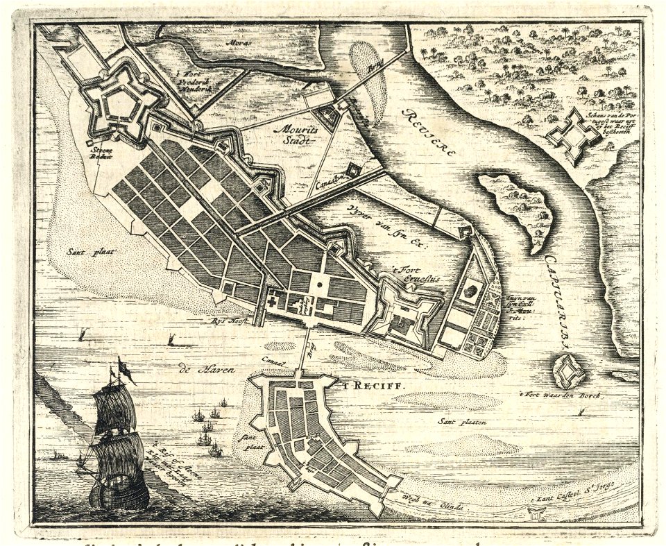
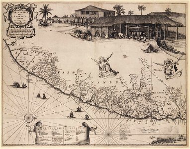
1647 maps of brazil
georg marggraf
maps by emanuel bowen
1747 maps
17th-century maps of schleswig-holstein
nordstrand
maps of paris from bibliothèque nationale de france
maps of paris by john rocque
sheet 15 of the turgot map of paris
maps of paris from paris musées
illustrations from the sphinx of the ice fields by george roux
maps of the southern ocean
old maps of heemstede, north holland
old maps of haarlem
maps of ceylon by petrus plancius
eran laor cartographic collection
atlas van der hagen (volume 3)
atlas van der hagen
maps in the library of congress
1877 maps of the united states
carte de barbarie, nigritie, guinée par guillaume delisle (1707)
1792 maps of africa
miniature speed atlas (1627) pieter van den keere
old county maps of anglesey
maps by willem and johannes blaeu
novus atlas blaeu
curt teich postcard archives, curt teich & company
map postcards
old maps of st. augustine, florida
john white (colonist and artist)
atlas van der hagen (volume 4)
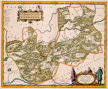
old maps of guizhou
media from the national library of finland
classicism
maps by girolamo porro
1572 maps
gelehrtenschule des johanneums
maps of hamburg-altstadt
1788 maps of the ottoman empire
1788 maps of austria
old county maps of lancashire
copper engravings
maps of the county of flanders
county of zeeland
1890 maps of oceania
île des pins
medieval history of near east
geography of near east
nürnberger reichswald
1559 maps of germany
paris à travers les âges
lithographs of paris
watercolor drawings by johannes vingboons
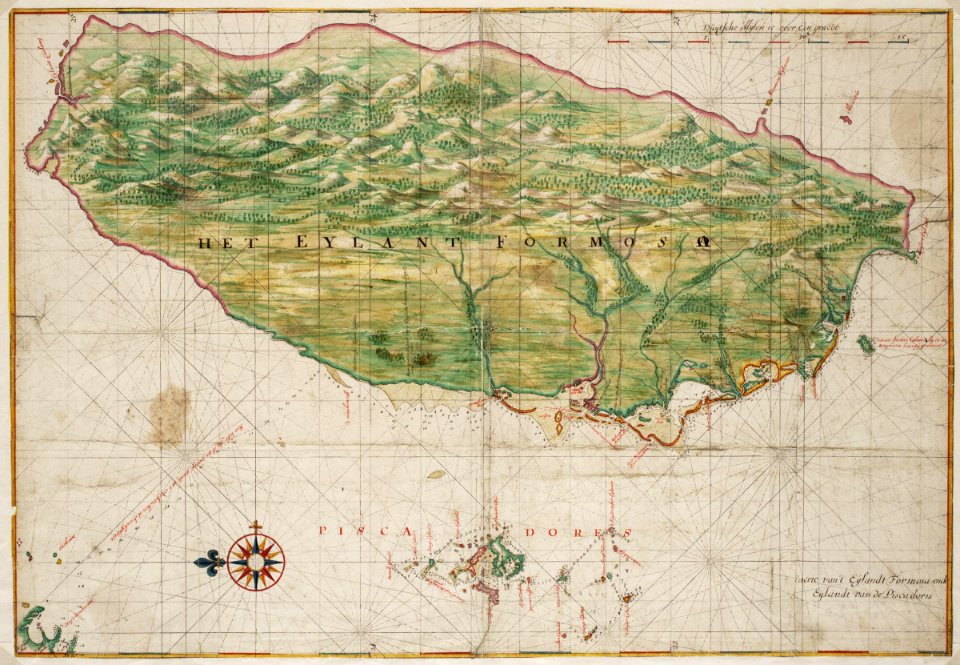
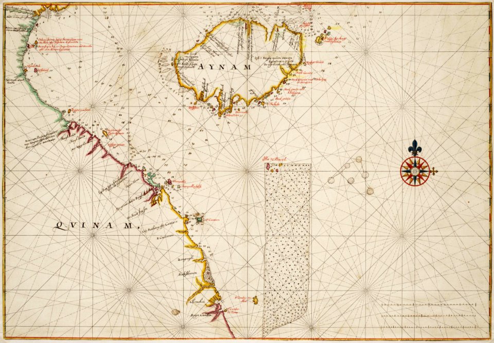
17th-century maps of taiwan
turgot map of paris, kyoto university library – derivative files
porte saint-antoine
island of california on world maps
1650s maps of the world
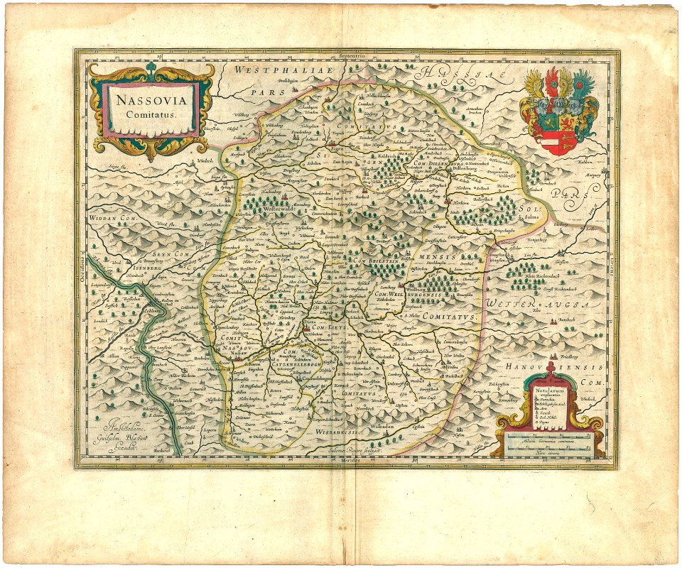
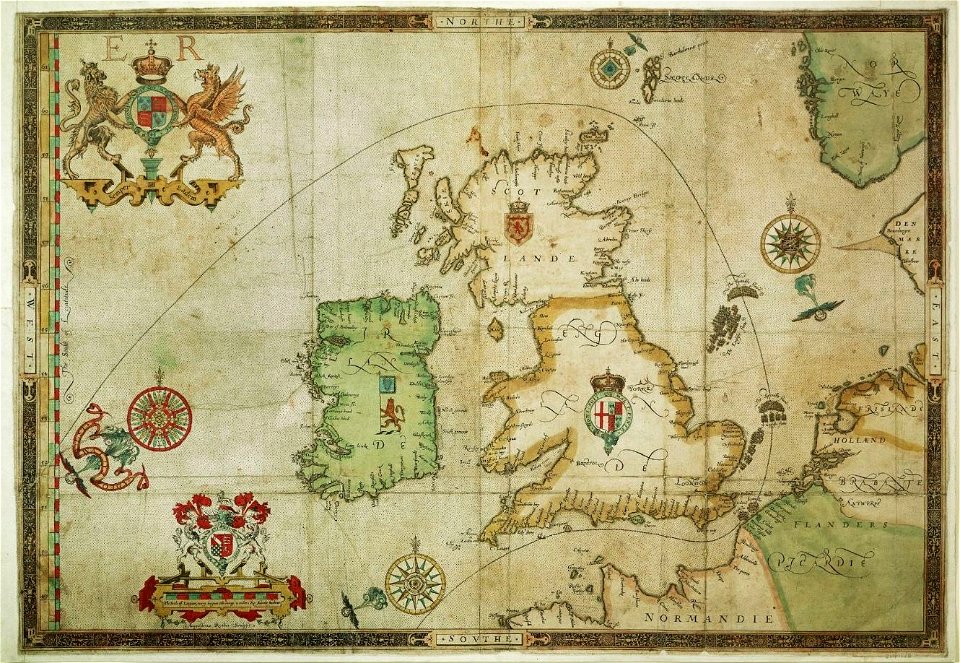
coats of arms on maps
house of nassau
maps in the library of congress
1890 maps of new york (state)
maps made in the 16th century
maps of the spanish armada
maps by willem and johannes blaeu
1680s maps of brazil
maps by john cary
1799 maps
maps of the hague by braun & hogenberg
atlas van loon
italia antiqua (galleria delle carte geografiche)
old maps of italy
old maps of the polish-lithuanian commonwealth
1790s maps of poland
maps in the staats- und universitätsbibliothek hamburg
1844 maps of hamburg
maps of nuremberg by braun & hogenberg
eran laor cartographic collection
1660s maps of belgium
old maps of bruges
maps of paris from bibliothèque nationale de france
bird's eye view maps of paris
old maps of the stations of the exodus
1650s maps of palestine
17th-century maps of the strait of magellan
maps by willem and johannes blaeu
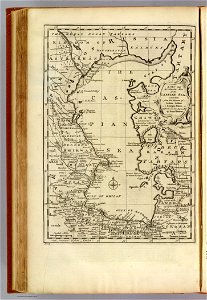
old maps of the south china sea
17th-century maps of vietnam
maps of asia by mercator-hondius
qara khitai
maps from the mechanical curator collection
through the subarctic forest (1896) by pike
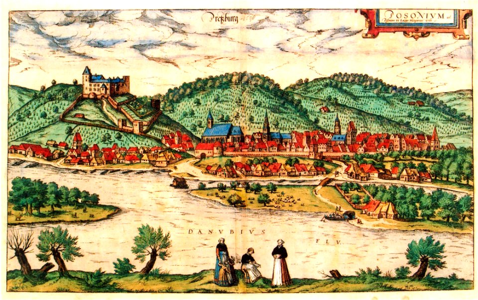
maps of bratislava by braun & hogenberg
history of bratislava
old maps of the danube in budapest
gerard jollain
maps of paris by louis-joseph mondhare
maps of paris from paris musées
1660s maps of denmark
maps of zealand
lucas janszoon waghenaer
bretagne in the 1580s
1501 - 1600 of 27,441
Next page
/ 275