Log in
All resources
Create a design
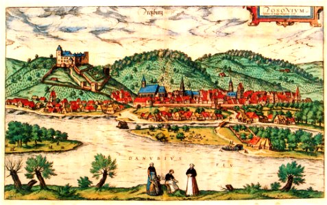
Bratislava in 16th century, 1588
Pozsony in 16th century. Original antique map of bratislava, published for the civitates orbis terrarum, the first atlas of printed town plans. Date: 1588.
Download
Edit image
Published by:
Creazilla
Author:
Wolfgang Lazius
Source:
commons.wikimedia.org
Loading...
0 downloads
Print it
Copy image
Loading...
maps of bratislava by braun & hogenberg
history of bratislava
bratislava
siege of hainburg
podhradie, bratislava
MORE LIKE THIS