Map of the Caribbean region, Jacob van Meurs, circa 1671

Map of the Caribbean region, Jacob van Meurs, circa 1671

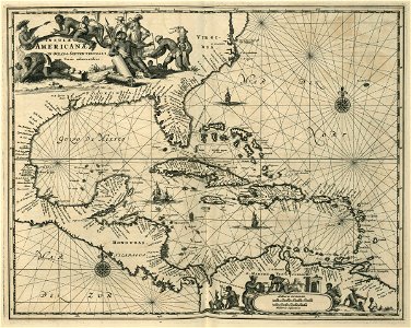
Map of the caribbean region. Insuale americanae in oceano septentrionali, terris adiacentibus. Cf. Koninklijke bibliotheek, the hague, inv. Nr. 1049b13_080. Date: circa 1671. Dimensions: height: 30 cm (11.8 in); width: 37 cm (14.5 in). Medium: engraving on paper. Collection: Koninklijke Bibliotheek. AMH-6725-KB Map of the Caribbean region
Edit image
Published by:
Creazilla
Author: Jacob van MeursSource: commons.wikimedia.org

Loading...

0 downloads
Loading...
maps of the west-indische compagnie16711670s maps of the caribbeanmaps by jacob van meurshenry morgan's panama expeditionengraving on paperkoninklijke bibliotheekjacob van meurs

MORE LIKE THIS

Creazilla logo
Over 10 million free graphic resources for content creators and designers.
© 2018 - 2025 Creazilla
Our resourcesAll imagesPhotosDigital illustrationsClipartIconsPNG ImagesEmojisSilhouettesTraditional Art3D ModelsVectorsFontsColor namesColor palettesGradientsAudioAnimationVideosTemplates
InformationAbout CreazillaTerms of useTech teamPrivacy policyLicence Information
FeedbackContact Us