Map of Paranambucae, Joan Blaeu, 1647

Map of Paranambucae, Joan Blaeu, 1647

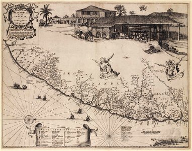
Map of paranambucae, 1647 (black and white print, not coloured or embellished). Object Type: copper engraving print, map. Genre: figurative art. Date: 1647. Dimensions: height: 54 cm (21.2 in) ; width: 42 cm (16.5 in). Medium: engraving. Collection: Koninklijke Bibliotheek. Joan Blauw after Georg Marcgraf and Frans Post - Paranambucae
Edit image
Published by:
Creazilla
Author: map: Joan Blaeu (1596–1673) engenho: Joan Blaeu (1596–1673) After Frans Post (1612–1680) After Georg Marcgrave (1610–1644)Source: commons.wikimedia.org

Loading...

0 downloads
Loading...
georg marggraf1647 maps of brazilpraefectura paranambucae pars borealis, una cum praefectura de itâmaracâ1640s maps of pernambuco1647 in pernambucoprints in the teylers museumengravingfigurative artkoninklijke bibliotheekjoan blaeu

MORE LIKE THIS

Creazilla logo
Over 10 million free graphic resources for content creators and designers.
© 2018 - 2025 Creazilla
Our resourcesAll imagesPhotosDigital illustrationsClipartIconsPNG ImagesEmojisSilhouettesTraditional Art3D ModelsVectorsFontsColor namesColor palettesGradientsAudioAnimationVideosTemplates
InformationAbout CreazillaTerms of useTech teamPrivacy policyLicence Information
FeedbackContact Us