Log in
All resources
Create a design
27,441 Free Images of Maps
maps in the library of congress
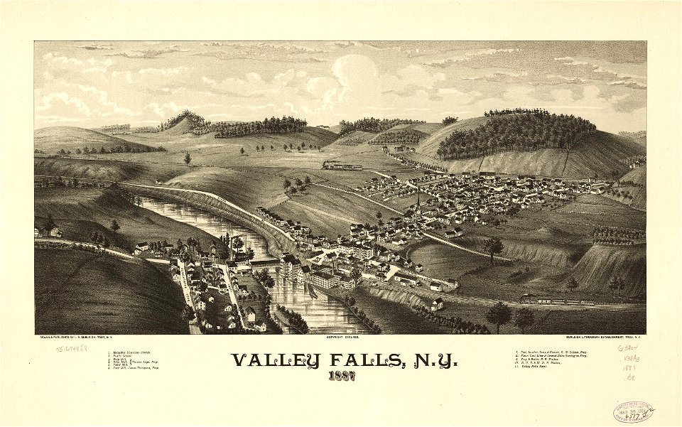
town maps by l. r. burleigh
bird's eye view maps of new york (state)
l. r. burleigh
maps by willem and johannes blaeu
joan blaeu
latin-language maps
koninklijke bibliotheek
maps of the west-indische compagnie
maps with figures
maps of the dutch east india company - india
dutch bengal
old maps of trinidad and tobago
17th-century maps of venezuela
old county maps of hampshire
old county maps of berkshire
historical images of kollam
kollam port
maps of isfahan
pascal coste
maps of the west-indische compagnie
1768 maps of north america
17th-century maps of the strait of magellan
1635 maps
maps in the staats- und universitätsbibliothek hamburg
1845 maps of hamburg
maps by richard william seale
1750 maps of africa
maps from the earth and its inhabitants, vol. vii
russian conquest of siberia
wars of the united kingdom
william wallace
frank leslie's illustrated newspaper, 1876
maps in the library of congress
beschreibung der städt der welt - braun & hogenberg - btv1b52512111k
maps of munich by braun & hogenberg
atlas van der hagen (volume 4)
atlas van der hagen
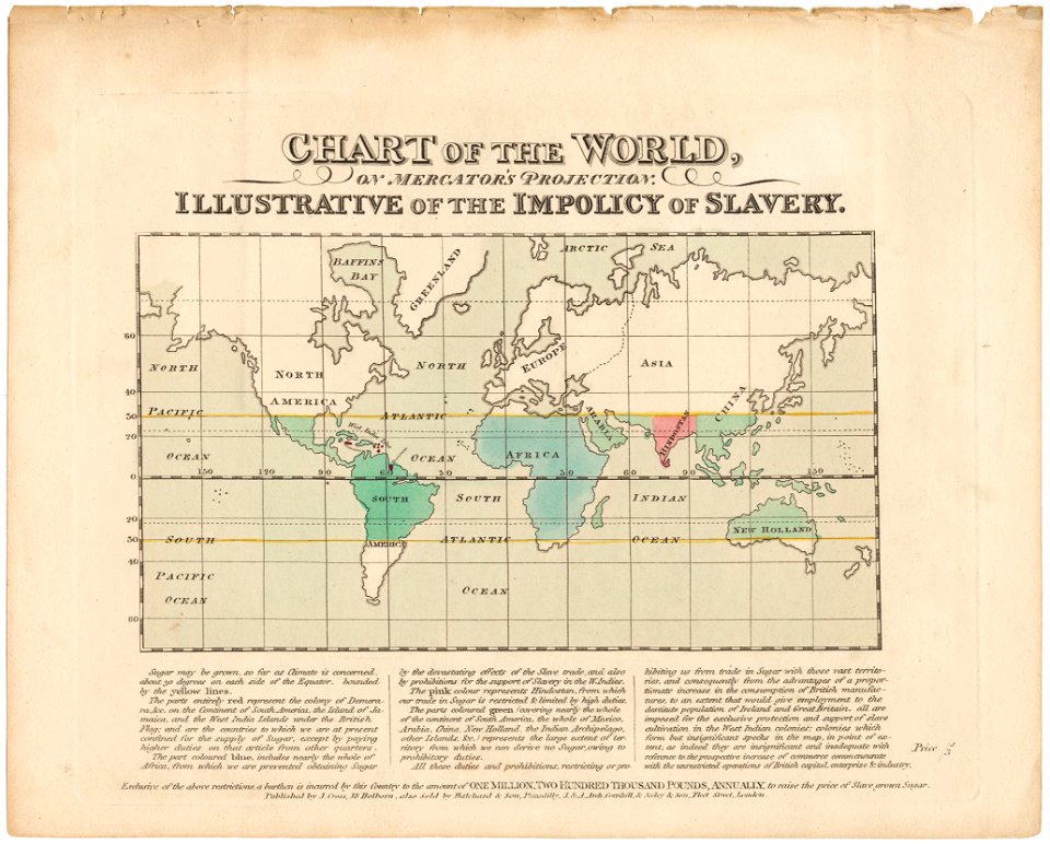
cornell: persuasive cartography: the pj mode collection
1665 maps
maps from the earth and its inhabitants, vol. vi
maps of journeys
14th-century illuminated manuscripts from spain
jong (ship)
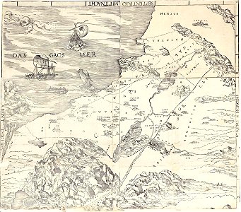
ptolemy's second projection
emery walker
17th-century maps of the moluccas
latin-language maps
maps in the library of congress
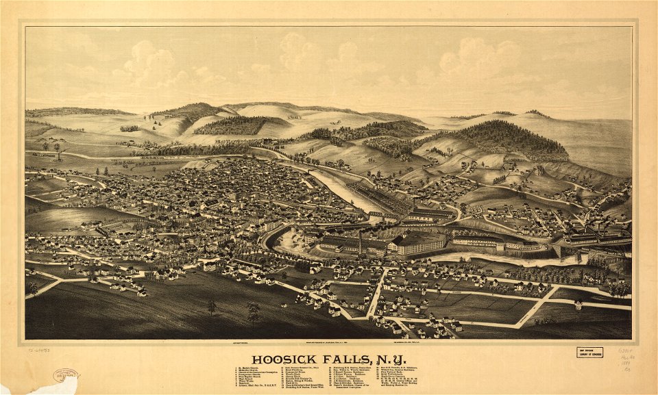
1889 maps of new york (state)
maps in the library of congress
1889 maps of new york (state)
maps in the library of congress
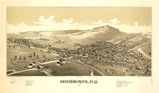
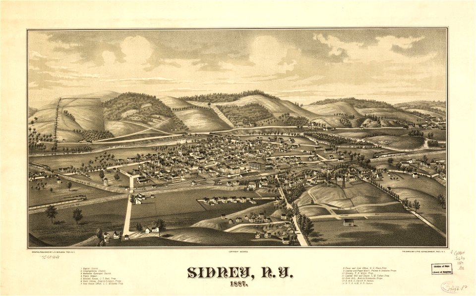
1887 maps of new york (state)
maps in the library of congress
1887 maps of new york (state)
maps in the library of congress
1889 maps of new york (state)
maps in the library of congress
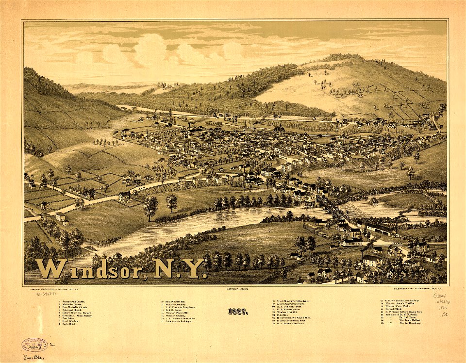
1887 maps of new york (state)
maps in the library of congress
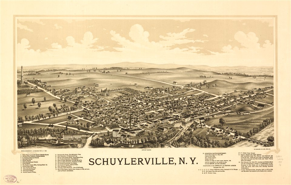
1886 maps of new york (state)
maps in the library of congress
1889 maps of new york (state)
maps in the library of congress
1884 maps of new york (state)
1780s maps of the philippines
old maps of palau
maps by willem and johannes blaeu
1660s maps of the world
2008 u.s. presidential election maps, democratic primary
2008 iowa election maps
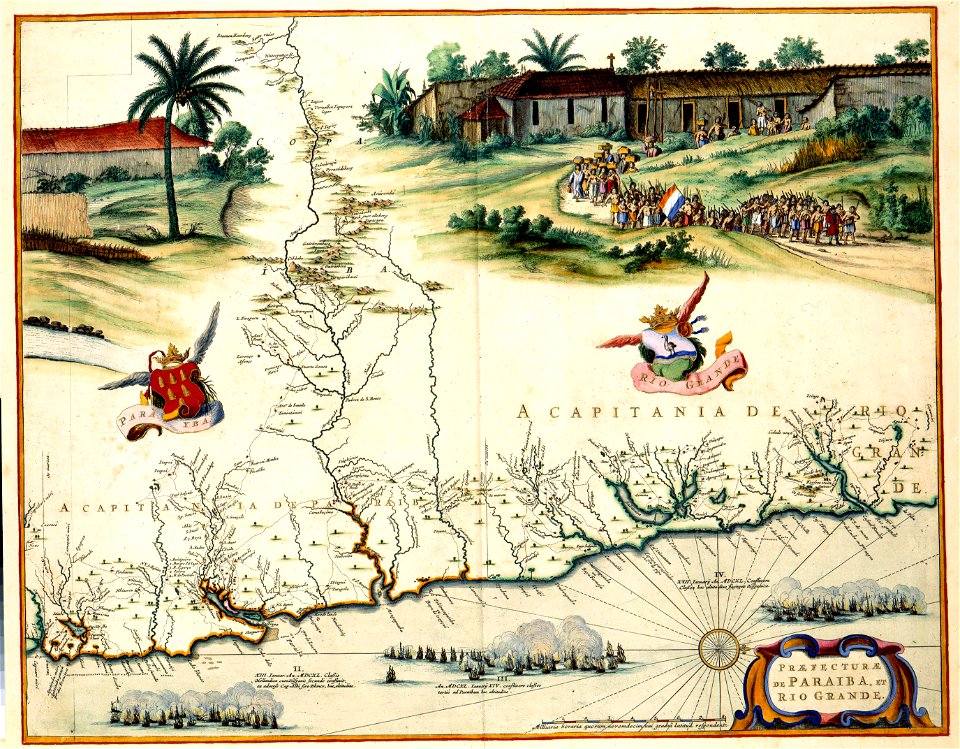
maps of the west-indische compagnie
old maps of dutch brazil
maps of the ming dynasty
old maps of china
maps by pieter van der keere
willem barentsz
old maps of marche
1624 maps of italy
old maps of livonia
old maps of latvia
jacques le moyne de morgues
1591 maps
gaspar bouttats
mocha
old maps of shaanxi
animals on maps
18th-century maps of the caspian sea
1720s maps of the russian empire
1780s maps of florida
maps of florida
maps by willem and johannes blaeu
coasts of brazil
1660s maps of spain
1667 maps
maps of lichtenvoorde
house of bronckhorst
17th-century maps of south america
maps by nicolas sanson
cornell: persuasive cartography: the pj mode collection
economic maps of the world
1857 maps of illinois
1850s maps of chicago
1660s maps of pernambuco
1665 maps of brazil
maps by willem and johannes blaeu
siege of breda 1624-1625
17th-century paintings of soldiers
lambert de hondt (ii)
racial type portraits
racial maps
maps from the earth and its inhabitants, vol. viii
maps of turkestan
maps from the earth and its inhabitants, vol. viii
maps of turkestan
bathymetric maps of the indian ocean
topographic maps of asia
maps of the west-indische compagnie
1660s maps of the caribbean
maps from university of amsterdam special collections
atlas der neederlanden
eran laor cartographic collection
latin-language maps
turgot map of paris, kyoto university library – derivative files
historical images of rue du bac (paris)
maps of san juan, puerto rico
san juan bay, puerto rico
maps in the library of congress
1887 maps of new york (state)
sanborn maps of manhattan published in 1904
old maps of west houston street (manhattan)
old maps of the bering strait
18th-century maps of siberia
maps by willem and johannes blaeu
coats of arms on maps
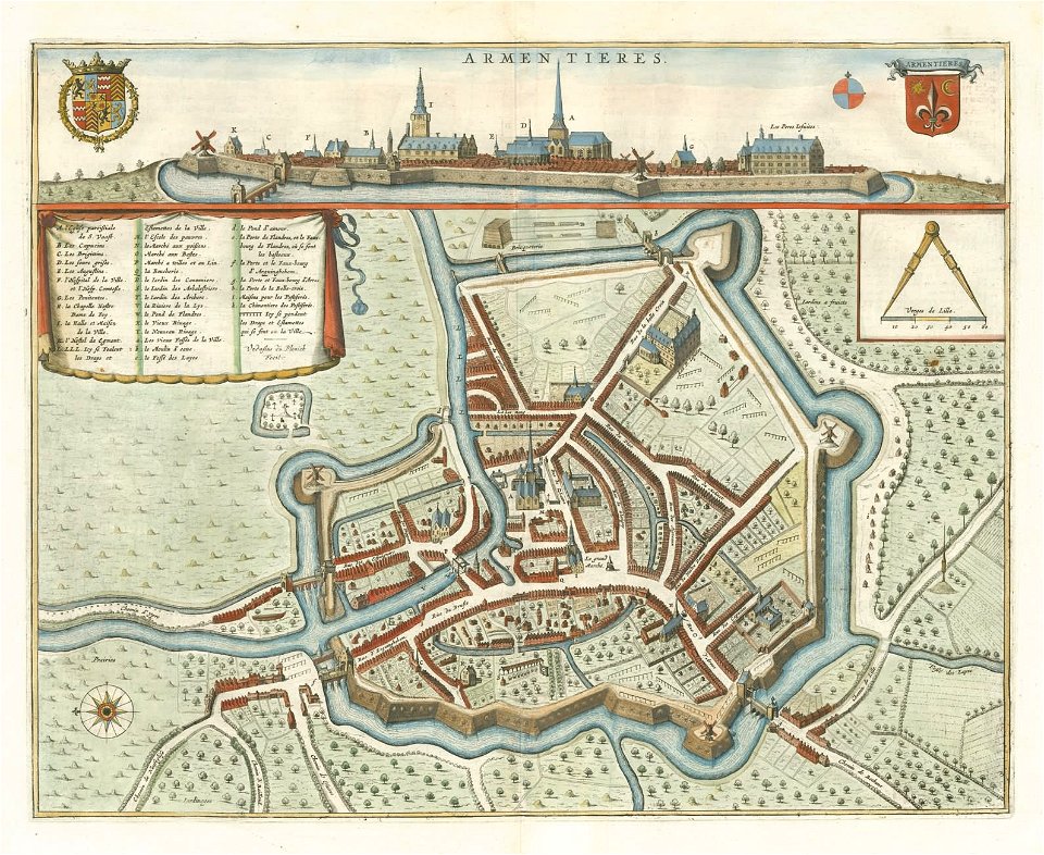
old maps of cities in france
old maps of armentières
maps by willem and johannes blaeu
old maps of overijssel
maps from the earth and its inhabitants, vol. xii
old maps of guinea
maps of lake chad
gustav nachtigal
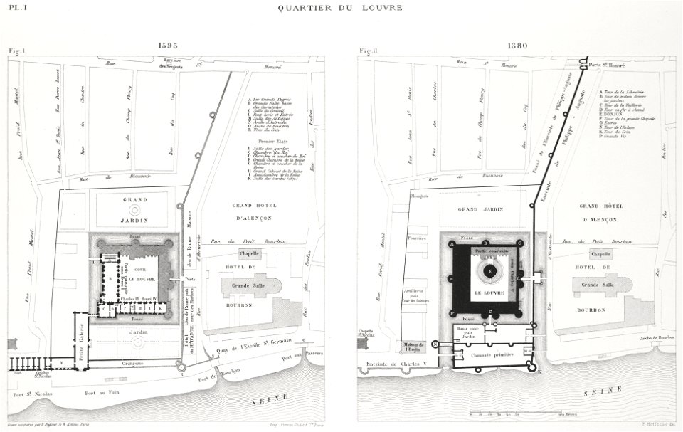
engravings of louvre by theodor hoffbauer
lithographs of paris
maps in the library of congress
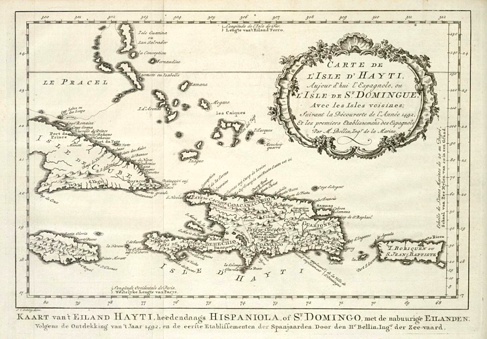
1750s maps of cuba
maps from university of amsterdam special collections
atlas der neederlanden
maps from university of amsterdam special collections
atlas der neederlanden
media from the national library of finland
classicism
media from the national library of finland
classicism
copper engravings
old maps of goes
maps by daniel lizars
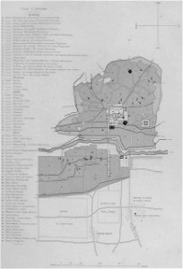
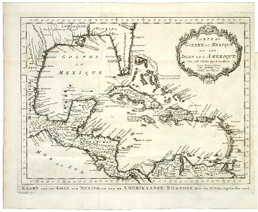
1831 maps of mexico
dutch baroque architecture
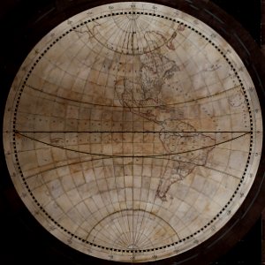
1740s maps of the world
maps in the library of congress
selma, alabama
magni ducatus lithuaniae
dnieper in ukraine
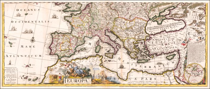
maps by carolus allard
1705 maps of europe
old maps of haarlem
thomas thomasz.
salzkammergut in upper austria
maps of salzkammergut
maps of the west-indische compagnie
1768 maps of north america
media from the national library of finland
classicism
maps of asia by jean-baptiste bourguignon d'anville
old maps of guangdong
cornell's primary geography (1860)
1867 maps of canada
ptolemy's 2nd asian map
maps by girolamo porro
jodocus hondius ii, nova totius terrarum orbis geographica ac hydrographica tabula, 1636
eran laor cartographic collection
glam national library of israel-education center
german renaissance
16th-century maps of ireland
maps by pieter van der keere
turgot map of paris, kyoto university library
sheet 1 of the turgot map of paris
statue of josé gervasio artigas (washington, d.c.)
maps of washington, d.c.
maps by gouverneur k. warren
maps by edwin freyhold
19th-century maps of nièvre
1852 maps of france
16th-century maps of sri lanka
ptolemy's 12th asian map
old geological maps by jean-etienne guettard
jean étienne guettard
1730s maps of the netherlands
1730 maps
1754 maps of the bahamas
1754 maps of florida
dutch baroque architecture
1740s maps of the world
novus atlas sinensis
old maps of hunan
old maps of the russian empire
1790s maps of alaska
1401 - 1500 of 27,441
Next page
/ 275