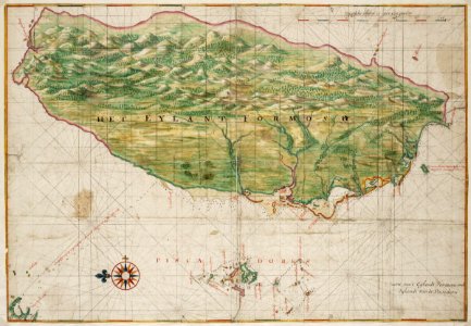
Title in the leupe catalogue (national archives): kaart van de kusten van formosa en de pescadores. Soundings indicated on the chart. Strips of paper have been pasted on the reverse. The strips bear letters and words, but these do not combine into a coherent text. The outlines of the island formosa and the pescadores on this map are exactly the same as the ones on the map in the atlas blaeu-van der hem from the österreichische nationalbibiothek , vienna, inv. Nr. Van der hem 41:02. Date: circa 1665. Dimensions: height: 68 cm (26.7 in); width: 47 cm (18.5 in). Medium: watercolour on paper. Collection: Nationaal Archief. AMH-6670-NA Map of the island of Formosa
Loading...