Log in
All resources
Create a design
76 Free Artworks of Old Maps Of North America
maps in the library of congress
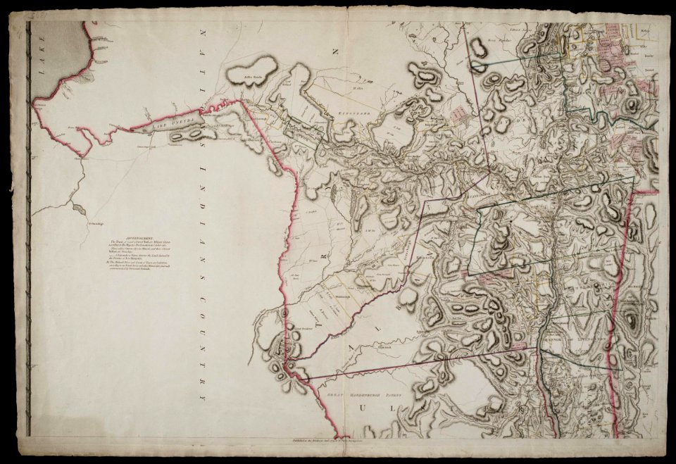
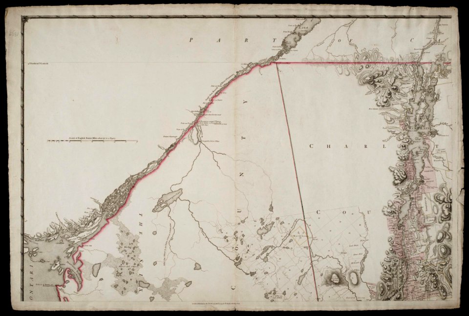
maps by claude joseph sauthier
claude joseph sauthier
island of california
old maps of new york (state)
maps by tomas lopez
old maps of the western hemisphere
bibliothèque nationale de france
animals on maps
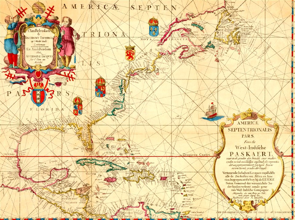
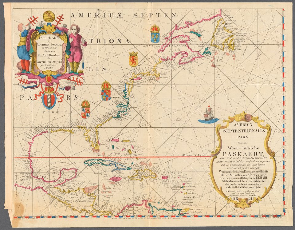
maps by willem and johannes blaeu
overwintering on nova zembla by willem barentsz, 1596-1597
maps in the rijksmuseum amsterdam
old constellation maps
maps by samuel dunn
diego gutiérrez
renaissance
history of antwerp
renaissance
1560s maps of north america
paolo forlani
old maps of the united states
copper engravings
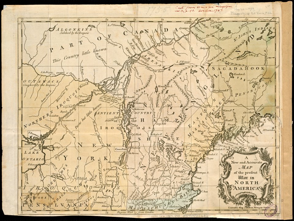
18th-century maps of north america
1708 maps of north america
1730s maps of south carolina
old maps of north america
old maps of the united states
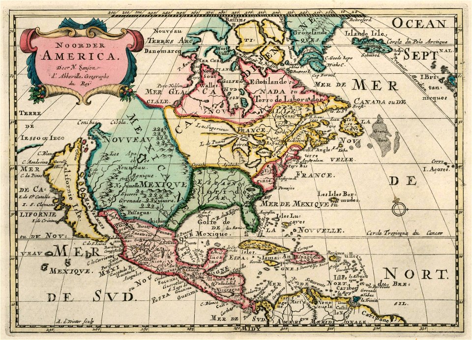
sanson maps of north america
1620s maps of north america
1620s maps of the caribbean
robert wallis (engraver)
henry warren
old maps of french guiana
1630s maps of brazil
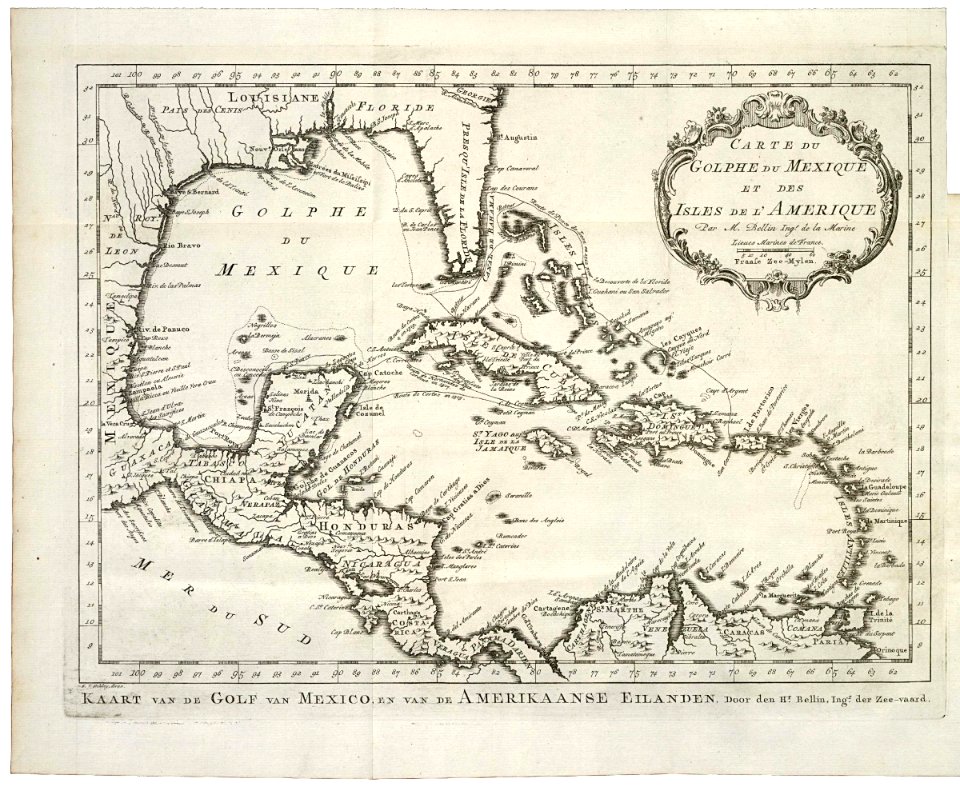
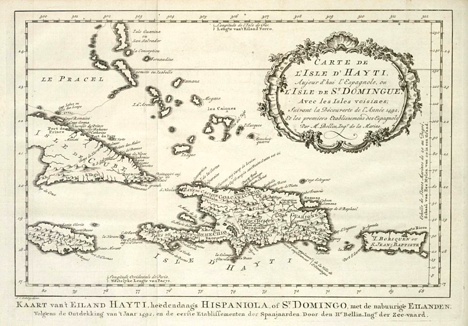
maps by jacques-nicolas bellin
old maps of new france
1849 maps of north america
old maps of canada
old maps of the united states from the norman b. leventhal map center
old maps of canada from the norman b. leventhal map center
old maps of north america from the norman b. leventhal map center
1740 maps of north america
1780s maps of florida
maps of florida
1620s maps of north america
1620s maps of the caribbean
1620s maps of north america
1620s maps of the caribbean
1770s maps of alaska
robert de vaugondy
old maps of north america from the norman b. leventhal map center
old maps of south america from the norman b. leventhal map center
old maps of the western hemisphere
1710s maps of the world
robert wallis (engraver)
henry warren
maps by willem and johannes blaeu
new amsterdam
old maps of north america
realism
maps of the history of the united states
old maps of the british empire
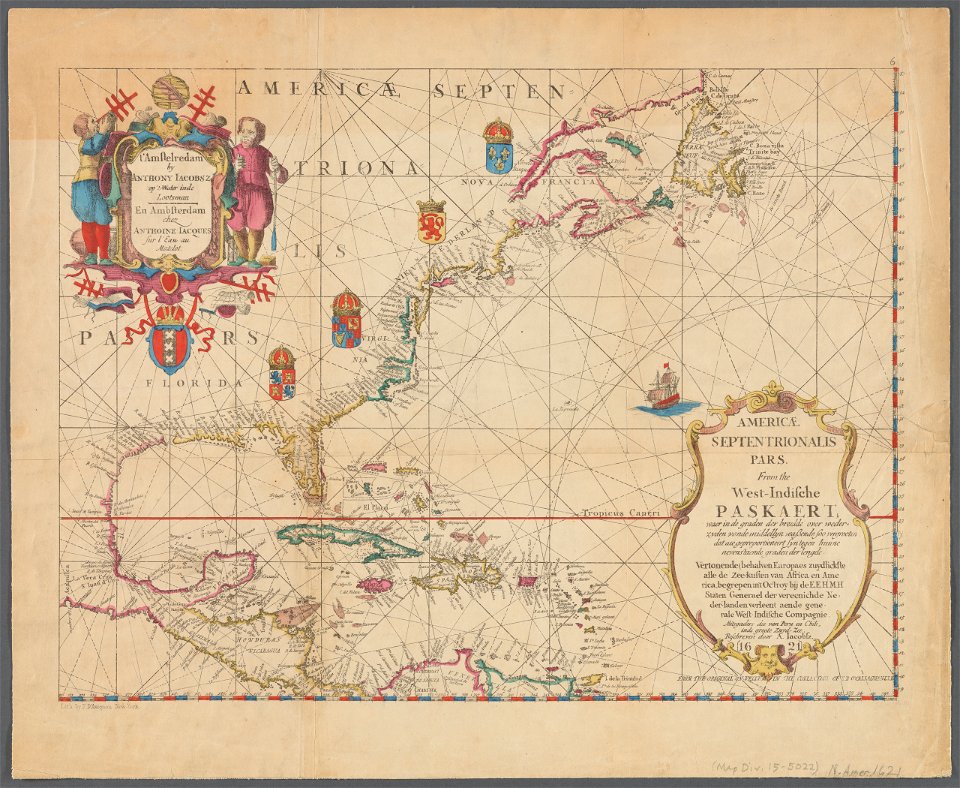
maps of the west-indische compagnie
1705
maps in the library of congress
old maps of new jersey
1850s maps of the americas
maps by john tallis
1650s maps of the americas
1658 maps
maps indicating exploration
royal geographical society
1620s maps of north america
1620s maps of the caribbean
maps in the library of congress
old maps of barbados
old maps of the western hemisphere
jacob van meurs
maps by bernard ratzer
maps by thomas kitchin
island of california on world maps
1680s maps of the world
maps of the west-indische compagnie
1768 maps of north america
maps in the library of congress
old maps of latin america
old geological maps by jean-etienne guettard
jean étienne guettard
maps in the library of congress
1758 maps of cuba
old maps of st. augustine, florida
john white (colonist and artist)
considérations géographiques et physiques sur les nouvelles découvertes au nord de la grande mer
1750s maps of the russian empire
description de l'universe
old maps of north america
1750s maps of central america
maps by tomas lopez
maps in the library of congress
old maps of florida
old geological maps by jean-etienne guettard
jean étienne guettard
maps of the west-indische compagnie
1768 maps of north america
st. augustine, florida in the 18th century
1783 maps of north america
native american history of virginia
17th-century maps of virginia
old maps of the russian empire
1790s maps of alaska
1779 maps of new york (state)
old maps of new york (state)
maps by john cary
1799 maps
lawrence h. slaughter collection of english maps, charts, globes, books and atlases
maps by claude joseph sauthier
carte de l'amérique septentrionale by guillaume delisle (1700)
1700 maps of north america
considérations géographiques et physiques sur les nouvelles découvertes au nord de la grande mer
old maps of the yellow sea
colonial history of the united states
old maps of new york (state)
victor levasseur - maps of the world
old maps of north america
1762 maps of north america
maps by tomas lopez
1803 maps of the caribbean
maps by john cary
french-language maps of north america
1809 maps of north america
the generall historie of virginia (john smith)
1624 engravings
old maps of the new kingdom of granada
maps by willem and johannes blaeu
maps by claude joseph sauthier
old maps of new york (state)
maps by claude joseph sauthier
old maps of new york (state)
maps in the library of congress
1777 maps of north america
maps in the library of congress
old maps of antigua and barbuda
maps in the library of congress
1849 maps
maps in the library of congress
1777 maps
maps by claude joseph sauthier
old maps of new york (state)
old maps of nova belgica et anglia nova
maps by willem and johannes blaeu
1821 maps of the united states
maps by john cary
geocentric model
1730 maps
the cruise of the alice may in the gulf of st. lawrence and adjacent waters (1885) by benjamin
old maps of north america
1806 maps of the united states
maps by john cary
old maps of north america
the book of birds (1918)
maps by joachim bormeester
1685 maps
1 - 76 of 76
/ 1