Log in
All resources
Create a design
321 Free Artworks of Maps Of Florida
maps in the library of congress
old maps of florida
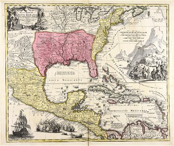
carte du mexique et de la floride by guillaume delisle (1703)
1885 maps
maps by tomas lopez
bibliothèque nationale de france
1639 maps
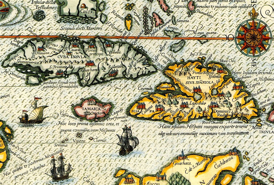
16th-century maps of cuba
maps by john cary
john cary
1805 maps of the united states
maps by john cary
yellow
maps
maps in the library of congress
old maps of florida
maps in the library of congress
old maps of florida
maps in the library of congress
old maps of florida
maps in the library of congress
old maps of florida
maps in the library of congress
old maps of florida
maps in the library of congress
old maps of florida
maps in the library of congress
old maps of florida
maps in the library of congress
old maps of florida
medieval
maps
maps in the library of congress
old maps of florida
medieval
maps
maps in the library of congress
old maps of florida
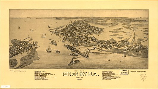
cedar key
florida
cedar key
florida
maps in the library of congress
florida
maps in the library of congress
florida
maps by thomas jefferys
old maps of florida
maps with cartouches
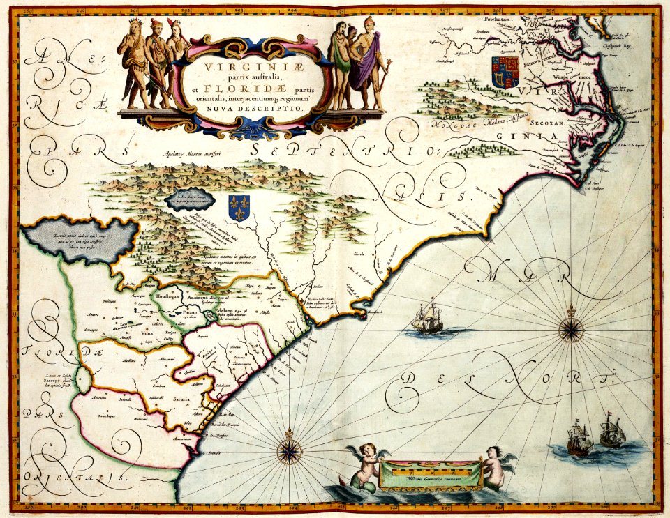
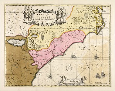
maps of virginia
old maps of florida
madrid
veracruz
florida
maps in the library of congress
old maps of maryland
maps in the library of congress
old maps of maryland
maps in the library of congress
old maps of florida
maps in the library of congress
old maps of florida
maps in the library of congress
1861 maps
maps in the library of congress
1861 maps
maps in the library of congress
old maps of florida
maps in the library of congress
old maps of florida
new york
florida
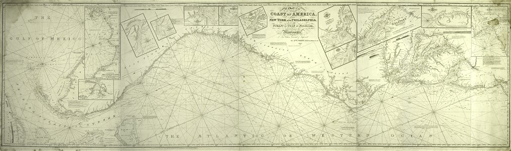
old maps of the gulf of mexico
maps by thomas jefferys
florida
1730s
dutch-language maps
johannes ratelband
map images supported by wikimedia uk
1856 maps
maps made in the 17th century
gerard valck
old maps of alabama
old maps of florida
map images supported by wikimedia uk
1856 maps
old maps of guatemala
old maps of colombia
18th-century maps of puerto rico
18th-century maps of cuba
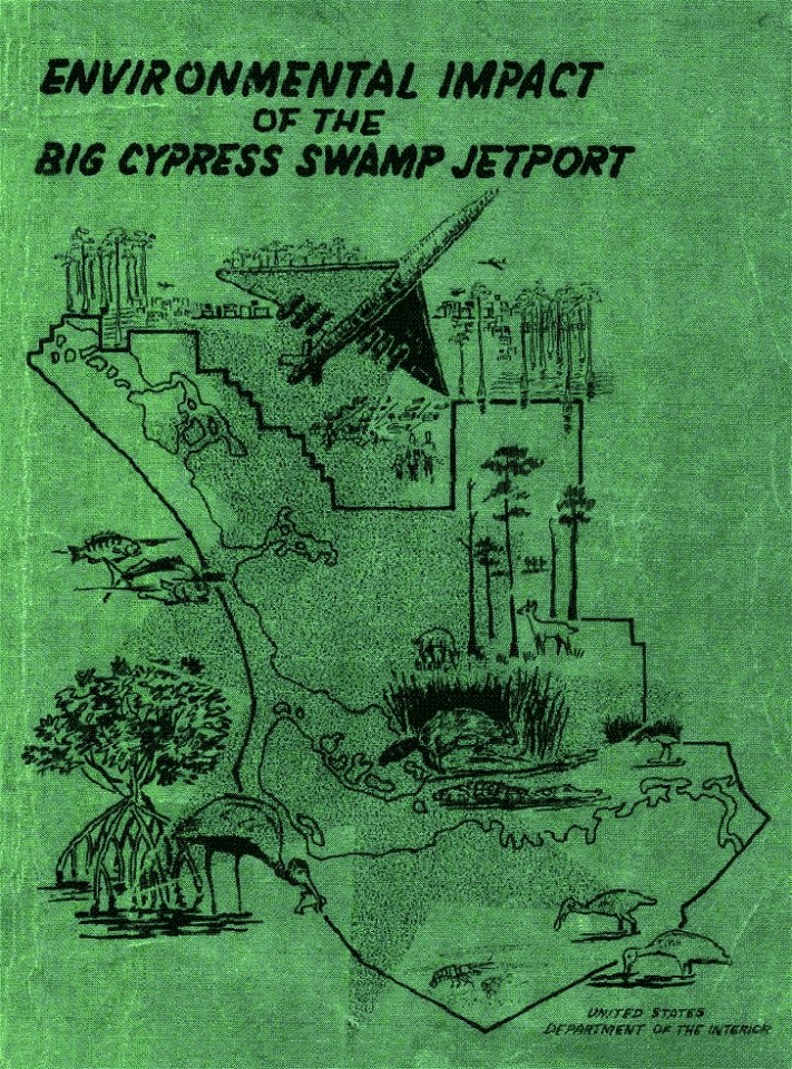
environmental impact
1969 in florida
old maps of colombia
theodor de bry
theatrum orbis terrarum (london 1606)
files from the bodleian libraries
cornell university library
abolitionism
maps made in the 18th century
johann baptist homann
charts and maps of the royal museums greenwich
cornell university library
thomas paine
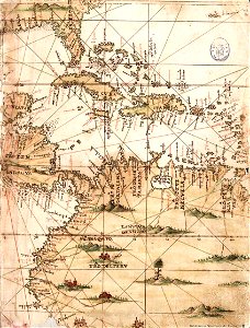
diego gutiérrez
renaissance
jacques le moyne de morgues
1591
1747 maps of north carolina
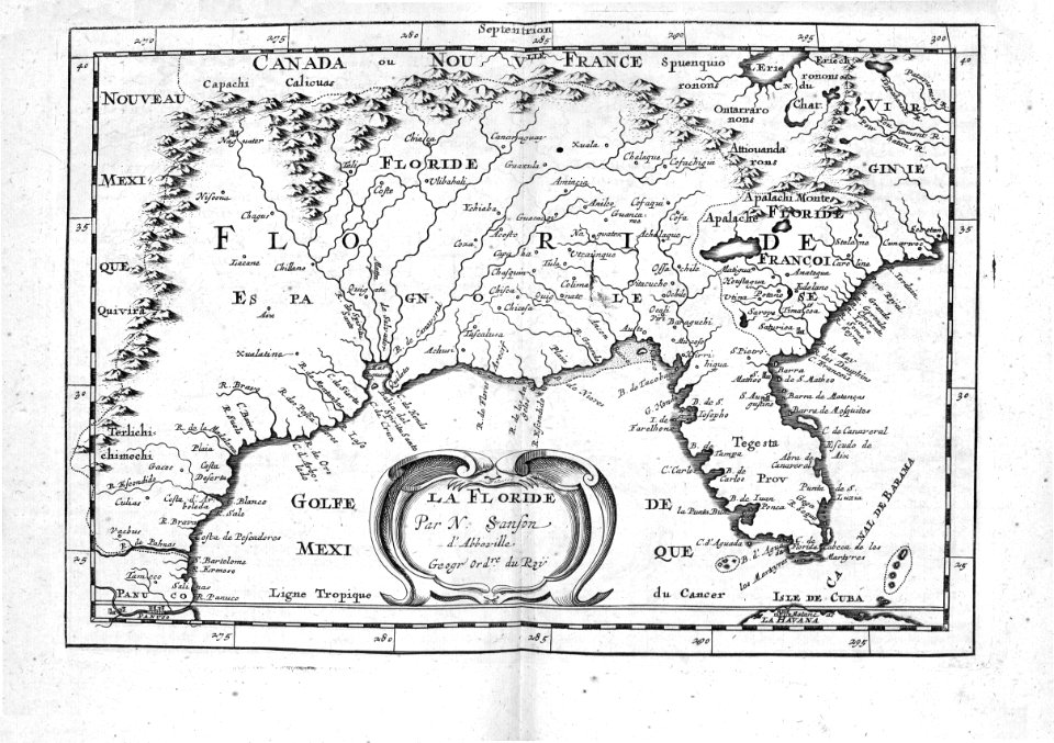
maps by emanuel bowen
1780s maps of florida
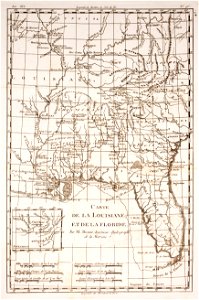
maps of florida
maps of the war of the spanish succession
apalachee
americae 1562 by diego gutiérrez and hieronymus cock
renaissance
1754 maps of the bahamas
1754 maps of florida
1730s maps of south carolina
old maps of north america
old maps of the chesapeake bay
sir walter raleigh
maps in the library of congress
old maps of florida
1790s maps of central america
1790s maps of cuba
1560s maps of north america
paolo forlani
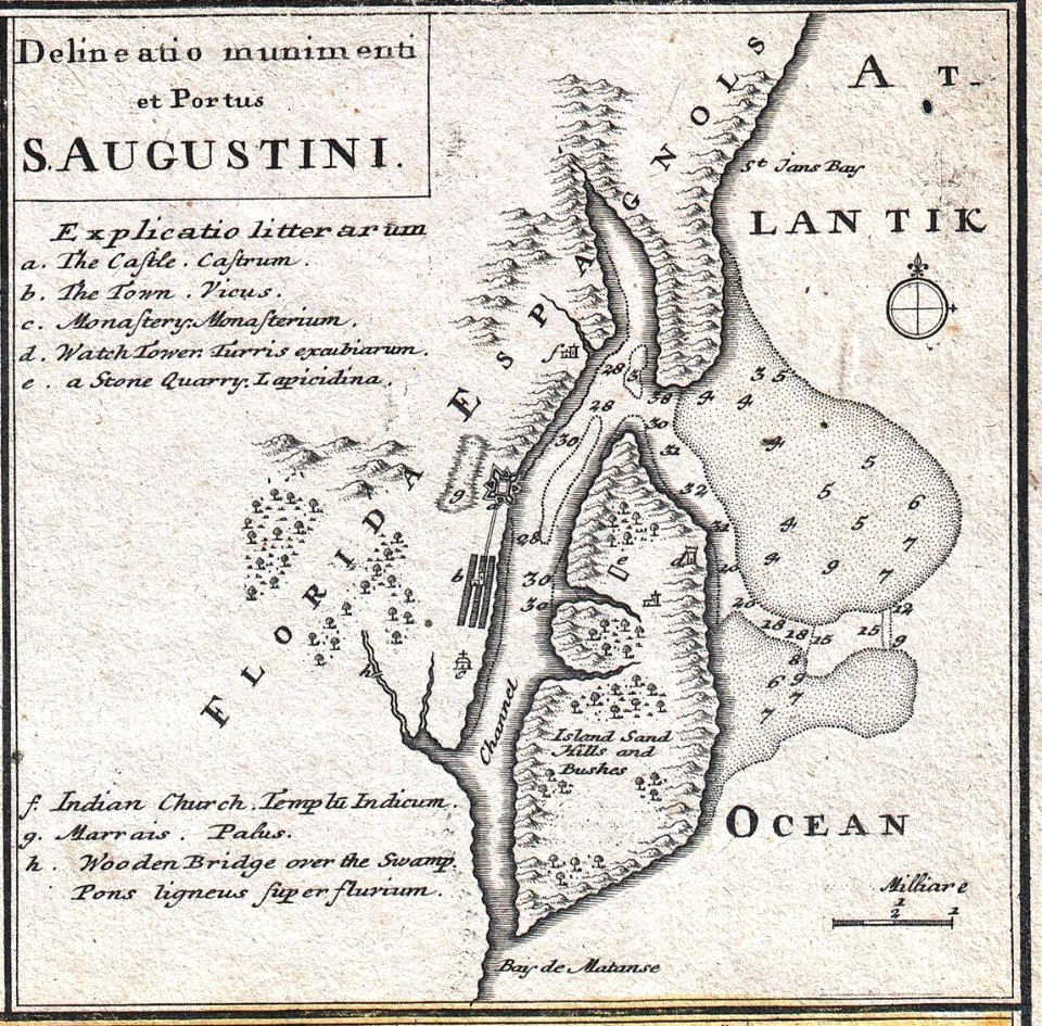
st. augustine, florida in the 18th century
1783 maps of north america
17th-century maps of north carolina
old maps of virginia
old maps of st. augustine, florida
john white (colonist and artist)
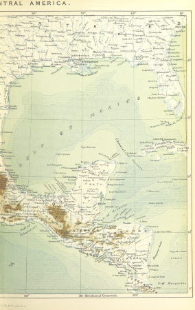
maps from the earth and its inhabitants, vol. xvii
history of florida
1696 maps of the caribbean
1690s maps of mexico
jacques le moyne de morgues
1591 maps
lawrence h. slaughter collection of english maps, charts, globes, books and atlases
nypl lionel pincus and princess firyal map division
1803 maps of the caribbean
maps by john cary
bibliothèque nationale de france
maps by tomas lopez
maps from the earth and its inhabitants, vol. xvi
1870s maps of mexico
maps in the library of congress
old maps of latin america
maps from the earth and its inhabitants, vol. xvii
1870s maps of florida
maps by john cary
1799 maps
juan de la cruz cano y olmedilla
1755 maps of north america
old maps of the viceroyalty of new spain
the spanish borderlands
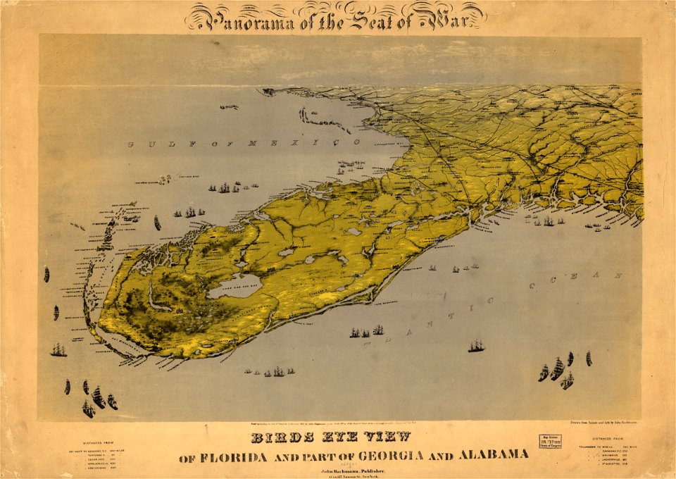
old maps of the american civil war
francis d'avignon
cartography
maps
1800s maps of the americas
maps by john cary
caribbean maps in leiden university library
files uploaded at wiki techstorm 2019
caribbean maps in leiden university library
files uploaded at wiki techstorm 2019
1690s maps of the caribbean
1690s maps of the americas
carte du mexique et de la floride by guillaume delisle (1703)
bibliothèque nationale de france
bahamas
florida
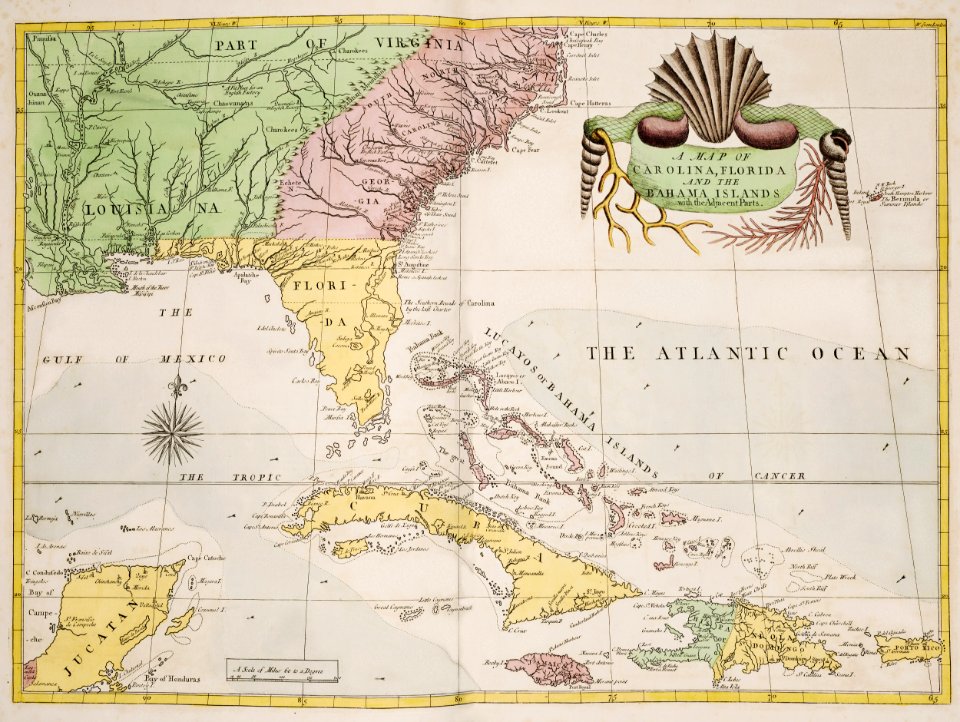
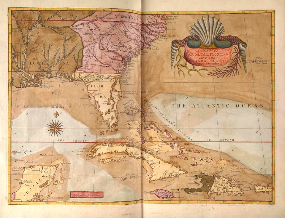
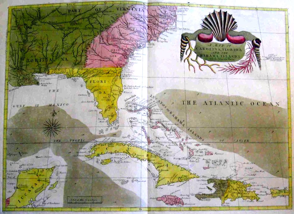
the natural history of carolina, florida and the bahama islands
haliaeetus leucocephalus (illustrations)
1750s maps of central america
maps by tomas lopez
1750s maps of central america
maps by tomas lopez
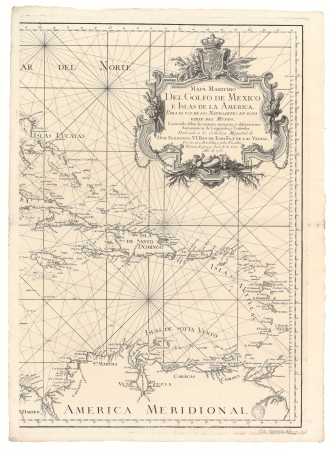
carte du mexique et de la floride by guillaume delisle (1703)
bibliothèque nationale de france
1806 maps of the united states
maps by john cary
maps from the earth and its inhabitants, vol. xvi
1870s maps of panama
maps from the earth and its inhabitants, vol. xvi
1870s maps of panama
old maps of the united states
description de l'universe
carte du mexique et de la floride by guillaume delisle (1703)
bibliothèque nationale de france
bird
bus
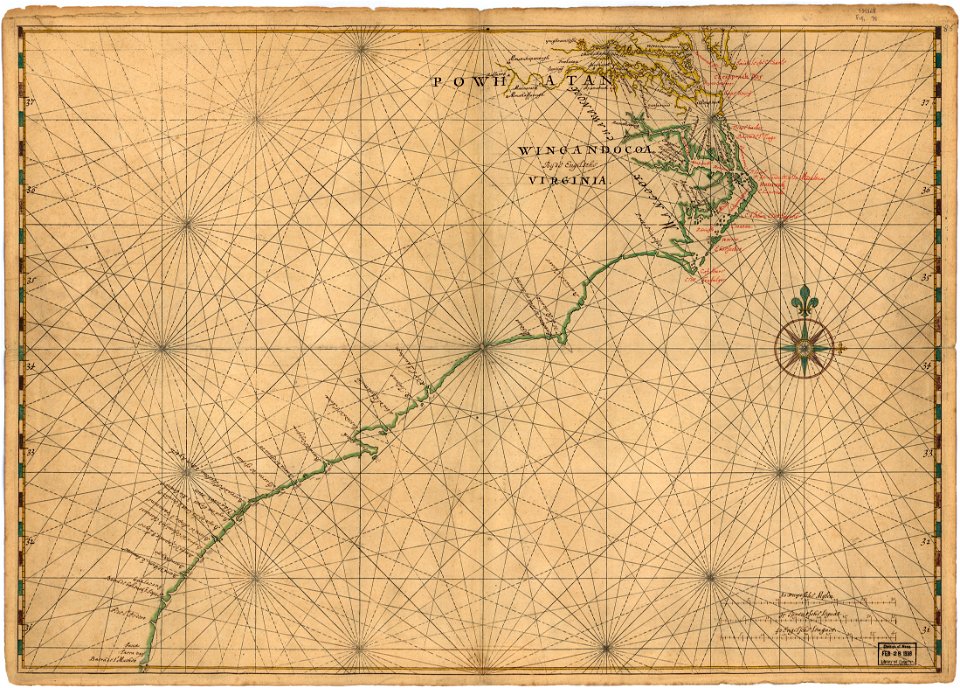
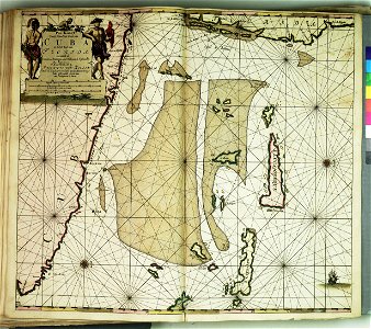
de nieuwe groote lichtende zee-fakkel (rijksmuseum)
maps in the rijksmuseum amsterdam
carte du mexique et de la floride by guillaume delisle (1703)
maps in the library of congress
1810 maps of north america
1810 maps of mexico
lawrence h. slaughter collection of english maps, charts, globes, books and atlases
covens en mortier
juan de la cruz cano y olmedilla
1750s maps of the caribbean
maps in the library of congress
1861 maps
media contributed by university of illinois urbana-champaign university library
carte du mexique et de la floride by guillaume delisle (1703)
the natural history of carolina, florida, and the bahama islands (1754)
unidentified scaridae
1 - 100 of 321
Next page
/ 4