Map of Haiti and surrounding islands, Jakob van der Schley, 1768

Map of Haiti and surrounding islands, Jakob van der Schley, 1768

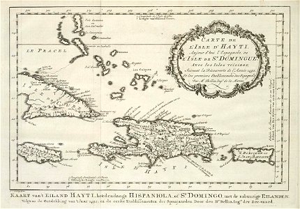
Map of haiti and surrounding islands. Carte de l'isle d'hayti, aujourd'hui l'espagnole, ou isle de st. Domingue, avec les isles voisines. Kaart van 't eiland hayti, heedendaags hispaniola, of st. Domingo, met de nabuurige eilanden. Date: 1768. Dimensions: height: 25 cm (9.8 in); width: 17.5 cm (6.8 in). Medium: engraving on paper. Collection: Koninklijke Bibliotheek. AMH-8040-KB Map of Haiti and surrounding islands
Edit image
Published by:
Creazilla
Author: Jacques-Nicolas BellinSource: commons.wikimedia.org

Loading...

0 downloads
Loading...
maps of the west-indische compagnie1768 maps of north americamaps by jacques-nicolas bellin1760s maps of the caribbeanmaps by jakob van der schleyold maps of haitiengraving on paperkoninklijke bibliotheekjakob van der schley

MORE LIKE THIS

Creazilla logo
Over 10 million free graphic resources for content creators and designers.
© 2018 - 2025 Creazilla
Our resourcesAll imagesPhotosDigital illustrationsClipartIconsPNG ImagesEmojisSilhouettesTraditional Art3D ModelsVectorsFontsColor namesColor palettesGradientsAudioAnimationVideosTemplates
InformationAbout CreazillaTerms of useTech teamPrivacy policyLicence Information
FeedbackContact Us