Log in
All resources
Create a design
27,441 Free Images of Maps
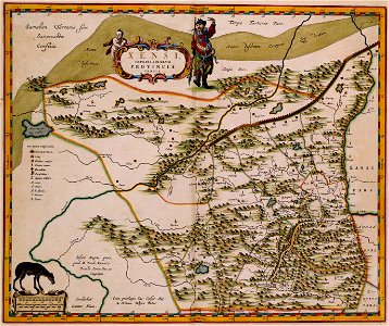
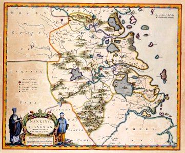
joan blaeu
novus atlas sinensis
maps with figures
copper engraving print
maps with cartouches
maps of the great wall of china
latin-language maps
koninklijke bibliotheek
ships on maps
atlas van der hagen
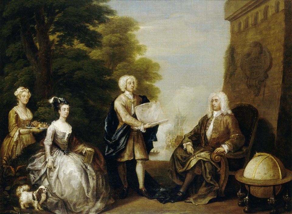
oil paintings of the royal museums greenwich
realism
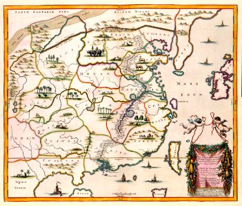
atlas maior, vol 11 (asia) - joan blaeu, 1667 - bl 114.h(star).11
1667 maps
19th-century maps of the black sea
1870s maps of the caucasus
german renaissance,northern renaissance
details of the ambassadors (holbein)
turgot map of paris, norman b. leventhal map center
sheet 19 of the turgot map of paris
maps from university of amsterdam special collections
atlas der neederlanden
17th-century maps of the black sea
maps by pieter van der keere
atlas van der hagen (volume 1)
atlas van der hagen
maps by guillaume delisle
philippe buache
maps by thomas kitchin
andrew dury
1910s maps of somaliland
harar
maps made in the 17th century
siege of groenlo
maps of the history of the united kingdom
maps of voyages
1690s maps of the world
copper engravings
maps of nieuwkoop
aarlanderveen
maps of aboriginal australia
old maps of new south wales
1895 maps of new york (state)
old maps of albany, new york
vector images using elements from other vector images
self-published work
maps by nicolaes visscher i
prints by nicolaes berchem
1834 maps of new york (state)
maps of the erie railroad
atlas maior, vol 11 (asia) - joan blaeu, 1667 - bl 114.h(star).11
1667 maps
old maps of new york city
battle of fort washington
hydrographic and oceanographic department, japan coast guard
old japanese nautical charts
armillary spheres in art
novus atlas sinensis
terra australis
padrón real
gemeente atlas van nederland - north holland
maps of haarlemmerliede en spaarnwoude
maps by nicolaes visscher i
old maps of assyria
maps of cambridge by braun & hogenberg
maps of trinity college, cambridge
caricatures
cartoons
atlas van der hagen (volume 4)
atlas van der hagen
john rocque's 1746 map of london
history of london
16th-century maps of the persian gulf
maps of the gulf of suez
maps of the west-indische compagnie
old maps of the dutch gold coast
armillary spheres in art
novus atlas sinensis
maps by daniel lizars
1830s maps of belize
novus atlas sinensis
maps of yangzhou
atlas van der hagen (volume 4)
atlas van der hagen
johann friedrich leberecht reinhold
18th-century children
john rocque's 1746 map of london
details of old maps of london
maps of arabia quadrangle
mars topography
old maps of bouvet island
bouvet island
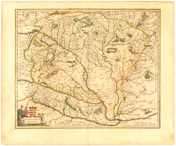
historical national coats of arms of hungary
1640s maps of hungary
valentine's day
maps
files with no machine-readable author
self-published work
1630s maps of new york city
manatus map
1850s maps of the americas
maps by john tallis
maps made in the 16th century
johannes ruysch
maps from the earth and its inhabitants, vol. viii
population density maps of india
maps by willem and johannes blaeu
siege of breda 1637
maps from the earth and its inhabitants, vol. vi
tian shan
maps from the earth and its inhabitants, vol. vi
tian shan
christina of sweden
rené descartes
atlas maior, vol 11 (asia) - joan blaeu, 1667 - bl 114.h(star).11
17th-century maps of korea
maps by christian sgrothen
inde (river)
maps of the crown of aragon
old maps of medieval iberia
old maps of the american revolution
1777 maps of new york (state)
definitive stamps of australia
1929 stamps of australia
17th-century maps of hungary
old maps of hont county
engravings of louvre by theodor hoffbauer
lithographs of paris
maps by john tallis
maps by john rapkin
old maps of bouvet island
bouvet island
atlas maior, vol 11 (asia) - joan blaeu, 1667 - bl 114.h(star).11
1667 maps
sanborn maps of manhattan published in 1905
aestheticism
atlas van der hagen (volume 4)
atlas van der hagen
maps by john cary
1799 maps
admiralty charts region b: england wales ireland english channel southern north sea
admiralty charts 1801-2000
maps in the library of congress
novus atlas sinensis
old maps of the duchy of jülich
maps of the duchy of berg
1590s maps of the world
1595 maps
maps of argyre quadrangle
mars topography
history of cartography
fra mauro map
danubius pannonico-mysicus
1720s maps of transylvania
atlas van der hagen
mount wutai
old submaps of paris 17e arrondissement
plan de roussel - derivative files
bird's-eye views of paris
1860 in paris
maps in the library of congress
1877 in ohio
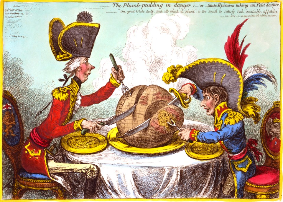
the plumb-pudding in danger (cartoon)
1805-02-26
1660s maps of the ottoman empire
old maps of the danube
17th-century maps of the baltic sea
17th-century maps of scandinavia
boris kisin
classicism
maps from the earth and its inhabitants, vol. vi
tian shan
19th-century portrait paintings in the musée national du château de versailles
françois joseph kinson
old maps of the dutch east india company
old maps of the south china sea
très riches heures du duc de berry
early netherlandish painting
details of old maps of the world showing "aquita" in japan
johannes baptista vrints
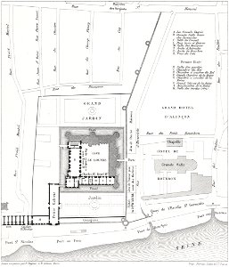
historical images of the jardin des plantes de paris
maps of the jardin des plantes de paris
fort zeelandia, taiwan in art
siege of fort zeelandia
1849 maps of north america
old maps of canada
1660s maps of belgium
old maps of bruges
ethnographic maps of austria-hungary
1890s maps of austria-hungary
russian empire in thomas kitchen's general atlas (1773)
general atlas (1773)
maps by emanuel bowen
1740s maps of turkey
edward wright (mathematician)
maps by jodocus hondius
17th-century maps of asia
maps from gallica
1855 maps of the russian empire
1850s maps of crimea
maps by cornelis anthonisz.
1560 maps of europe
1860s maps of palestine
al-salihiyya
1810s maps of the near east
maps by john cary
maps by giacomo gastaldi
maps by gerard de jode
maps from the mechanical curator collection available to georeference
maps from the mechanical curator collection
901 - 1000 of 27,441
Next page
/ 275