Log in
All resources
Create a design
102 Free Artworks of 17th Century Maps Of Asia
description de l'universe
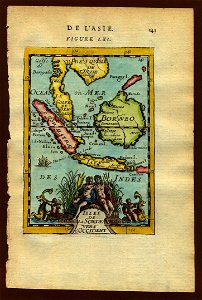
17th-century maps of southeast asia
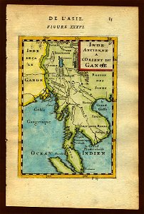
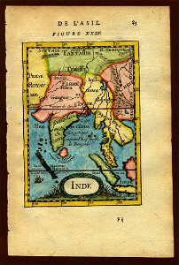
alain manesson mallet
cartography
chalcography
fondo antiguo
calcografía
cartografía
cartografía, mapas | cartography, maps
engraving
the voyage of the vega round asia and europe
third voyage of willem barentsz
italian-language maps
maps with cartouches
old maps of tibet
old maps of asia
printing in the netherlands
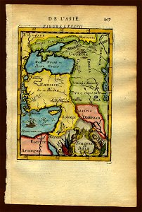
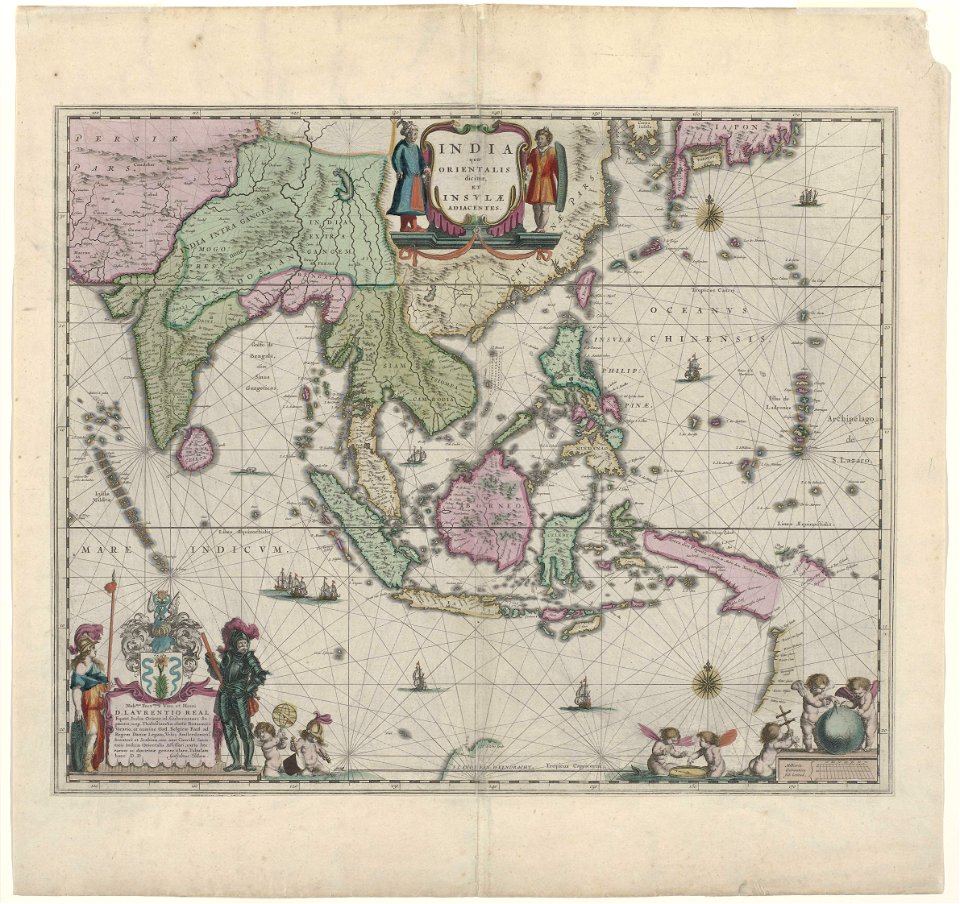
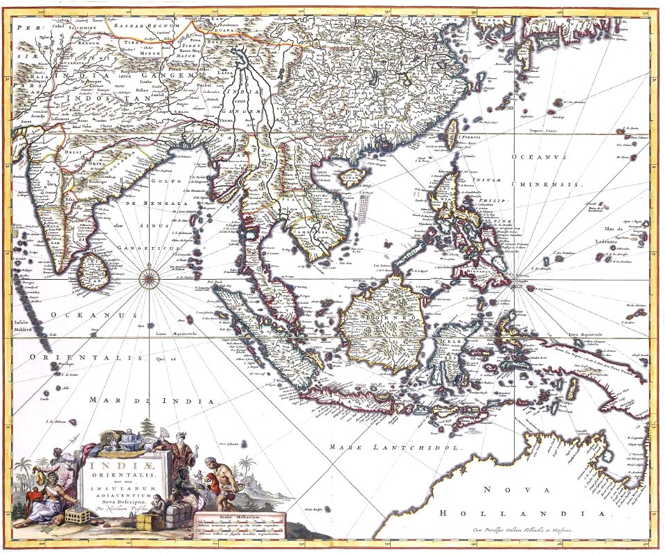
asia in the 17th century
maps with cartouches
copper engraving
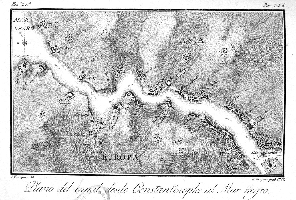
17th-century maps of the black sea
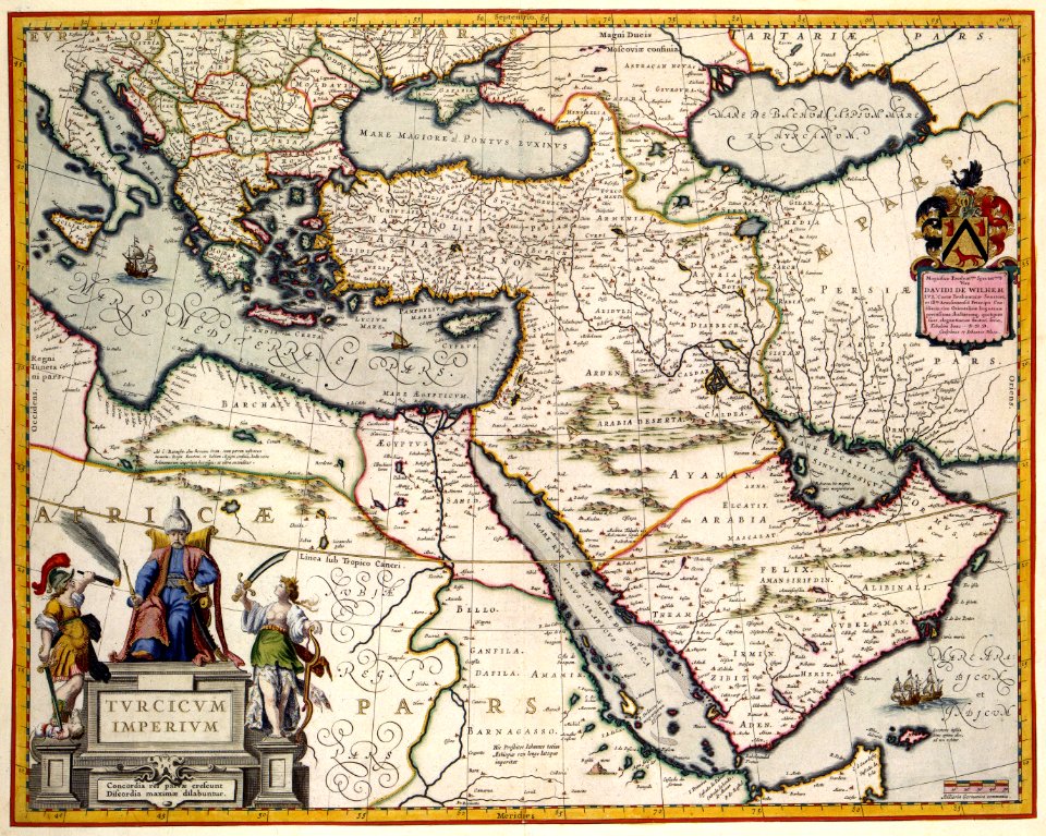
old maps of turkey
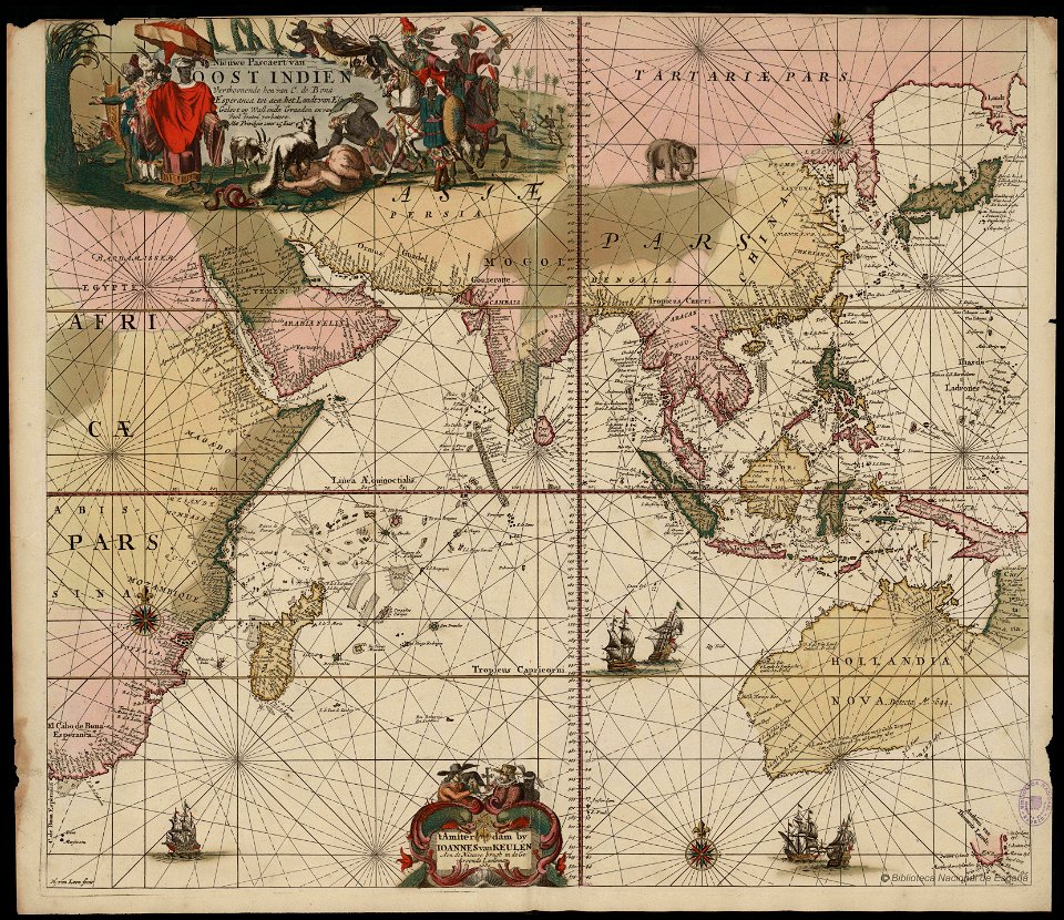
17th-century maps of indonesia
1621
copper engraving
gerard valck
17th-century maps of the caucasus
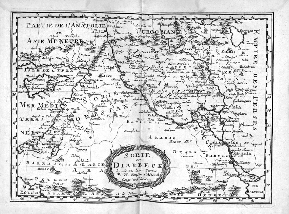
old maps of the middle east
atlas van der hagen (volume 4)
maps with cartouches
old maps of australia
maps with cartouches
maps by willem and johannes blaeu
maps in the rijksmuseum amsterdam
atlantis magni tomus quintus (biblioteca comunale di trento)
maps made in the 17th century
maps made in the 17th century
nicolaes visscher ii
history of indonesia
mataram sultanate
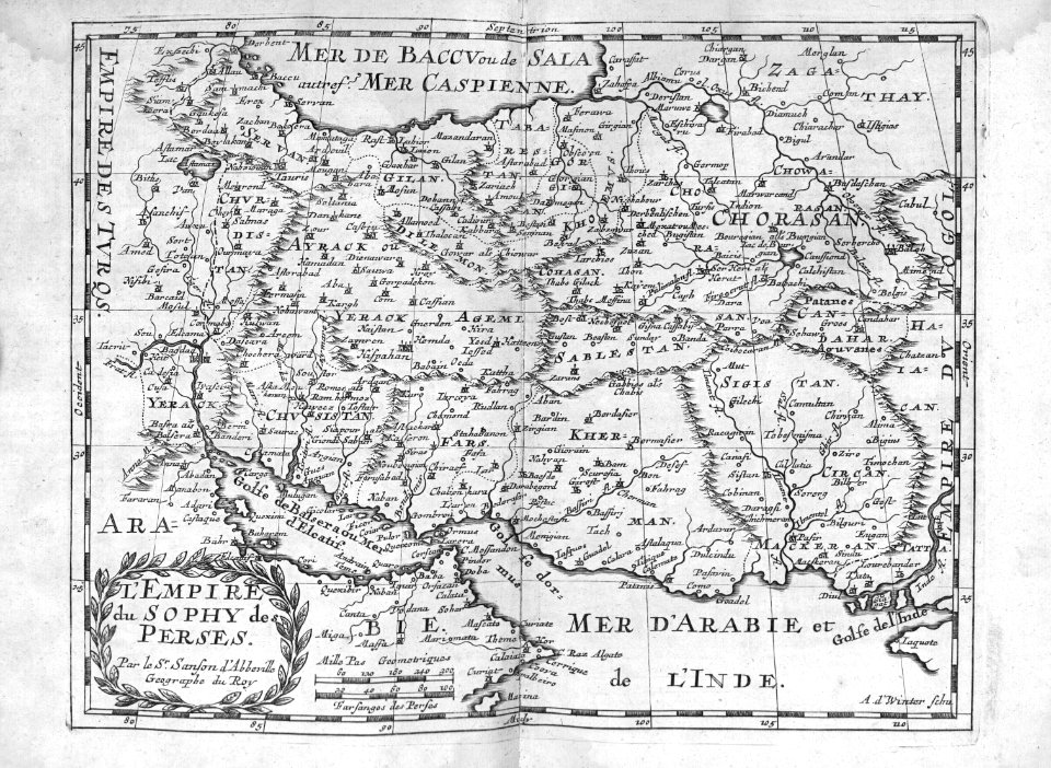
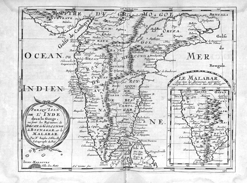
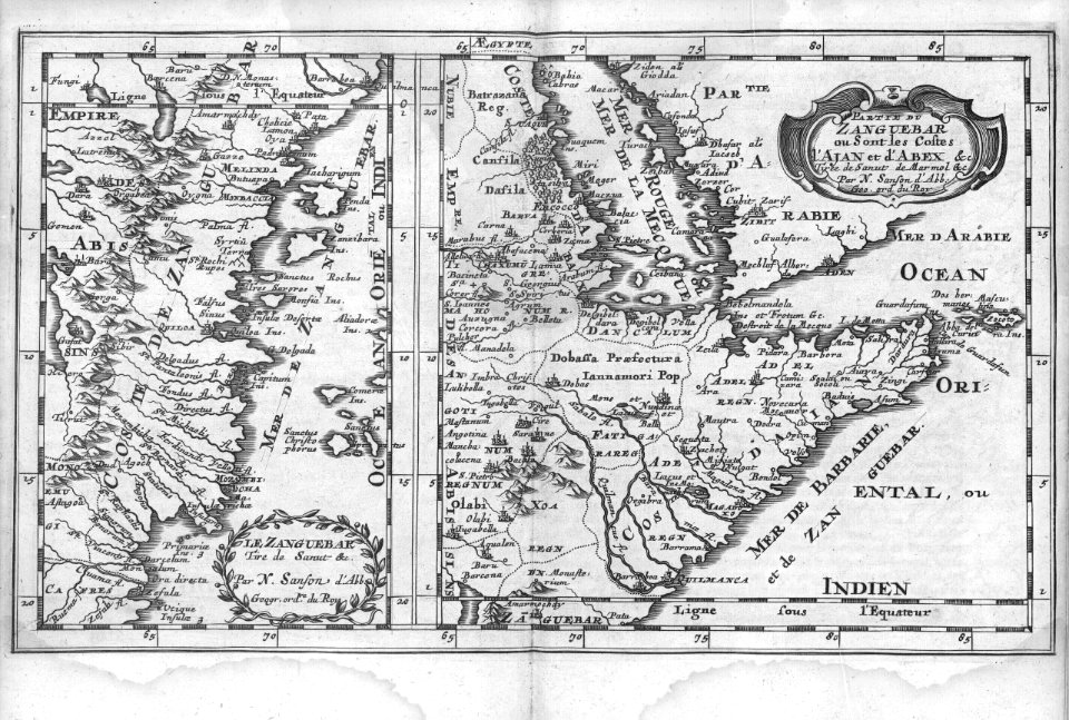
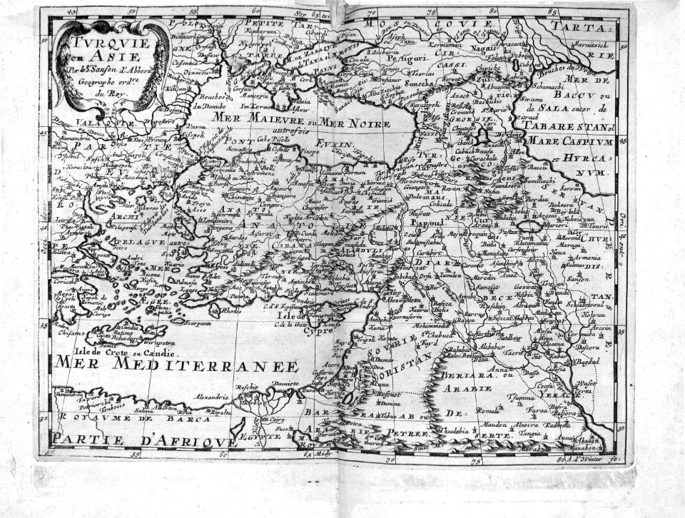
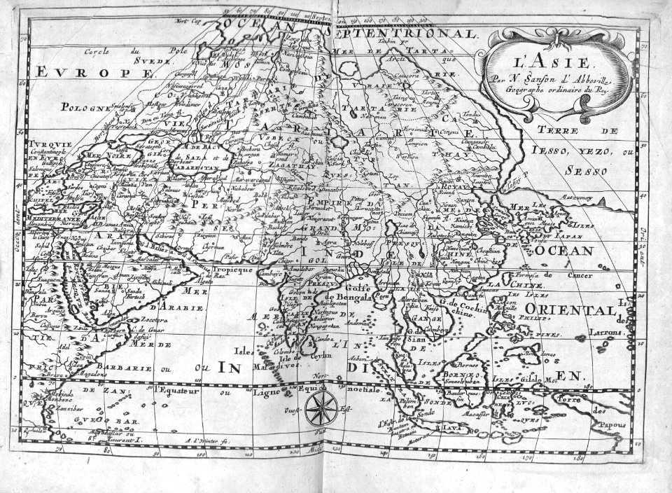
sanson maps of asia
company land
van langren map of southeast asia
1619 maps of asia
atlas maior, vol 11 (asia) - joan blaeu, 1667 - bl 114.h(star).11
17th-century maps of korea
17th-century maps of asia
maps from gallica
atlas van der hagen (volume 4)
atlas van der hagen
old maps of the south china sea
1680 maps of asia
1650s maps of china
1655 maps of asia
atlas maior, vol 11 (asia) - joan blaeu, 1667 - bl 114.h(star).11
1667 maps
1650s maps of china
1655 maps of asia
asiae nova descriptio, by pieter van der keere
17th-century maps of southeast asia
tresor des cartes geographiques (1659)
1650s maps of india
maps by alain manesson-mallet
description de l'universe
17th-century maps of southeast asia
maps by girolamo porro
maps by willem and johannes blaeu
17th-century maps of asia
maps by willem and johannes blaeu
17th-century maps of asia
maps in the library of congress
1655 maps of asia
17th-century maps of the black sea
description de l'universe
maps by jodocus hondius ii
17th-century maps of asia
jerusalem in 17th-century art
asia noviter delineata
17th-century maps of southeast asia
description de l'universe
asiae nova descriptio, by pieter van der keere
17th-century maps of southeast asia
asia noviter delineata
old images of kolkata
17th-century maps of the near east
description de l'universe
maps by daniel lizars
1820 maps of asia
asia noviter delineata
muscovy
1700s maps of the ottoman empire
maps made in the 17th century
moluccas in the 17th century
asia noviter delineata
asia noviter delineata
balaghat range
17th-century maps of tartary
17th-century maps of siberia
maps by willem and johannes blaeu
chami empire
17th-century maps of southeast asia
description de l'universe
17th-century maps of southeast asia
description de l'universe
17th-century maps of southeast asia
description de l'universe
17th-century maps of southeast asia
description de l'universe
17th-century maps of southeast asia
description de l'universe
asia noviter delineata
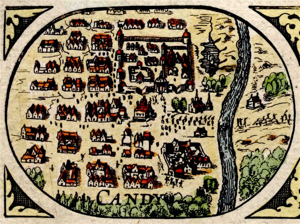
history of kandy
asia noviter delineata
history of banten
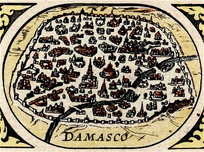
maps of damascus by braun & hogenberg
asia noviter delineata
17th-century maps of southeast asia
description de l'universe
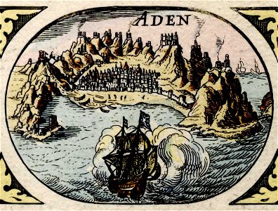
maps of aden by braun & hogenberg
asia noviter delineata
17th-century maps of sri lanka
description de l'universe
cartography
maps
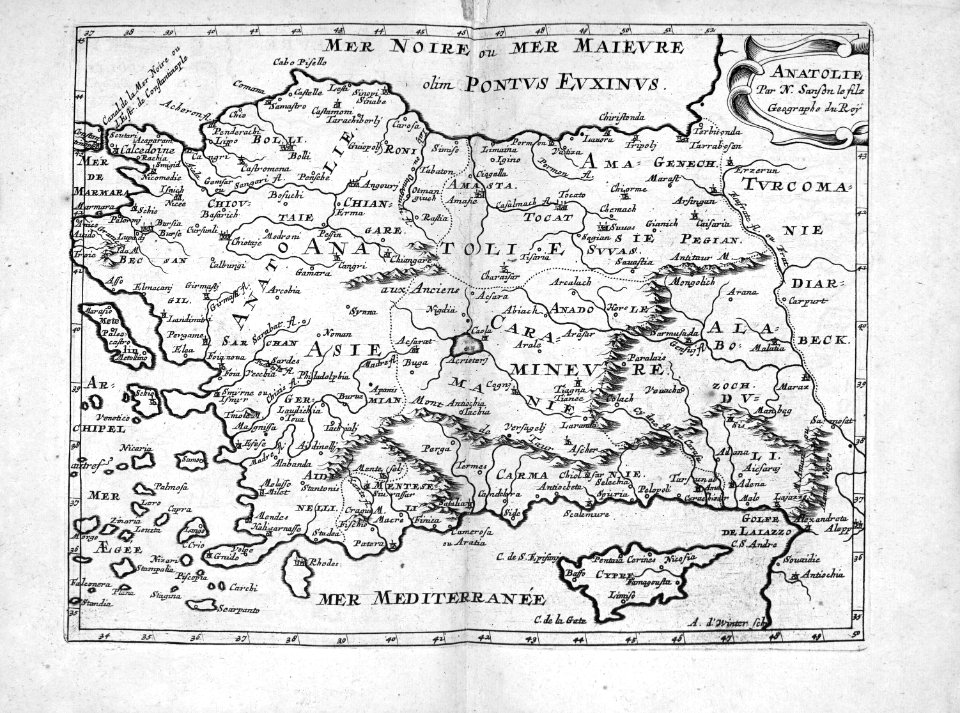
map of ancient asia minor by philippe de la rué
bibliothèque nationale de france
17th-century maps of jerusalem
description de l'universe
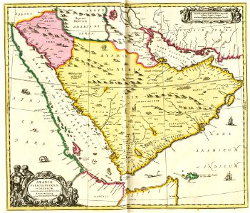
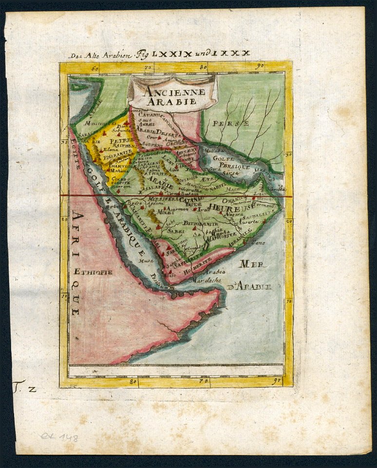
17th-century maps of arabia
description de l'universe
17th-century maps of arabia
description de l'universe
cartography
maps
17th-century maps of southeast asia
maps by jodocus hondius
asia noviter delineata
old goa
history of hormuz island
asia noviter delineata
atlas maior, vol 11 (asia) - joan blaeu, 1667 - bl 114.h(star).11
1667 maps
description de l'universe
1680s maps of china
atlas ou representation du monde universel t. 2 (1633)
17th-century maps of southeast asia
17th-century maps of southeast asia
description de l'universe
17th-century maps of southeast asia
description de l'universe
17th-century maps of southeast asia
description de l'universe
17th-century maps of southeast asia
description de l'universe
cartography
maps
atlas maior, vol 11 (asia) - joan blaeu, 1667 - bl 114.h(star).11
1667 maps
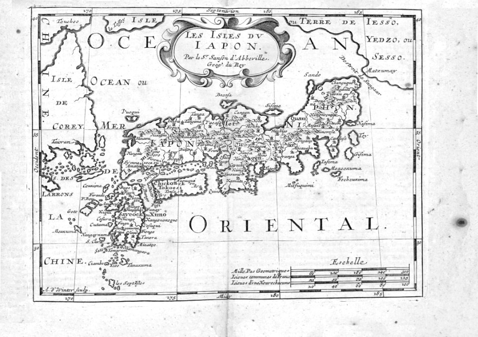
japan
maps
cartography
maps
maps of novaya zemlya
1590s maps
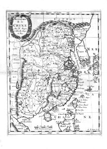
china
maps
cartouches by alexis-hubert jaillot
17th-century maps of asia
china
maps
cartography
maps
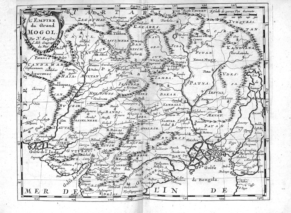
india
maps
17th-century paintings in the amsterdam museum
paintings by pieter isaacsz
africa
maps
cartography
maps
africa
maps
mappe-monde geo-hydrographique (sanson and jaillot, 1674)
cartography of france
cartography
maps
1600 maps of africa
benjamin wright
cartography
maps
philippe de la rué
maps of mysia
cartography
maps
maps by joachim bormeester
1680s maps of the world
cartography
maps
cartography
maps
1740s maps of the world
maps by emanuel bowen
maps in the rijksmuseum amsterdam
old maps of the ottoman empire
maps by joachim bormeester
1685 maps
17th-century engravings in the rijksmuseum amsterdam
old maps of banten
dutch 17th-century prints in the rijksmuseum amsterdam
siege of breda 1624-1625
1 - 100 of 102
Next page
/ 2


![Gerardi Mercatoris and I. Hondii Atlas or Representation of the Universal World, and of the Parts of It, Made in Tables and Very Ample Descriptions. [t. 2].](https://cdn.creazilla.com/illustrations/10000597422/gerardi-mercatoris-and-i-hondii-atlas-or-representation-of-the-universal-world-and-of-the-parts-of-it-made-in-tables-and-very-ample-descriptions-t-2-sm.jpg)