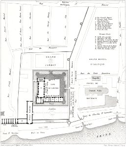
Quartier du Louvre, 1595, Theodor Josef Hubert Hoffbauer, between 1875 and 1882
Maps of the louvre neighborhood. On the left, a map showing 1595. On the right, a map showing 1380. The overlay shows the same area in 1876. Date: between 1875 and 1882. Medium: lithograph. Collection: Brown University Library. Quartier du Louvre, 1595