Log in
All resources
Create a design
172 Free Images of Maps By Pieter Mortier
bibliothèque nationale de france
maps from gallica
pierre mortier
pieter mortier i
maps in the rijksmuseum amsterdam
1700 maps
eran laor cartographic collection
french-language maps
prints by jan luyken in the rijksmuseum amsterdam
maps by jan luyken
kaart van het baljuwschap kennemerland
maps in the rijksmuseum amsterdam
old maps of mexico
covens en mortier
cornell university library
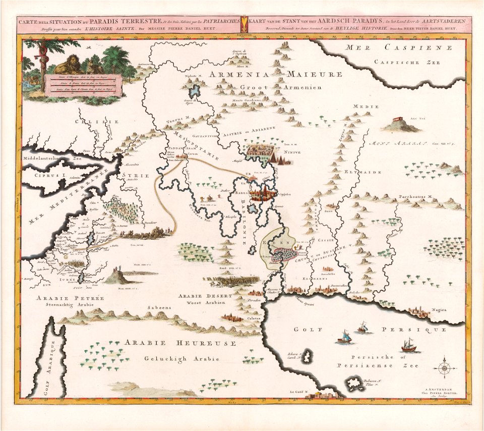
garden of eden
old maps of valletta
joan blaeu
maps made in the 17th century
old maps of gelderland
atlantis magni tomus tertius (biblioteca comunale di trento)
maps made in the 17th century
maps made in the 17th century
guillaume sanson
1726
asie
18th-century maps of antwerp
maps of antwerp city walls
maps of antwerp city walls
old maps of antwerp
engravings of buildings
maps by pieter mortier
1720s maps of the caribbean
maps by pieter mortier
eran laor cartographic collection
pierre mortier
maps of the duchy of courland and semigallia
old maps of livonia
eran laor cartographic collection
pierre mortier
eran laor cartographic collection
pierre mortier
maps by pieter mortier
indochina
eran laor cartographic collection
pierre mortier
eran laor cartographic collection
pierre mortier
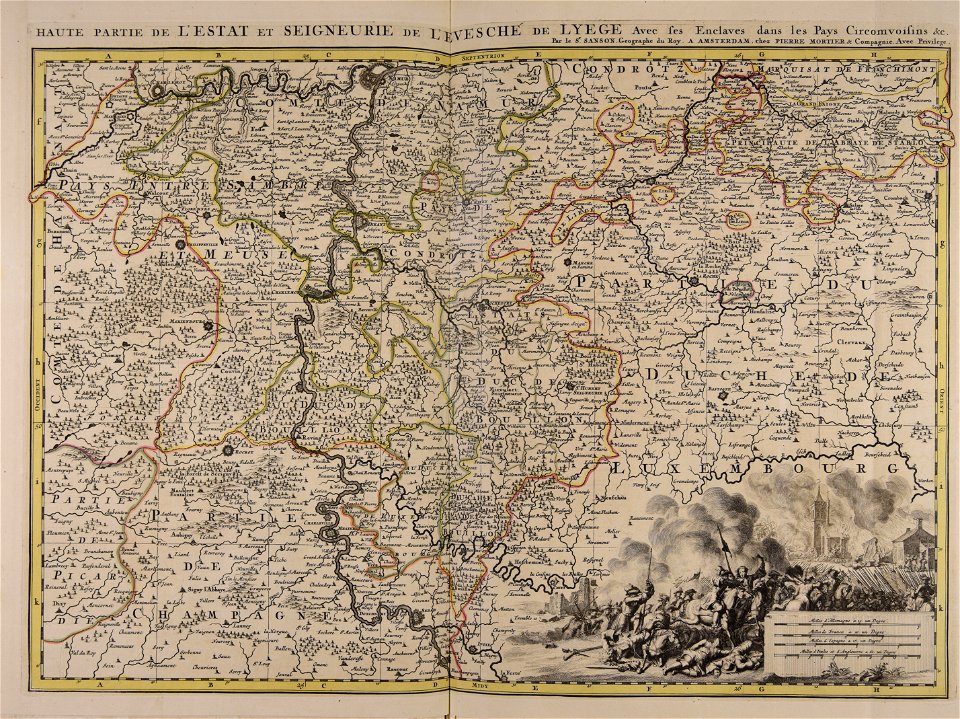
old maps of luxembourg city
maps by pieter mortier
atlas van der hagen (volume 3)
atlas van der hagen
eran laor cartographic collection
pierre mortier
old maps of narva
1700 maps
maps by pieter mortier
old maps of asia
maps by pieter mortier
old maps of genoa
maps by pieter mortier
terra d'otranto
atlas van der hagen (volume 4)
people with animals in art
historical maps of crema
porta ombriano
historical maps of crema
porta serio
historical maps of crema
maps by pieter mortier
atlas van der hagen (volume 3)
atlas van der hagen
historical maps of crema
maps by pieter mortier
eran laor cartographic collection
pierre mortier
atlas van der hagen (volume 3)
atlas van der hagen
maps by pieter mortier
old maps of rovigo
maps of the duchy of mantua
guillaume sanson
biblioteca di storia e cultura del piemonte "giuseppe grosso"
media from giuseppe grosso library
maps by pieter mortier
maps from gallica
maps of paris from the david rumsey historical map collection
map of paris by jouvin de rochefort (boutier 133)
old maps of livonia
old maps of latvia
maps by pieter mortier
maps of the cevennes
maps by pieter mortier
1700 maps of africa
maps by pieter mortier
old maps of asia
le neptune francois
charles pène 8th
historical maps of crema
borgo san pietro (crema)
atlas van der hagen (volume 3)
atlas van der hagen
maps by pieter mortier
maps from gallica
17th-century maps of africa
maps from gallica
maps by pieter mortier
maps from gallica
collections of the national library of israel
1725 maps
de wikisource book leaflet
de nordseeküste (karten)
1690s maps of greece
maps from gallica
1700s maps of the world
le neptune francois
maps by pieter mortier
le neptune francois
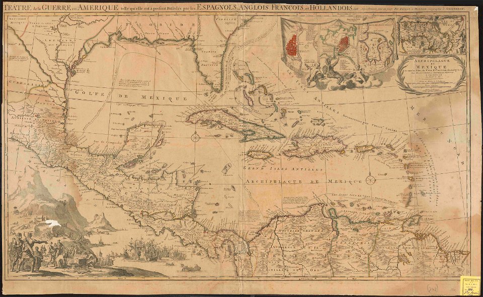
1690s maps of the caribbean
1690s maps of the americas
maps by pieter mortier
maps from gallica
maps by pieter mortier
maps from gallica
maps by pieter mortier
maps from gallica
maps by pieter mortier
maps from gallica
maps in the british museum
maps by pieter mortier
maps by pieter mortier
maps from gallica
18th-century maps of north america
1708 maps of north america
maps by pieter mortier
maps from gallica
maps by pieter mortier
maps from gallica
maps by pieter mortier
le neptune francois
maps from gallica
old maps of rome
maps by pieter mortier
maps from gallica
maps by pieter mortier
maps from gallica
maps by pieter mortier
maps from gallica
17th-century maps of africa
maps from gallica
old maps of austria
1695 books
maps from university of amsterdam special collections
atlas der neederlanden
maps by pieter mortier
maps from gallica
maps by pieter mortier
maps from gallica
le neptune francois
1700 maps of cuba
charts and maps of the royal museums greenwich
1693 maps
maps by pieter mortier
le neptune francois
maps by pieter mortier
maps from gallica
maps by pieter mortier
maps from gallica
carte particulière des costes de l'afrique qui comprend le royaume de gualata ... - btv1b8595466g
maps by pieter mortier
carte particulière des costes de l'afrique qui comprend le royaume de gualata ... - btv1b8595466g
maps by pieter mortier
maps by pieter mortier
maps from gallica
prints by jan luyken in the rijksmuseum amsterdam
maps in the rijksmuseum amsterdam
maps from university of amsterdam special collections
atlas der neederlanden
carte particulière des costes de l'afrique qui comprend le royaume de cacheo, le province de gelofo etc. - btv1b8595501g
maps by pieter mortier
maps by pieter mortier
maps from gallica
maps by pieter mortier
1695 books
prints by jan luyken in the rijksmuseum amsterdam
maps in the rijksmuseum amsterdam
maps in the rijksmuseum amsterdam
maps by pieter mortier
maps from university of amsterdam special collections
atlas der neederlanden
lawrence h. slaughter collection of english maps, charts, globes, books and atlases
1700 maps of the atlantic ocean
history of avignon
atlas van loon
lawrence h. slaughter collection of english maps, charts, globes, books and atlases
1700 maps of the atlantic ocean
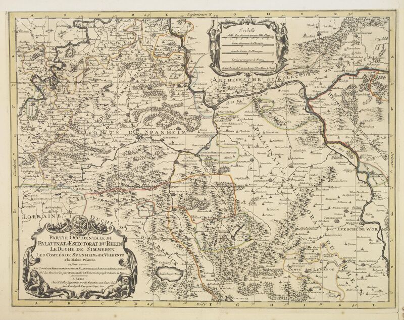
maps of the palatinate of the rhine
1692 maps of rhineland-palatinate
prints by jan luyken in the rijksmuseum amsterdam
maps by jan luyken
prints by jan luyken in the rijksmuseum amsterdam
maps in the rijksmuseum amsterdam
prints by jan luyken in the rijksmuseum amsterdam
maps in the rijksmuseum amsterdam
fortifications of charleroi
old maps of charleroi
prints by jan luyken in the rijksmuseum amsterdam
maps in the rijksmuseum amsterdam
prints by jan luyken in the rijksmuseum amsterdam
maps by jan luyken
1 - 100 of 172
Next page
/ 2


![Stadsprofiel van] VENETIA, Joan Blaeu, 1704](https://cdn.creazilla.com/illustrations/10000311106/stadsprofiel-van-venetia-joan-blaeu-1704-md.jpeg)


![Titelblad] AFRICA](https://cdn.creazilla.com/illustrations/10000408184/titelblad-africa-sm.webp)


![Stadsprofiel van] ROMA, 1704](https://cdn.creazilla.com/illustrations/10000357441/stadsprofiel-van-roma-1704-md.jpeg)


![Stadsprofiel van] NAPOLI, 1704](https://cdn.creazilla.com/illustrations/10000682766/stadsprofiel-van-napoli-1704-md.jpeg)


![Stadsprofiel van] GENOA, 1704](https://cdn.creazilla.com/illustrations/10000768860/stadsprofiel-van-genoa-1704-md.jpeg)


![Hellas seu Graecia universa apud P[ieter] Mortier, 1690](https://cdn.creazilla.com/illustrations/10001021044/hellas-seu-graecia-universa-apud-pieter-mortier-1690-md.jpg)


![Alphabetical table of the names of towns, villages etc. which are on the map of Zeeland by Mr. Sanson ([1692]), [1692]](https://cdn.creazilla.com/illustrations/10000748056/alphabetical-table-of-the-names-of-towns-villages-etc-which-are-on-the-map-of-zeeland-by-mr-sanson-1692-1692-md.jpg)

![The Kingdom of Siam with its tributary kingdoms and the islands of Sumatra, Andemaon and the neighboring islands [sic], 1705](https://cdn.creazilla.com/illustrations/10000834338/the-kingdom-of-siam-with-its-tributary-kingdoms-and-the-islands-of-sumatra-andemaon-and-the-neighboring-islands-sic-1705-sm.jpg)


![Atlantic Ocean or North Sea Where the Route from Europe [sic] to the East Indies and from the West Indies to Europe are exactly observed, Drawn up on the most recent Relations, 1700](https://cdn.creazilla.com/illustrations/10001005747/atlantic-ocean-or-north-sea-where-the-route-from-europe-sic-to-the-east-indies-and-from-the-west-indies-to-europe-are-exactly-observed-drawn-up-on-the-most-recent-relations-1700-md.jpg)

![The County of Zeelande / draws up new plans based on the memoirs by Mr. Sanson, ordinary geographer to the King, [1692]](https://cdn.creazilla.com/illustrations/10001468571/the-county-of-zeelande-draws-up-new-plans-based-on-the-memoirs-by-mr-sanson-ordinary-geographer-to-the-king-1692-sm.webp)


![The Lordship of Groningen subdivided into all its jurisdictions / drawn up on the most recent memoirs by Mr. Sanson, [1708]](https://cdn.creazilla.com/illustrations/10001164695/the-lordship-of-groningen-subdivided-into-all-its-jurisdictions-drawn-up-on-the-most-recent-memoirs-by-mr-sanson-1708-md.jpg)