Log in
All resources
Create a design
157 Free Artworks of Maps Of New York City
old maps of manhattan
maps from valentine's manual
george hayward
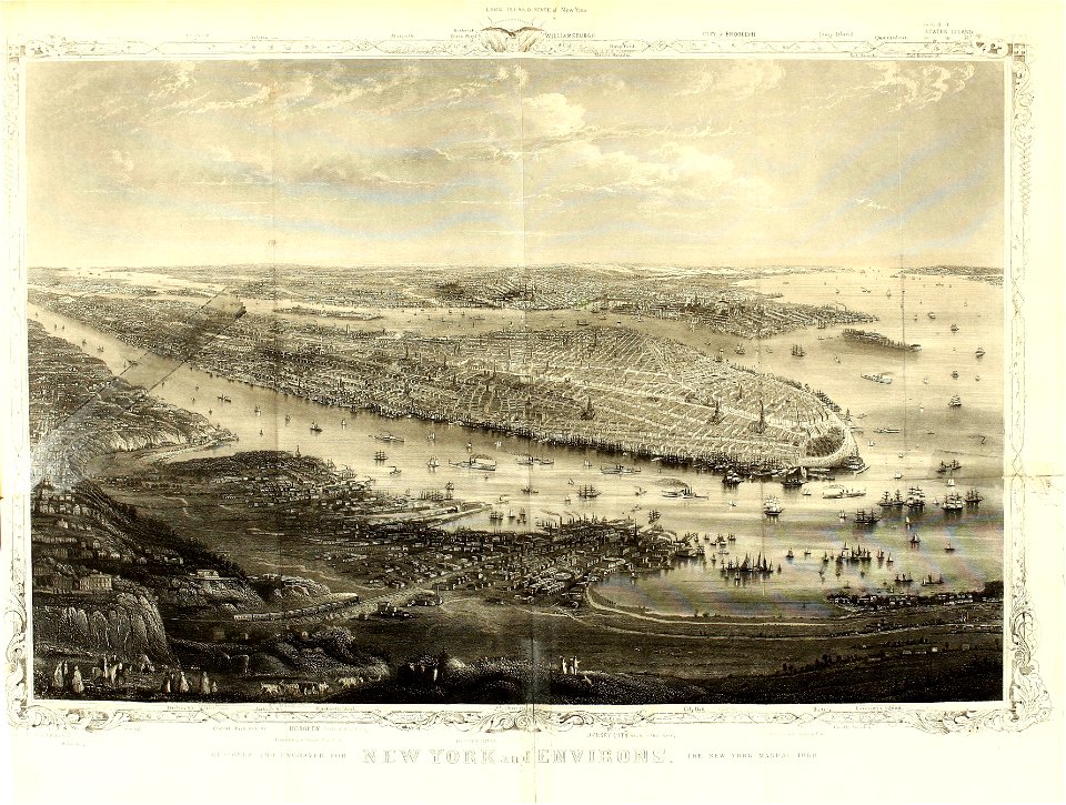
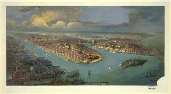
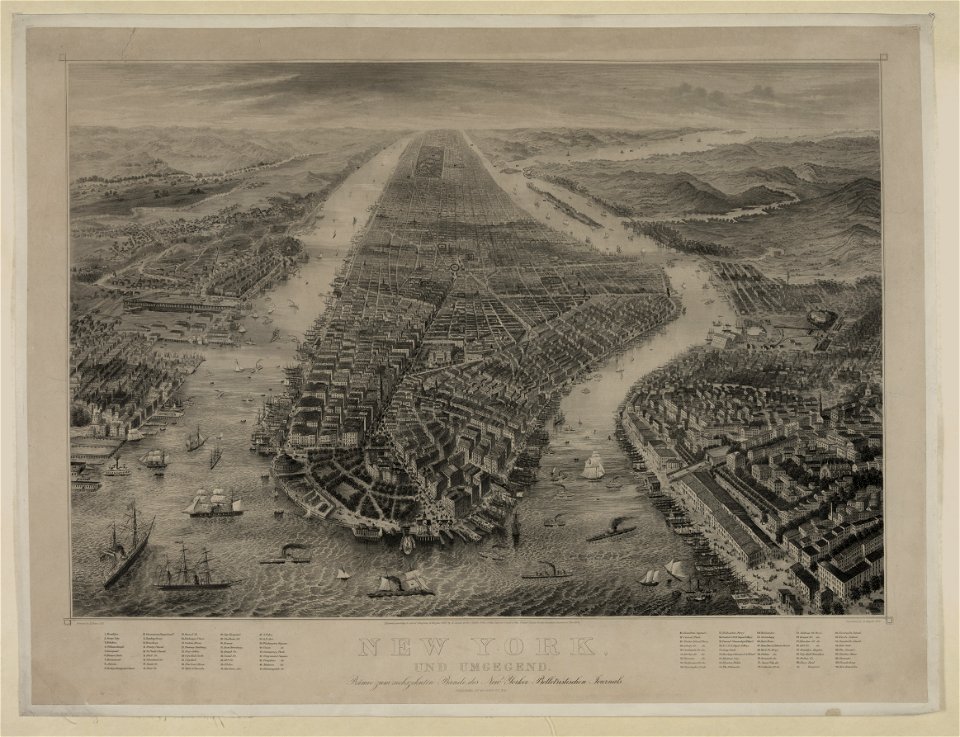
bird's eye view maps of new york city
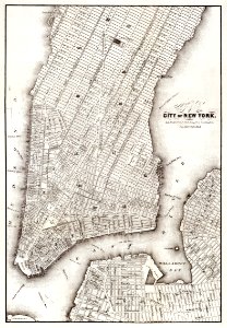
old maps of new york city
maps in the library of congress
old maps of manhattan, new york city
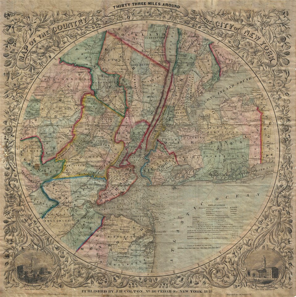
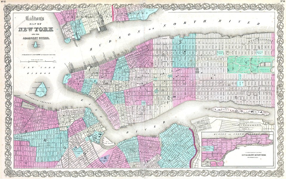
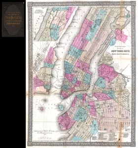
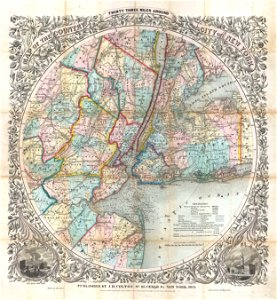
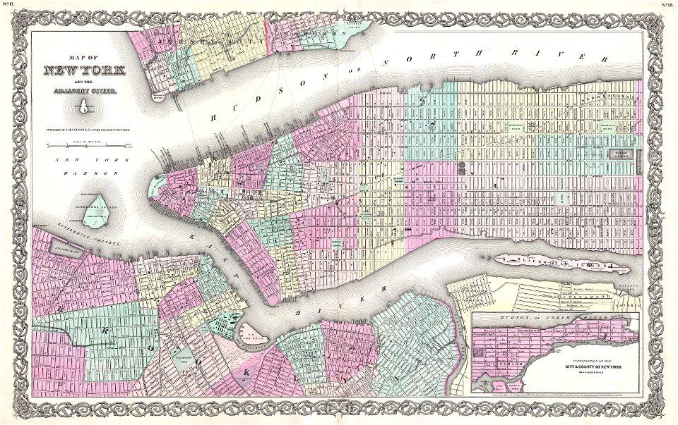
maps by joseph hutchins colton
images from the new york public library
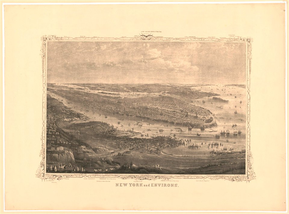
new york harbor in art
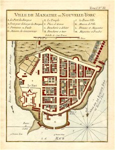
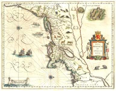
1639 maps
1670 maps
1660 in new york city
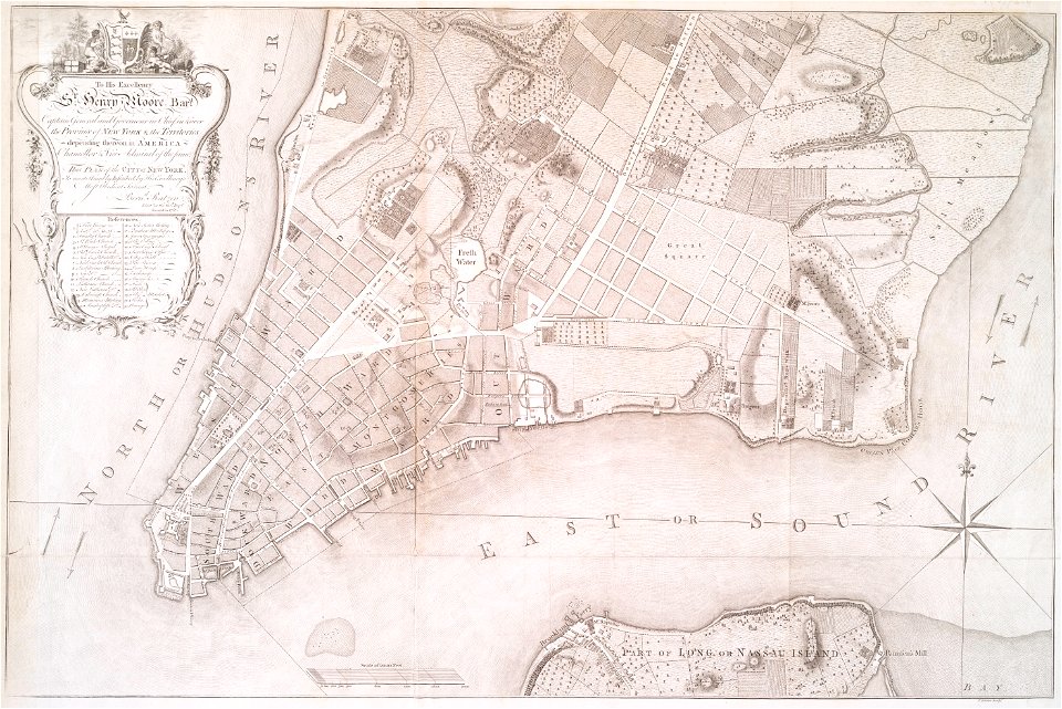
fort amsterdam
city investing building
astor house building
new york
maps
1867 engravings
new york city
manual of the corporation of the city of new york (1870)
new york city
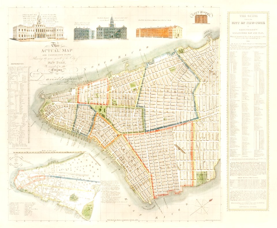
old maps of manhattan
new york city
new jersey
hoboken
new jersey
hoboken
old maps of new york city
english-language maps
new jersey
hoboken
1867 engravings
new york city
lithographs of new york city
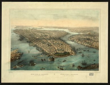
chromolithograph
fires in new york (state)
new york city
chromolithograph
new york city
old maps of manhattan
new york city
brooklyn borough hall
new york city hall
bird's eye view maps of new york city
1867 in new york city
brooklyn borough hall
new york city hall
new york city
1867 maps
chromolithograph
new york city
chromolithograph
new york city
old maps of manhattan
new york city
cartography of new york city
english-language maps
old maps of new york city
1865 maps
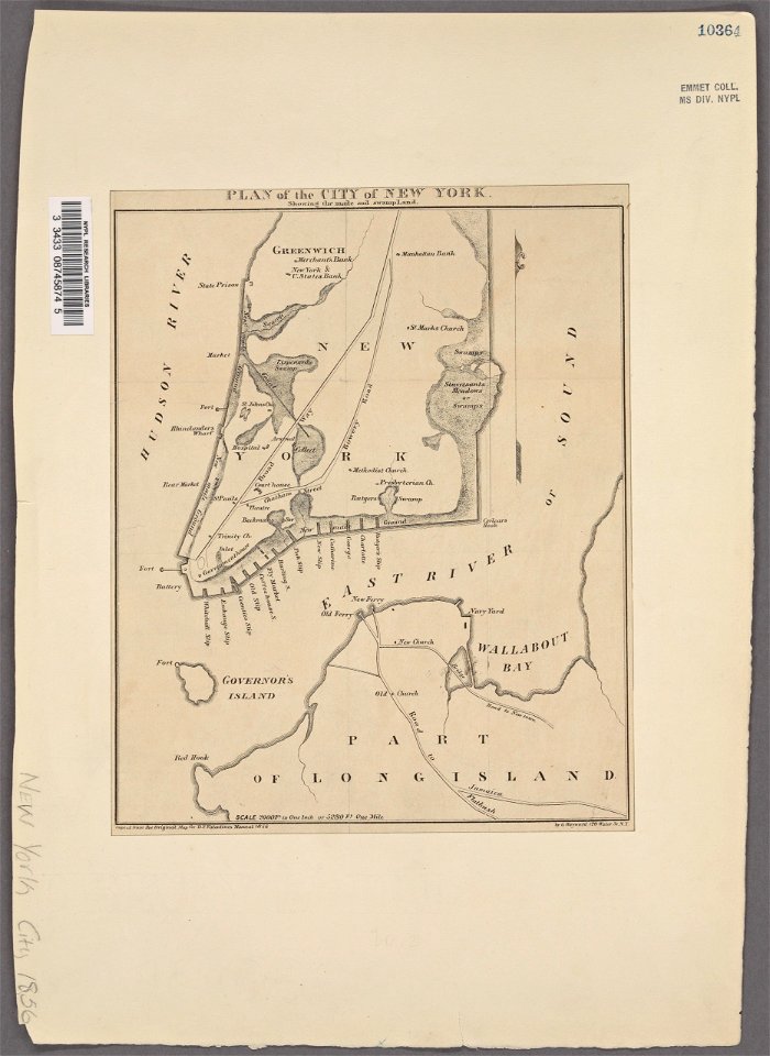
manual of the corporation of the city of new york (1856)
new york city
old maps of new york city
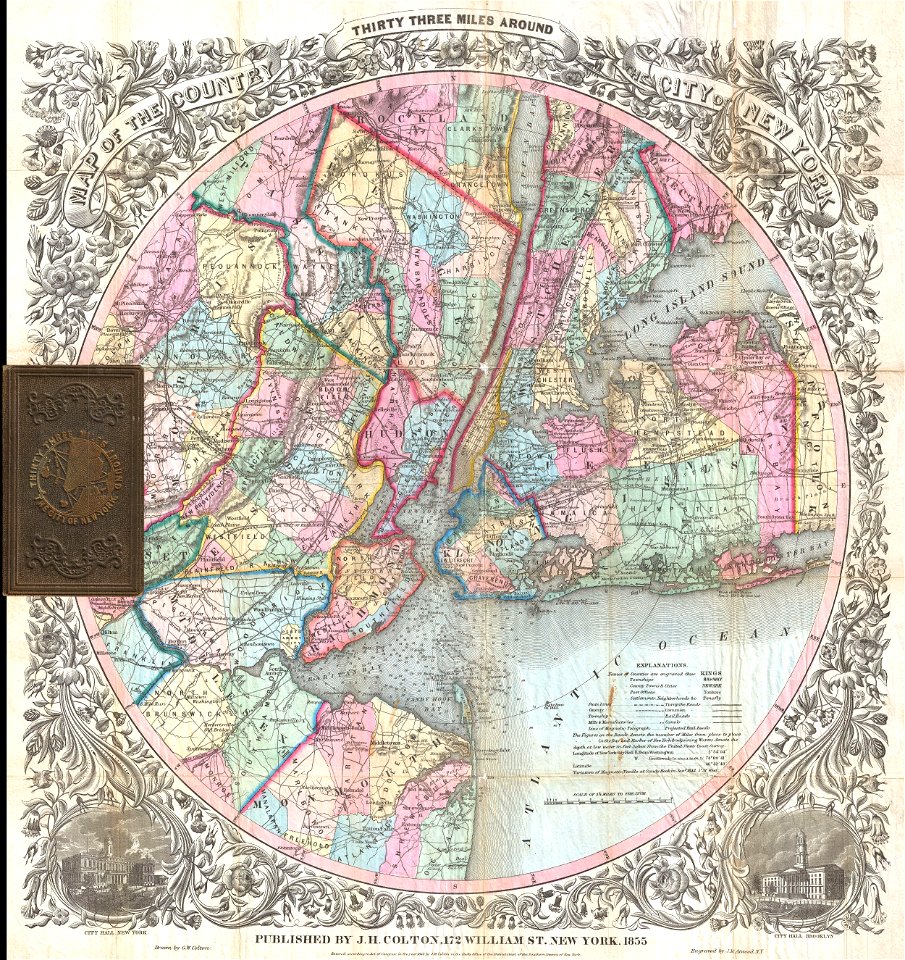
1855 maps
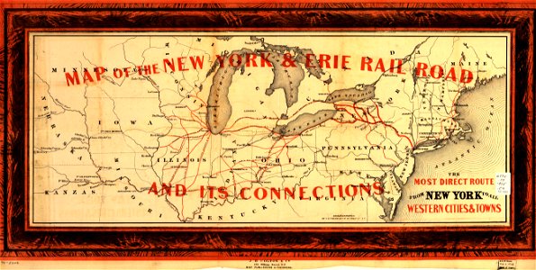
erie county
new york
erie county
new york
new york city
1863 maps
chromolithograph
currier and ives
lower manhattan
new york city
new york city
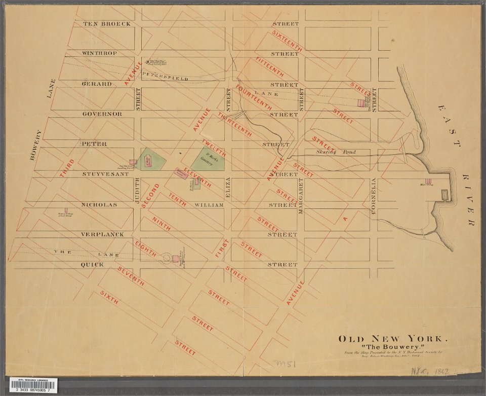
bowery
bird's eye view maps of new york city
1867 maps of new york (state)
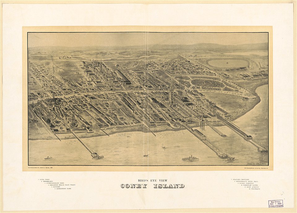
coney island
brooklyn
images from the new york public library
george hayward
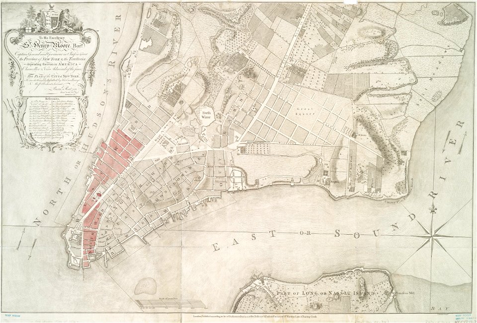
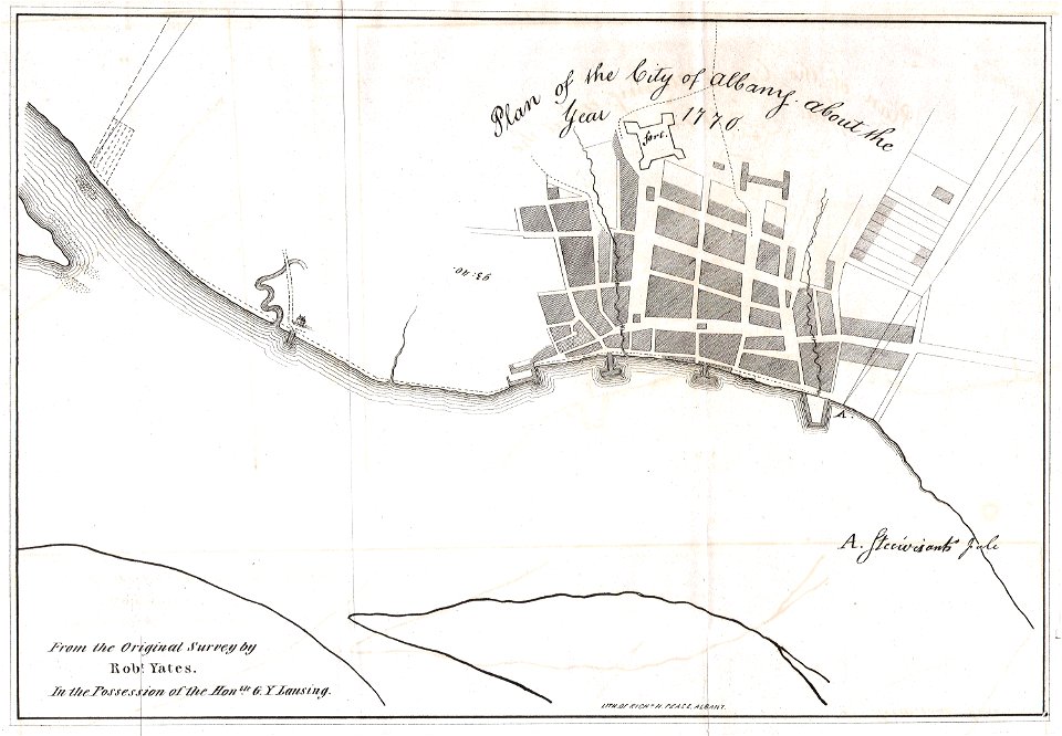
1770 maps
new york
images from the new york public library
new york city
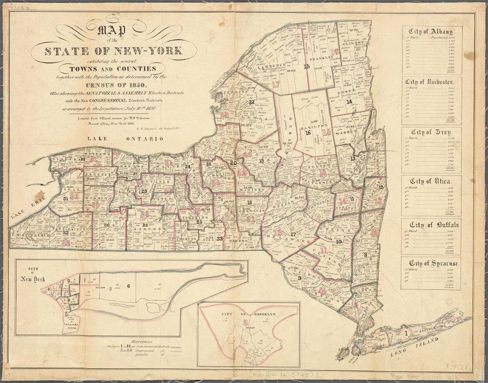
old maps of new york (state)
new york city
manhattan
bronx
manhattan
bronx
images from the new york public library
cartography of new york city
maps by willem and johannes blaeu
hudson valley
bird's eye view maps of new york city
harvard university
map of manhattan
map images supported by wikimedia uk
1856 maps
maps in the library of congress
1855 maps
maps in the library of congress
1855 maps
sherwood studio building
maps of new york city
maps in the library of congress
new york city
maps in the library of congress
new york city
cornell university library
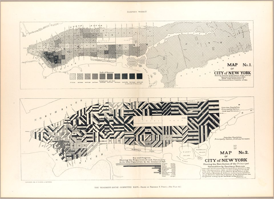
new york city in the 1890s
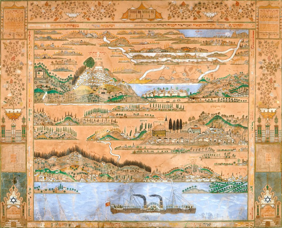
collections of the jewish museum (new york city)
old maps of israel
new york city
bronx
illustration
maps
new york city
bronx
artworks with known accession number
artworks without wikidata item
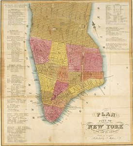
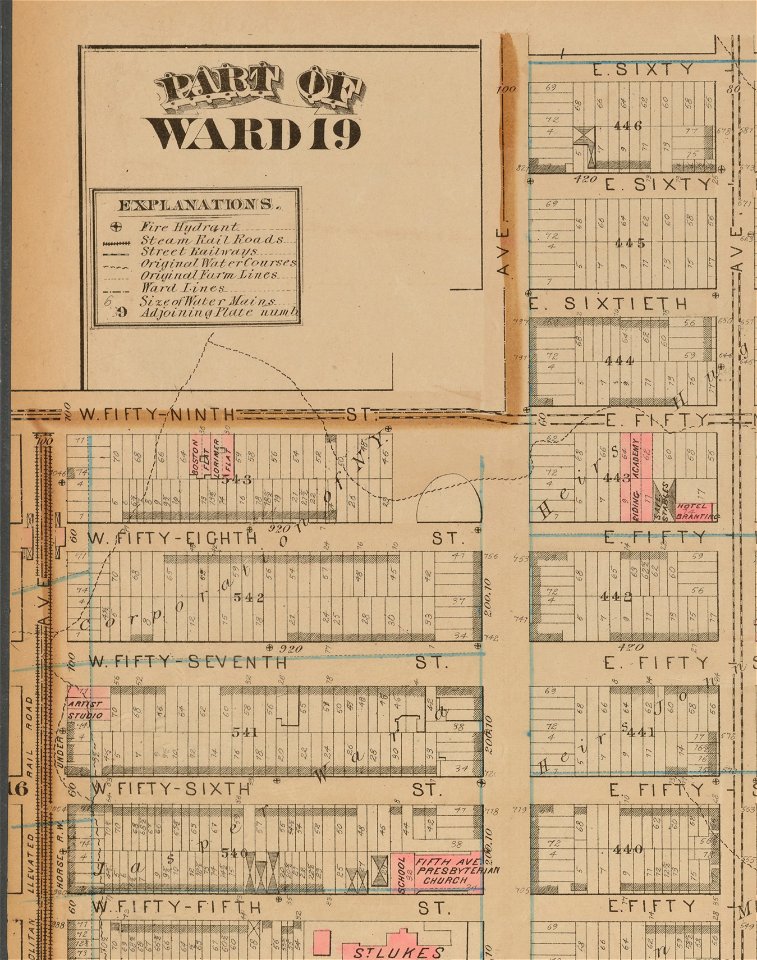
perris maps of manhattan published 1852–1853
old brick church (new york city)
maps in the library of congress
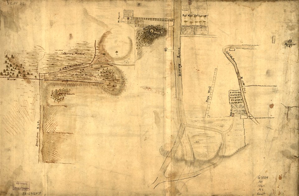
adriaen van der donck
old constellation maps
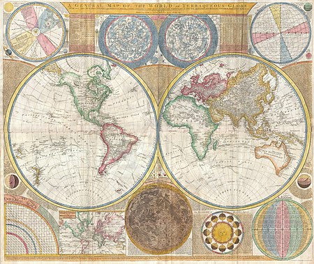
maps by samuel dunn
1673 in new york city
24 august
old maps of manhattan, new york city
1851 maps
empire building (manhattan)
pictorialism
manual of the corporation of the city of new york (1858)
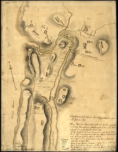
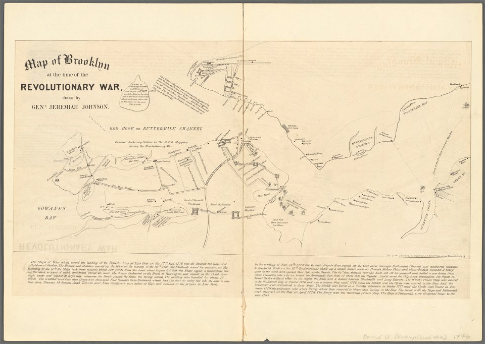
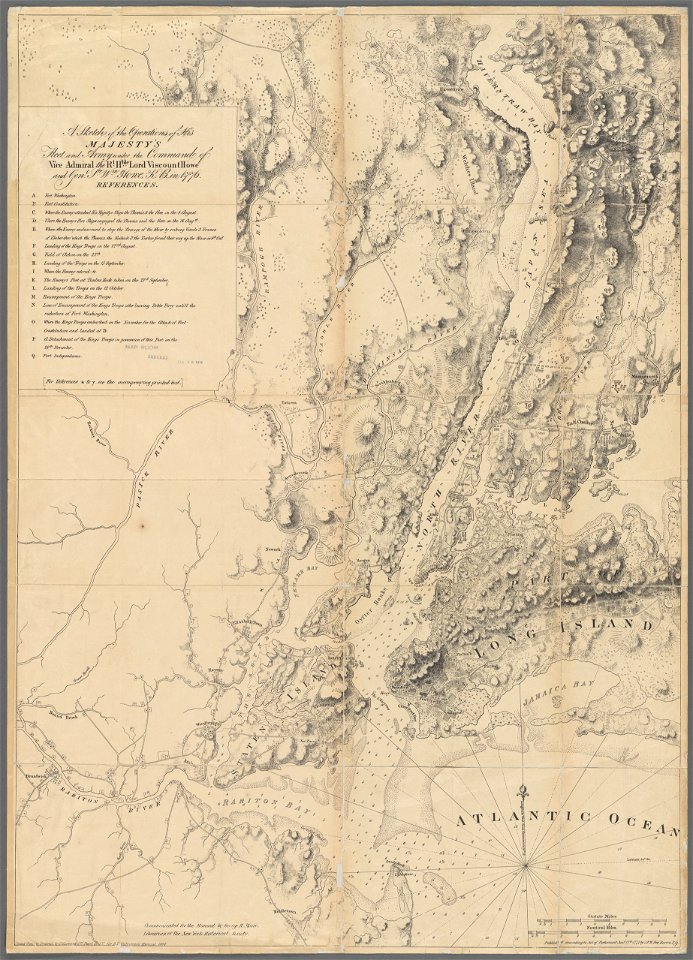
battle of long island
old maps of manhattan, new york city
1851 maps
manual of the corporation of the city of new york (1858)
battle of long island
maps in the library of congress
adriaen van der donck
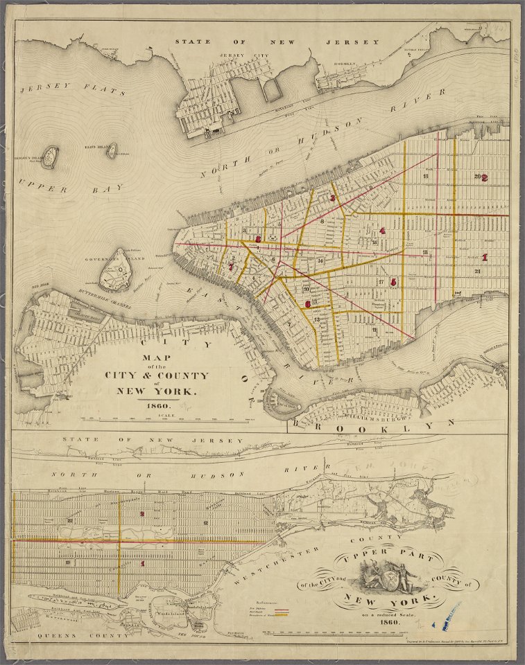
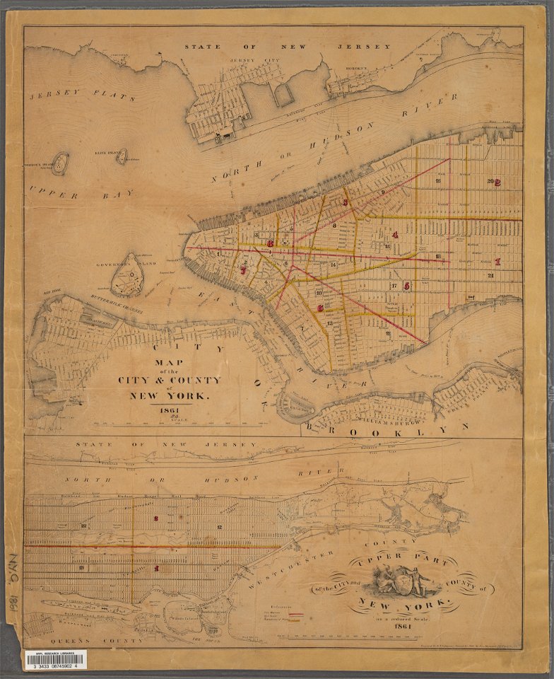
1860s maps of new york (state)
maps showing 1776
st andrew's church (roman catholic, manhattan)
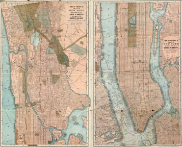
sanborn maps of manhattan published in 1905
manual of the corporation of the city of new york (1858)
maps from valentine's manual
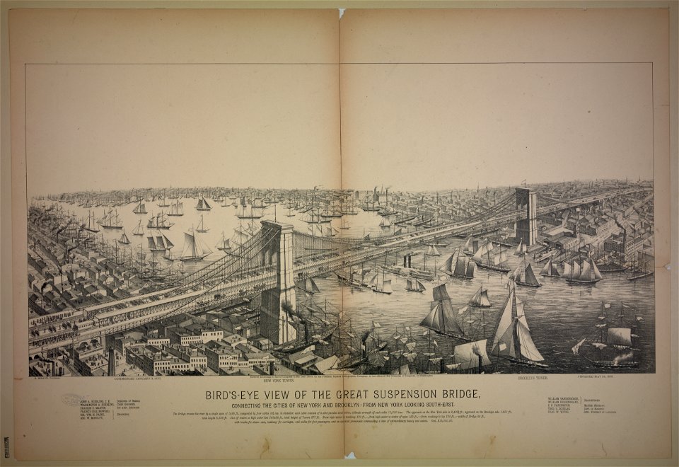
brooklyn bridge – city hall (irt lexington avenue line)
city hall (irt lexington avenue line)
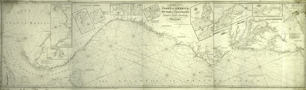
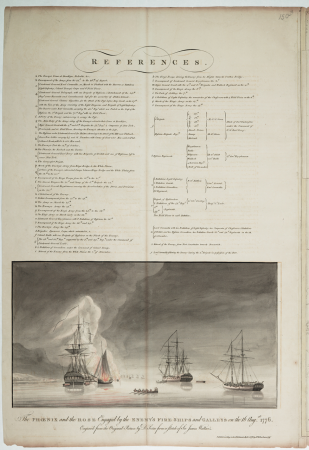
charts and maps of the royal museums greenwich
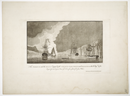
1778 maps of new york (state)
1777 maps of new york (state)
1777 maps of new jersey
manual of the corporation of the city of new york (1860)
maps from valentine's manual
manual of the corporation of the city of new york (1861)
maps from valentine's manual
former new york life insurance company building
sanborn maps of manhattan published in 1905
old maps of new york city
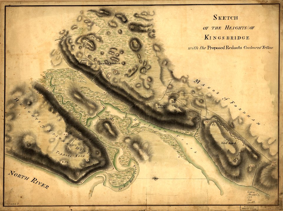
battle of fort washington
perris maps of manhattan published 1852–1853
neoclassicism
manual of the corporation of the city of new york (1853)
maps from valentine's manual
manual of the corporation of the city of new york (1852)
george hayward
manual of the corporation of the city of new york (1853)
maps from valentine's manual
manual of the corporation of the city of new york (1852)
george hayward
manual of the corporation of the city of new york (1856)
george hayward
manual of the corporation of the city of new york (1864)
maps showing 1776
maps of the new york and new jersey campaign
maps showing 1776
old maps of manhattan, new york city
jasper danckaerts
perris maps of manhattan published 1852–1853
neoclassicism
charts and maps of the royal museums greenwich
1777 maps of new york (state)
sanborn maps of manhattan published in 1905
irt sixth avenue line stations
old maps of manhattan, new york city
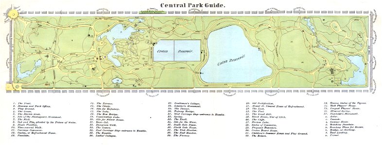
croton aqueduct
new york state supreme court 60 centre street
bromley maps of manhattan published 1955–56
colonial history of the united states
old maps of new york (state)
maps from valentine's manual
george hayward
dripps maps of manhattan published in 1867
neoclassicism
manual of the corporation of the city of new york (1851)
maps from valentine's manual
manual of the corporation of the city of new york (1862)
maps from valentine's manual
sanborn maps of manhattan published in 1904
old maps of west houston street (manhattan)
1823 maps of new york city
circular maps
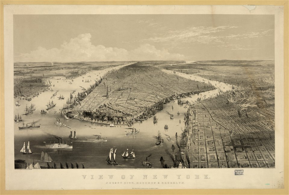
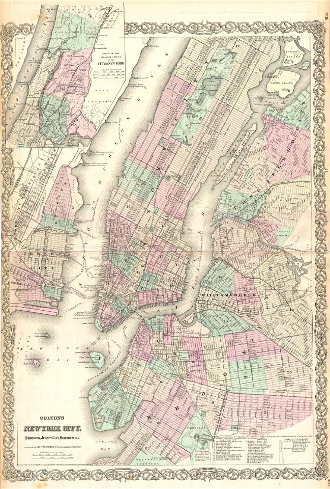
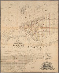
new york and brooklyn, with jersey city and hoboken water front
maps in the library of congress
bromley maps of manhattan published 1955–56
court square building
1 - 100 of 157
Next page
/ 2