Log in
All resources
Create a design
609 Free Artworks of England Map
university of toronto wenceslas hollar digital collection
county maps of england by wenzel hollar
hundred (county division)
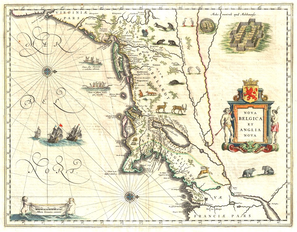
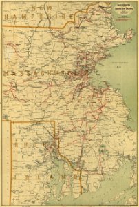
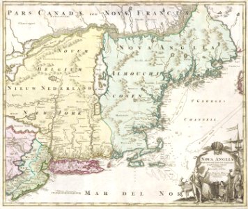
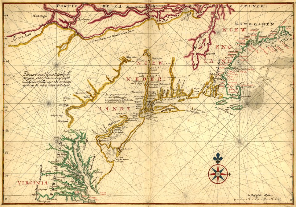
maps of new england
maps in the library of congress
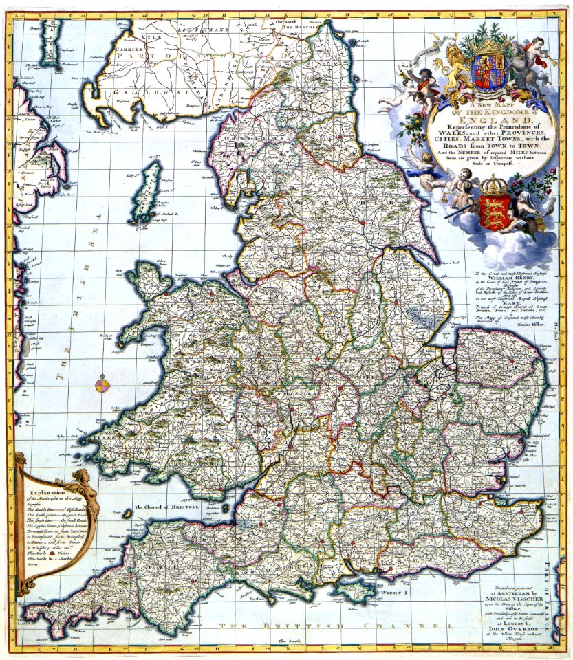
maps by nicolaes visscher i
nicolaes visscher
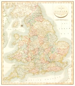
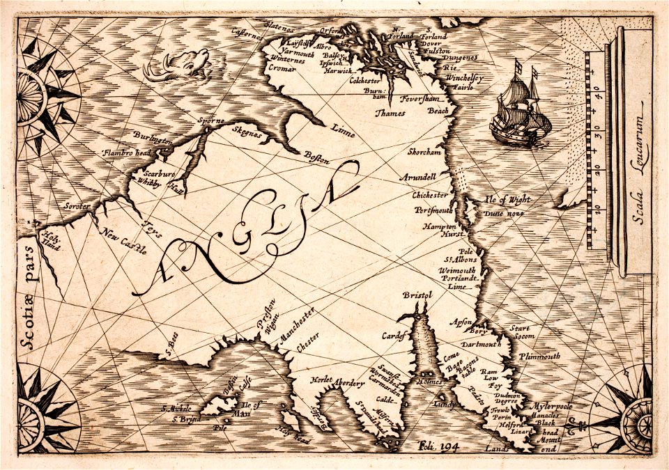
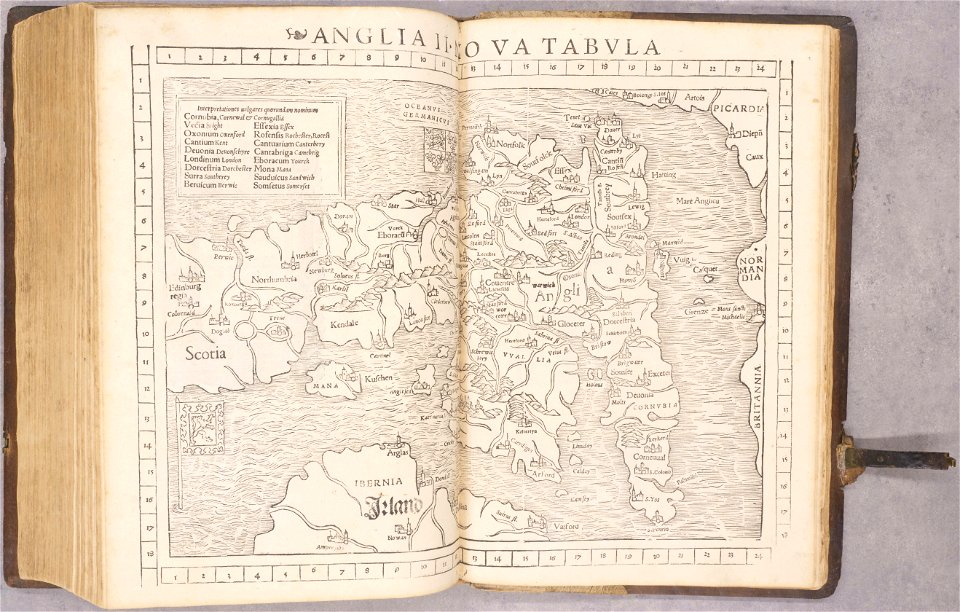
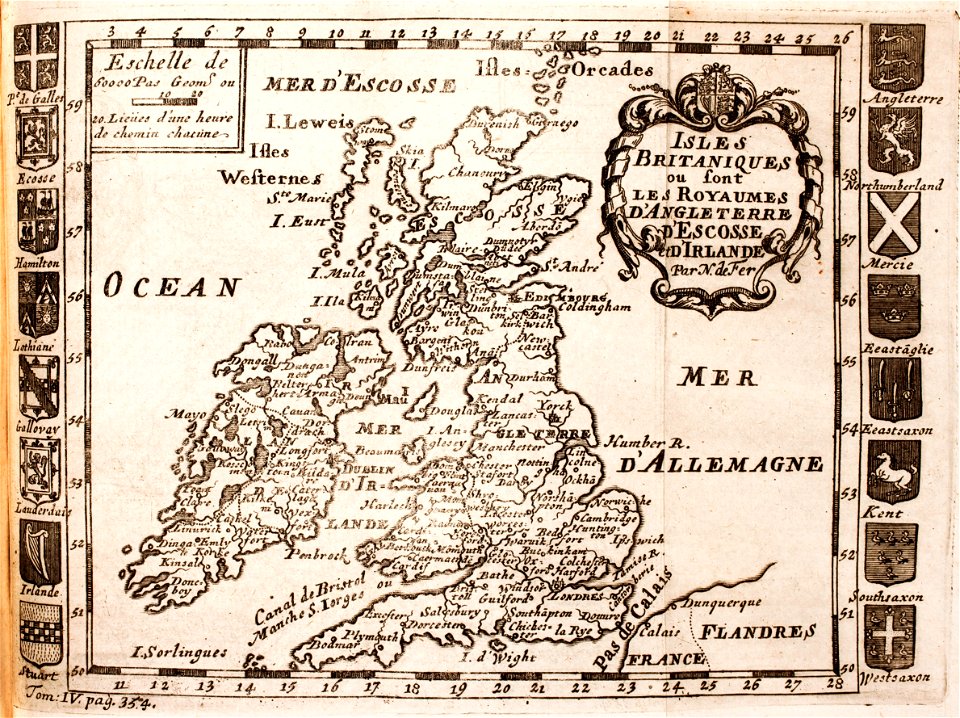
old maps of england
old maps of new york (state)
new amsterdam
the generall historie of virginia (john smith)
17th-century maps of bermuda
elizabeth i of england by marcus gheeraerts the younger
elizabeth i of england (the ditchley portrait)
maps by nicolaes visscher i
atlas van der hagen
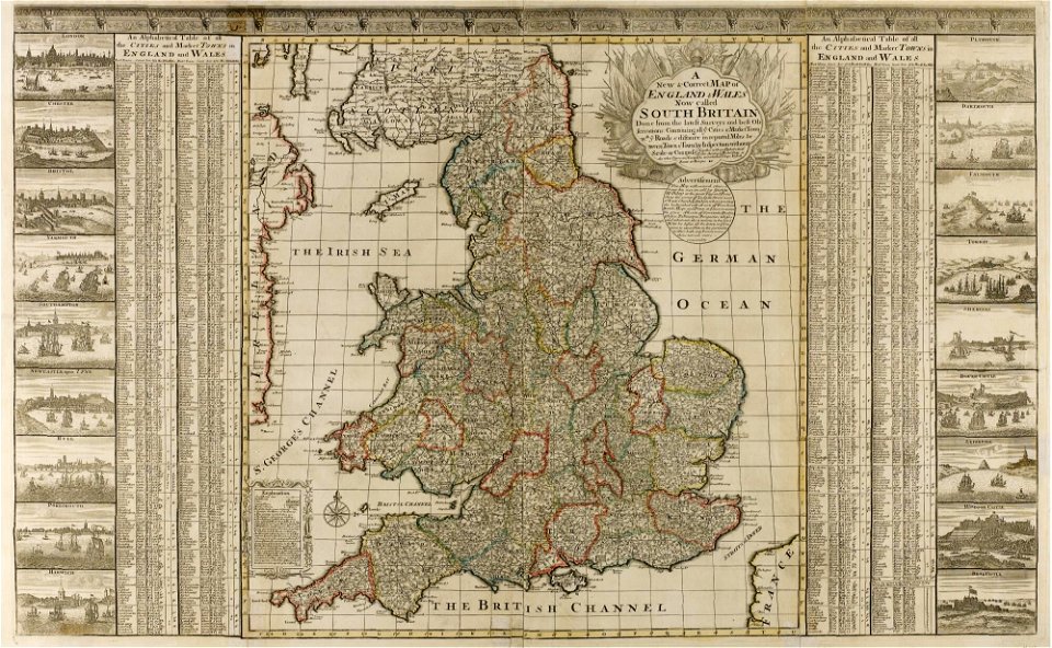
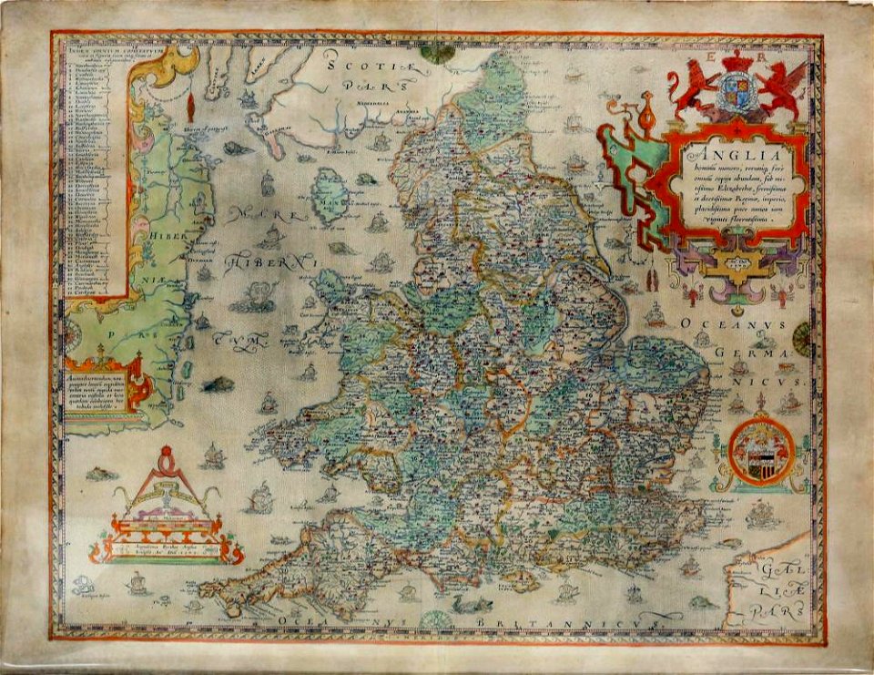
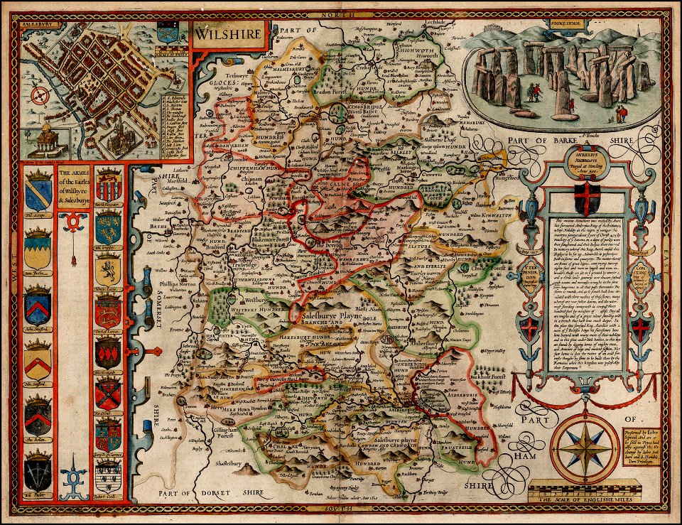
county maps of england by john speed
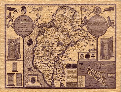
old county maps of cumberland
vintage
maps
maps of new england
1857 maps
old maps of england
old maps of wales
maps
sea
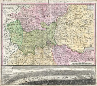
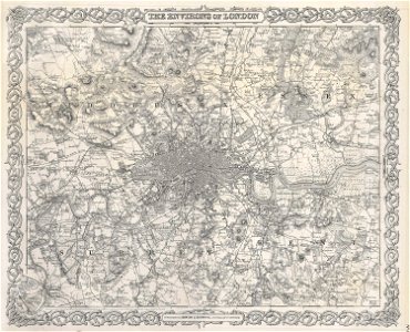
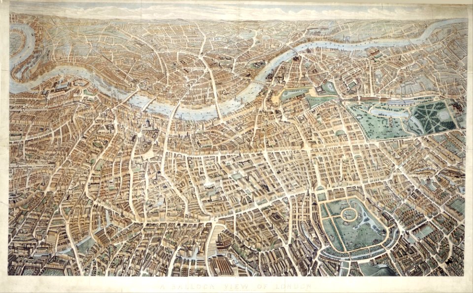
18th-century maps of london
johann baptist homann
old maps of new york (state)
new york city
county maps of england by john speed
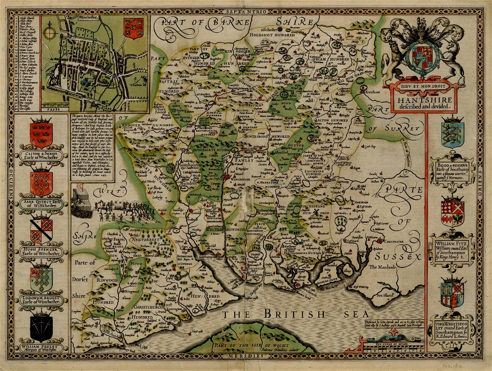
old county maps of hampshire
lincolnshire
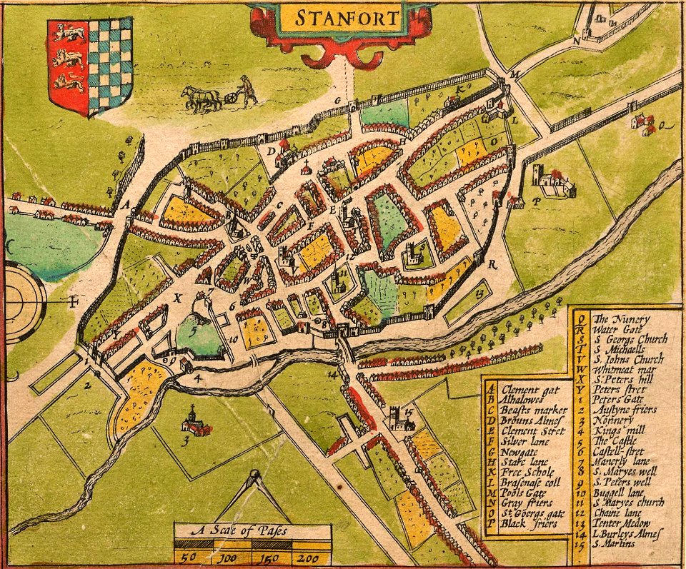
stamford
university of toronto wenceslas hollar digital collection
hollar maps and plans of london
maps in the library of congress
old maps of new england
19th-century maps of london
1855 maps
old maps of england
old maps of wales
county maps of england by john speed
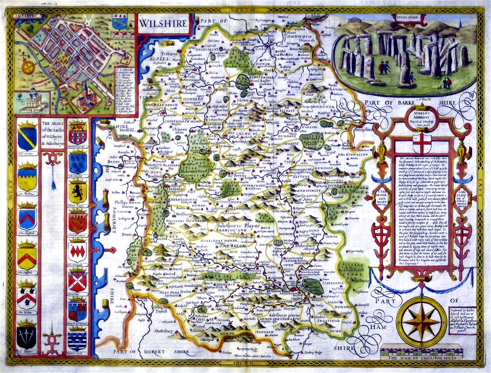
history of wiltshire
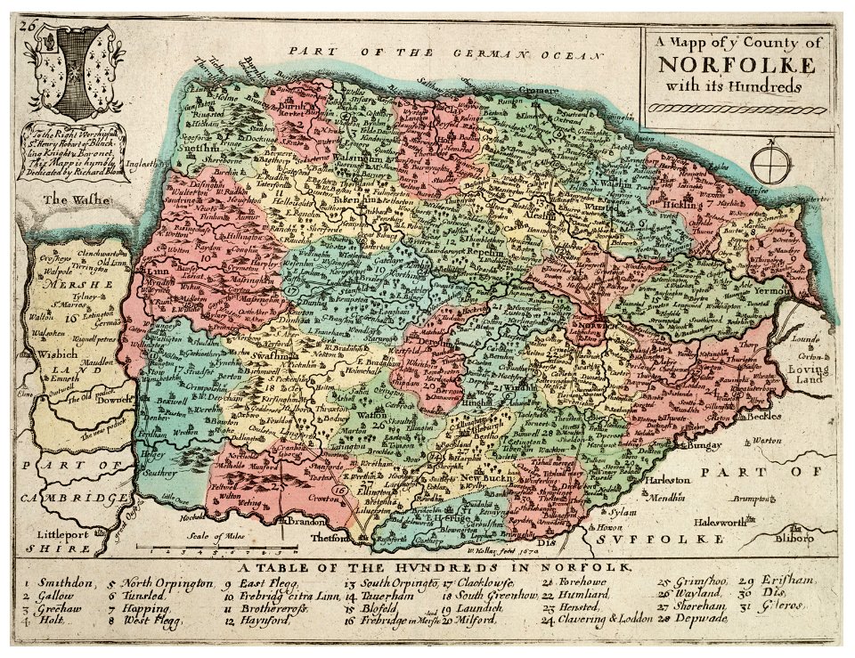
history of norfolk
england
19th-century maps of london
1855 maps
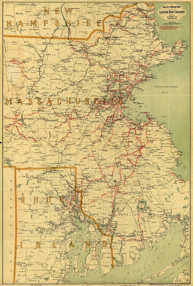
maps by george h. walker and company
maps in the library of congress
maps by george h. walker and company
maps in the library of congress
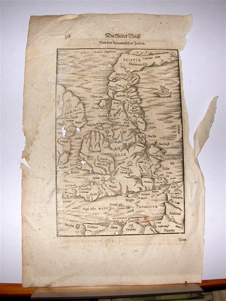
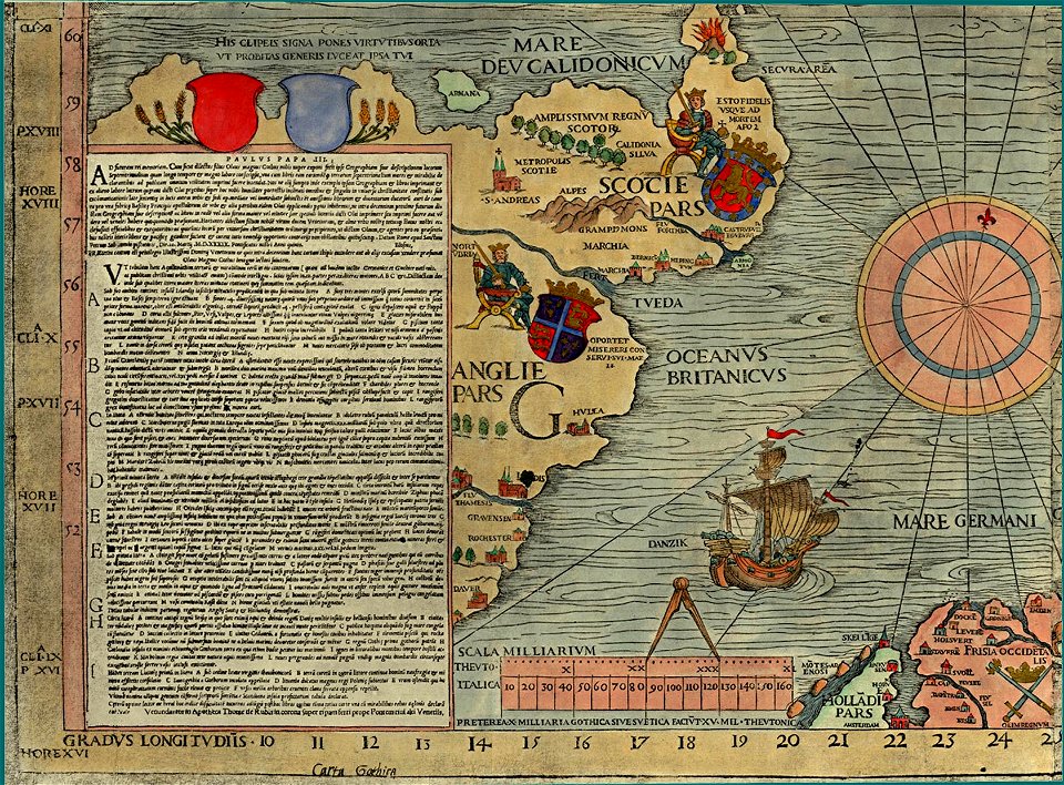
cosmographia (1628) by sebastian münster
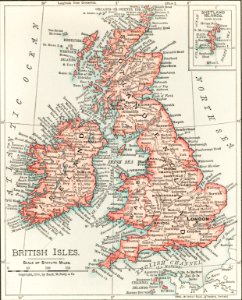
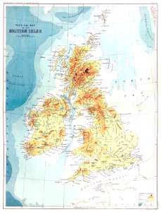
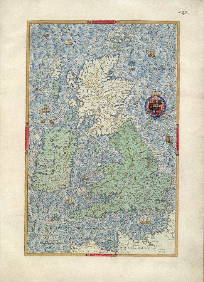
old maps of the british isles
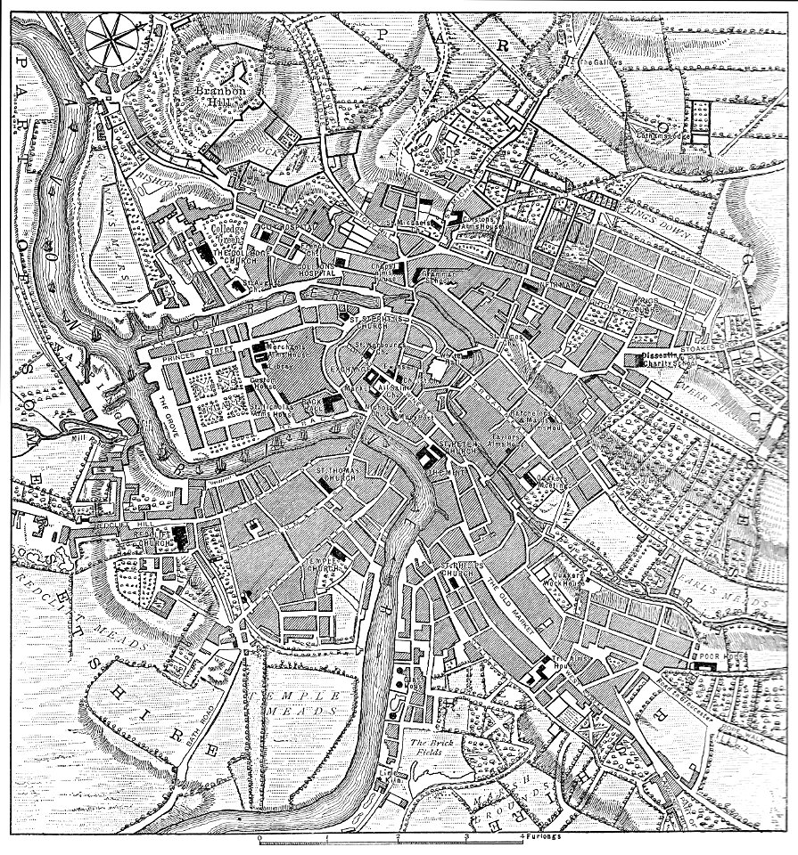
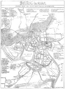
images from bristol past and present (1882)
old maps of bristol
county maps of england by john speed
nonsuch palace
county maps of england by john speed
john speed
maps of the west-indische compagnie
1780
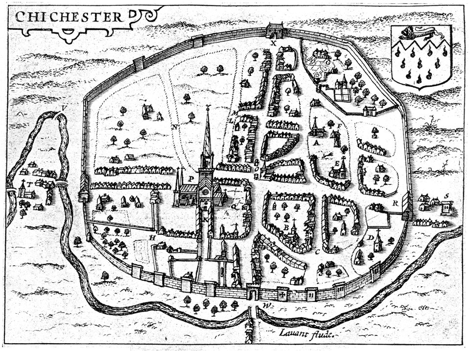
west sussex
chichester
old maps of the united states
johann baptist homann
england
maps
english society
somerset
military bases of the united states
old maps of the history of normandy
old maps of the british isles
old maps of europe
old maps of the british isles
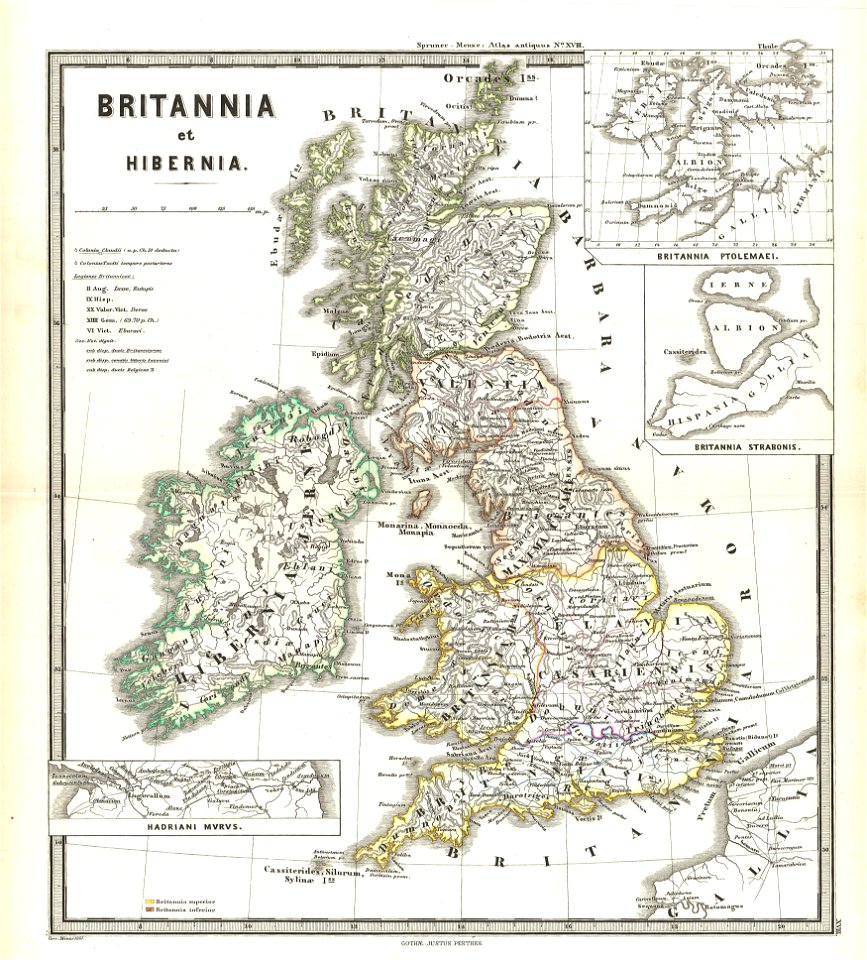
karl spruner von merz
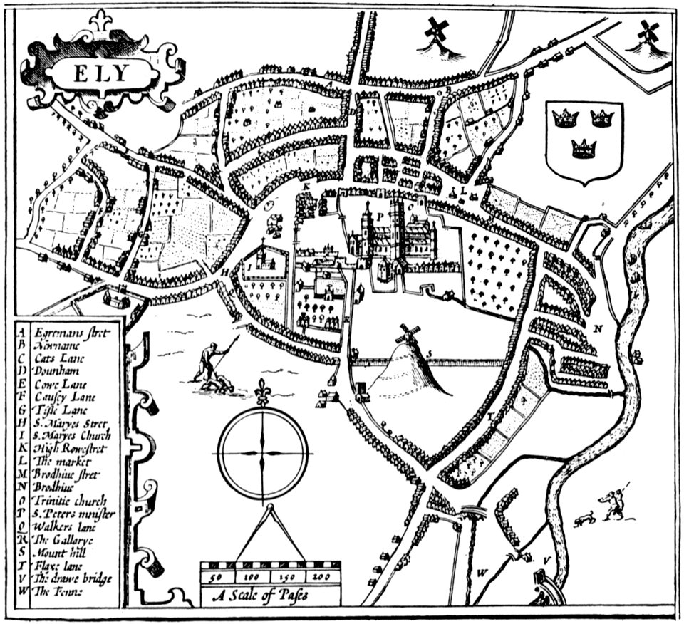
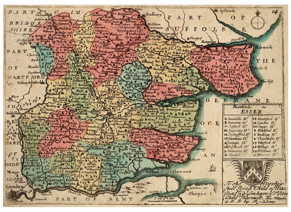
cambridgeshire
ely
maps of reading abbey
reading
johann baptist homann
latin-language maps
prints from selden mare clausum at the peace palace library
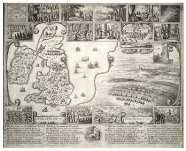
1636 maps of england
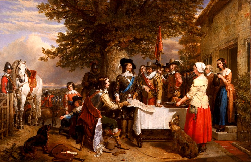
charles landseer
fairy painting
university of toronto wenceslas hollar digital collection
hollar maps and plans of london
university of toronto wenceslas hollar digital collection
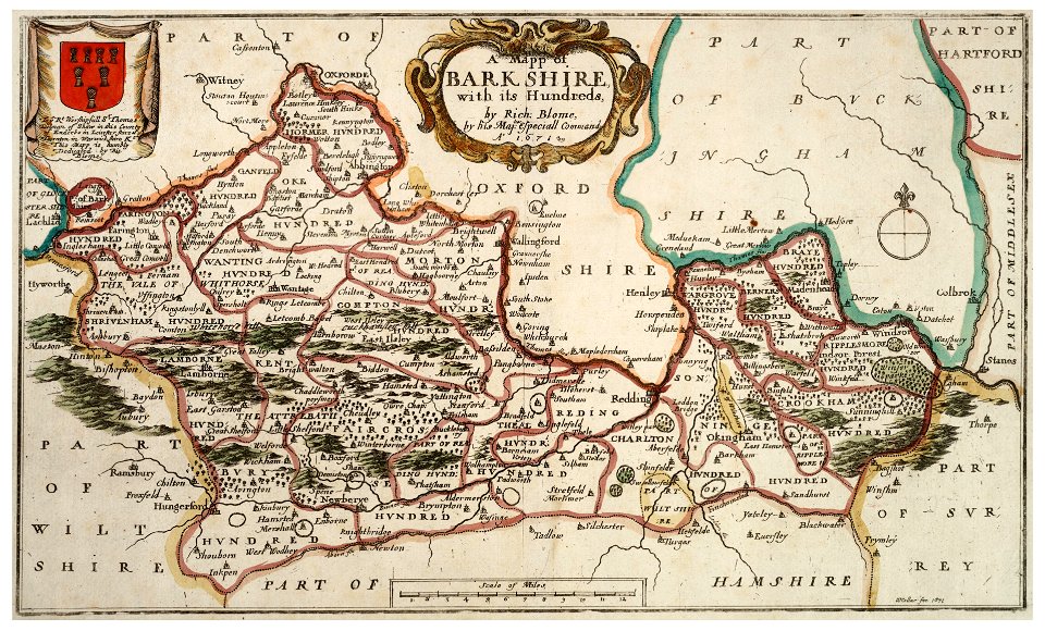
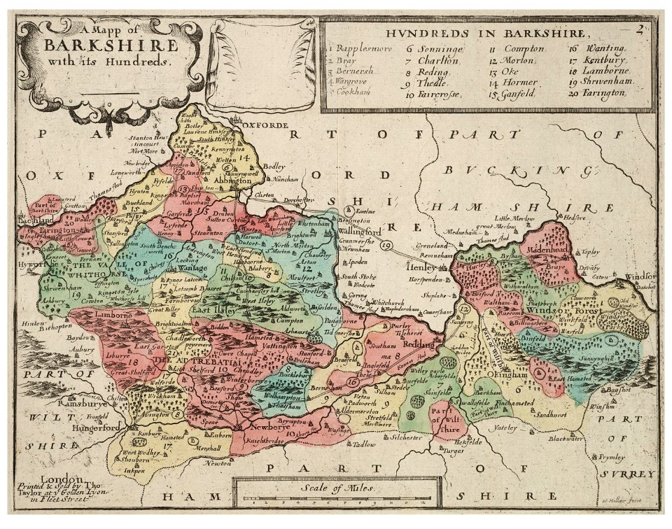
old county maps of berkshire
old map
pirate
old maps of london
pictorial maps
broad street
reading
old map
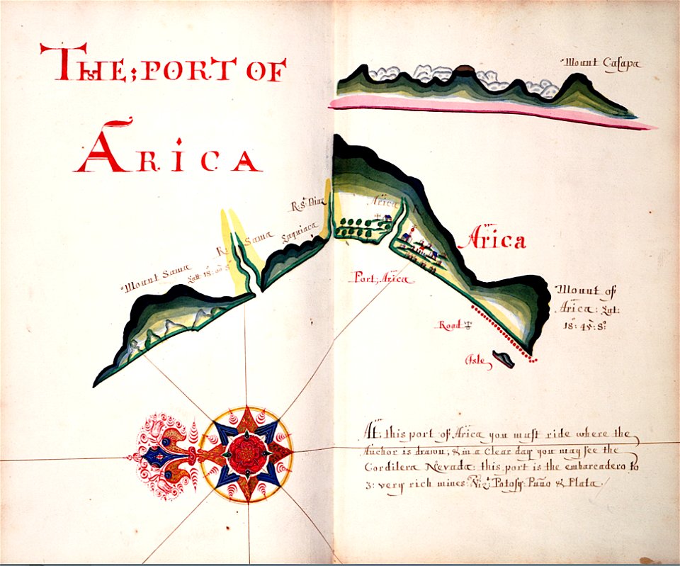
surat
carta marina (details)
university of toronto wenceslas hollar digital collection
old county maps of berkshire
university of toronto wenceslas hollar digital collection
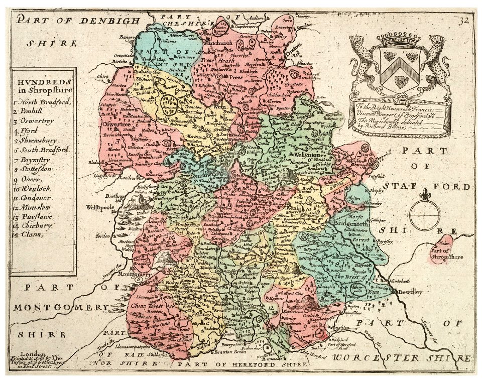
old county maps of shropshire
maps in the library of congress
old maps of new england
maps in the library of congress
old maps of new england
images from bristol past and present (1882)
old maps of bristol
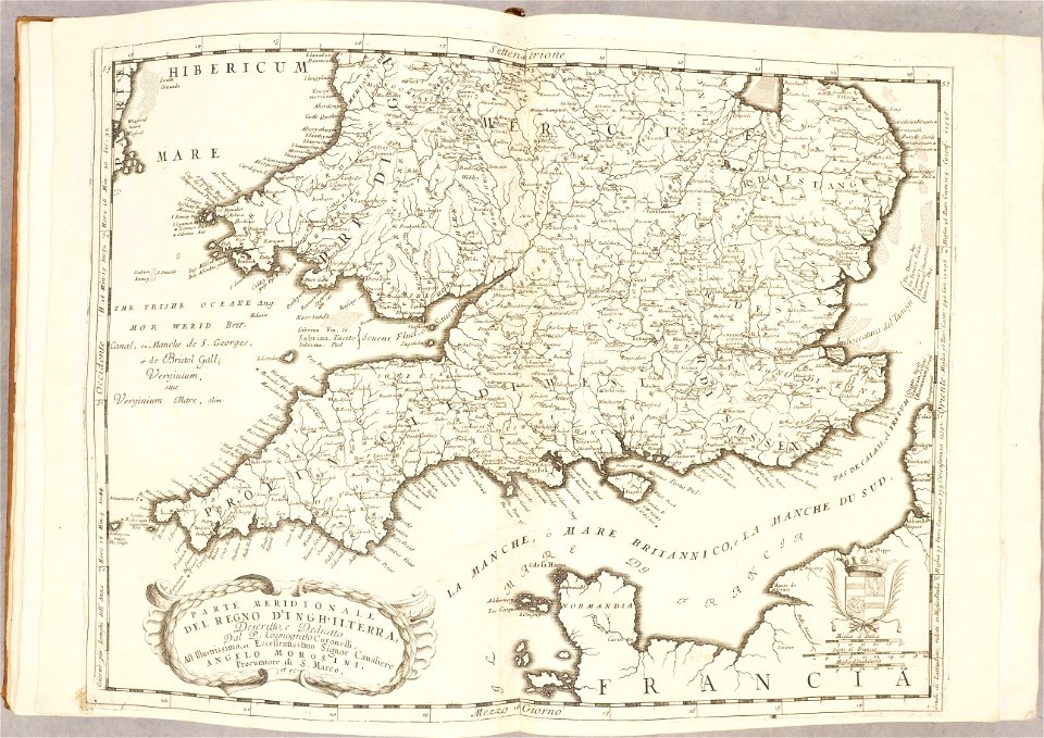
atlante veneto (raremaps.com) volume 2
old maps of england
atlante veneto (raremaps.com) volume 2
old maps of england
university of toronto wenceslas hollar digital collection
old county maps of sussex
university of toronto wenceslas hollar digital collection
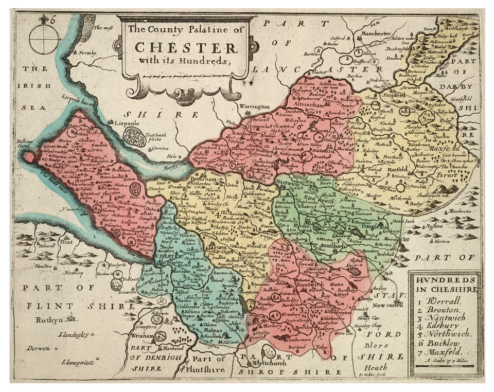
old county maps of cheshire
university of toronto wenceslas hollar digital collection
history of watford
old maps of europe
printing
university of toronto wenceslas hollar digital collection
old maps of the british isles
old maps of the saint lawrence river
old maps of new england
university of toronto wenceslas hollar digital collection
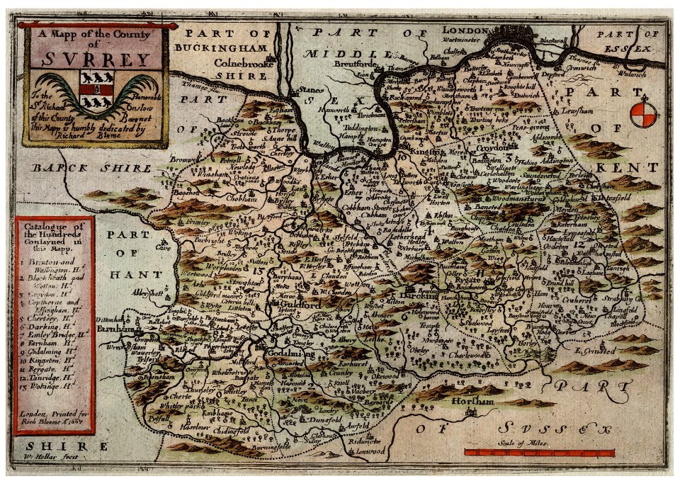
surrey
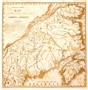
1780 maps of pennsylvania
1780 maps of new jersey
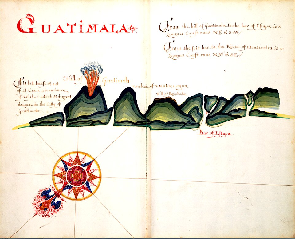
volcanoes in guatemala
old maps of guatemala
old maps of england
1552
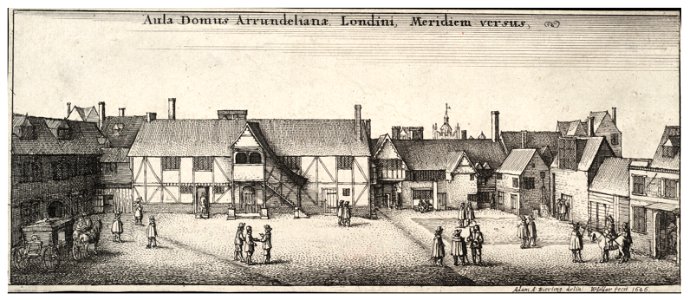
university of toronto wenceslas hollar digital collection
staffordshire
prints from bonne atlas de toutes les parties at the peace palace library
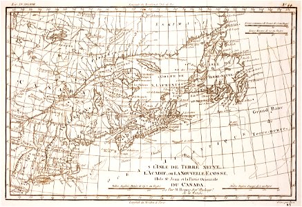
1780 maps of canada
cornell university library
1888 maps
prints from the peace palace library
1652
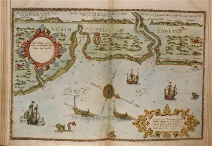
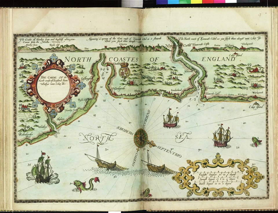
charts and maps of the royal museums greenwich
lucas janszoon waghenaer
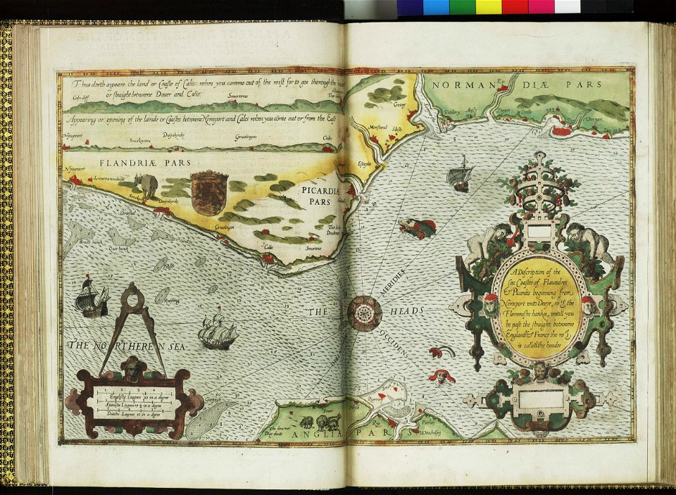
charts and maps of the royal museums greenwich
lucas janszoon waghenaer
university of toronto wenceslas hollar digital collection
hundred (county division)
images from bristol past and present (1882)
clifton (bristol ward)
history of spalding
river welland
images from bristol past and present (1882)
old maps of bristol
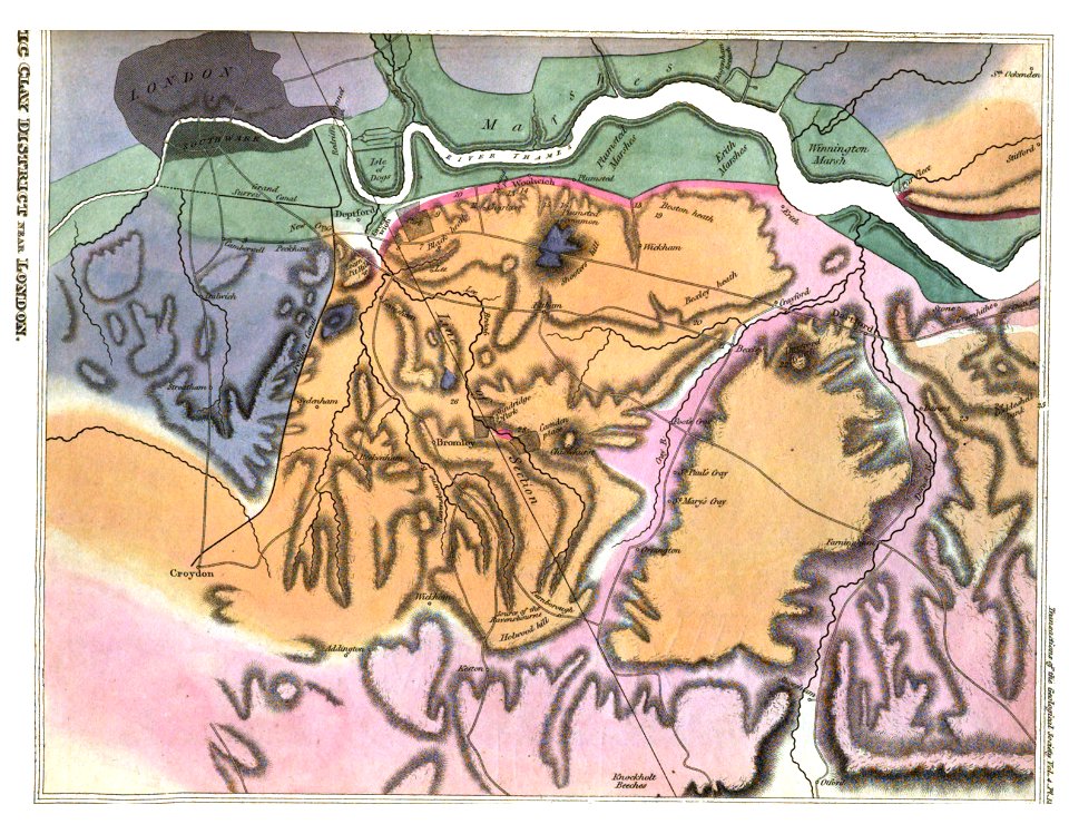
transactions of the geological society of london
vol. 4
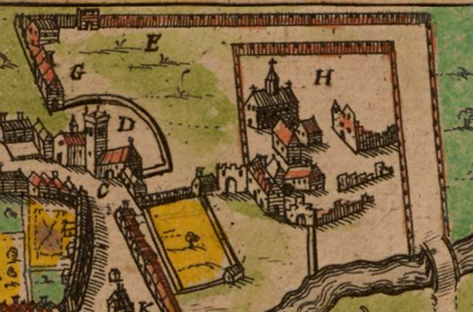
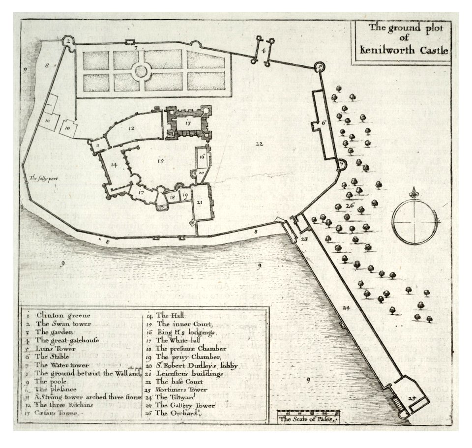
kenilworth castle in art
kenilworth castle
charts and maps of the royal museums greenwich
lucas janszoon waghenaer
maps by willem and johannes blaeu
hudson valley
english-language title pages
title pages of maps
prints by wenzel hollar
stranded
bibliothèque nationale de france français illuminated manuscripts
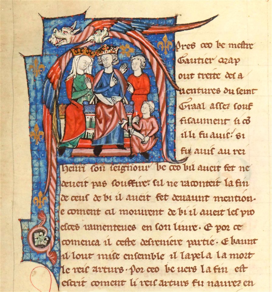
henry ii of england in miniatures
torquato tasso in art
italian-language maps
university of toronto wenceslas hollar digital collection
prints by wenzel hollar
netherlands
the hague
charts and maps of the royal museums greenwich
lucas janszoon waghenaer
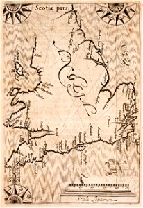
coats of arms of scotland
hatched coats of arms
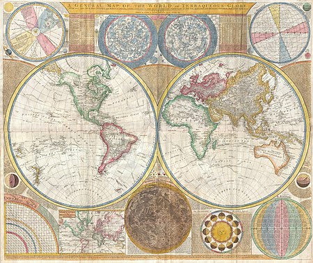
old constellation maps
maps by samuel dunn
maps in the library of congress
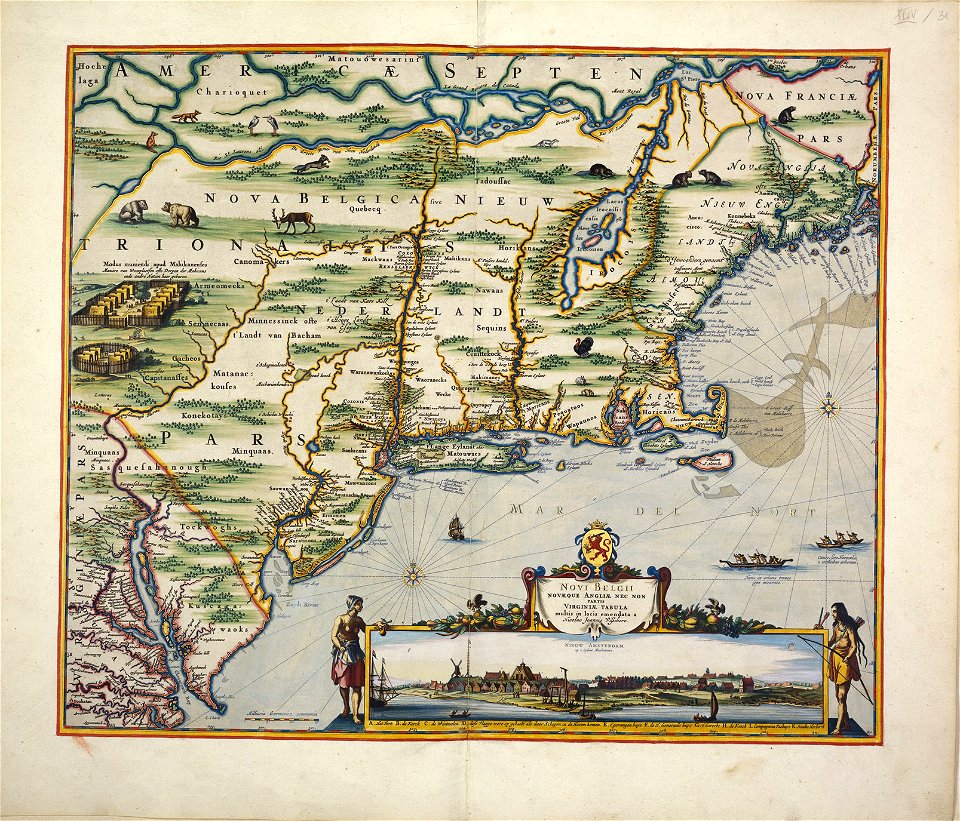
adriaen van der donck
beautification
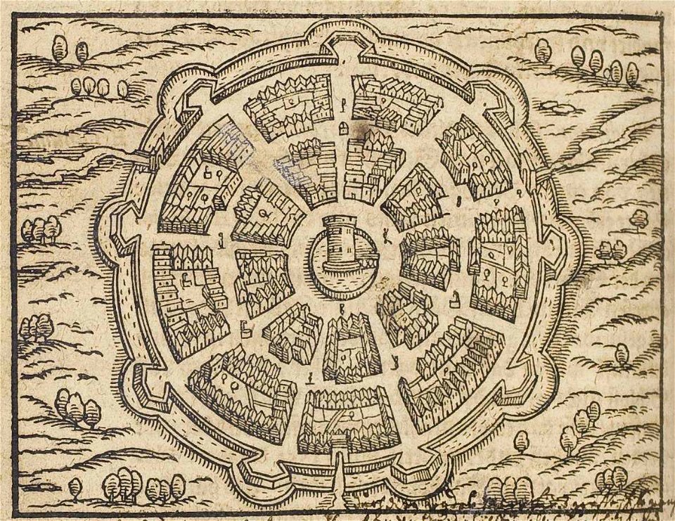
palmanova
maps made in the 17th century
adriaen van der donck
maps in the library of congress
adriaen van der donck
maps in the british museum
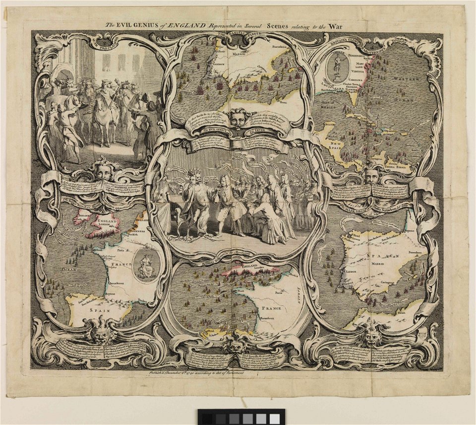
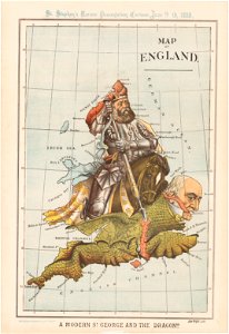
satirical maps
old maps of the united states
copper engravings
lawrence h. slaughter collection of english maps, charts, globes, books and atlases
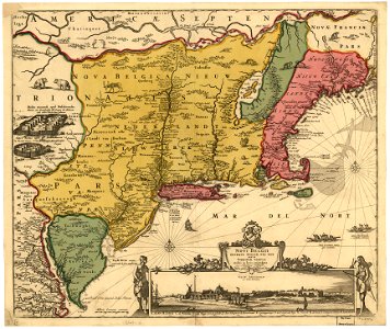
maps of nieuw nederland
maps of the west-indische compagnie
1800 maps of the united states
maps of cambridge by braun & hogenberg
maps of trinity college, cambridge
the generall historie of virginia (john smith)
1624 books from london
maps of dioceses of the church of england
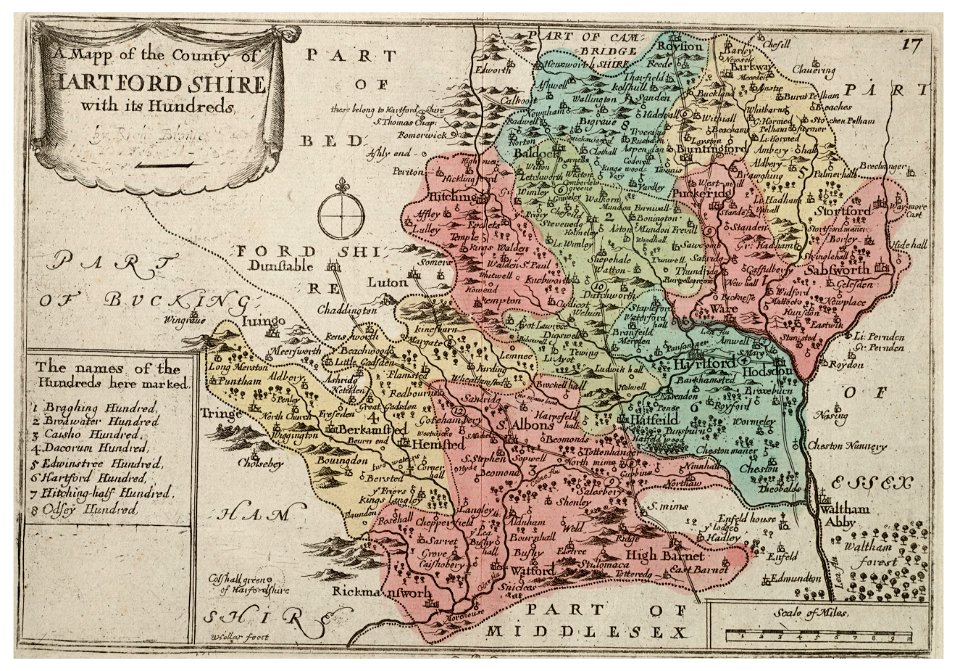
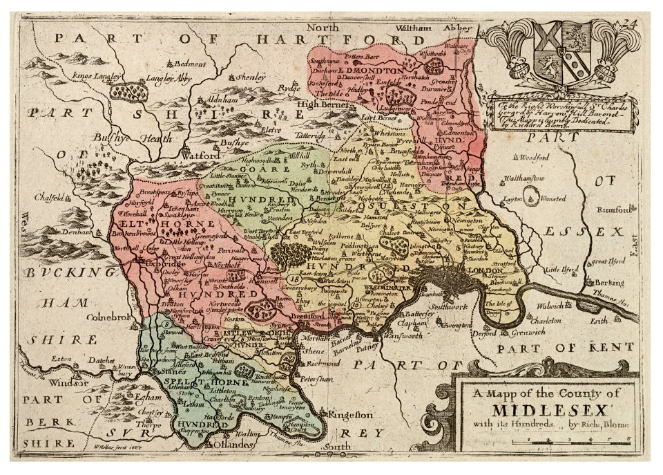
18th-century maps of hertfordshire
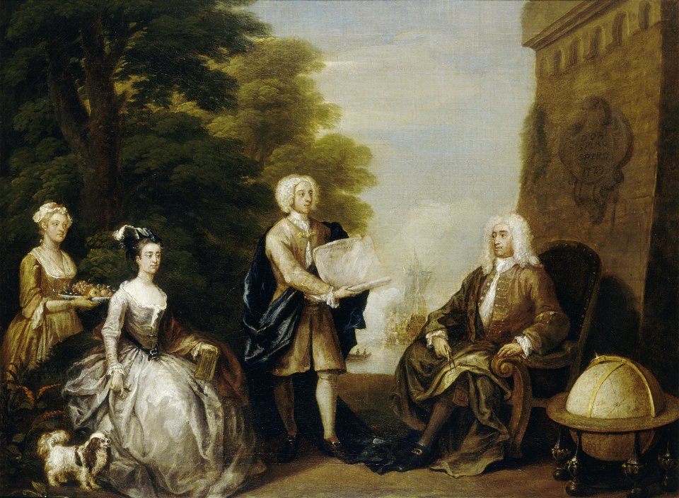
oil paintings of the royal museums greenwich
realism
cornell: persuasive cartography: the pj mode collection
1790s maps of england
maps in the library of congress
adriaen van der donck
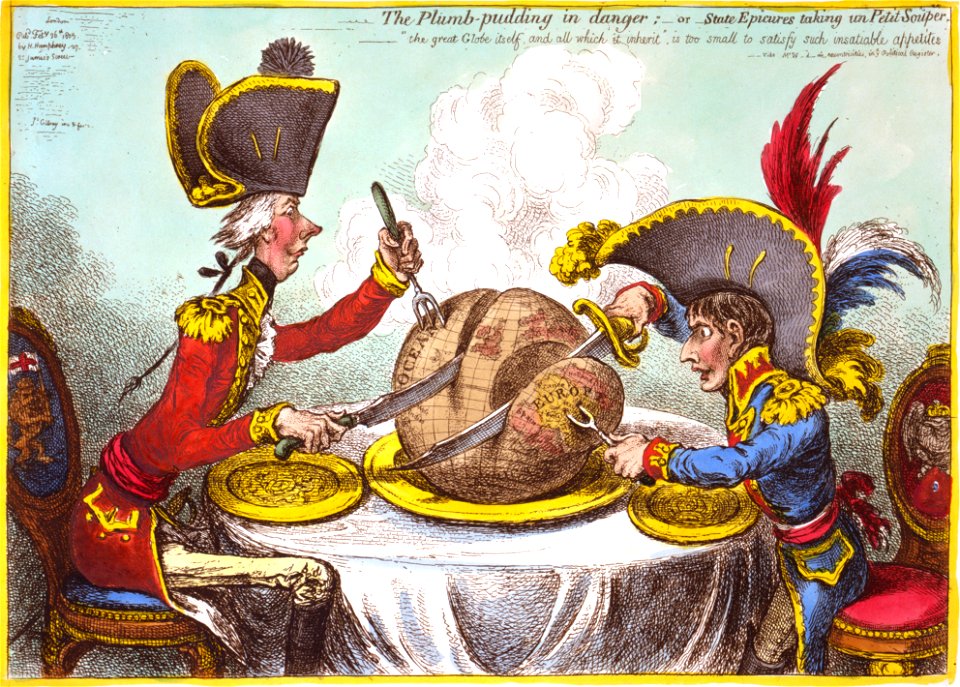
the plumb-pudding in danger (cartoon)
1805-02-26
1 - 100 of 609
Next page
/ 7