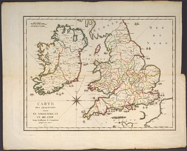
Invasions of England and Ireland - From William the Conqueror Onward, Pierre François Tardieu, 1798
This map shows attempted invasions of england and ireland from 1066 to 1797. Date: 1798. Dimensions: (cm, H x W) 42 x 56. Collection: Cornell University Library. Tardieu, Invasions of England and Ireland, 1798, Cornell CUL PJM 1028 01