Log in
All resources
Create a design
257 Free Artworks of 19th Century Maps Of London
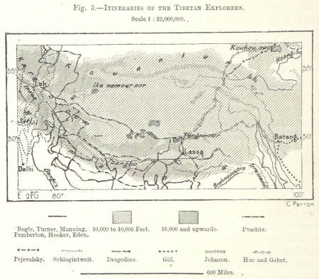
maps from the earth and its inhabitants, vol. iv
voyage dans la russie méridionale et la crimée (1840-1842) par anatolii nikolaevich demidov
archibald fullarton
old maps of viceroyalty of the caucasus
1870s maps of the caucasus
19th-century maps of the black sea
john cary
1890s maps showing history
maps from the earth and its inhabitants, vol. viii
1872 maps of georgia
maps from the earth and its inhabitants, vol. vi
charles eugène perron
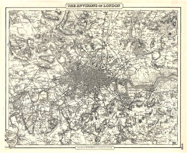
19th-century maps of london
1855 maps
19th-century maps of london
1855 maps
19th-century maps of london
1840 books
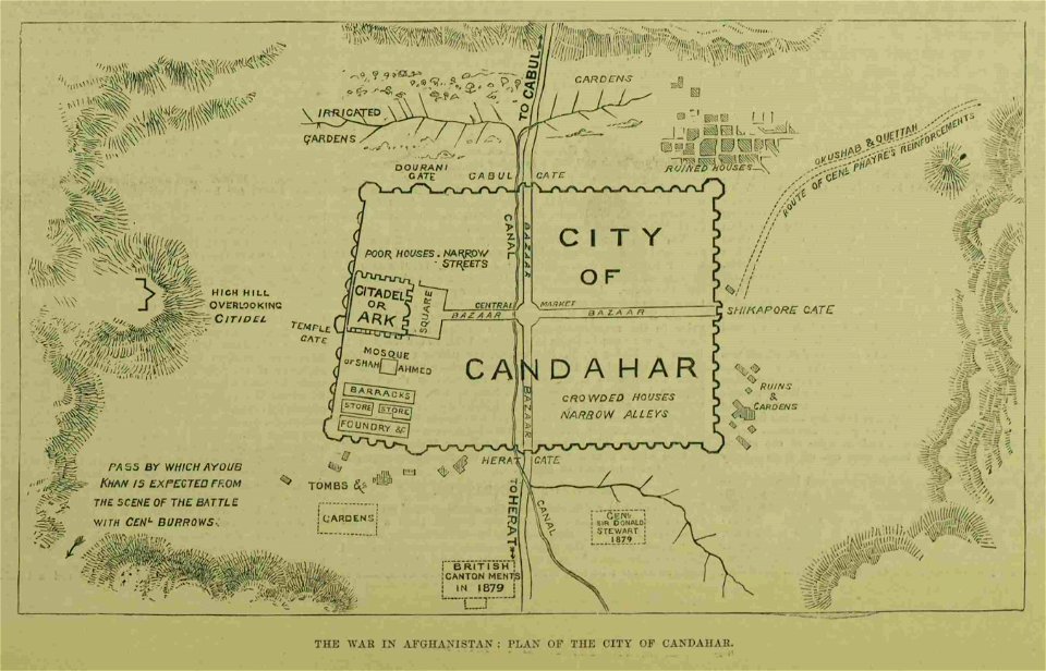
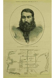
kandahar in the 19th century
battle of kandahar
the illustrated london news 1860
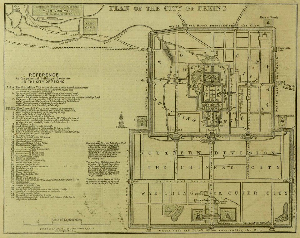
19th-century maps of china
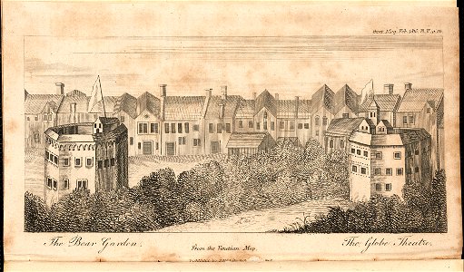
globe theatre
southwark
kandahar in the 19th century
thomas dewell scott
morro castle (havana)
london
london
1841
portraits with cigarette or cigar
london
portraits with cigarette or cigar
london
nathaniel whittock
skylines of london
domenico pellegrini
london
1882 in london
port of london
maps from the earth and its inhabitants, vol. vii
évariste régis huc
maps from the earth and its inhabitants, vol. xvi
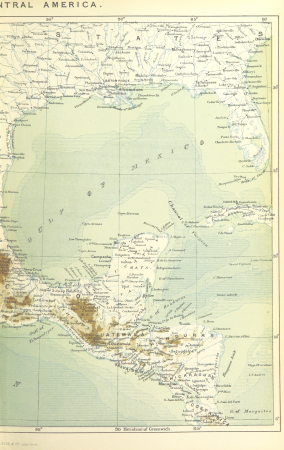
1870s maps of mexico
maps from the earth and its inhabitants, vol. viii
maps of turkestan
maps from the earth and its inhabitants, vol. viii
maps of turkestan
19th-century maps of the black sea
1870s maps of the caucasus
maps from the earth and its inhabitants, vol. x
19th-century maps of the sinai peninsula
19th-century maps of the black sea
g. h. swanston
19th-century maps of oxfordshire
bodleian maps collection
19th-century maps of the black sea
1870s maps of the caucasus
19th-century maps of the black sea
g. h. swanston
19th-century maps of the black sea
1870s maps of the caucasus
19th-century maps of the black sea
1870s maps of the caucasus
maps from the earth and its inhabitants, vol. xi
19th-century maps of chad
maps from the earth and its inhabitants, vol. ix
ethnographic maps of asia
19th-century maps of crimea
g. h. swanston
maps from the earth and its inhabitants, vol. xv
19th-century maps of british columbia
maps from the earth and its inhabitants, vol. xv
19th-century maps of british columbia
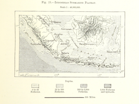
19th-century maps of the malay archipelago
the cruise of the marchesa (1889)
maps from the earth and its inhabitants, vol. ix
maps of south india
1849 maps of north america
old maps of canada
19th-century maps of the black sea
1870s maps of the caucasus
maps from the earth and its inhabitants, vol. iv
maps of river trent
19th-century maps of europe
maps by john cary
19th-century maps of europe
maps by john cary
maps by john cary
1836 maps
maps from the earth and its inhabitants, vol. iv
old maps of the lake district
maps from the earth and its inhabitants, vol. xii
19th-century maps of senegal
maps from the earth and its inhabitants, vol. iv
old maps of the lake district
a school geography (1898) by bird
old maps of the yellow sea
the comprehensive history of england (1876)
english-language maps showing history
1870s maps of the caucasus
g. h. swanston
19th-century maps of cornwall
19th-century maps of devon
maps from the earth and its inhabitants, vol. xi
old maps of the sahara
picturesque burma, past and present (1897)
1890s maps showing history
old maps of the strait of gibraltar
a school geography (1898) by bird
maps from the earth and its inhabitants, vol. iv
chorley, england
maps from the earth and its inhabitants, vol. xiv
maps of the sunda strait
19th-century maps of the british isles
arnold's geographical handbook (1899)
19th-century maps of southern africa
1890s maps of africa
1870s maps of the caucasus
g. h. swanston
19th-century maps of the british isles
19th-century maps of the north sea
maps by john cary
1811 maps
constantinople and the scenery of the seven churches of asia minor illustrated (1836-38)
1830s maps of turkey
maps from the earth and its inhabitants, vol. iv
halifax, yorkshire
19th-century maps of cameroon
19th-century maps of nigeria
the cruise of the marchesa (1889)
19th-century maps of borneo
ismailïa. a narrative of the expedition to central africa for the suppression of the slave trade (1874)
1874 maps of africa
maps from the earth and its inhabitants, vol. xiii
maps indicating exploration
maps from the earth and its inhabitants, vol. vii
1878 maps of asia
maps from the earth and its inhabitants, vol. viii
1870s maps of india
maps from the earth and its inhabitants, vol. viii
1870s maps of india
maps from the earth and its inhabitants, vol. xiv
19th-century maps of borneo
constantinople - and the scenery of the seven churches of asia minor (1839)
1830s maps of turkey
maps from the earth and its inhabitants, vol. iv
boston, england
siberia and the exile system (1891)
19th-century maps of siberia
siberia and the exile system (1891)
19th-century maps of siberia
the cruise of the marchesa (1889)
19th-century maps of new guinea
maps from the earth and its inhabitants, vol. iv
maps of portland, england
maps from the earth and its inhabitants, vol. x
19th-century maps of egypt
maps from the earth and its inhabitants, vol. viii
demographic maps of thailand
old maps of viceroyalty of the caucasus
19th-century maps of crimea
the birds of the sandwich islands
the geography of mammals (1899)
old maps of la gomera
1878 maps of spain
maps from the earth and its inhabitants, vol. xiv
1870s maps of new zealand
arnold's geographical handbook (1899)
19th-century maps of scandinavia
arnold's geographical handbook (1899)
19th-century maps of the americas
maps from the earth and its inhabitants, vol. xiii
topographic maps of angola
maps from the earth and its inhabitants, vol. iv
holyhead
maps from the earth and its inhabitants, vol. xviii
treaty of tordesillas
maps from the earth and its inhabitants, vol. iv
peterhead
maps from the earth and its inhabitants, vol. xiii
1878 maps of africa
maps from the earth and its inhabitants, vol. iv
menai strait
the comprehensive history of england (1876)
english-language maps showing history
picturesque burma, past and present (1897)
1890s maps showing history
picturesque burma, past and present (1897)
1890s maps showing history
picturesque burma, past and present (1897)
19th-century maps of myanmar
a system of modern geography (1810)
1810 maps of germany
picturesque burma, past and present (1897)
1890s maps showing history
cary's new itinerary (1815)
1810s maps of england
maps from the earth and its inhabitants, vol. iv
maps of cheltenham
maps from the earth and its inhabitants, vol. iv
bathymetric maps of the north sea
maps from the earth and its inhabitants, vol. iv
maps of balmoral castle
maps from the earth and its inhabitants, vol. iii
1870s maps of switzerland
maps from the earth and its inhabitants, vol. iv
old maps of windsor
maps from the earth and its inhabitants, vol. iv
old maps of dover, kent
1 - 100 of 257
Next page
/ 3