Log in
All resources
Create a design
283 Free Artworks of Old Maps Of England
university of toronto wenceslas hollar digital collection
copper engravings
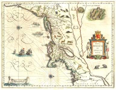
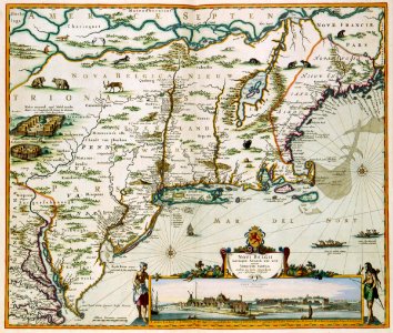
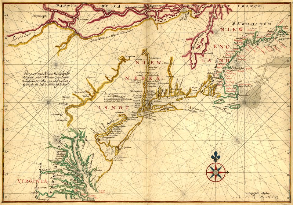
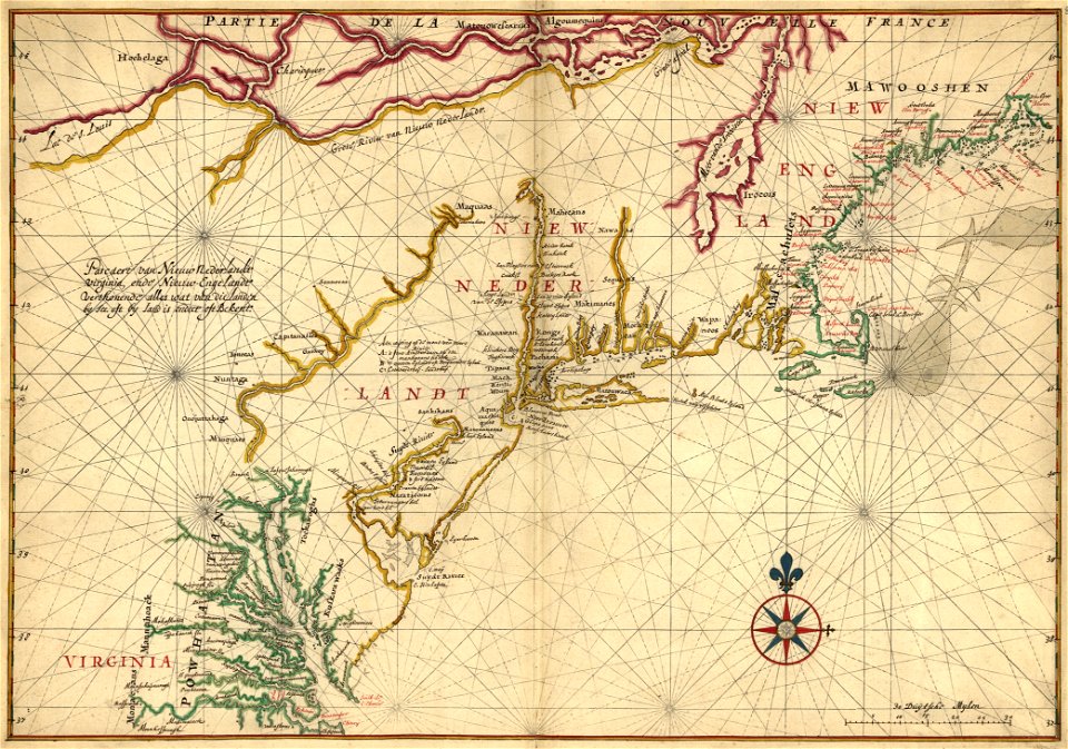
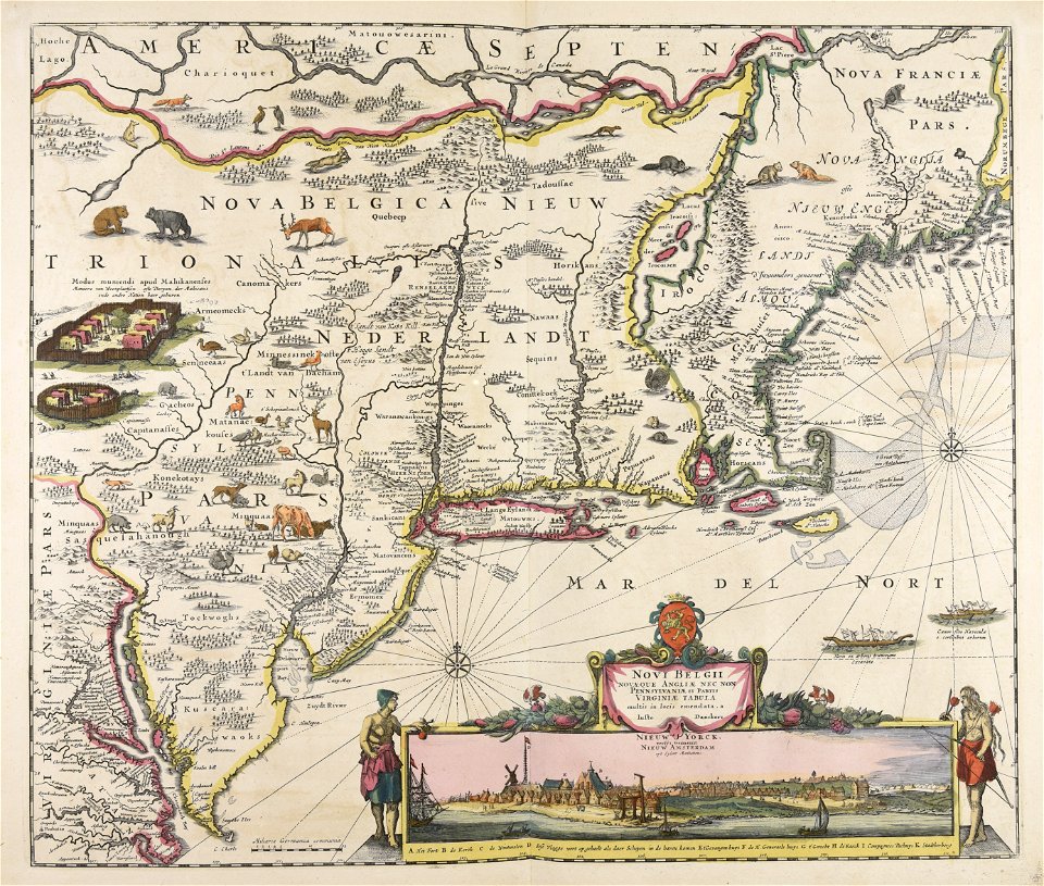
maps of new england
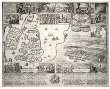
county maps of england by wenzel hollar
maps made in the 17th century
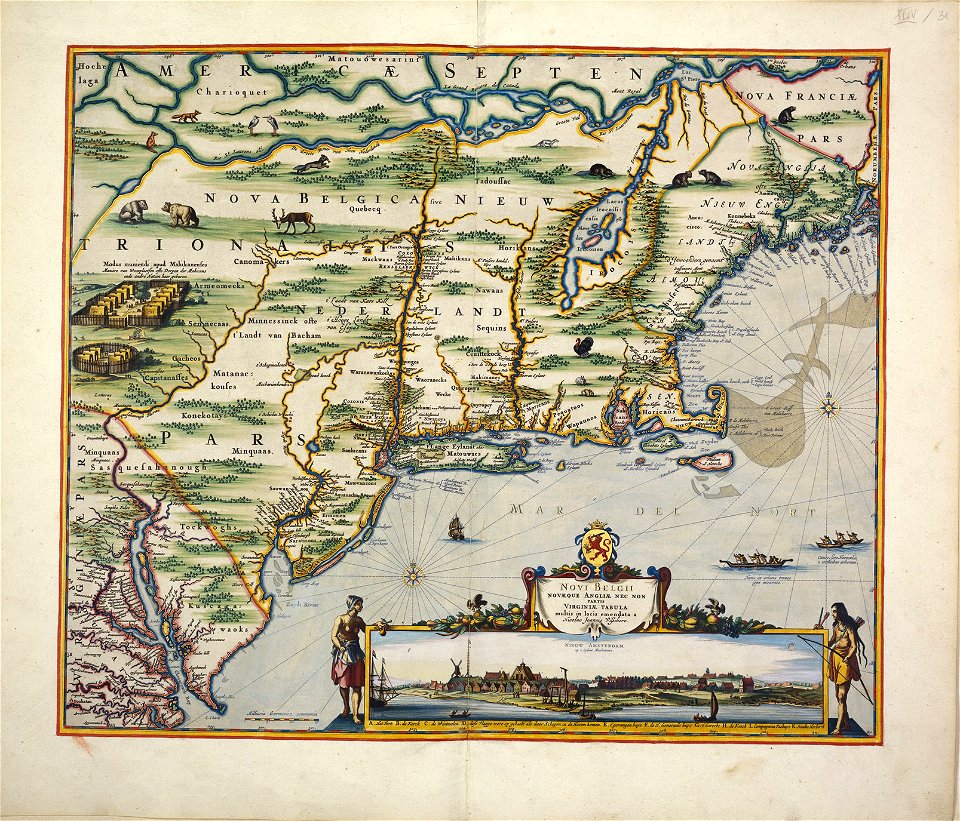
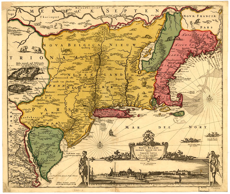
old maps of new york (state)
hundred (county division)
new amsterdam
maps of nieuw nederland
beavers in art
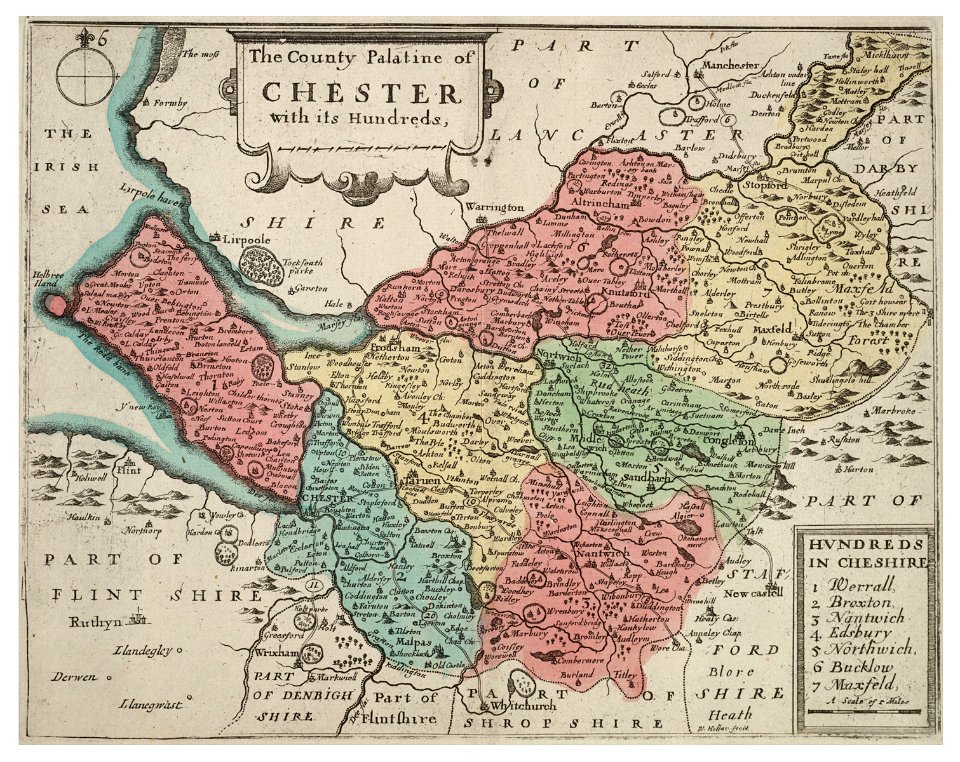
old county maps of lancashire
copper engravings
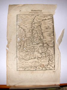
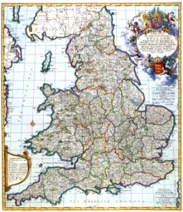
old maps of england
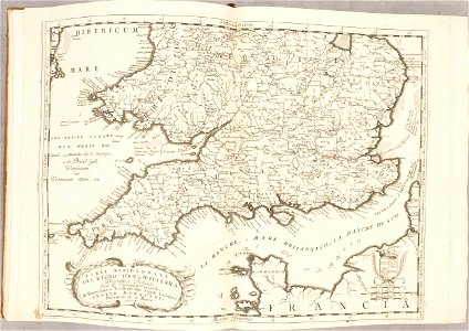
old maps of wales
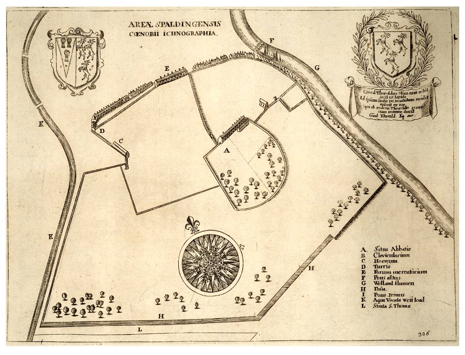
lincolnshire
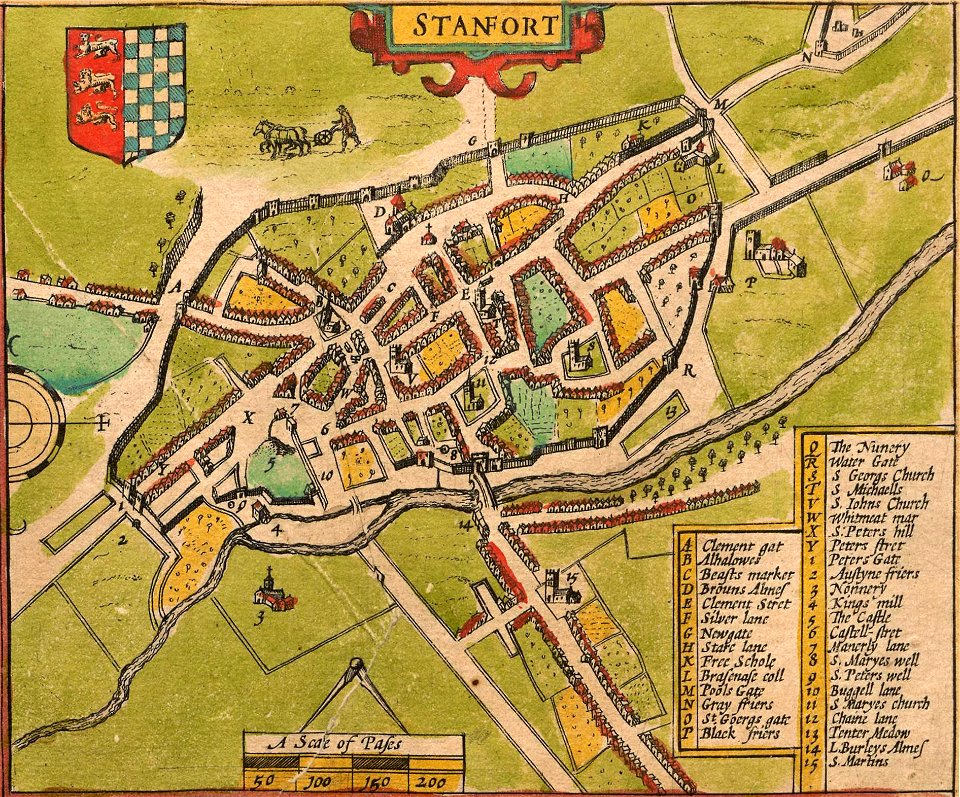
stamford
old maps of england
old maps of wales
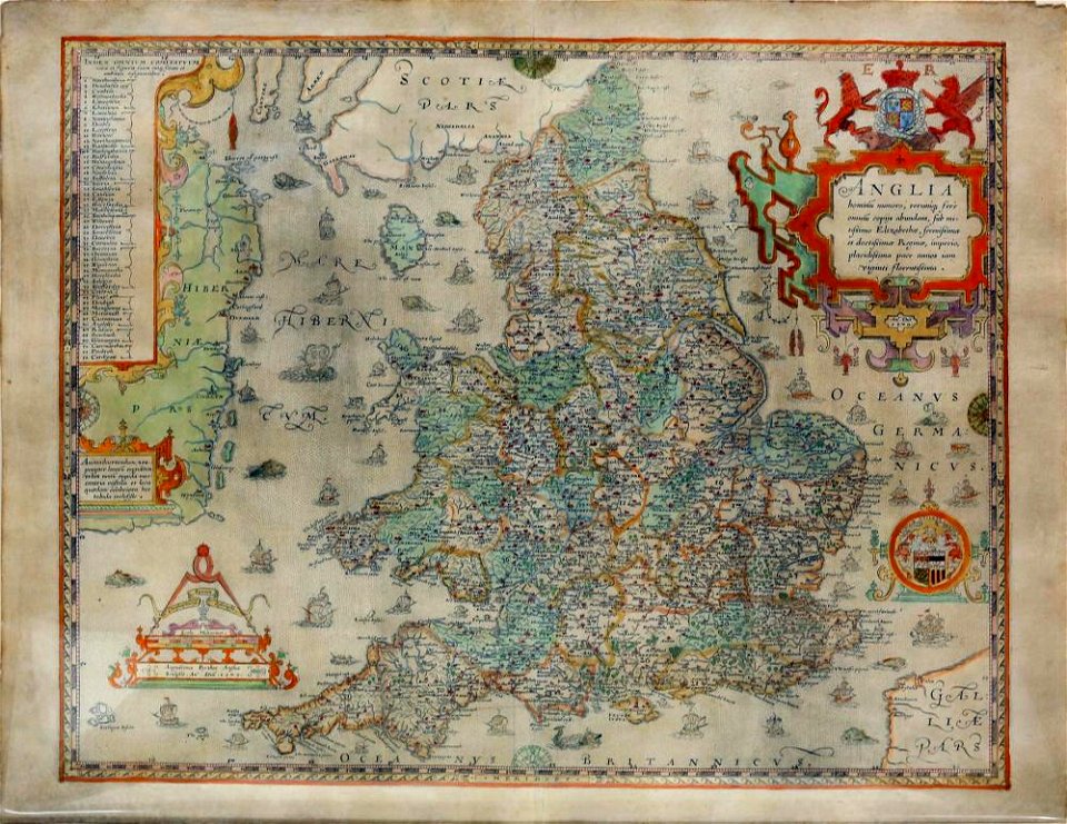
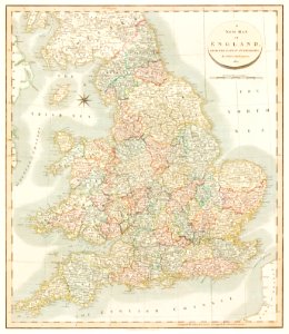
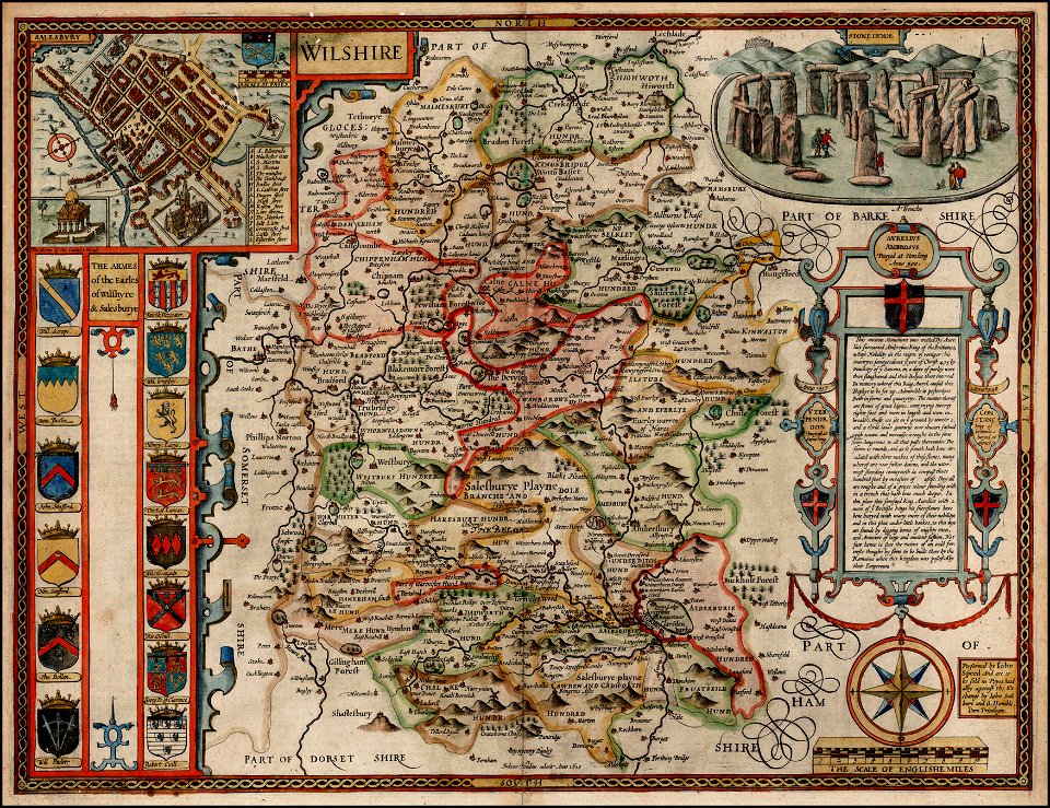
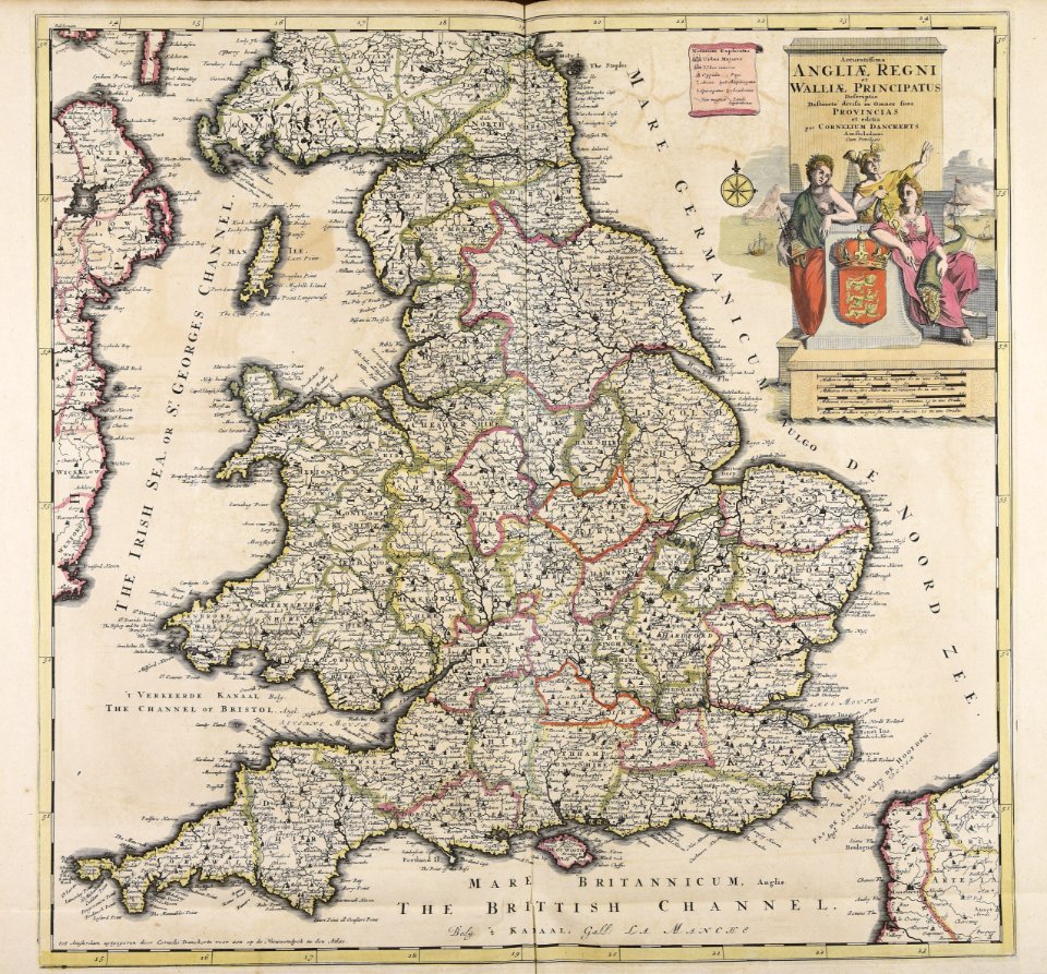
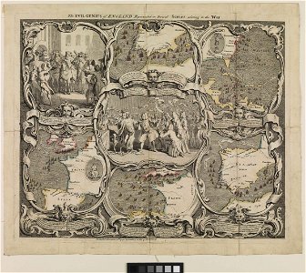
county maps of england by john speed
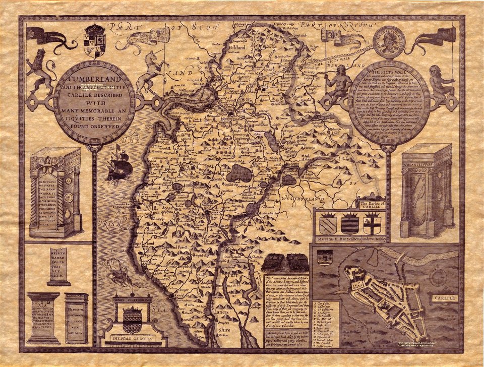
old county maps of cumberland
old maps of new york (state)
new york city
vintage
maps
county maps of england by john speed
nonsuch palace
county maps of england by john speed
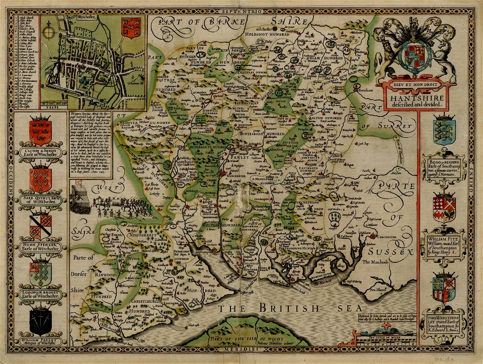
old county maps of hampshire
university of toronto wenceslas hollar digital collection
hollar maps and plans of london
old maps of new england
1684
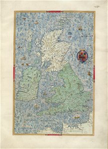
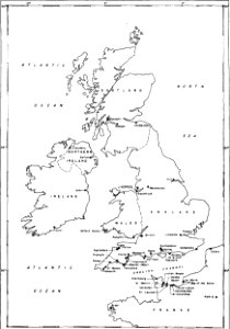
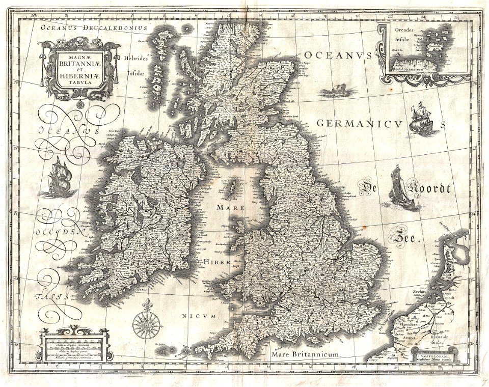
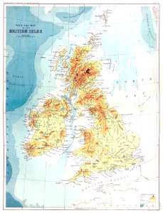
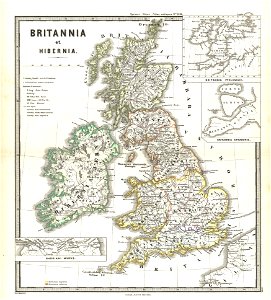
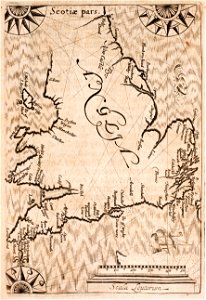
old maps of the british isles
old maps of europe
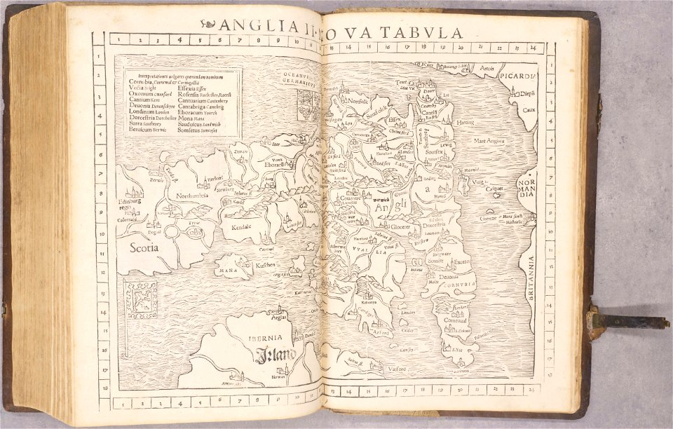
cosmographia (1628) by sebastian münster
old maps of the british isles
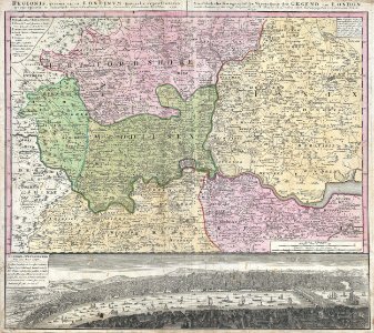
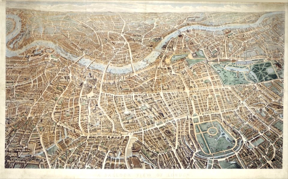
18th-century maps of london
johann baptist homann
maps in the library of congress
old maps of new england
county maps of england by john speed
john speed
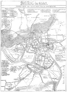
images from bristol past and present (1882)
old maps of bristol
military bases of the united states
old maps of the history of normandy
university of toronto wenceslas hollar digital collection
hollar maps and plans of london
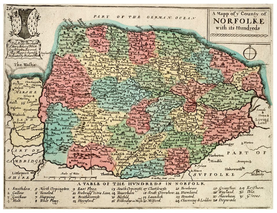
history of norfolk
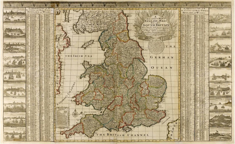
england
old maps of the united states
johann baptist homann
old map
pirate
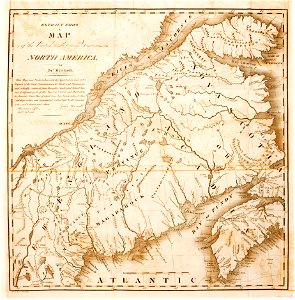
1780 maps of pennsylvania
1780 maps of new jersey
maps made in the 17th century
old maps of wales
maps by willem and johannes blaeu
old maps of the british isles
old maps of the saint lawrence river
old maps of new england
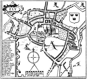
cambridgeshire
ely
old map
surat
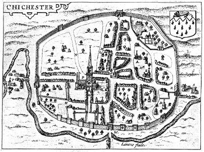
west sussex
chichester
england
maps
old maps of the british isles
karl spruner von merz
university of toronto wenceslas hollar digital collection
old maps of the british isles
prints from bonne atlas de toutes les parties at the peace palace library
1780 maps of canada
atlante veneto (raremaps.com) volume 2
old maps of england
atlante veneto (raremaps.com) volume 2
old maps of england
images from bristol past and present (1882)
old maps of bristol
university of toronto wenceslas hollar digital collection
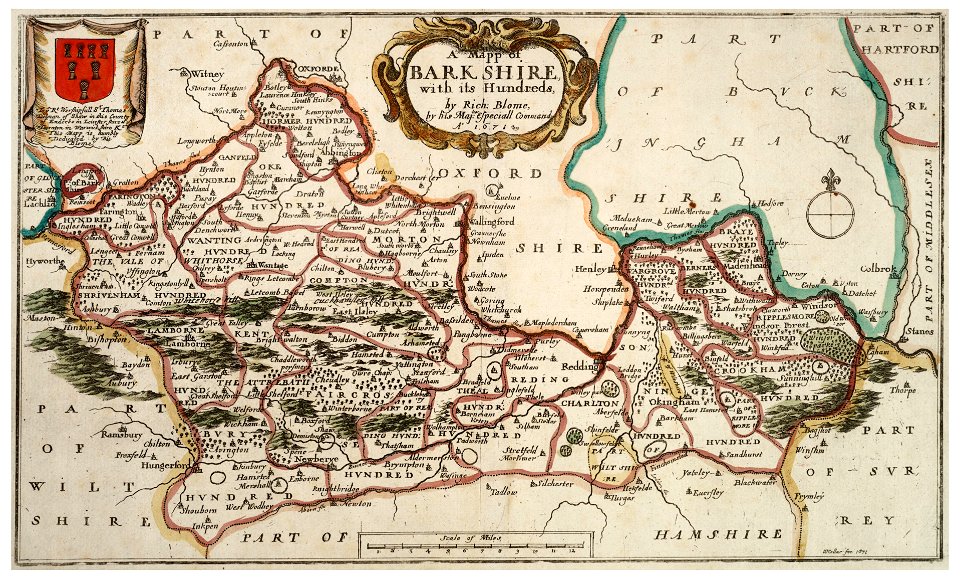
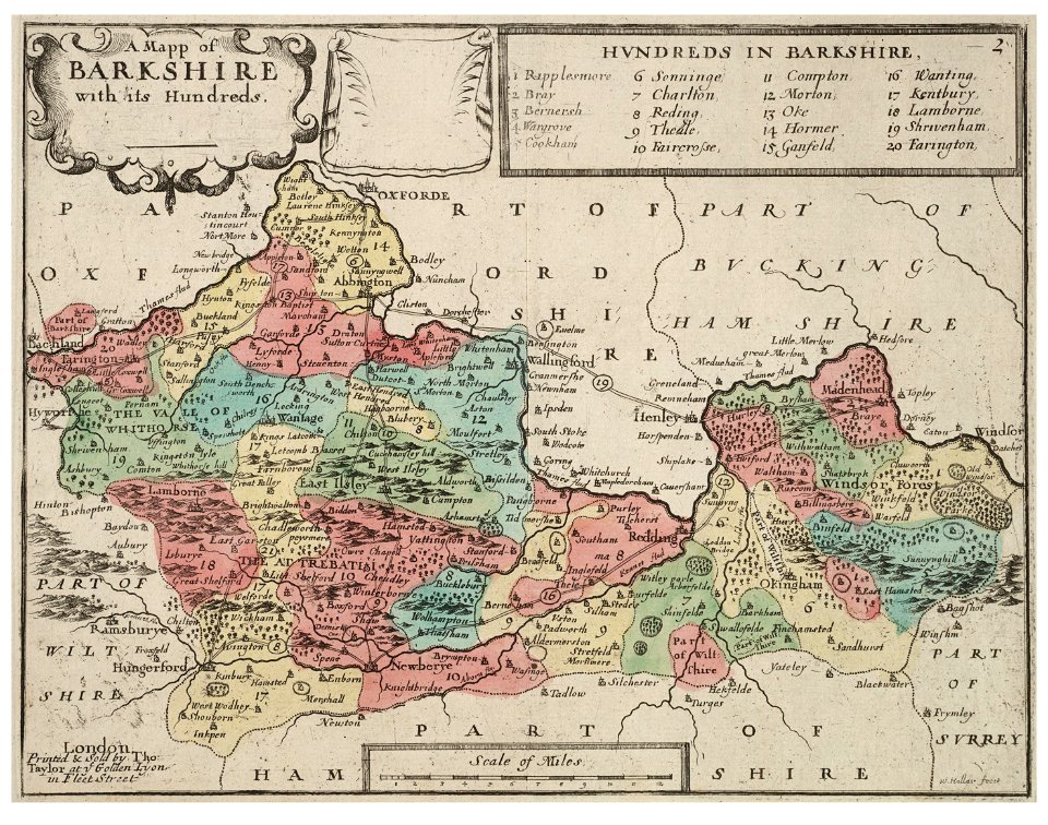
old county maps of berkshire
university of toronto wenceslas hollar digital collection
old county maps of berkshire
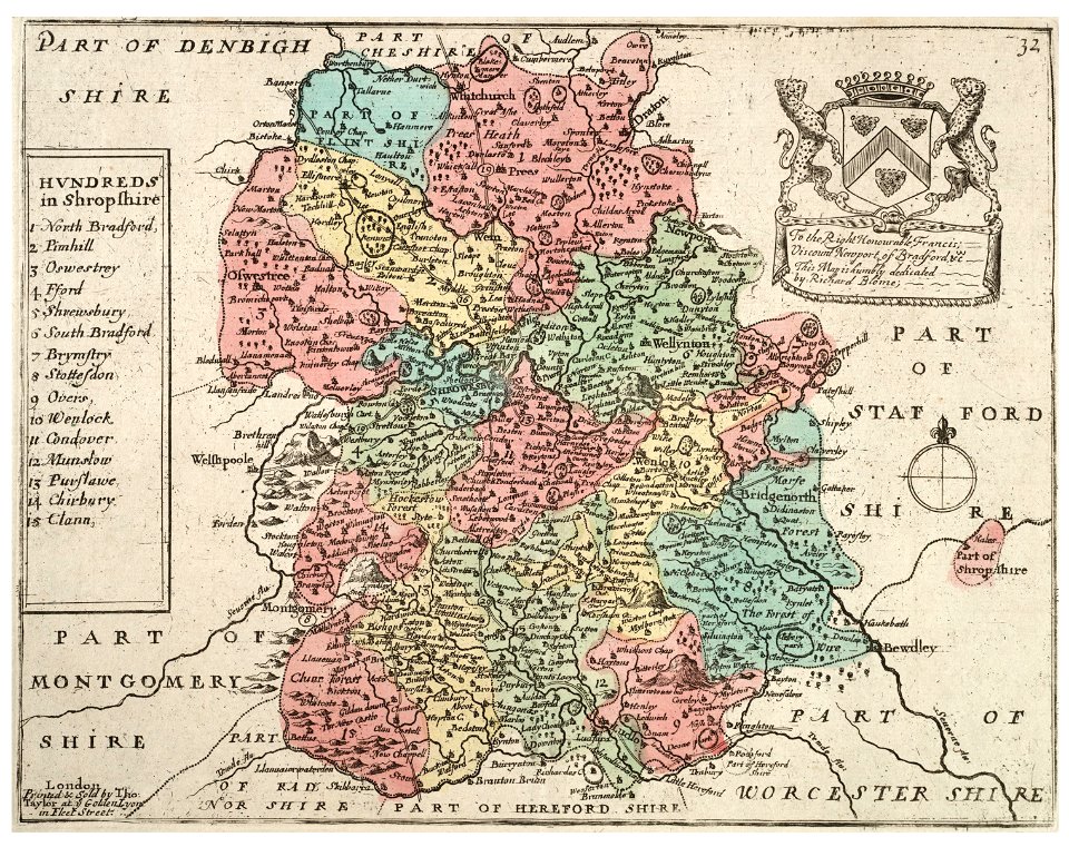
university of toronto wenceslas hollar digital collection
old county maps of shropshire
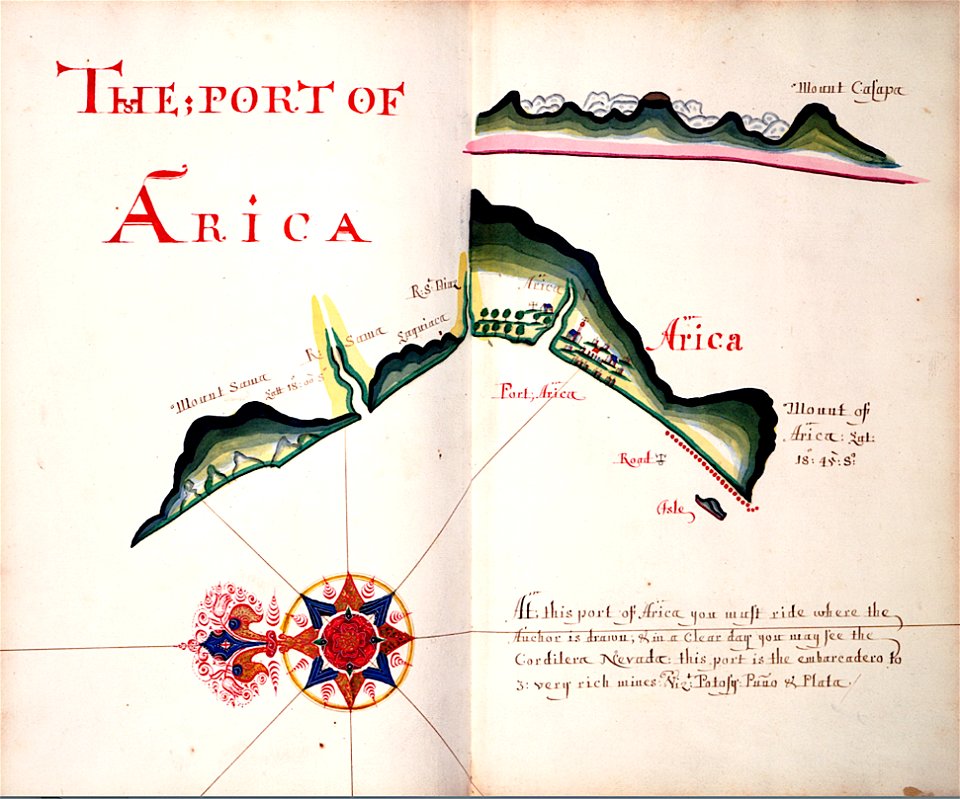
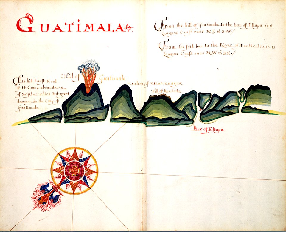
volcanoes in guatemala
old maps of guatemala
old maps of england
1552
gerard valck
england
university of toronto wenceslas hollar digital collection
old county maps of sussex
broad street
reading
copper engraving
beavers in art
university of toronto wenceslas hollar digital collection
old county maps of cheshire
university of toronto wenceslas hollar digital collection
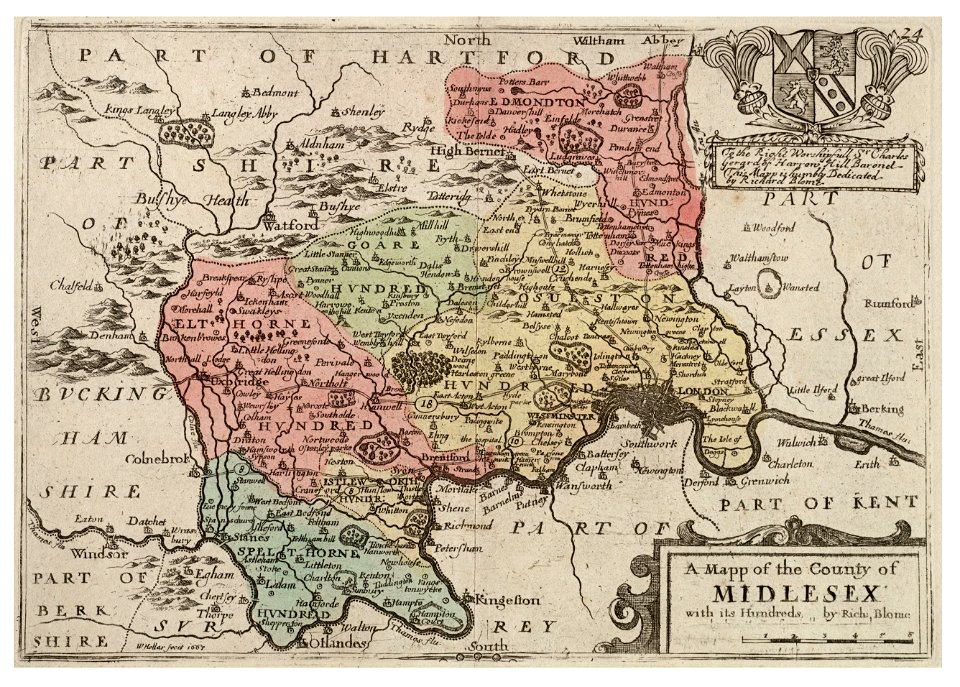
history of watford
maps in the library of congress
old maps of new england
old maps of europe
printing
prints from the peace palace library
1652
maps in the library of congress
old maps of new england
old maps of london
pictorial maps
images from bristol past and present (1882)
clifton (bristol ward)
copper engraving
beavers in art
university of toronto wenceslas hollar digital collection
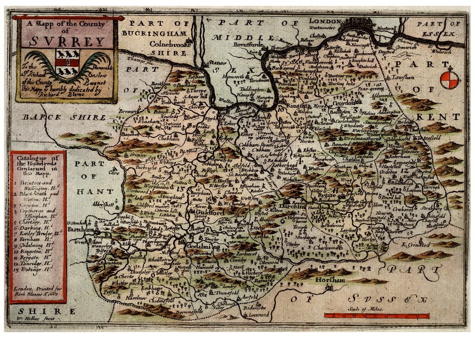
surrey
university of toronto wenceslas hollar digital collection
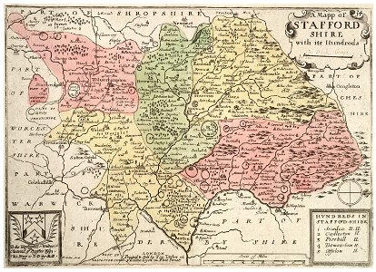
staffordshire
images from bristol past and present (1882)
old maps of bristol
netherlands
the hague
english society
somerset
copper engraving
beavers in art
history of spalding
river welland
maps by willem and johannes blaeu
hudson valley
old constellation maps
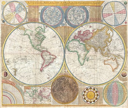
maps by samuel dunn
maps in the library of congress
adriaen van der donck
maps in the library of congress
adriaen van der donck
maps of dioceses of the church of england
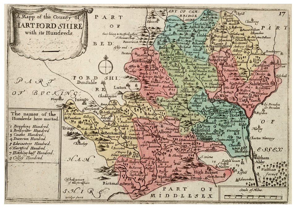
18th-century maps of hertfordshire
old maps of the united states
copper engravings
maps in the library of congress
adriaen van der donck
maps of the west-indische compagnie
1800 maps of the united states
lawrence h. slaughter collection of english maps, charts, globes, books and atlases
maps of nieuw nederland
maps in the library of congress
adriaen van der donck
jean étienne guettard
philippe buache
old maps of the coast of england
bodleian maps collection
old maps of the kingdom of france (987-1792)
19th-century maps of the british isles
16th-century maps of the netherlands
16th-century maps of belgium
maps of plymouth, massachusetts
william wood
counties of england in art
1590 engravings
jean étienne guettard
philippe buache
images of places from encyclopædia britannica
old maps of manchester and salford
a set of fifty new and correct maps of england and wales
old county maps of northamptonshire
old maps of cambridge
1690 maps of england
highways and byways in cambridge and ely (book)
old maps of cambridge
miniature speed atlas (1627) pieter van den keere
old county maps of anglesey
old maps of towns in england
arundel castle in art
old maps of guernsey
old maps of jersey
old maps of the united states
copper engravings
old county maps of lancashire
copper engravings
william hole (engraver)
michael drayton
the antiquities of england and wales (1773)
1773 fleurons
the antiquities of england and wales (1773)
1773 fleurons
the antiquities of england and wales (1773)
1773 fleurons
old county maps of lancashire
copper engravings
maps by john cary
1796 maps
18th-century maps of kent
old county maps of kent
old maps of england
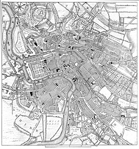
1860 maps
the antiquities of england and wales (1773)
18th-century maps of lancashire
1777 maps of new york (state)
1777 maps of new jersey
miniature speed atlas (1627) pieter van den keere
county maps of england by john speed
grosser deutscher atlas
old maps of england
atlas maior, vol 5 (england) - joan blaeu, 1667 - bl 114.h(star).5
old county maps of pembrokeshire
1 - 100 of 283
Next page
/ 3