Log in
All resources
Create a design
57 Free Images of Old Maps Of The Rhine
old maps of north rhine-westphalia
atlas novus (blaeu)
coats of arms on maps
baroque
joan blaeu
old maps of the rhineland
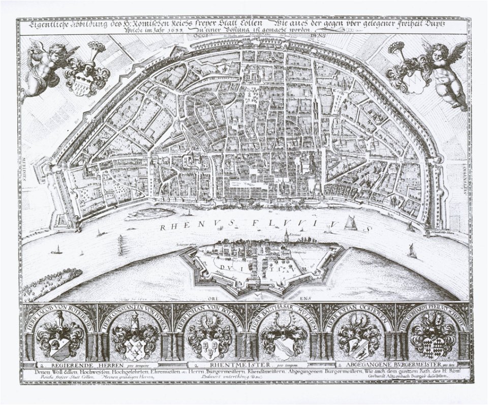
old maps of cologne
maps by willem and johannes blaeu
engravings by matthäus merian
matthäus merian
old maps of north rhine-westphalia
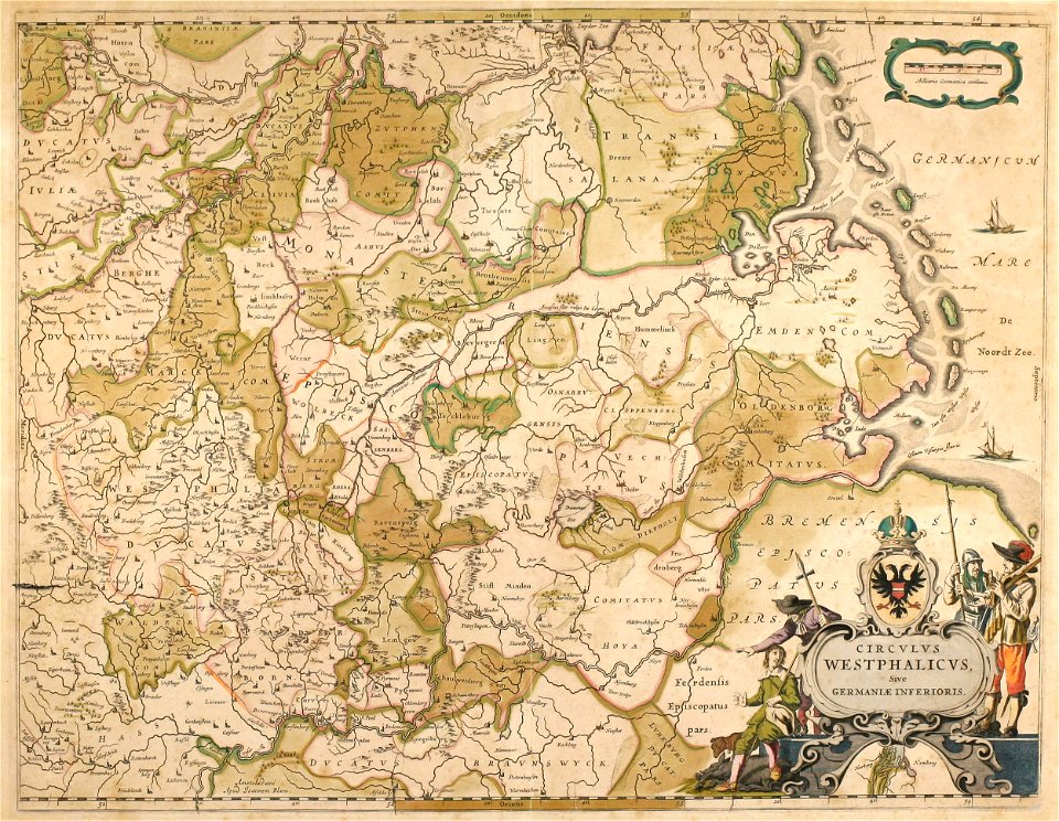
lower rhine region
maps made in the 18th century
old maps of europe
old maps of north rhine-westphalia
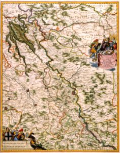
netherlands
maps made in the 18th century
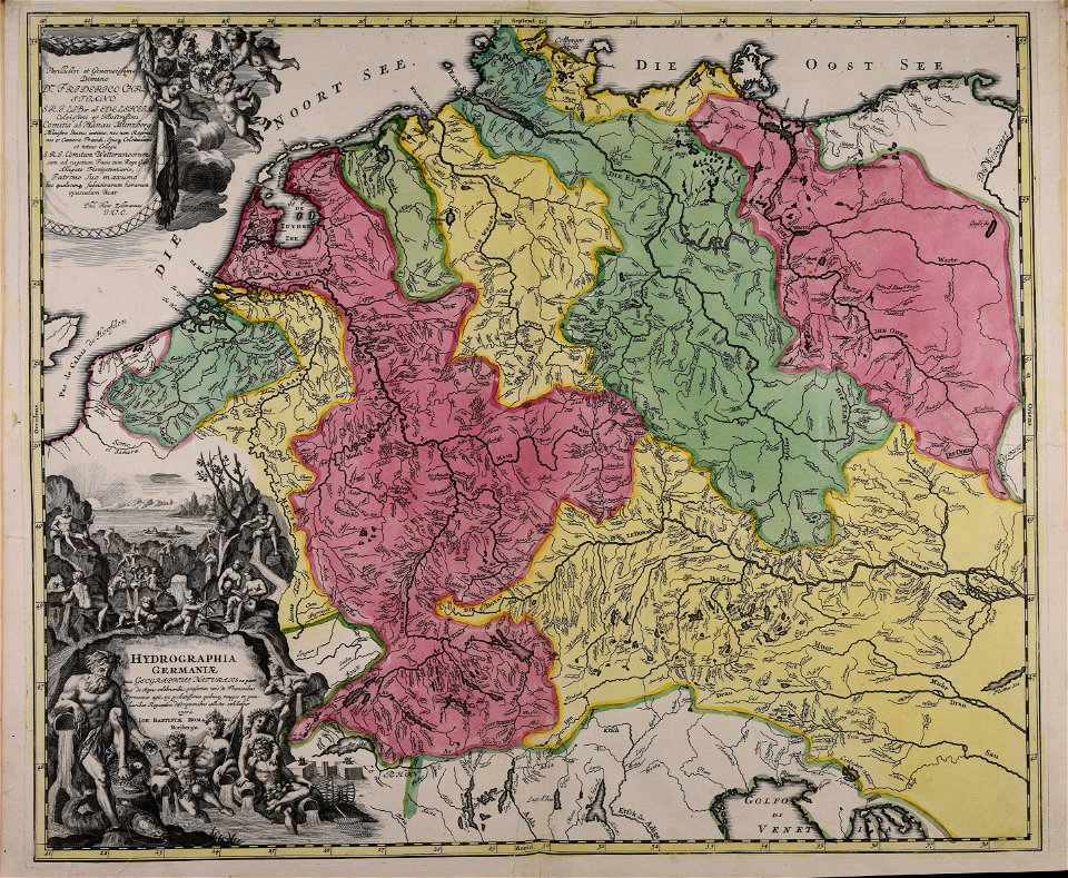
johann baptist homann
johann baptist homann
old maps of hesse
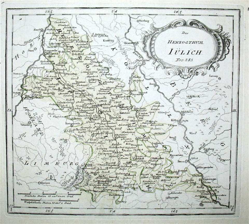
old maps of north rhine-westphalia
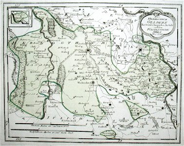
upper guelders
maps by homannsche erben
latin-language maps
old maps of north rhine-westphalia
coats of arms on maps
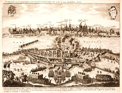
1633 in north rhine-westphalia
old maps of cologne
battles of the thirty years' war
cologne
maps with cartouches
copper engraving
old maps of north rhine-westphalia
maps with cartouches
german empire
east germany
collections of generallandesarchiv karlsruhe
hagenbach
topographia alsatiae (merian)
baroque
friedrich wilhelm delkeskamp
old maps of the rhineland
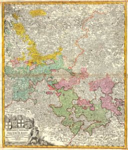
old maps of the county of ravensberg
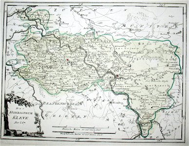
duchy of cleves
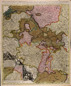
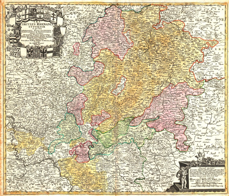
old maps of the rhine
neuburg am rhein
1640s maps of the netherlands
coats of arms on maps
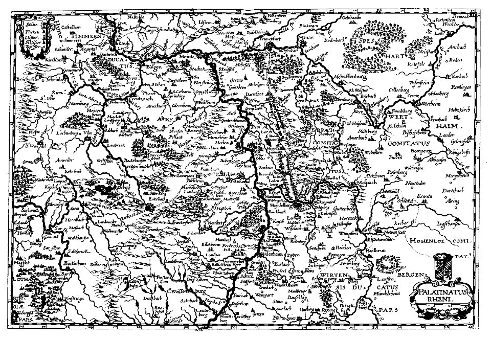
old maps of rhineland-palatinate
old maps of alsace
old maps of rhineland-palatinate
baroque
old maps of north rhine-westphalia
maps of rietberg
maps by willem and johannes blaeu
old maps of arnhem
old maps of arnhem
rhine in arnhem
old maps of north rhine-westphalia
maps of the county of mark
1590s maps of the netherlands
1590s maps of belgium
1640s maps of north rhine-westphalia
maps by willem and johannes blaeu
engravings by matthäus merian
baroque
old maps of north rhine-westphalia
atlas novus (blaeu)
köln-weidenpesch
köln-nippes
old maps of north rhine-westphalia
maps of balve
maps by willem and johannes blaeu
1640 maps
maps by john cary
1799 maps
lechenich
baroque
city walls of lechenich
baroque
tombleson's views of the rhine (1832)
old maps of the rhine
lechenich
baroque
flughafen köln-butzweilerhof
köln-bocklemünd/mengenich
1609 works in north rhine-westphalia
abraham hogenberg
maps of moers by johannes mercator
old maps of duisburg
maps of prince-bishopric of münster
prince-bishopric of osnabrück
atlas maior, vol 3 (germany) - joan blaeu, 1667 - bl 114.h(star).3
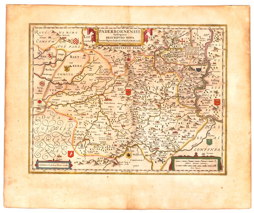
johannes gigas
atlas maior, vol 3 (germany) - joan blaeu, 1667 - bl 114.h(star).3
johannes gigas
maps of fossa eugeniana by willem and johannes blaeu
old maps of north rhine-westphalia
maps by alexis-hubert jaillot
maps by guillaume sanson
old maps of westphalia
johannes gigas
old maps of prince-bishopric of paderborn
johannes gigas
nicolaus person
rhenish hesse
atlas ou representation du monde universel t. 2 (1633)
maps by hendrik hondius the younger
maps by john cary
1799 maps
old maps of swabia
maps by john cary
maps from the earth and its inhabitants, vol. iii
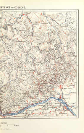
old maps of the rhine
maps from the earth and its inhabitants, vol. iii
old maps of the rhine
atlas ou representation du monde universel t. 2 (1633)
maps by hendrik hondius the younger
old maps of duchy of cleves
guillaume sanson
potsdam in the 1770s
old maps of potsdam
drawings in musée carnavalet
jean-baptiste lesueur
1 - 57 of 57
/ 1


![Gerardi Mercatoris and I. Hondii Atlas or Representation of the Universal World, and of the Parts of It, Made in Tables and Very Ample Descriptions. [t. 2].](https://cdn.creazilla.com/illustrations/10000421870/gerardi-mercatoris-and-i-hondii-atlas-or-representation-of-the-universal-world-and-of-the-parts-of-it-made-in-tables-and-very-ample-descriptions-t-2-md.jpg)
![Gerardi Mercatoris and I. Hondii Atlas or Representation of the Universal World, and of the Parts of It, Made in Tables and Very Ample Descriptions. [t. 2].](https://cdn.creazilla.com/illustrations/10000334523/gerardi-mercatoris-and-i-hondii-atlas-or-representation-of-the-universal-world-and-of-the-parts-of-it-made-in-tables-and-very-ample-descriptions-t-2-sm.webp)
