Log in
All resources
Create a design
27,441 Free Images of Maps
atlas du canton de paris, 1795
maps of paris from the david rumsey historical map collection
composite map
latin-language maps
bibliothèque nationale de france
english-language maps
maps by jakob van der schley
koninklijke bibliotheek
jakob van der schley
eran laor cartographic collection
grosser deutscher atlas
old maps of portugal
maps by girolamo porro
1598 maps of russia
latin-language maps
1477 maps
gemeente atlas van nederland - south holland
1860s maps of south holland
cartes de franz schrader
1894 maps of france
prints of cartouches in the rijksmuseum amsterdam
maps in the rijksmuseum amsterdam
glaciers and glaciation (1910)
maps of yakutat bay
maps of ruthenian voivodeship
belz voivodeship
maps of hofgarten düsseldorf
kunstakademie düsseldorf
maps of paris from the david rumsey historical map collection
atlas du canton de paris, 1795
maps of paris from the david rumsey historical map collection
atlas du canton de paris, 1795
maps of paris from the david rumsey historical map collection
atlas du canton de paris, 1795
maps of paris from the david rumsey historical map collection
atlas du canton de paris, 1795
maps of paris from the david rumsey historical map collection
atlas du canton de paris, 1795
maps of paris from the david rumsey historical map collection
atlas du canton de paris, 1795
maps of paris from the david rumsey historical map collection
atlas du canton de paris, 1795
maps of paris from the david rumsey historical map collection
atlas du canton de paris, 1795
maps of paris from the david rumsey historical map collection
atlas du canton de paris, 1795
maps of paris from the david rumsey historical map collection
atlas du canton de paris, 1795
maps of paris from the david rumsey historical map collection
atlas du canton de paris, 1795
architectonographie des théâtres de paris
architectural drawing sheets
africa and its inhabitants, vol. ii
charles eugène perron
jodocus hondius ii, nova totius terrarum orbis geographica ac hydrographica tabula, 1636
map
maps of polders in south holland
old maps of delfland
the loyal west in the times of the rebellion
1803 maps of the united states
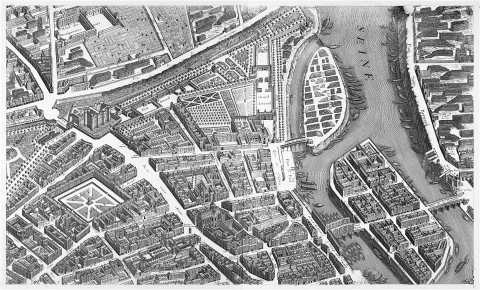
turgot map of paris, kyoto university library
sheet 6 of the turgot map of paris
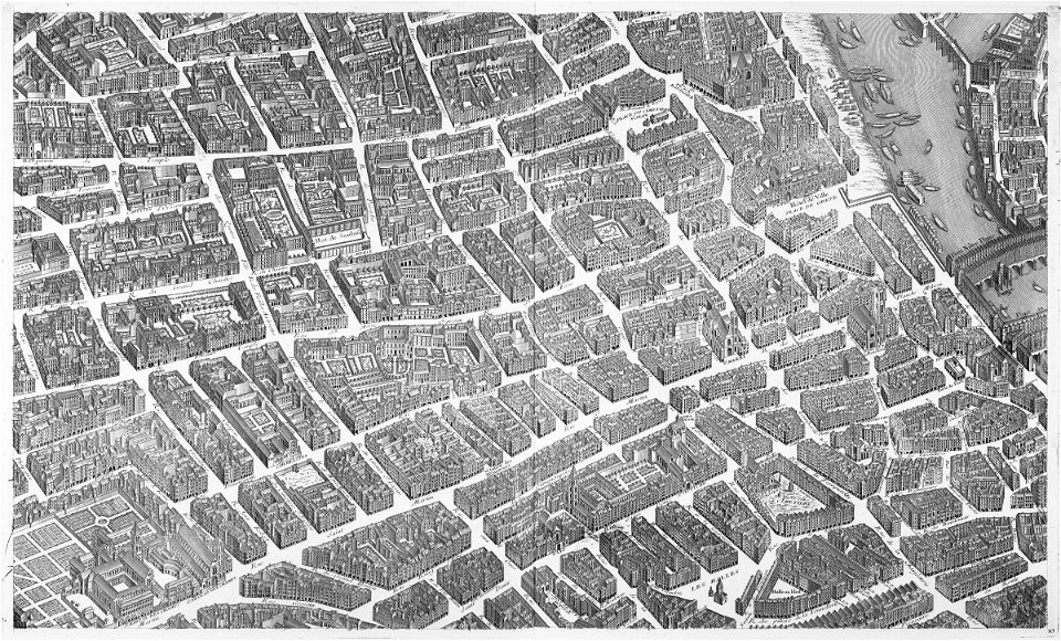
turgot map of paris, kyoto university library
sheet 10 of the turgot map of paris
maps by alexis-hubert jaillot
1730s maps of france
maps in the british museum
maps by pieter mortier
16th-century maps of the indian ocean
renaissance
1652 maps
shipmills
civitates orbis terrarvm, liber primvs (1577)
maps of tangier by braun & hogenberg
maps by willem and johannes blaeu
old maps of tripoli
maps by willem and johannes blaeu
old maps of the arctic
map of paris by jouvin de rochefort (boutier 112)
maps of paris from geographicus
guide joanne espagne et portugal-1906
french-language maps
guide joanne espagne et portugal-1915
1915 maps
guide joanne espagne et portugal-1915
1915 maps
arnold van langren map of southwest africa
renaissance
latin-language maps
bologna ptolemy
maps in the library of congress
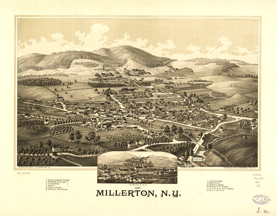
millerton, new york
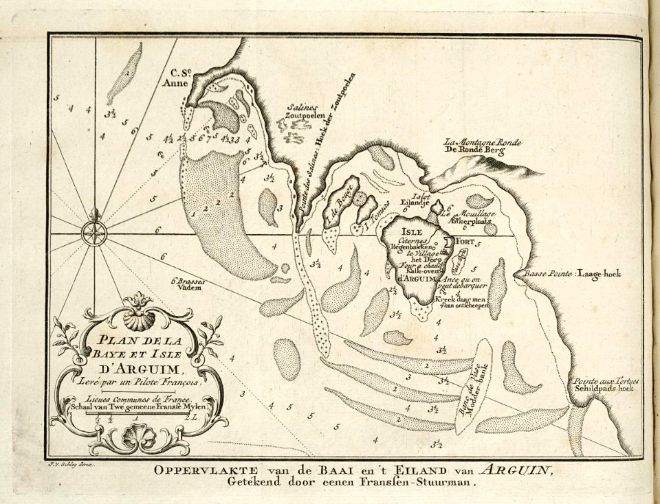
maps of the west-indische compagnie
1747 maps
maps by jakob van der schley
1753 maps
1780s maps of the world
german renaissance
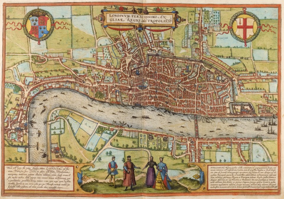
maps of london by braun & hogenberg
1572 in london
gemeente atlas van nederland - limburg
maps of tegelen
maps of antwerp city walls
old maps of antwerp
1670s maps of new york (state)
1670s maps of new jersey
17th-century maps of north carolina
old maps of virginia
gemeente atlas van nederland - south holland
19th-century maps of rotterdam
maps of the dutch east india company - indonesia
watercolor drawings by johannes vingboons
maps of the west-indische compagnie
1682
1760s maps of north rhine-westphalia
düsseldorf in the 1760s
maps by pieter van der keere
1610s maps of belgium
synopsis universae philologiae
1741 maps of europe
maps of the history of the united states
old maps of the british empire
maps of tangier by braun & hogenberg
maps of safi by braun & hogenberg
maps in the british museum
1610s maps of ireland
maps by pieter van der keere
old maps of basel
maps by matthäus merian
baroque
somalia in the 15th century
1459
topographia westphaliae (merian)
baroque
balthasar florisz. van berckenrode
eran laor cartographic collection
gemeente atlas van nederland - groningen
maps of appingedam
maya angelou
travel maps
maps of the dutch east india company - india
1756 maps
maps of the west-indische compagnie
1747 maps
africa in the 18th century
1794 maps of africa
africa in the 18th century
1794 maps of africa
maps in the library of congress
1758 maps
maps from the earth and its inhabitants, vol. iv
topographic maps of ireland
maps from the earth and its inhabitants, vol. ix
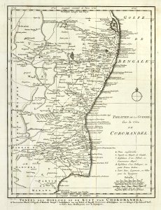
maps of south india
maps from the earth and its inhabitants, vol. iv
linguistic maps of the united kingdom
maps from the earth and its inhabitants, vol. xi
19th-century maps of chad
maps of weather and climate of the united kingdom
maps from the earth and its inhabitants, vol. iv
maps from the earth and its inhabitants, vol. xvii
maps of u.s. water resource subbasins
maps from the earth and its inhabitants, vol. xiv
1870s maps of new zealand
maps by girolamo porro
1596 maps of africa
maps by girolamo porro
1596 maps of africa
maps by girolamo porro
1596 maps of africa
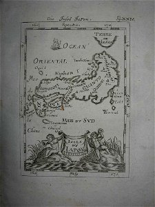
18th-century maps of japan
description de l'universe
eran laor cartographic collection
emanuel bowen
eran laor cartographic collection
michael burghers
eran laor cartographic collection
michael burghers
armillary spheres in art
1770s maps of the world
maps of the kingdom of kongo
maps by petrus bertius
chicago and the midwest, newberry library
maps by rand mcnally
eran laor cartographic collection
emanuel bowen
historical images of the jardin du luxembourg
maps of jardin du luxembourg
18th-century double hemisphere world maps
1730s maps of the world
18th-century double hemisphere world maps
1730s maps of the world
maps by willem and johannes blaeu
maps of gulf of khambhat
maps by joachim bormeester
1680s maps of the world
fragments of shubert's maps
lopukhinsky garden
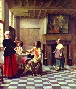
baroque,dutch golden age painting
paintings by pieter de hooch
1807 maps of canada
maps by john cary
maps by willem and johannes blaeu
1630s maps of tunisia
interior of grote or sint-bavokerk (haarlem)
1689 map of haarlem
gemeente atlas van nederland - south holland
1860s maps of south holland
maps in the library of congress
maps of alexandria, virginia
3101 - 3200 of 27,441
Next page
/ 275