Log in
All resources
Create a design
51 Free Artworks of 1730s Maps Of France
bibliothèque nationale de france
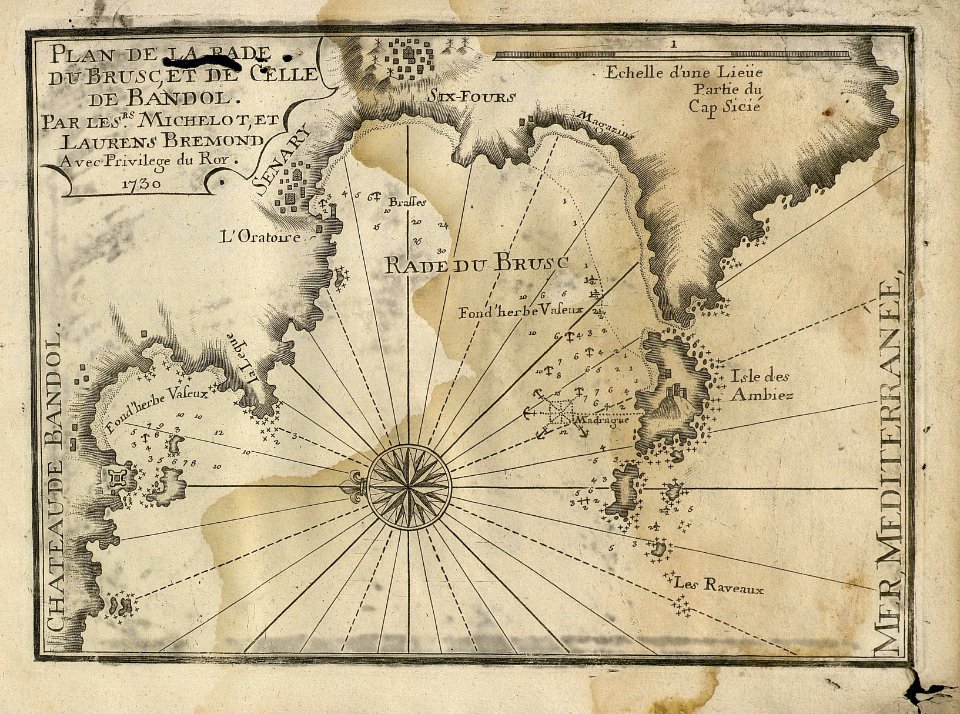
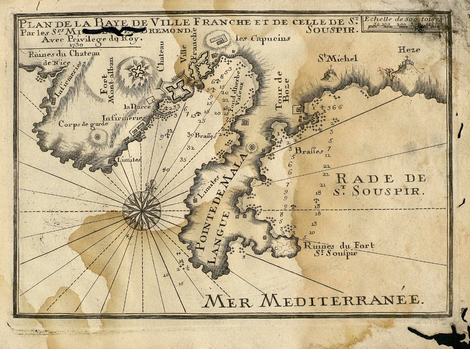
sea
cartography
harbor
mediterranean
port
17th century
puerto
francia
mediterráneo
old maps of france
1730
maps of paris from the barry lawrence ruderman antique maps inc.
maps by homannsche erben
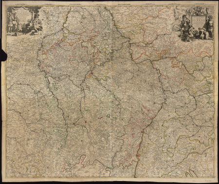
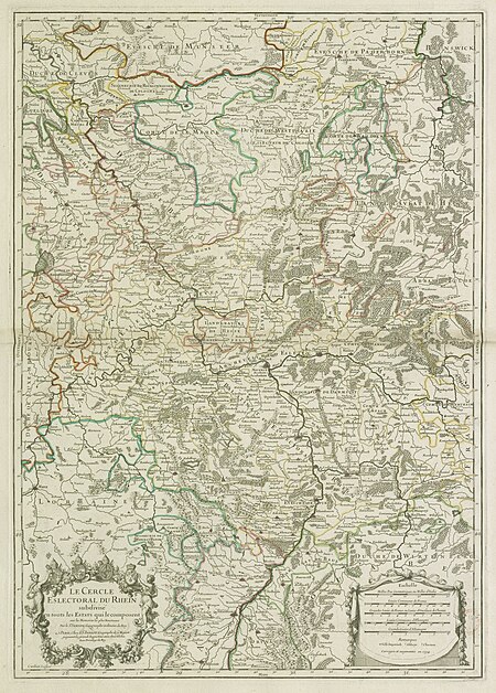
map of the circle of the rhineland by sanson
1730s maps of rhineland-palatinate
maps by nicolas sanson
1730s maps of france
maps of paris from bibliothèque nationale de france
plan de roussel
maps by alexis-hubert jaillot
1730s maps of france
historical images of palais bourbon
plans of castles in france
maps of paris from bibliothèque nationale de france
plan de roussel
map of the circle of the rhineland by sanson
1730s maps of rhineland-palatinate
a map of the british empire in america with the french and spanish settlements adjacent thereto
1730s maps of the caribbean
cornelis huyberts
guillaume sanson
map of the circle of the rhineland by sanson
1730s maps of rhineland-palatinate
map of the circle of the rhineland by sanson
1730s maps of rhineland-palatinate
18th-century maps of istanbul
maps from gallica
a map of the british empire in america with the french and spanish settlements adjacent thereto
1730s maps of the caribbean
old maps of the republic of genoa
maps of the duchy of milan
a map of the british empire in america with the french and spanish settlements adjacent thereto
1730s maps of the caribbean
thomas milton
1739 maps
old maps of regions of france
pierre françois tardieu
map of the strait of kerch by guillaume sanson
bibliothèque nationale de france
carta hydrographica y chorographica de las yslas filipinas... - por... el pe pedro murillo velarde - btv1b53066953z
baroque painting
a map of the british empire in america with the french and spanish settlements adjacent thereto
1730s maps of the caribbean
a map of the british empire in america with the french and spanish settlements adjacent thereto
1730s maps of the caribbean
a map of the british empire in america with the french and spanish settlements adjacent thereto
1730s maps of central america
mainz in the 1730s
old maps of mainz
maps of the south atlantic
guillaume dheulland
1730s maps of the philippines
baroque painting
jean-fréderic phélypeaux
guillaume dheulland
bibliothèque nationale de france
hendrik de leth
maps
sea
maps
sea
maps
sea
maps
sea
maps
sea
maps
sea
maps
sea
maps
sea
maps
sea
maps
sea
maps
sea
maps
sea
old maps of mainz
baroque
map of italy by guillaume delisle (1700)
1700 maps of italy
maps of the iberian peninsula by guillaume delisle
1700s maps of the iberian peninsula
carte des côtes de malabar et de coromandel (1723)
philippe buache
cartouches by guillaume delisle
philippe buache
carte de barbarie, nigritie, guinée par guillaume delisle (1707)
university of washington
carte de l'isle de ceylan by guillaume delisle (1722)
philippe buache
carte de l'afrique françoise par guillaume delisle (1726)
philippe buache
map of europe by guillaume delisle (1700)
university of washington
carte de moscovie by guillaume de l'isle (1706)
university of washington
1 - 51 of 51
/ 1


![The Electoral Circle of the Rhine subdivided into all the Estates which compose it... / by Sanson, ,... Geometric Miles or Miles of Italy [30 = 12] common leagues of France, 1734](https://cdn.creazilla.com/illustrations/10001532968/the-electoral-circle-of-the-rhine-subdivided-into-all-the-estates-which-compose-it-by-sanson-geometric-miles-or-miles-of-italy-30-12-common-leagues-of-france-1734-sm.jpg)

![Map of Paris ([Reprod. in facsim.]) / by Roussel, engineer in 1700, 1730](https://cdn.creazilla.com/illustrations/10001522196/map-of-paris-reprod-in-facsim-by-roussel-engineer-in-1700-1730-md.jpg)