Log in
All resources
Create a design
353 Free Images of Cartography
topographic map of france, 1864
lemercier & cie.
cartouche (cartography)
cornell: persuasive cartography: the pj mode collection
bibliothèque nationale de france
cornell university library
eran laor cartographic collection
map
national library of israel
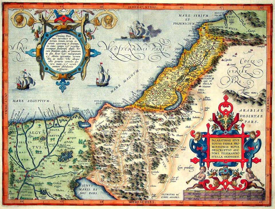
cartography of palestine
maps by abraham ortelius
maps by jodocus hondius
catalan atlas, 1959 reproduction
cartography of ukraine
maps of delft by braun & hogenberg
cartouche (cartography)
maps in the library of congress
romanticism
northern renaissance
ambrosius holbein
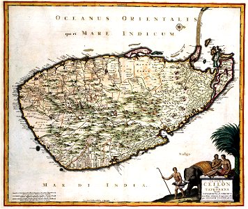
maps of ceylon by nicolaes visscher
sri lanka in the 17th century
maps by giacomo gastaldi
cornelis de jode
cornell: persuasive cartography: the pj mode collection
works by james montgomery flagg
maps by giacomo gastaldi
cornelis de jode
maps of aalst by braun & hogenberg
cartouche (cartography)
old maps of the united states
copper engravings
cornell: persuasive cartography: the pj mode collection
caricatures of richard croker
maps in the library of congress
adriaen van der donck
maps by girolamo porro
1572 maps
cornell: persuasive cartography: the pj mode collection
kellanova
cornell: persuasive cartography: the pj mode collection
1665 maps
arnold van langren map of southwest africa
cartouche (cartography)
old maps of ischia (island)
giulio jasolino
cartouches by joseph roux
cartouche (cartography)
cartouche (cartography)
cornelis de jode
cornell: persuasive cartography: the pj mode collection
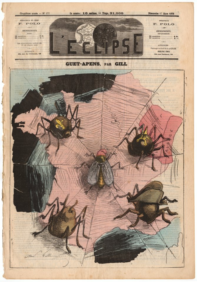
europe in the 1870s
map of modern syria by philippe de la rué
1650s maps of palestine
cornell: persuasive cartography: the pj mode collection
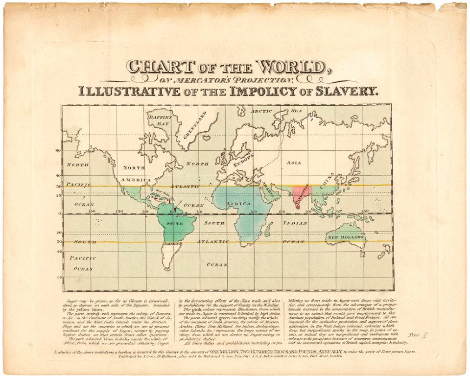
economic maps of the world
topographic map of france, 1864
lemercier & cie.
topographic map of france, 1864
lemercier & cie.
topographic map of france, 1864
lemercier & cie.
topographic map of france, 1864
lemercier & cie.
topographic map of france, 1864
lemercier & cie.
topographic map of france, 1864
lemercier & cie.
topographic map of france, 1864
lemercier & cie.
topographic map of france, 1864
lemercier & cie.
topographic map of france, 1864
lemercier & cie.
topographic map of france, 1864
lemercier & cie.
topographic map of france, 1864
lemercier & cie.
topographic map of france, 1864
lemercier & cie.
topographic map of france, 1864
lemercier & cie.
topographic map of france, 1864
lemercier & cie.
topographic map of france, 1864
lemercier & cie.
topographic map of france, 1864
lemercier & cie.
topographic map of france, 1864
lemercier & cie.
topographic map of france, 1864
lemercier & cie.
topographic map of france, 1864
lemercier & cie.
topographic map of france, 1864
lemercier & cie.
topographic map of france, 1864
lemercier & cie.
topographic map of france, 1864
lemercier & cie.
topographic map of france, 1864
lemercier & cie.
topographic map of france, 1864
lemercier & cie.
topographic map of france, 1864
lemercier & cie.
topographic map of france, 1864
lemercier & cie.
topographic map of france, 1864
lemercier & cie.
topographic map of france, 1864
lemercier & cie.
topographic map of france, 1864
lemercier & cie.
topographic map of france, 1864
lemercier & cie.
topographic map of france, 1864
lemercier & cie.
topographic map of france, 1864
lemercier & cie.
topographic map of france, 1864
lemercier & cie.
topographic map of france, 1864
lemercier & cie.
cornell: persuasive cartography: the pj mode collection
1790s maps of england
walter riemer (illustrator)
pictorial maps of germany
media from the national library of finland
classicism
eran laor cartographic collection
afbeeldinge der stad jerusalem
maps of the caribbean by mercator-hondius
details of old maps
cornell: persuasive cartography: the pj mode collection
franco-prussian war in art
cornell: persuasive cartography: the pj mode collection
charles magnus
cornell: persuasive cartography: the pj mode collection
maps of continents
cornell: persuasive cartography: the pj mode collection
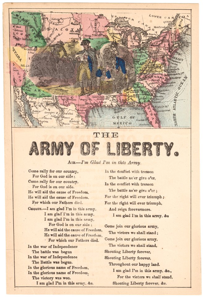
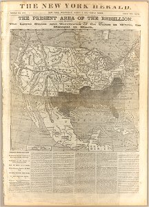
slavery in the united states
carte de france instructive et amusante divisée en quatrevingt six départements - btv1b84949605
bibliothèque nationale de france
carte de france instructive et amusante divisée en quatrevingt six départements - btv1b84949605
bibliothèque nationale de france
cornell: persuasive cartography: the pj mode collection
arthur wellesley, 1st duke of wellington
frontispieces from england
maps by william faden
prints by mario cartaro
old maps of jerusalem
old maps of europe
achille belloguet
old maps of europe
achille belloguet
historical map collection
maps of new france
sanson maps of asia
1670s maps of asia
cartouche (cartography)
cornelis danckerts (ii)
cornell: persuasive cartography: the pj mode collection
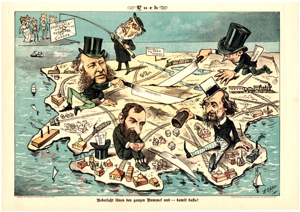
puck, 1882
1830s maps of switzerland
1834 maps of europe
military cartographic institute (prague)
cultural monuments in bubeneč
1810s maps of the iberian peninsula
maps of spain by tomas lopez
old constellation maps
maps by samuel dunn
1858 van de velde maps of palestine and jerusalem
1850s maps of lebanon
an account of the pelew islands
1793 fleurons
atlas maior, vol 3 (germany) - joan blaeu, 1667 - bl 114.h(star).3
copper engraving print
henricus hondius ii, nova totius terrarum orbis geographica ac hydrographica tabula, 1630
eran laor cartographic collection
an account of the pelew islands
1788 fleurons
cartouche (cartography)
pierre mariette i
1667 map of madagascar by guillaume sanson
bibliothèque nationale de france
atlas van der hagen (volume 4)
german renaissance
atlas maior, vol 2 (sweden, russia, poland, eastern europe, and greece) - joan blaeu, 1667 - bl 114.h(star).2
magni ducatus lithuaniae
laurent jean-françois truguet
cartouche (cartography)
cartouche (cartography)
jean-claude dezauche
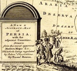
1747 persia map by emanuel bowen
cartouche (cartography)
maps in the british museum
clément-pierre marillier
pierre alexander tardieu
delaval (surname)
cartouche (cartography)
nicholas tindal
cartouches by joseph roux
cartouche (cartography)
van langren map of southeast asia
1595 maps of asia
henricus hondius ii, nova totius terrarum orbis geographica ac hydrographica tabula, 1630
eran laor cartographic collection
henricus hondius ii, nova totius terrarum orbis geographica ac hydrographica tabula, 1630
eran laor cartographic collection
201 - 300 of 353
Next page
/ 4