Bowen, Emanuel. Persia, adjacent countries. 1747 (E), Emanuel Bowen

Bowen, Emanuel. Persia, adjacent countries. 1747 (E), Emanuel Bowen

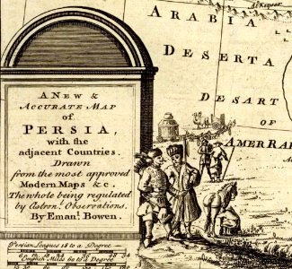
A new & accurate map of persia, with the adjacent countries. Drawn from the most approved modern maps &c, the whole being regulated by astronl. Observations. By emanl. Bowen. (london: printed for william innys, richard ware, aaron ward, j. And p. Knapton, john clarke, t. Longman and t. Shewell, thomas osborne, henry whitridge. M. Dcc. Xlvii). Date: 1747.
Edit image
Published by:
Creazilla
Author: Emanuel BowenSource: commons.wikimedia.org

Loading...

0 downloads
Loading...
cartouche (cartography)1747 persia map by emanuel bowenrichard ware (bookseller)emanuel bowen

MORE LIKE THIS

Creazilla logo
Over 10 million free graphic resources for content creators and designers.
© 2018 - 2025 Creazilla
Our resourcesAll imagesPhotosDigital illustrationsClipartIconsPNG ImagesEmojisSilhouettesTraditional Art3D ModelsVectorsFontsColor namesColor palettesGradientsAudioAnimationVideosTemplates
InformationAbout CreazillaTerms of useTech teamPrivacy policyLicence Information
FeedbackContact Us