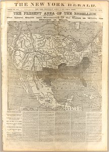
The Present Area of the Rebellion: The Loyal States and Territories of the Union in White, the Disloyal in Black, 1862
After passage of the kansas-nebraska act in 1854, this map illustrats the danger that slavery would spread to newly admitted states in the west. Date: 1862. Dimensions: 34 x 36. Collection: Cornell University Library.