Log in
All resources
Create a design
85 Free Artworks of Maps Of Continents
maps in the rijksmuseum amsterdam
university of washington
maps by emanuel bowen
emanuel bowen
prints of cartouches in the rijksmuseum amsterdam
thomas kitchin
university of texas at arlington
philippe buache
maps by thomas kitchin
1740s maps of the americas
overwintering on nova zembla by willem barentsz, 1596-1597
maps in the rijksmuseum amsterdam
cornell: persuasive cartography: the pj mode collection
cornell university library
description de l'universe
1710s maps of the world
old maps of the dutch east india company - africa
nicolaes visscher ii
19th-century maps of africa
maps with figures
maps of the dutch east india company - madagascar
1635
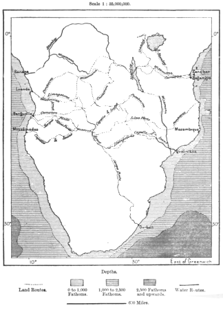
through the dark continent
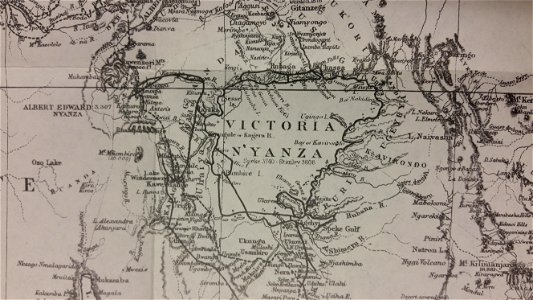
lake victoria
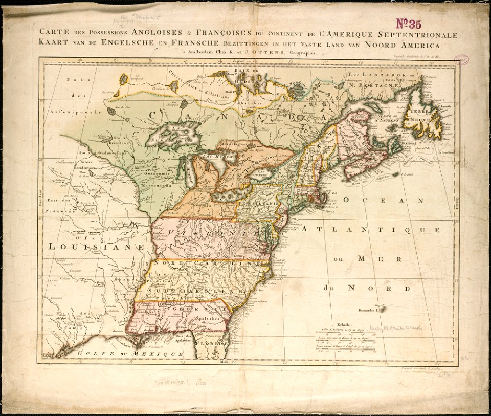
old maps of north america from the norman b. leventhal map center
1755 maps of the united states
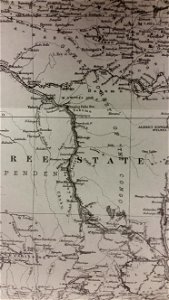
old maps of the democratic republic of the congo
lake tanganyika
coats of arms of switzerland
coats of arms of italy
old maps of the democratic republic of the congo
through the dark continent
old constellation maps
maps by samuel dunn
maps with figures
michael burghers
caricatures
cartoons
eran laor cartographic collection
thomas kitchin
synopsis universae philologiae
maps of continents
alphabet charts
lord's prayer
illustrations de histoire naturelle - tome i - de seve 1749
maps of afro-eurasia
illustrations de histoire naturelle - tome i - de seve 1749
1740s maps of the americas
maps from the earth and its inhabitants, vol. xiii
africa in the 1890s
maps from the earth and its inhabitants, vol. xii
africa in the 1890s
navigantium atque itinerantium bibliotheca
18th-century maps of south asia
details of old maps
michael burghers
old maps of the arctic
maps by emanuel bowen
hemispheres centered south pole
manuscript maps
1750s maps of the caribbean
maps by thomas kitchin
travels on the continent, sicily, and the lipari islands (1829)
19th-century maps of sicily
maps by emanuel bowen
robert sayer
1747 maps of north carolina
maps by emanuel bowen
1740s maps of the world
maps by emanuel bowen
travels on the continent, sicily, and the lipari islands (1829)
floor plans of italy
18th-century maps of north america
1708 maps of north america
1677 maps of asia
georg widmann
maps in the library of congress
1755 maps of north america
18th-century maps of antarctica
1741 maps
maps by emanuel bowen
robert sayer
maps by alain manesson-mallet
maps of greenland
atlas van der hagen (volume 4)
people with animals in art
1830s maps of the world
maps by daniel lizars
historical map collection
maps by emanuel bowen
maps by john cary
1801 maps
maps in the library of congress
1763 maps of north america
wilhelm pleydenwurff
hartmann schedel
1760s maps of the americas
1760 maps
africa in the 18th century
1794 maps of africa
africa in the 18th century
1794 maps of africa
gerardi mercatoris atlantis novi. pars tetria (1638)
17th-century maps of lombardy
johannes honterus
renaissance
maps in the rijksmuseum amsterdam
1820s maps of europe
carte de barbarie, nigritie, guinée par guillaume delisle (1707)
1718 maps of africa
maps by willem and johannes blaeu
1610s maps of the americas
wolffgang hartmann
philipp clüver
atlas van der hagen (volume 2)
atlas van der hagen
german renaissance,northern renaissance
maps in the british museum
prints about plague in the british museum
romanticism
carte de l'amérique septentrionale by guillaume delisle (1700)
1700 maps of north america
1760s maps of the americas
jean janvier
nicolas sanson. “mappe-monde, ou carte generale du monde.”
1667 map of madagascar by guillaume sanson
nicolas sanson. “mappe-monde, ou carte generale du monde.”
map of the bosphorus strait by guillaume sanson (1665)
maps by joachim bormeester
1680s maps of the world
maps of the arctic by gerardus mercator
maps by hendrik hondius the younger
map of italy by guillaume delisle (1700)
1700 maps of italy
1740s maps of the americas
1747 maps of north america
maps by joachim bormeester
1685 maps
maps in the rijksmuseum amsterdam
johannes van den aveelen
french-language maps of north america
1809 maps of north america
carte de l'afrique françoise par guillaume delisle (1726)
philippe buache
carte des côtes de malabar et de coromandel (1723)
philippe buache
cartouches by guillaume delisle
philippe buache
maps of the iberian peninsula by guillaume delisle
1700s maps of the iberian peninsula
carte de barbarie, nigritie, guinée par guillaume delisle (1707)
university of washington
carte de l'isle de ceylan by guillaume delisle (1722)
philippe buache
maps in the rijksmuseum amsterdam
maps by willem and johannes blaeu
carte de moscovie by guillaume de l'isle (1706)
university of washington
maps in the rijksmuseum amsterdam
old maps of 's-hertogenbosch
map of europe by guillaume delisle (1700)
university of washington
maps in the rijksmuseum amsterdam
maps by willem and johannes blaeu
prints published by claes jansz. visscher (ii) in the rijksmuseum amsterdam
maps in the rijksmuseum amsterdam
maps in the rijksmuseum amsterdam
maps by willem and johannes blaeu
maps in the rijksmuseum amsterdam
works after adriaen van de velde
maps of the captaincy general of cuba
maps of the history of florida
maps in the rijksmuseum amsterdam
etchings of bulls
theodoor galle
baroque
prints published by philips galle in the rijksmuseum amsterdam
prints of cartouches in the rijksmuseum amsterdam
old maps of the viceroyalty of new spain
the spanish borderlands
1 - 85 of 85
/ 1


![Titelblad] AFRICA](https://cdn.creazilla.com/illustrations/10000408184/titelblad-africa-sm.webp)