Log in
All resources
Create a design
112 Free Artworks of Old Maps Of Russia
old maps of the tsardom of russia
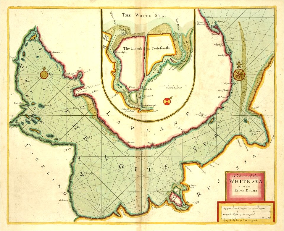
old maps of the white sea
maps of the barents sea
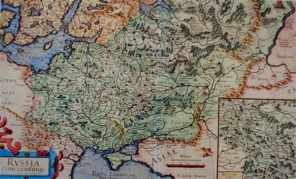
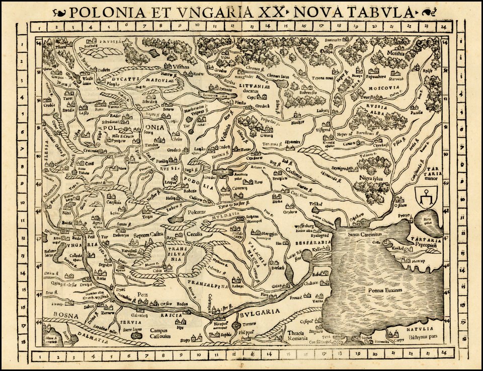
latin-language maps
dutch-language maps
baptista van doetecum
northern sea route
old maps of scandinavia
19th-century maps of the black sea
third voyage of willem barentsz
maps from the earth and its inhabitants, vol. vi
russia in the 19th century
third voyage of willem barentsz
16th-century maps of the arctic
maps from the earth and its inhabitants, vol. vi
russia in the 19th century
third voyage of willem barentsz
history of dutch sea fisheries
third voyage of willem barentsz
history of dutch sea fisheries
third voyage of willem barentsz
16th-century maps of the arctic
third voyage of willem barentsz
16th-century maps of the arctic
the voyage of the vega round asia and europe
third voyage of willem barentsz
maps from the earth and its inhabitants, vol. vi
charles eugène perron
overwintering on nova zembla by willem barentsz, 1596-1597
maps in the rijksmuseum amsterdam
overwintering on nova zembla by willem barentsz, 1596-1597
maps in the rijksmuseum amsterdam
itinerario (jan huygen van linschoten)
latin-language maps
clothing of russia
ships on maps
old maps of the tsardom of russia
atlas novus (blaeu)
old maps of the tsardom of russia
red ruthenia
old maps of china
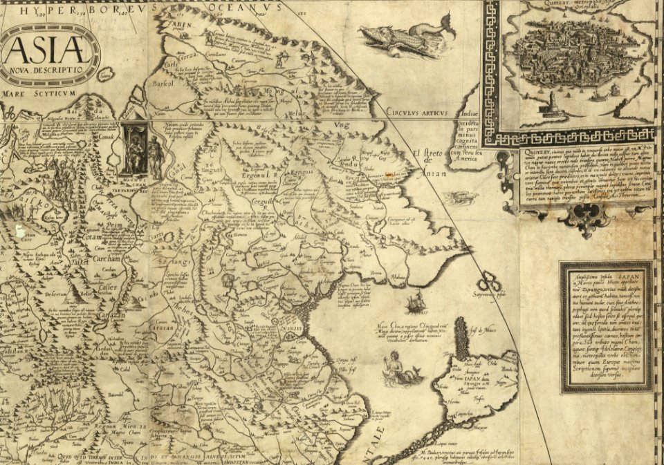
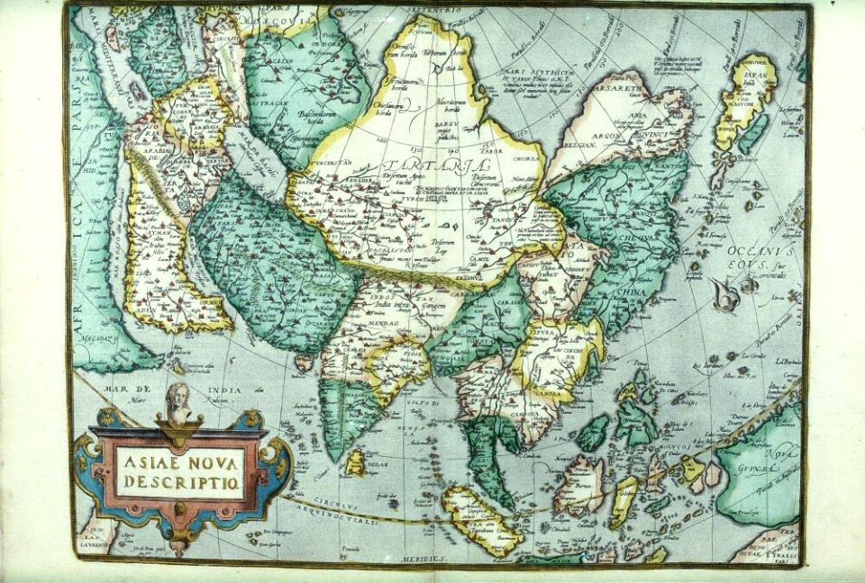
old maps of asia
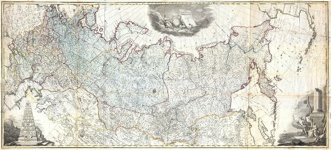
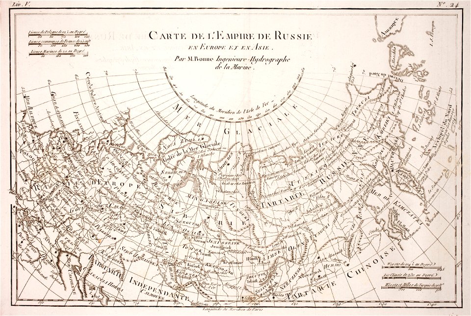
old maps of the russian empire
1855 maps
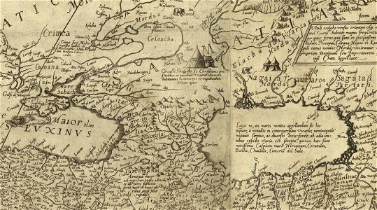
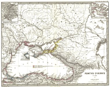
16th-century maps of the black sea
battista agnese
atlante veneto (raremaps.com) volume 2
old maps of russia
old maps of the tsardom of russia
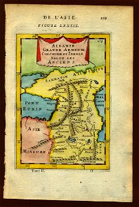
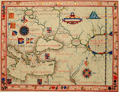
old maps of the middle east
16th-century maps of the black sea
maps of the middle east
16th-century maps of the black sea
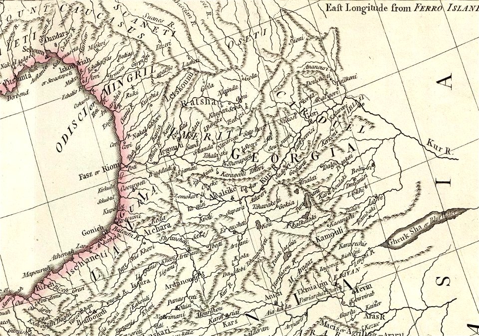
16th-century maps of georgia
coats of arms of the tsardom of russia
crowned double-headed eagles
david rumsey historical map collection
old maps of samegrelo
old maps of the tsardom of russia
1590 maps
old maps of the russian empire
latin-language maps
17th-century maps of georgia
old maps of turkey
maps by johannes janssonius
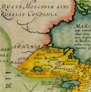
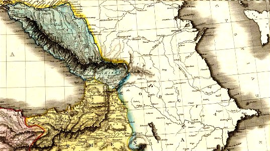
old maps of armenia
crowned eagles argent
pictorial maps
old maps of the tsardom of russia
history of valuyki
old maps of indonesia
old maps of japan
david rumsey historical map collection
jr
images from the new york public library
old maps of the tsardom of russia
old maps of the russian empire
johannes ratelband
david rumsey historical map collection
old maps of samegrelo
david rumsey historical map collection
old maps of samegrelo
16th-century maps of the black sea
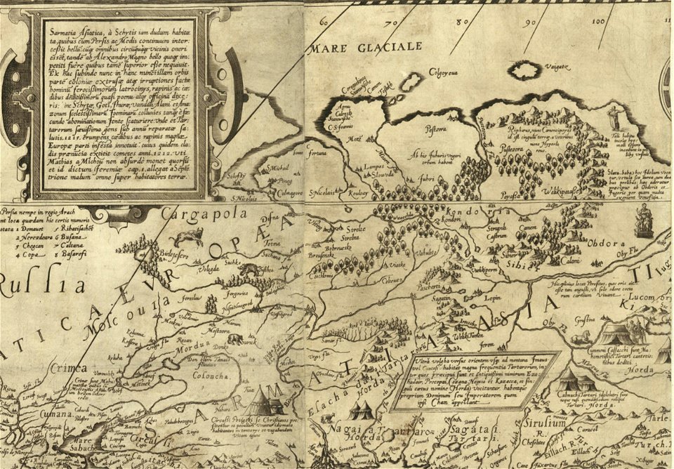
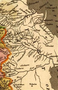
old maps of the caspian sea
david rumsey historical map collection
jr
16th-century maps of the black sea
old maps of the middle east
atlante veneto (raremaps.com) volume 2
old maps of russia
description de l'universe
alain manesson-mallet
description de l'universe
alain manesson-mallet
old maps of samegrelo
french-language maps
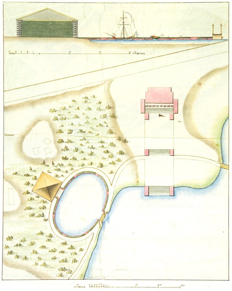
1790s drawings
palace park
volume 2 of le tour du monde
old maps of russia
pictorial history of the russian war 1854-5-6 by george dodd
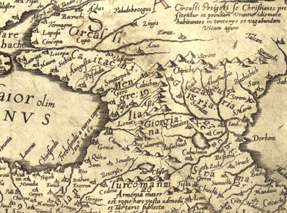
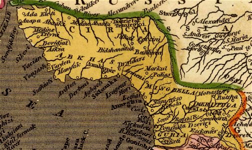
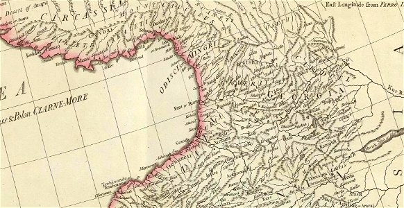
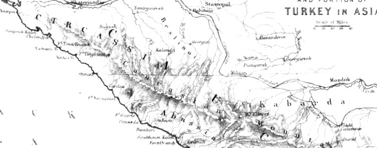
maps of circassia
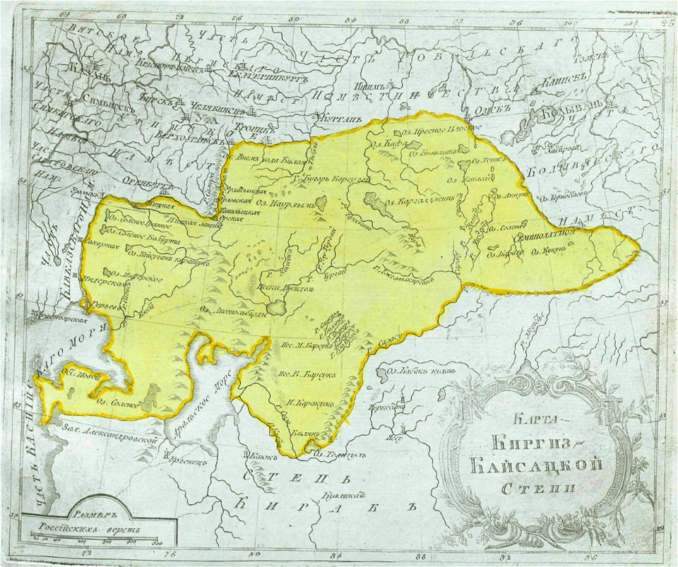
maps of central asia
maps of kazakhstan
david rumsey historical map collection
old maps of the caspian sea
old maps of india
old maps of tibet
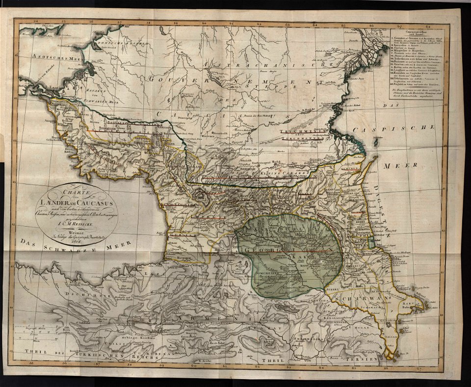
19th-century maps of the caucasus
maps of circassia
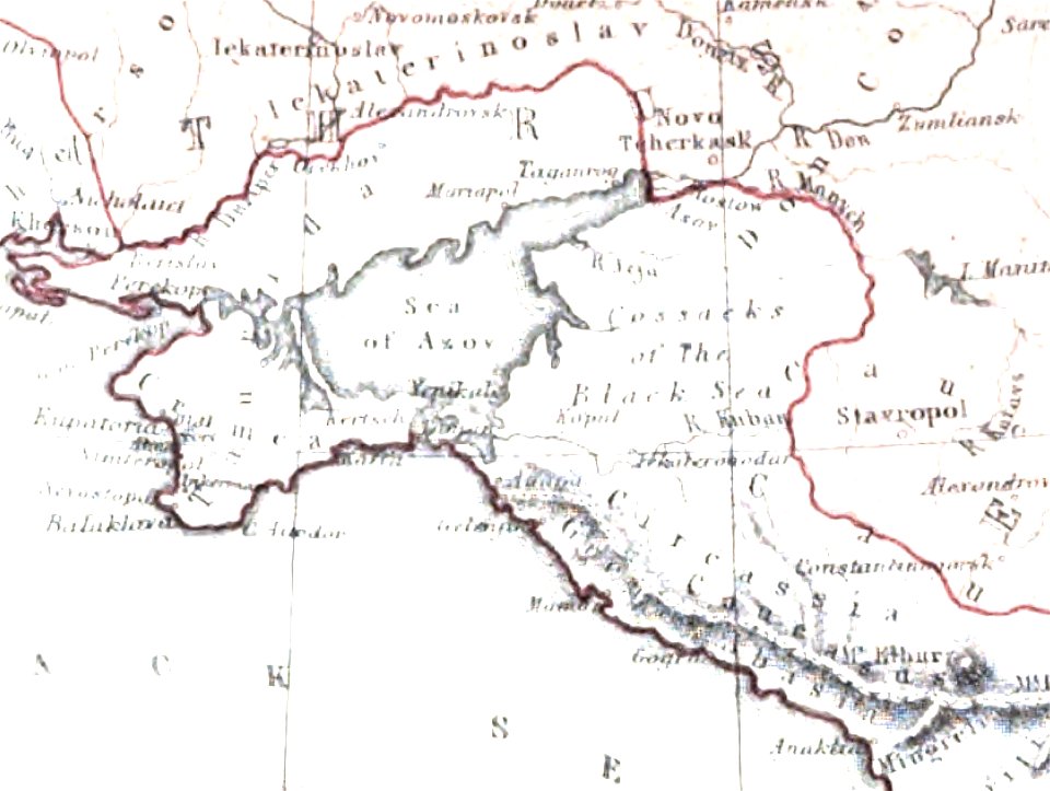
old maps of the sea of azov
maps of circassia
kutepov's hunting - illustrations (volume 1)
old maps of the tsardom of russia
maps in the library of congress
1720 maps
19th-century maps of the caucasus
karl spruner von merz
maps in the library of congress
1720 maps
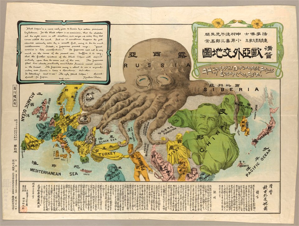
caricatures of wilhelm ii of germany
cornell university library
maps by sebastian münster
old maps of crimea
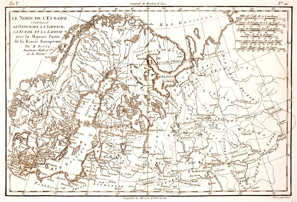
1780 maps of finland
1780 maps of norway
1780 maps of russia
bonne projection
kutepov's hunting - illustrations (volume 1)
old maps of the tsardom of russia
christian gottfried heinrich geißler
19th-century maps of the caucasus
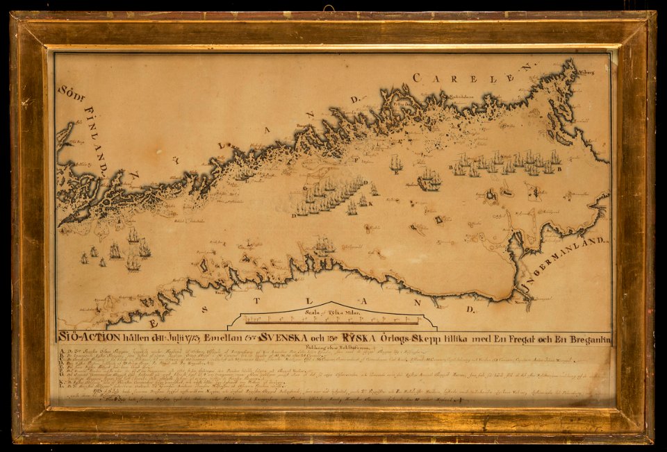
water transport in vyborg
lucas janszoon waghenaer
naval battles involving sweden
russo-swedish war (1788–1790)
russo-turkish war (1877–1878)
old maps of europe
itinerario (jan huygen van linschoten)
latin-language maps
cossack cavalry
kar
1900 maps of russia
1900 maps of china
17th-century maps of estonia
old maps of latvia
russo-turkish war (1877–1878) in art
great eastern crisis (1875–78)
maps by giacomo gastaldi
maps by gerard de jode
19th-century maps of the black sea
1870s maps of the caucasus
old cartoon maps of europe
1870 cartoons
rus' (eastern europe)
1747 maps of russia
old maps of the bering strait
18th-century maps of siberia
maps by girolamo porro
1598 maps of russia
russian empire in thomas kitchen's general atlas (1773)
general atlas (1773)
maps from the earth and its inhabitants, vol. vi
mean precipitation maps
russian empire in thomas kitchen's general atlas (1773)
general atlas (1773)
1855 maps of the russian empire
1850s maps of crimea
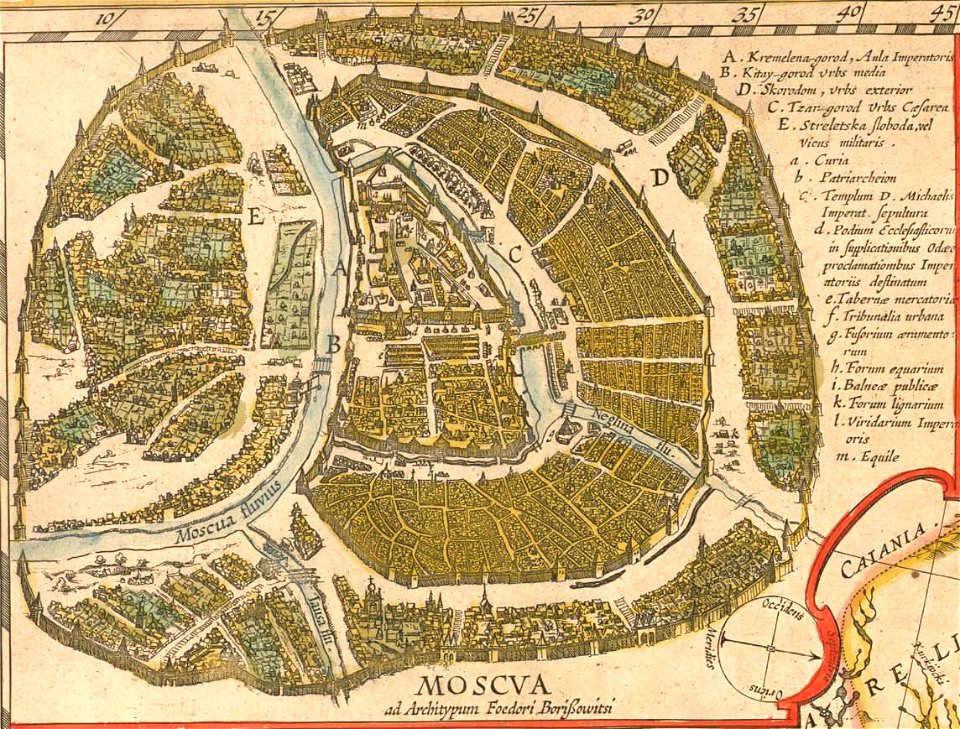
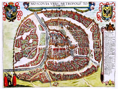
17th-century maps of moscow
maps of the moscow kremlin
18th-century maps of estonia
old maps of livonia
1570s maps of russia
frans hogenberg
maps by john cary
1799 maps
general atlas (1773)
old maps of sakhalin
maps by girolamo porro
1598 maps of russia
old maps of the tsardom of russia
national coat of arms of russia
maps by pieter van der keere
1600s maps of norway
maps by pieter van der keere
maps with cartouches
retro
maps
old maps of the polish-lithuanian commonwealth
1790s maps of poland
retro
maps
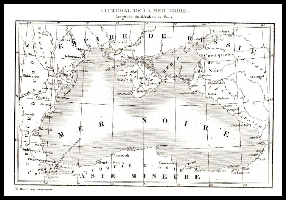
19th-century maps of the black sea
g. h. swanston
old maps of veliky novgorod
maps of velikiy novgorod
19th-century maps of the black sea
g. h. swanston
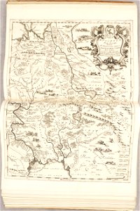
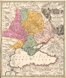
atlas maior, vol 2 (sweden, russia, poland, eastern europe, and greece) - joan blaeu, 1667 - bl 114.h(star).2
17th-century maps of estonia
19th-century maps of the black sea
1870s maps of the caucasus
19th-century maps of the black sea
1870s maps of the caucasus
1710s maps of eastern europe
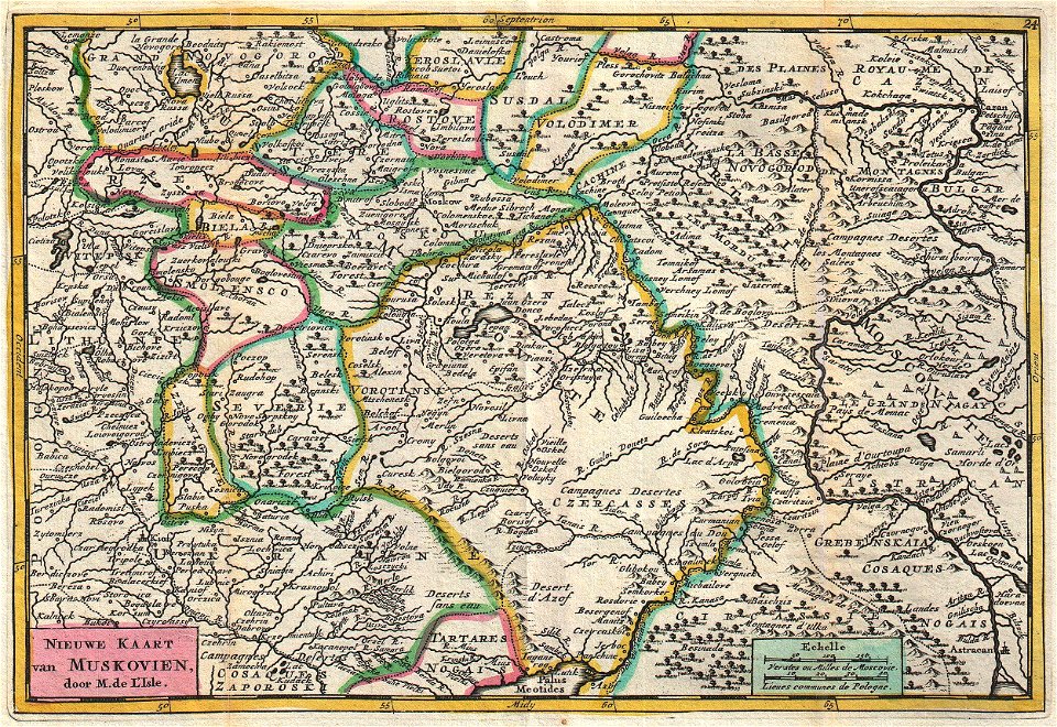
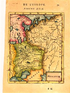
muscovy
old maps of manchuria
general atlas (1773)
riga in the 17th century
old maps of riga
1 - 100 of 112
Next page
/ 2