Log in
All resources
Create a design
41 Free Artworks of Old Maps Of Jersey
old maps of new jersey
maps in the library of congress
o. h. bailey
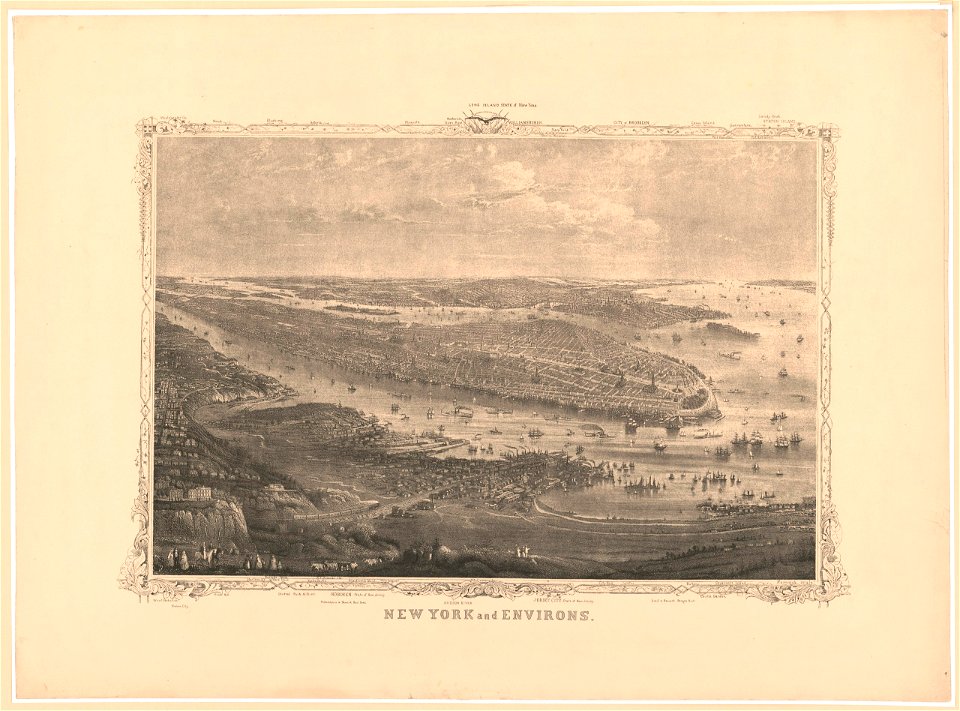
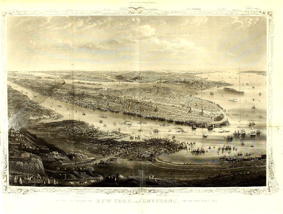
new york city
old maps of manhattan
new york harbor in art
bird's eye view maps of new york city
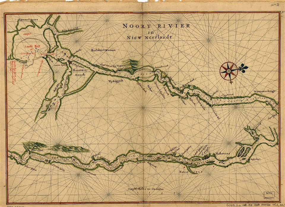
pavonia, new netherland
new jersey
hoboken
1639 maps
1670 maps
city investing building
astor house building
west-indische compagnie
image restoration
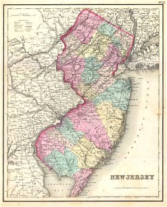
old maps of new jersey
1857 maps
maps in the library of congress
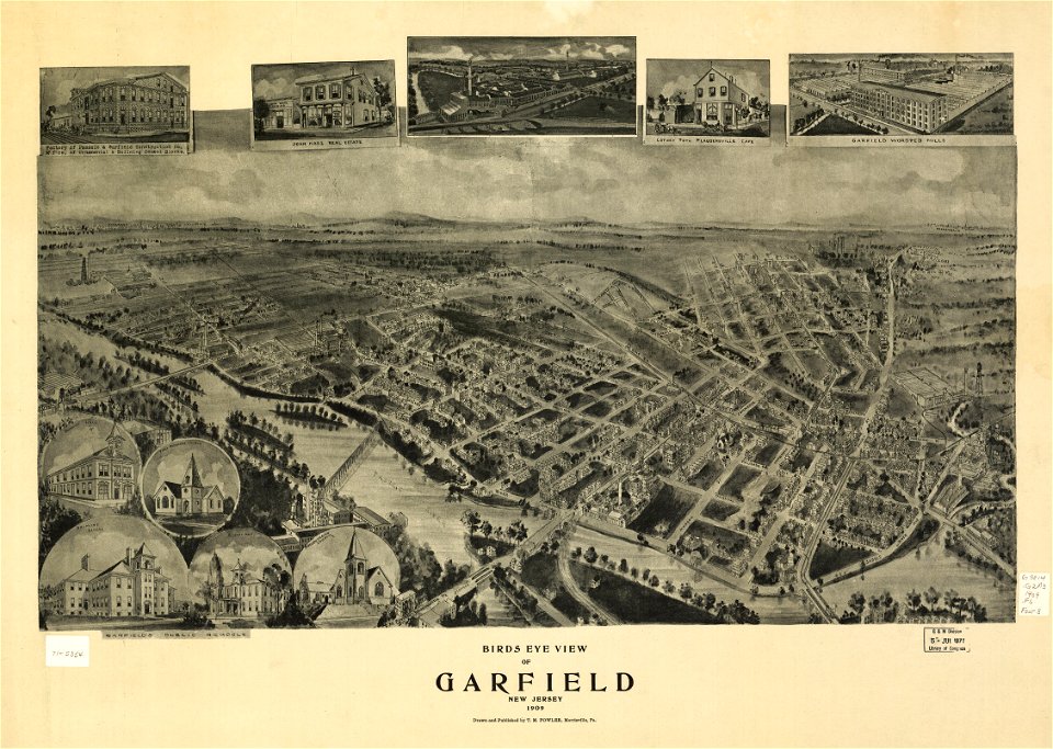
1909 maps
maps in the library of congress
1909 maps
maps in the library of congress
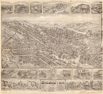
o. h. bailey
maps in the library of congress
o. h. bailey
maps in the library of congress
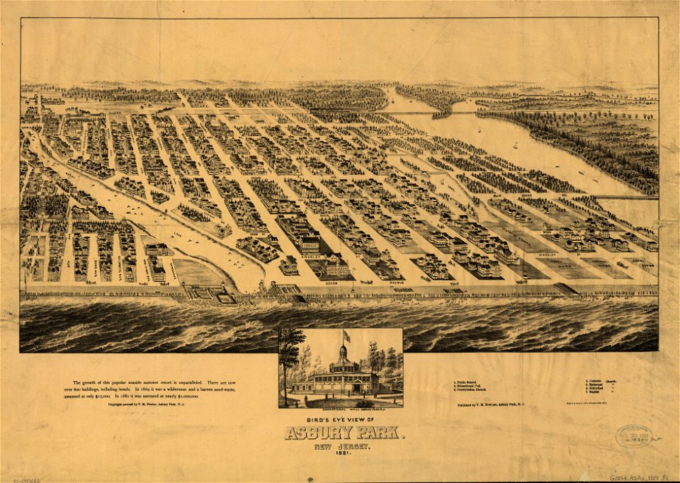
1881 maps
maps in the library of congress
1881 maps
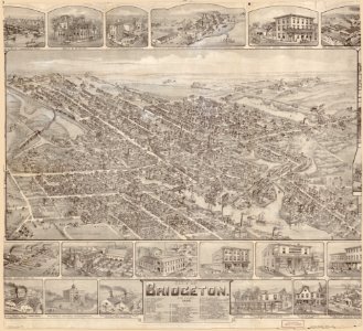
o. h. bailey
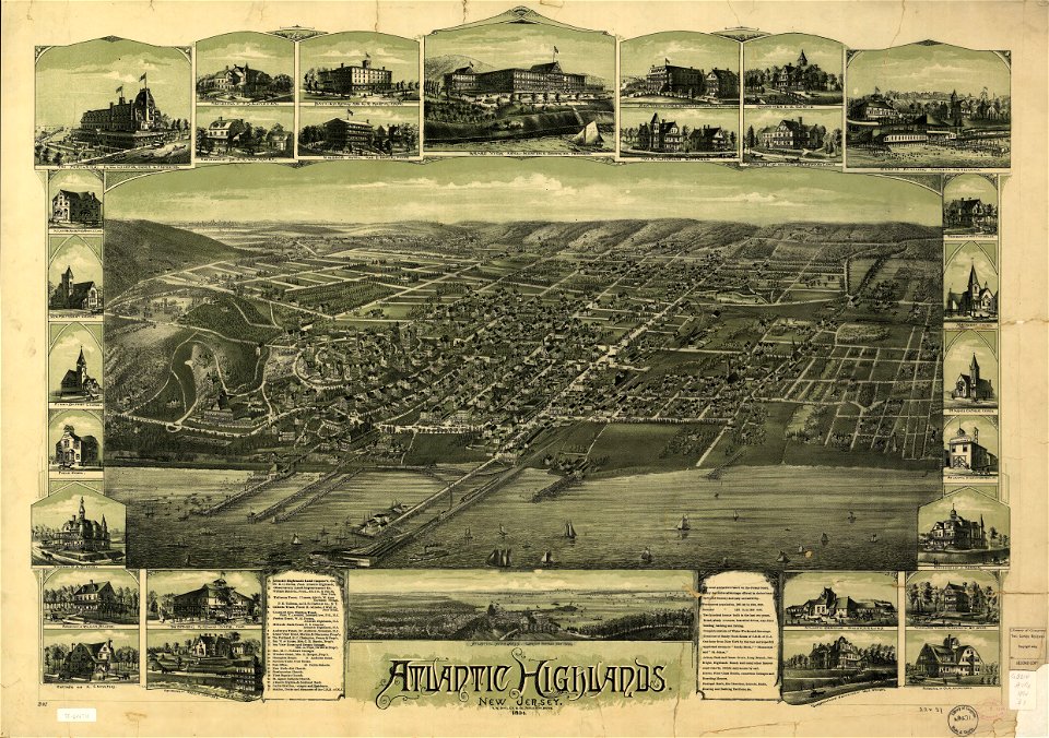
1894 maps
o. h. bailey
1894 maps
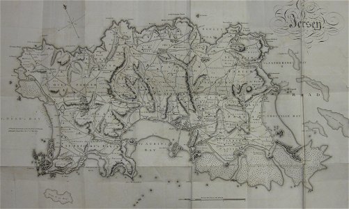
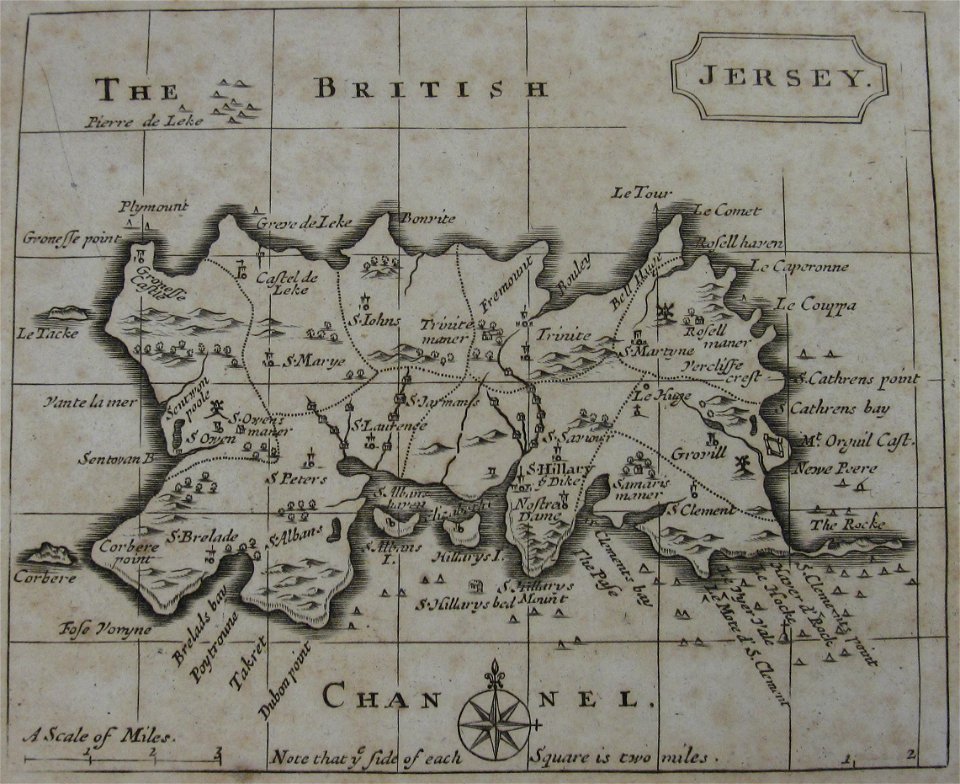
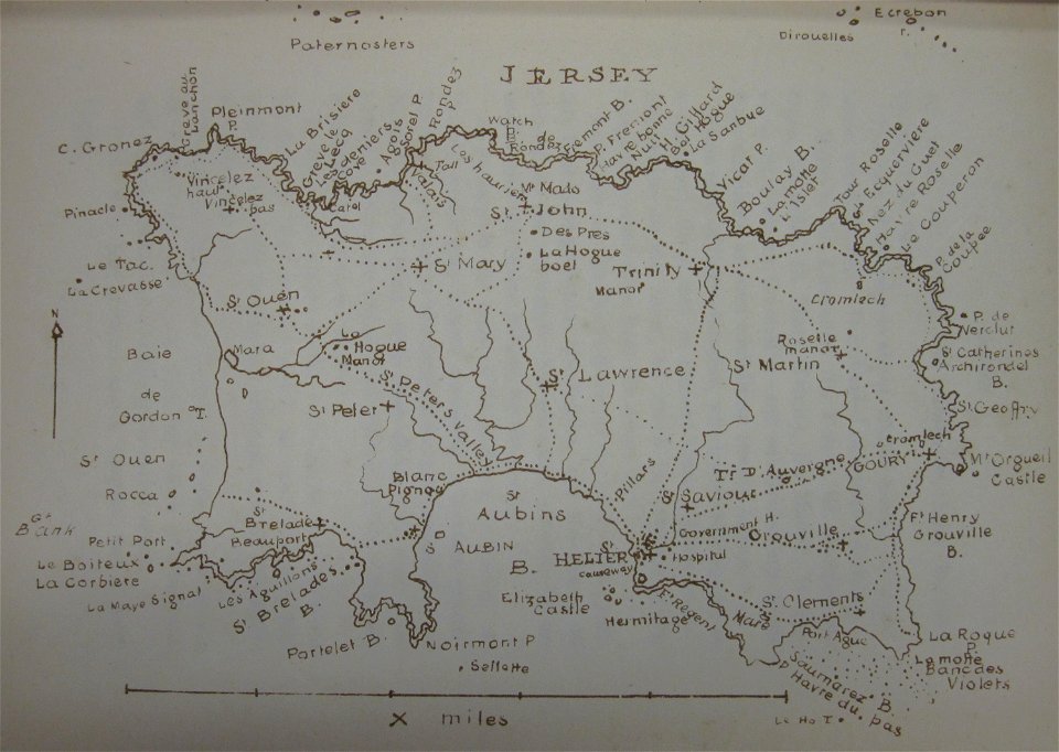
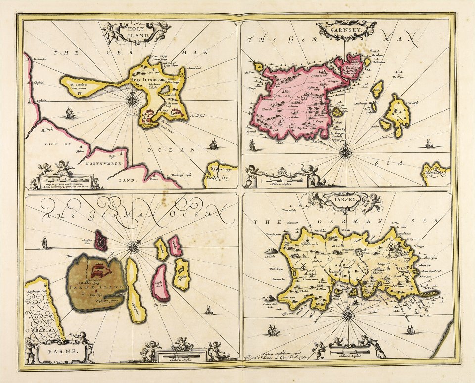
old maps of jersey
1780s maps
old maps of jersey
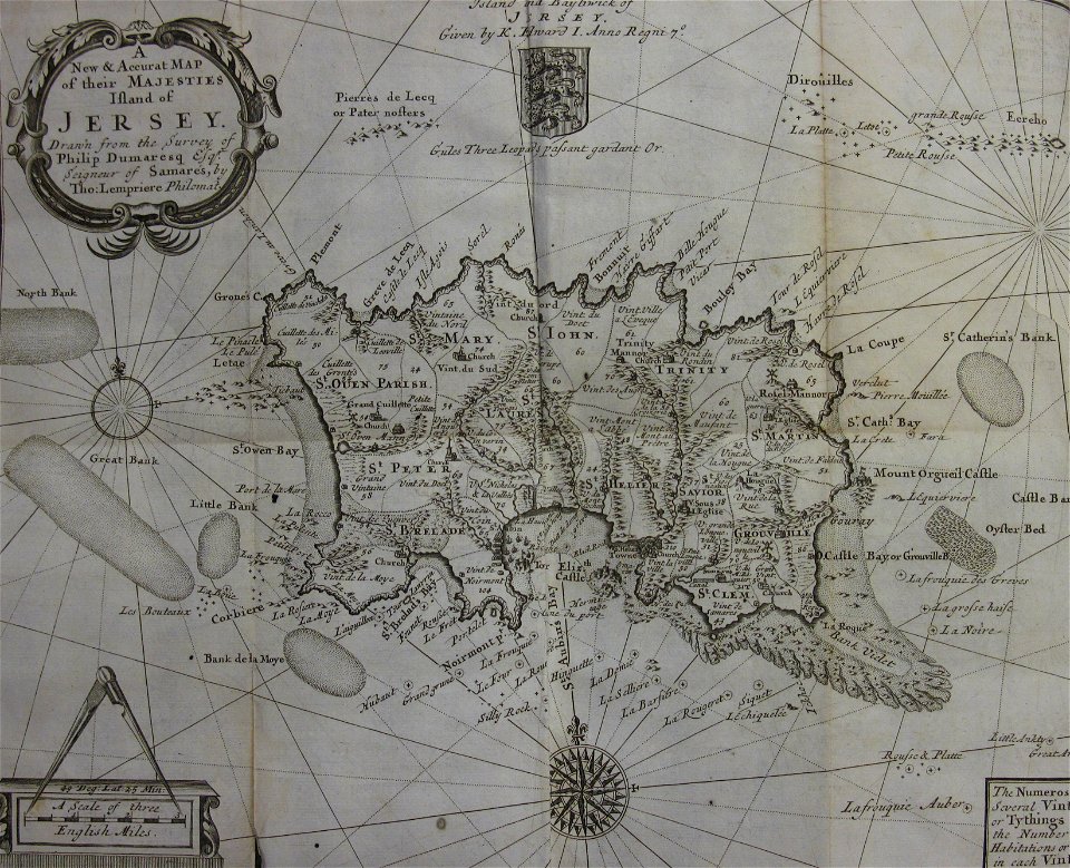
1694 maps
old maps of jersey
1797 maps
maps in the library of congress
1639 maps
images from the new york public library
george hayward
old maps of jersey
1858 maps
maps made in the 17th century
gerard valck
1780 maps of pennsylvania
1780 maps of new jersey
maps in the library of congress
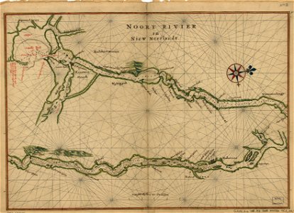
maps of the hudson
new jersey
hoboken
new jersey
hoboken
new jersey
hoboken
chromolithograph
new york city
maps by willem and johannes blaeu
hudson valley
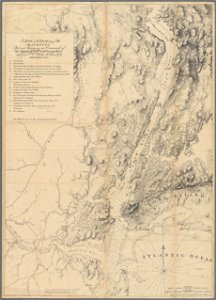
a plan of the operations of the king's army under the command of general sr. william howe, k.b. in new york and east new jersey, against the american forces commanded by general washington, from the 12th. of october, to the 28th. of november 1776
old maps of new york (state) from the norman b. leventhal map center
maps by willem and johannes blaeu
new amsterdam
old maps of guernsey
old maps of jersey
historical collections of the state of new jersey (1868)
1860s maps of new jersey
maps in the library of congress
old maps of new jersey
manual of the corporation of the city of new york (1858)
battle of long island
1777 maps of new york (state)
1777 maps of new jersey
historical collections of the state of new jersey (1852)
1852 maps of the united states
old maps of manhattan, new york city
croton aqueduct
18th-century maps of north america
1708 maps of north america
maps in the library of congress
old maps of new jersey
colonial history of the united states
old maps of new york (state)
1806 maps of the united states
maps by john cary
independence hall, philadelphia in the 1750s
east prospect of the city of philadelphia
1821 maps of the united states
maps by john cary
1 - 41 of 41
/ 1