Log in
All resources
Create a design
26,489 Free Artworks of Map
bibliothèque nationale de france
maps by willem and johannes blaeu
national library of poland
maps by gerard valck
maps by pieter schenk (i)
municipal library of trento
gerard valck
maps in the library of congress
africa in the 1890s
joan blaeu
john rocque 1746 crops from library of congress
maps in the library of congress
maps from the earth and its inhabitants, vol. xiii
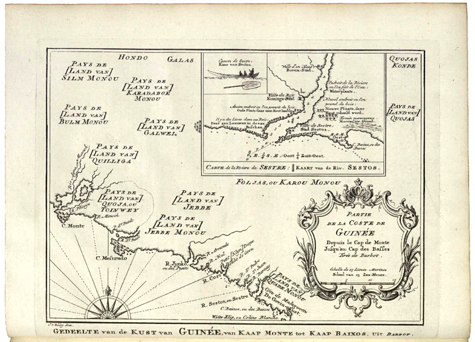
maps of africa
maps by willem and johannes blaeu
17th-century maps of silesia
gemeente atlas van nederland - south holland
maps of schipluiden
maps of amersfoort by braun & hogenberg
maps by jan janssonius
maps of bilbao by braun & hogenberg
bilbao
19th-century maps of dresden
johanniskirche (dresden)
1762 maps of north america
maps by tomas lopez
1800s maps of the iberian peninsula
maps of spain by tomas lopez
maps of the iberian peninsula by guillaume delisle
1700s maps of the iberian peninsula
english-language maps
maps by john cary
maps in the library of congress
1851 maps of new york (state)
maps in the library of congress
1768 maps of north america
tōzai ezo sansen chiri torishirabezu
oshima peninsula
glaciers and glaciation (1910)
maps of glaciers of alaska
media from the national library of finland
classicism
description de l'universe
old maps of patmos
description de l'universe
1680s maps of germany
description de l'universe
1680s maps of ireland
maps in the british museum
hitchin herts
vrbivm praecipvarvm totivs mvndi liber tertivs (1616)
maps of venlo by braun & hogenberg
vrbivm praecipvarvm totivs mvndi liber tertivs (1616)
maps of walcourt by braun & hogenberg
old maps of guizhou
maps from gallica
maps from the earth and its inhabitants, vol. xi
africa in the 1890s
maps from the earth and its inhabitants, vol. xiii
africa in the 1890s
maps from the earth and its inhabitants, vol. xi
africa in the 1890s
maps made in the 17th century
1630s maps of taiwan
hendrik van langren map of south asia
1590s maps of india
maps by willem and johannes blaeu
maps of szolnok
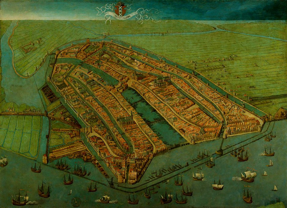
anthonisz., cornelis - gezicht op amsterdam in vogelvlucht - amsterdam museum
amsterdam
old maps of nova belgica et anglia nova
maps made in the 17th century
maps of the mexican-american war
maps by joseph warren revere
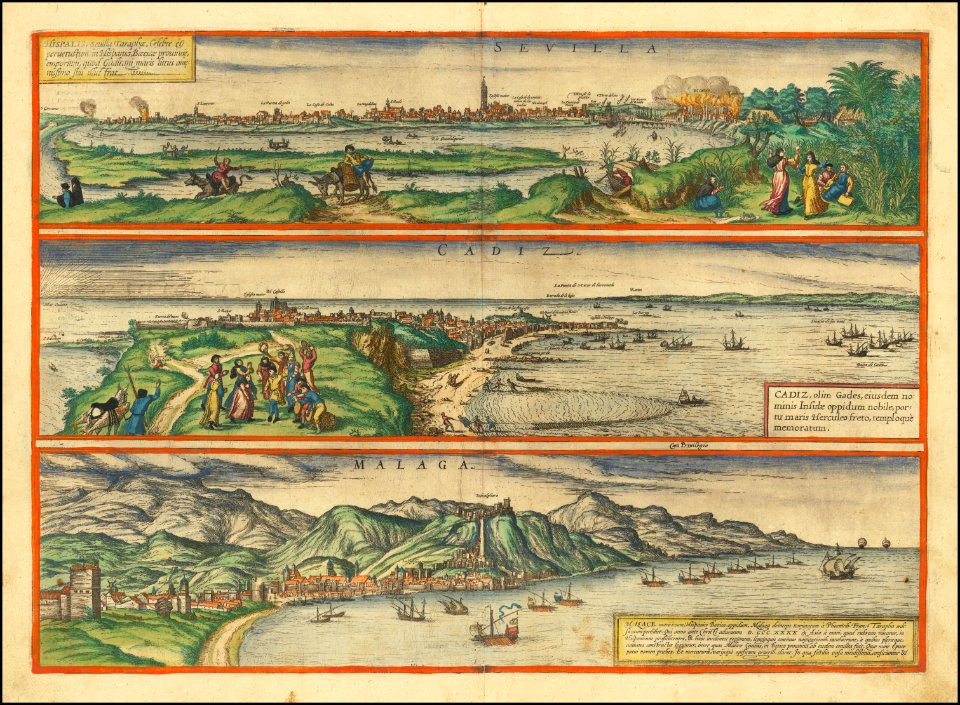
maps of málaga by braun & hogenberg
maps of cadiz by braun & hogenberg
17th-century maps of crimea
1640s maps of ukraine
images of places from encyclopædia britannica
1910s maps of london
curt teich postcard archives
map postcards
images of places from encyclopædia britannica
1910s maps of london
blaeu atlas of scotland 1654
coats of arms on maps
maps by willem and johannes blaeu
1649 maps
maps from the earth and its inhabitants, vol. xii
1892 in africa
duin en kruidberg, santpoort
maps of zuid-kennemerland
maps of oslofjorden
1584 maps of norway
maps of the west-indische compagnie
1705
maps of béthune by braun & hogenberg
city walls of béthune
gewerbe-ausstellung für rheinland, westfalen und benachbarte bezirke
old maps of düsseldorf
chromolithographs in the rijksmuseum amsterdam
maps in the rijksmuseum amsterdam
maps by william home lizars
1836 maps of texas
media from regionaal archief alkmaar
maps of heiloo
media from regionaal archief alkmaar
maps of wieringerwaard
locator maps of countries of europe (gray and green scheme)
maps of tintin
media from regionaal archief alkmaar
maps of heerhugowaard
map of ghent by foppens
road maps of arizona
catalina highway
map of ghent by foppens
maps of the west-indische compagnie
1747 maps of africa
maps in the british museum
taddeo crivelli
maps from kiesslings wanderbuch für die mark brandenburg
1898 in berlin
admiralty charts region r: usa and mexico west coasts
admiralty charts 401-600
17th-century maps of lombardy
17th-century maps of piedmont
the history and antiquities of the parish of lambeth, and the archiepiscopal palace (1827)
soil science maps
maps from university of amsterdam special collections
atlas der neederlanden
maps of prince-bishopric of münster
prince-bishopric of osnabrück
atlas maior, vol 12 (america) - joan blaeu, 1667 - bl 114.h(star).12
1667 maps
maps from university of amsterdam special collections
atlas der neederlanden
old maps of south africa
1879 maps of africa
maps from the earth and its inhabitants, vol. viii
buddhist pilgrimage sites in india
old maps of the bering sea
old maps of kamchatka
maps by willem and johannes blaeu
old maps of sneek
maps by willem and johannes blaeu
old maps of harderwijk
old maps of hesse
baroque
maps by carolus allard
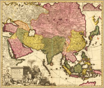
1695 maps of asia
maps by willem and johannes blaeu
ships on maps
maps of the dutch east india company - india
old maps of the dutch east india company
de praecipvis totivs vniversi vrbibvs, liber secvndvs (1575)
maps of kleve by braun & hogenberg
maps by guillaume delisle showing history
old maps of alexander the great's empire
de praecipvis totivs vniversi vrbibvs, liber secvndvs (1575)
maps of wissembourg by braun & hogenberg
laying the atlantic telegraph cable from ship to shore (1857)
valentia island
de praecipvis totivs vniversi vrbibvs, liber secvndvs (1575)
maps of neuss by braun & hogenberg
portrait paintings by giuseppe duprà (house of savoy)
portrait paintings of marie josephine louise of savoy
the geographical distribution of animals (book)
maps of ecozones
maps by willem and johannes blaeu
1634 maps
maps of kodagu district
old maps of india
maps in the rijksmuseum amsterdam
18th-century maps of japan
17th-century maps of dordogne
sarlat-la-canéda
theatre oft toonneel des aerdt-bodems (1571 kb)
maps of wales by humphrey llwyd
drawings in the museu antônio parreiras
canvas
maps made in the 17th century
rethel (territorio)
maps in the library of congress
1713 maps
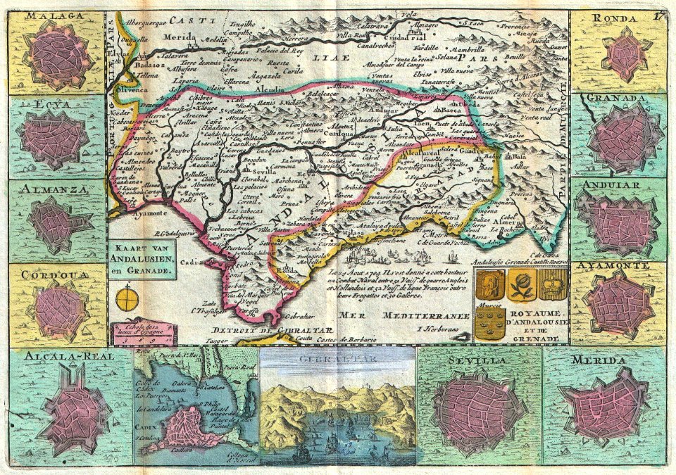
18th-century maps of andalusia
daniel de la feuille
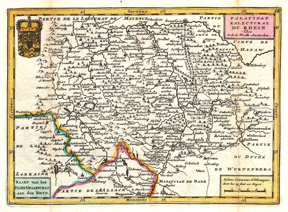
old maps of rhineland-palatinate
daniel de la feuille
maps of the west-indische compagnie
1671
maps of frankfurt (oder) by braun & hogenberg
maps of wittenberg by braun & hogenberg
maps by nicolaes visscher i
maps by daniel stoopendaal
maps of cagliari by braun & hogenberg
maps of valletta by braun & hogenberg
old county maps of the west riding of yorkshire
17th-century maps of yorkshire
old county maps of the east riding of yorkshire
17th-century maps of yorkshire
madrid in the 1820s
maps by juan lopez
old maps of henan
maps with figures
eran laor cartographic collection
pierre mortier
18th-century maps of the bahamas
18th-century maps of hispaniola
3701 - 3800 of 26,489
Next page
/ 265