Log in
All resources
Create a design
216 Free Artworks of 1690 Maps
bibliothèque nationale de france
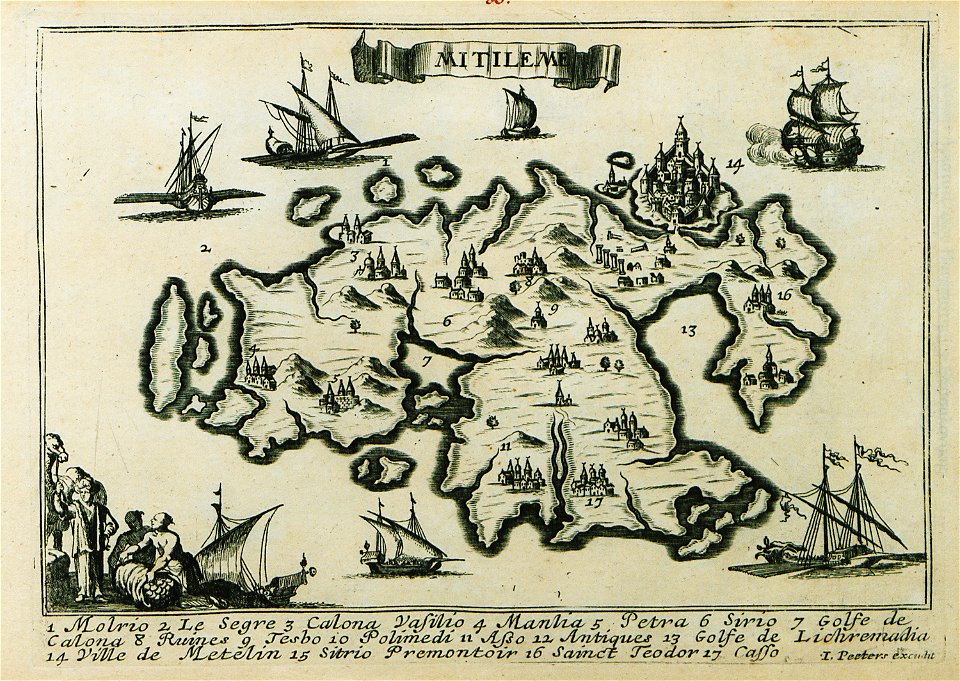
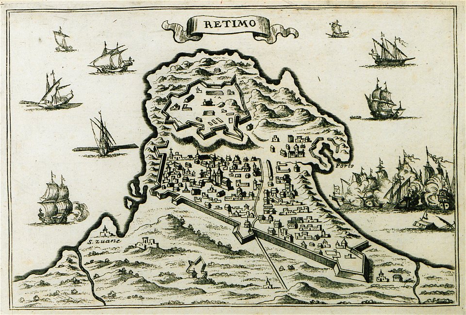
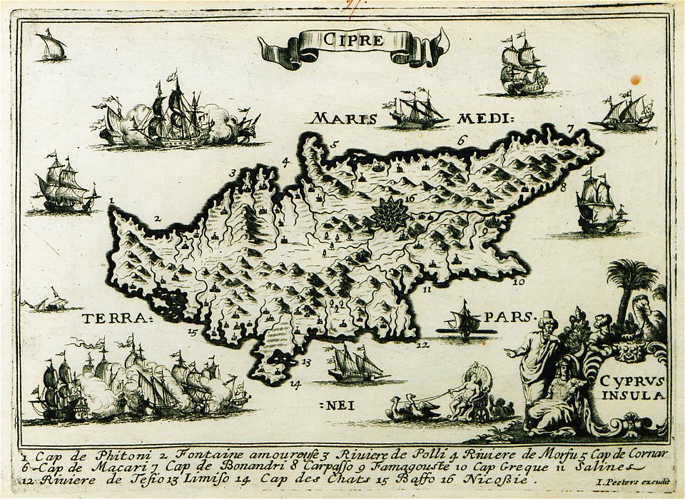
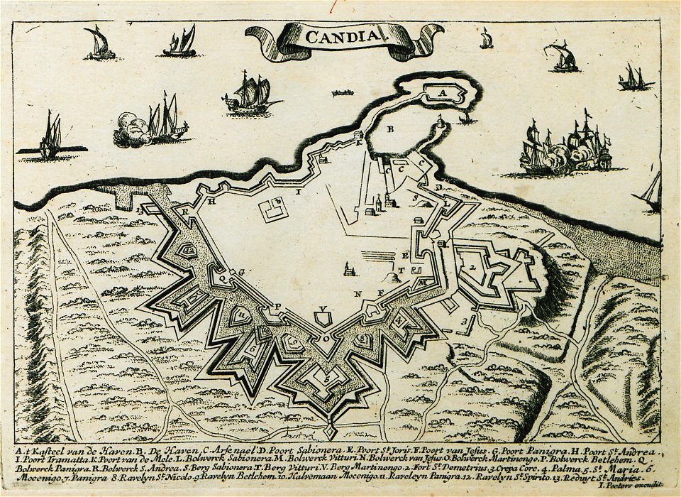
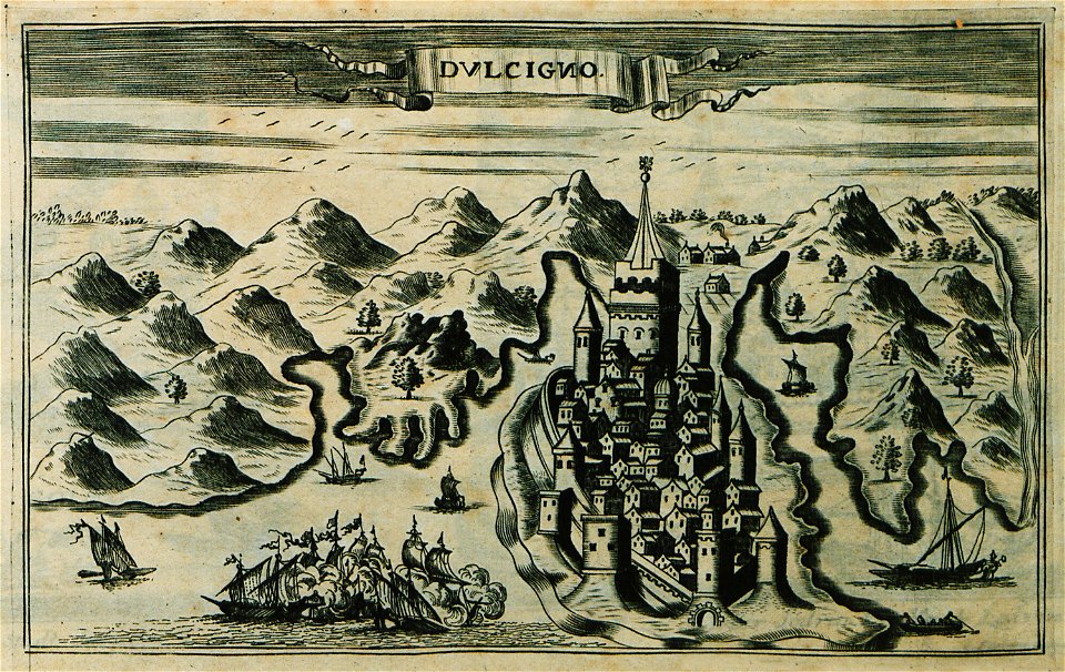
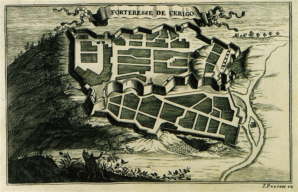
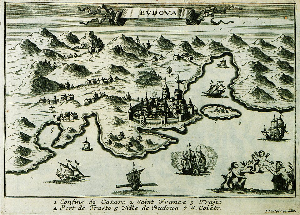
description des principales villes (1690)
jacob peeters
koninklijke bibliotheek
copper engraving print
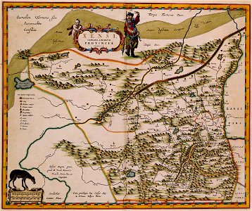
atlas van der hagen
atlas van der hagen (volume 4)
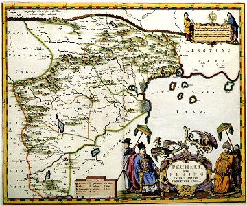
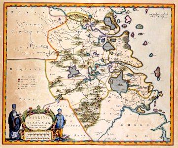
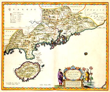
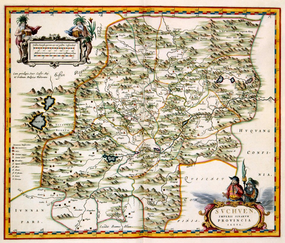
novus atlas sinensis
joan blaeu
maps with figures
atlas van der hagen (volume 4)
atlas van der hagen
atlas van der hagen (volume 4)
atlas van der hagen
lawrence h. slaughter collection of english maps, charts, globes, books and atlases
maps of nieuw nederland
gaspar bouttats
mocha
french-language maps from ios map collection
old maps of carinthia
1690s maps of eastern europe
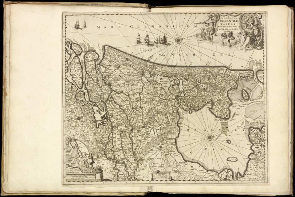
maps by carolus allard
sanson maps of asia
company land
maps of paris from bibliothèque nationale de france
johannes de ram
old maps of cambridge
1690 maps of england
atlas van der hagen (volume 4)
atlas van der hagen
1690s maps of the world
copper engravings
map of the circle of austria by sanson
1690s maps of austria
map of the circle of the rhineland by sanson
maps by nicolas sanson
map of the circle of austria by sanson
1690s maps of austria
map of the circle of austria by sanson
1690s maps of austria
map of the circle of austria by sanson
1690s maps of austria
borders of andorra-france
maps of borders of spain
history of neudenau
nicolaus person
atlas van der hagen (volume 4)
atlas van der hagen
cartouches by willem and johannes blaeu
dutch-language maps
maps by willem and johannes blaeu
dutch-language maps
1690s maps of the tsardom of russia
jacob von sandrart
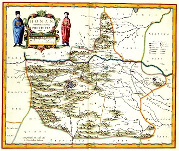
1690s maps of grand duchy of lithuania
maps by carolus allard
maps by nicolaes visscher i
old maps of spain
atlas van der hagen (volume 4)
atlas van der hagen
print room of the university of antwerp
plattegrond van antwerpen
atlas van der hagen
mount wutai
maps of the roman catholic diocese of liège
maps made in the 17th century
description des principales villes (1690)
maps of aegina
maps of alsace by guillaume sanson
1690s maps of baden-württemberg
maps of alsace by guillaume sanson
1690s maps of baden-württemberg
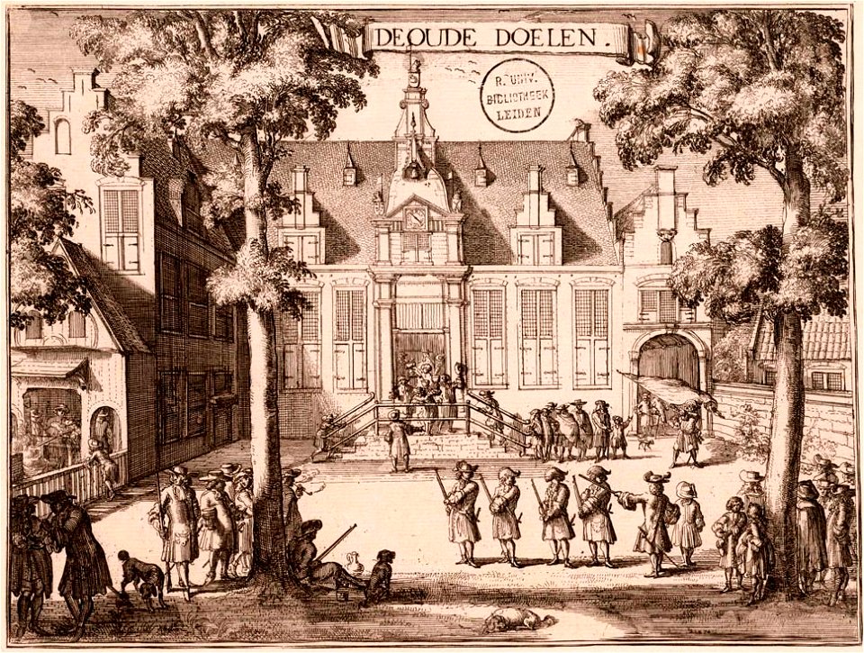
kloveniersdoelen (haarlem)
1689 map of haarlem
1690s maps of france
old maps of orléans
maps in the amsterdam museum
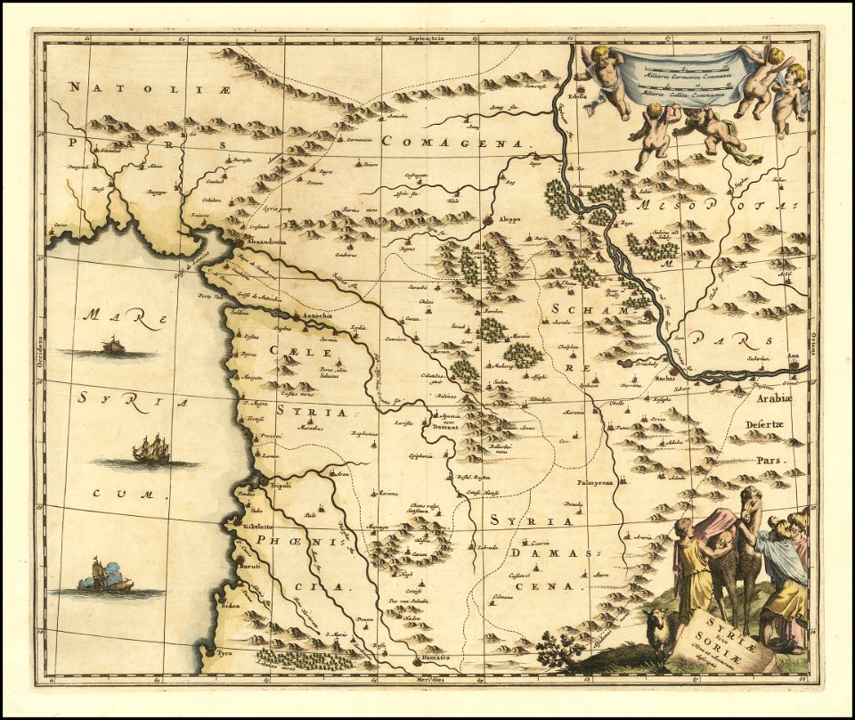
1690s maps of palestine
maps of the duchy of berg
maps by gerard valck
maps of the hague by braun & hogenberg
the hague in the 1690s
1690s maps of baden-württemberg
1690s maps of alsace
maps of alsace by guillaume sanson
1690s maps of alsace
description des principales villes (1690)
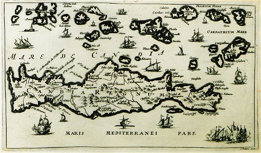
old maps of candia
maps of paris from bibliothèque nationale de france
maps of paris by alexis-hubert jaillot
atlas van der hagen (volume 4)
atlas van der hagen
maps in the stadsarchief amsterdam
maps by carolus allard
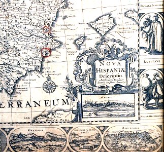
sanson maps of north america
1690s maps of north america
maps of the roman catholic diocese of liège
maps made in the 17th century
atlas van der hagen (volume 4)
atlas van der hagen
1690s maps of greece
maps from gallica
description des principales villes (1690)
old maps of lesbos
description des principales villes (1690)
maps of rethymno
atlas van der hagen (volume 4)
atlas van der hagen
1690s maps of the caribbean
1690s maps of the americas
1690s maps of the world
maps by carolus allard
cartouches by alexis-hubert jaillot
maps by guillaume sanson
nicolaus person
rhenish hesse
maps from university of amsterdam special collections
atlas der neederlanden
description des principales villes (1690)
old maps of athens
sanson maps of north america
island of california
atlas van der hagen (volume 4)
atlas van der hagen
17th-century maps of the eastern mediterranean
1690s maps of turkey
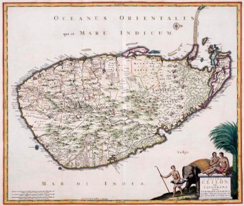
maps of the dutch east india company - sri lanka
1680s
praefectura paranambucae pars borealis, una cum praefectura de itâmaracâ
1690s maps of pernambuco
map of the upper rhenian circle by sanson
maps by nicolas sanson
maps in the british museum
old maps of leeds
description des principales villes (1690)
1690s maps of cyprus
le neptune francois
charles pène 8th
maps in the british museum
william lodge
maps in the british museum
old maps of leeds
landkreis eichsfeld in the 17th century
maps from gallica
suecia antiqua et hodierna, volume 1
17th-century maps of sweden
atlas van der hagen (volume 4)
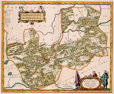
old maps of guizhou
map of the upper rhenian circle by sanson
1690s maps of hesse
art works by johann christian leopold
friedrich bernhard werner
historical map collection
maps of new france
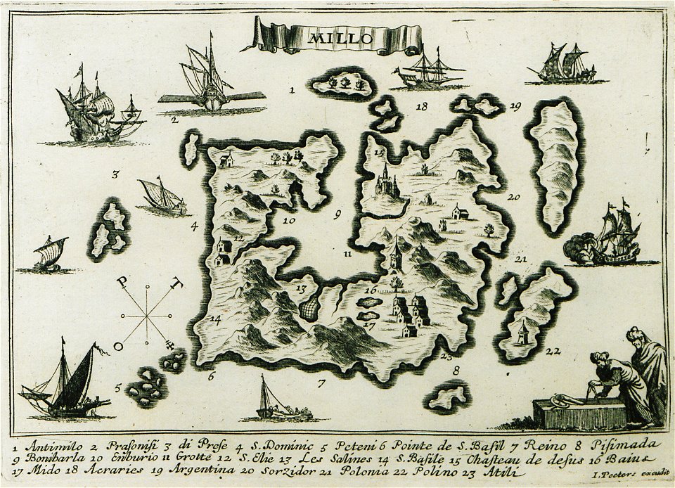
description des principales villes (1690)
old maps of milos
bibliothèque nationale de france
sanson map of lorraine
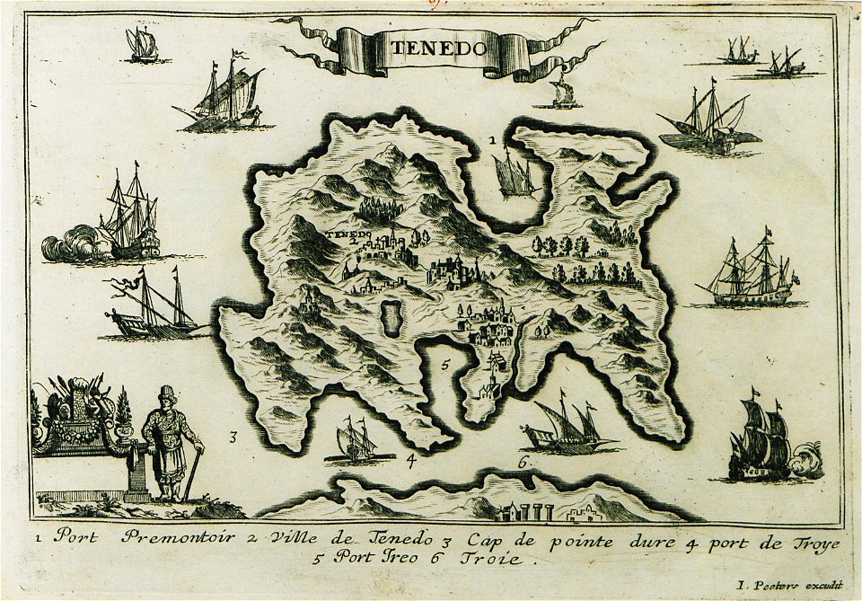
description des principales villes (1690)
old maps of tenedos
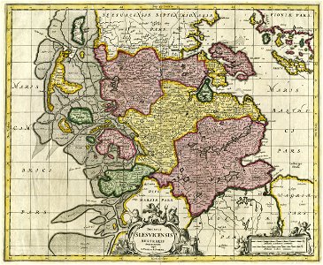
17th-century maps of schleswig-holstein
maps by pieter schenk (i)
bibliothèque nationale de france
sanson map of lorraine
lawrence h. slaughter collection of english maps, charts, globes, books and atlases
novi belgii, atlas maior
atlas van der hagen (volume 4)
people with animals in art
atlas van der hagen (volume 4)
atlas van der hagen
maps from university of amsterdam special collections
atlas der neederlanden
eran laor cartographic collection
jaspar isaac
description des principales villes (1690)
history of nicosia
prints by abraham allard in the rijksmuseum amsterdam
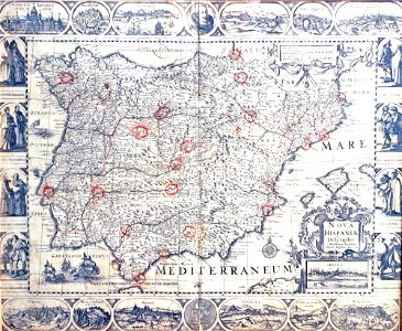
1700s maps of spain
1640s maps of the iberian peninsula
maps by nicolaes visscher i
old maps of atlantis
island of california
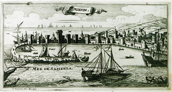
description des principales villes (1690)
old maps of methoni
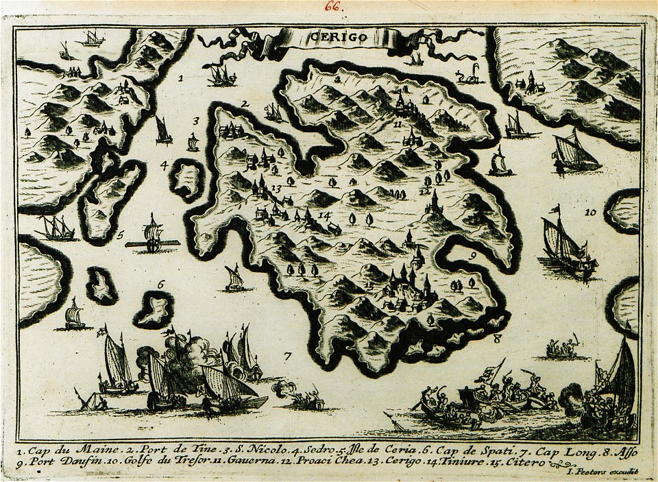
description des principales villes (1690)
old maps of kythira
description des principales villes (1690)
old maps of heraklion
17th-century maps of saxony
1690s maps of saxony
atlas van der hagen (volume 2)
atlas van der hagen
bibliothèque nationale de france
sanson maps of asia
description des principales villes (1690)
ulcinj in the 17th century
description des principales villes (1690)
old maps of kythira
description des principales villes (1690)
history of budva
description des principales villes (1690)
old maps of souda (crete)
description des principales villes (1690)
durrës in the 17th century
map of the circle of austria by sanson
context files from gallica
atlas van der hagen (volume 4)
atlas van der hagen
1690s maps of syria
cornelis de bruyn
1 - 100 of 216
Next page
/ 3