Log in
All resources
Create a design
19 Free Artworks of 17th Century Maps Of Saxony
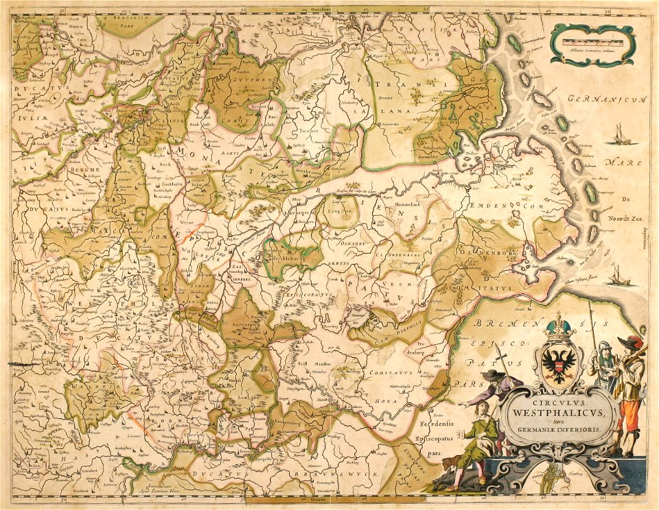
17th-century maps of lower saxony
atlantis magni tomus tertius (biblioteca comunale di trento)
maps made in the 17th century
gerard valck
maps by pieter schenk (i)
baroque
old maps of emden
cities in lower saxony in the 1640s
emden (lower saxony) in the 17th century
atlas novus (blaeu)
new york public library manuscripts
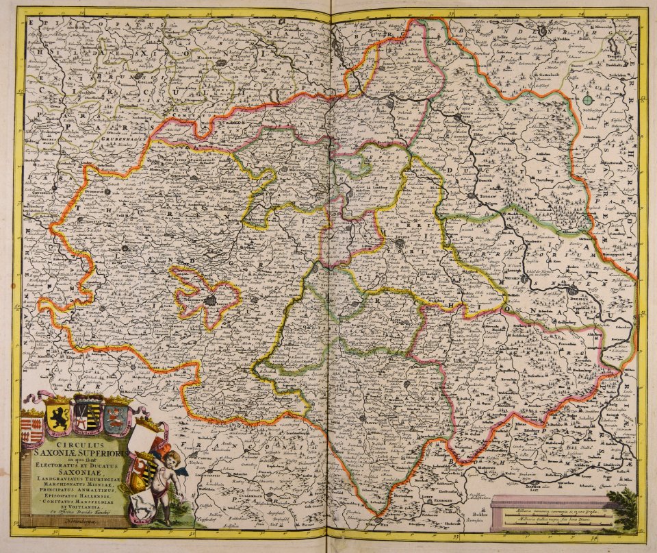
17th-century maps of saxony
old maps of north rhine-westphalia
maps by willem and johannes blaeu
atlantis magni tomus tertius (biblioteca comunale di trento)
maps made in the 17th century
engravings of topographia superioris saxoniae
thüringiae
maps made in the 17th century
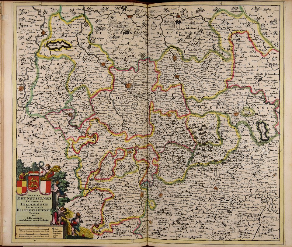
old maps of lower saxony
atlantis magni tomus tertius (biblioteca comunale di trento)
17th-century maps of lower saxony
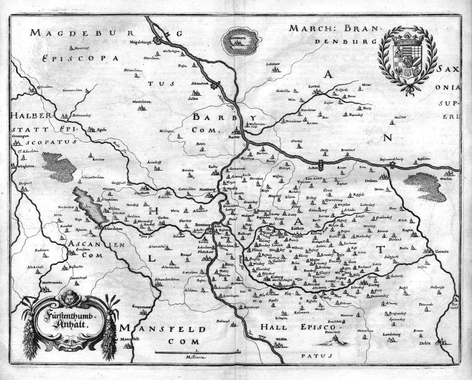
history of mansfeld land
gerard valck
topographia westphaliae (merian)
baroque
old maps of emden
baroque
maps by willem and johannes blaeu
old maps of emden
17th-century maps of lower saxony
atlas novus (blaeu)
hildesheim see coat of arms
coats of arms on maps
engravings of topographia superioris saxoniae, thüringiae, misniae et lusatiae (merian)
baroque
17th-century maps of bremen (state)
1600s maps of lower saxony
17th-century maps of saxony
1690s maps of saxony
17th-century maps of lower saxony
atlas novus (blaeu)
map of the circle of lower saxony by sanson
bibliothèque nationale de france
17th-century maps of lower saxony
maps of the duchy of oldenburg
17th-century maps of saxony
old maps of vogtland
1 - 19 of 19
/ 1