Log in
All resources
Create a design
27,441 Free Images of Maps
eran laor cartographic collection
bibliothèque nationale de france
africa in the 1890s
maps of africa
maps from the earth and its inhabitants, vol. xiii
1600 world map by girolamo porro
leonardo cernoti
girolamo porro
maps from the earth and its inhabitants, vol. x
maps by willem and johannes blaeu
maps from the earth and its inhabitants, vol. xiii
africa in the 1890s
historical images of église saint-nicolas-du-chardonnet
map of paris by braun & hogenberg - derivative files
maps from the earth and its inhabitants, vol. xiii
africa in the 1890s
maps of venice by braun & hogenberg
17th-century maps of venice
maps from the earth and its inhabitants, vol. xiii
africa in the 1890s
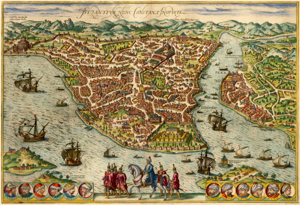
maps of constantinople by braun & hogenberg
1570s maps of istanbul
1600 world map by girolamo porro
leonardo cernoti
1600 world map by girolamo porro
leonardo cernoti
maps of bamberg by braun & hogenberg
map of ghent by jan blaeu
maps by frederick de wit
maps of constantinople by braun & hogenberg
1570s maps of istanbul
1600 world map by girolamo porro
leonardo cernoti
maps of constantinople by braun & hogenberg
1570s maps of istanbul
maps from the earth and its inhabitants, vol. x
old maps of the world
1600 world map by girolamo porro
leonardo cernoti
maps by willem and johannes blaeu
old maps of friesland
maps of the west-indische compagnie
1747 maps of africa
maps of the west-indische compagnie
1747 maps of africa
maps of the island of korčula
gustav freytag (cartographer)
maps of wales by humphrey llwyd
maps of portugal by fernando álvares seco
maps of beaumont by braun & hogenberg
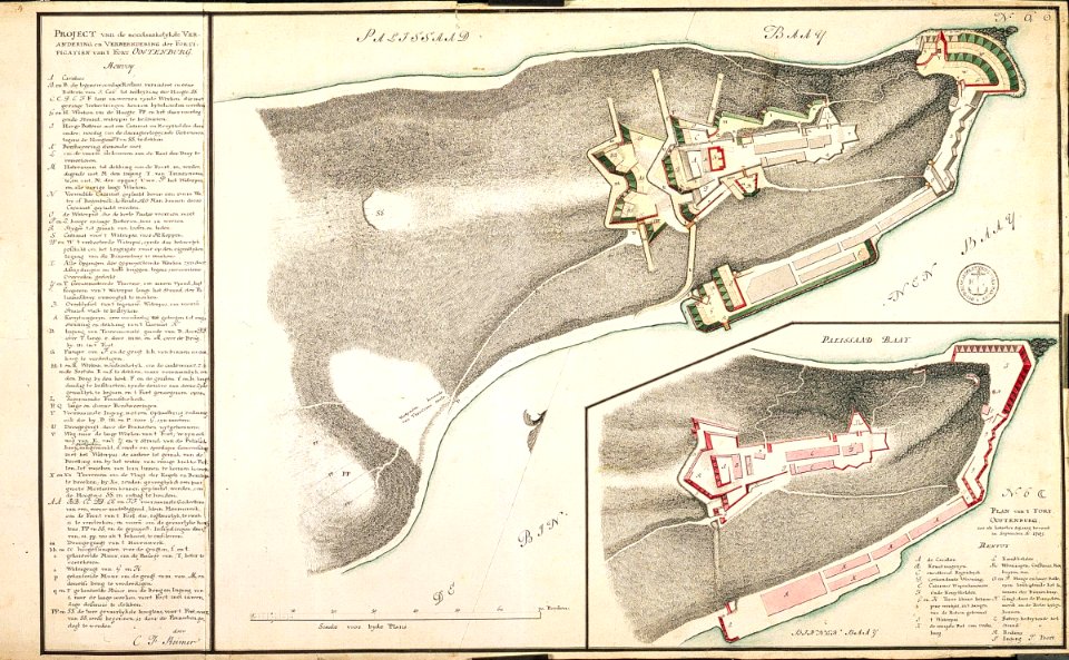
map of maastricht by willem and johannes blaeu (1649)
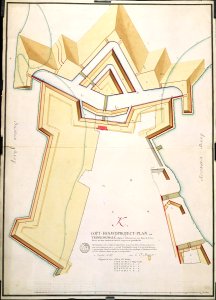
nieuwstad fortifications (maastricht)
maps by petrus schenk
adorf/vogtl.
accuratissima sliae fluminis descriptio
maps by johannes mejer
maps by willem and johannes blaeu
old maps of capitanata
gallery of geographical maps (vatican museums)
fucine plain
turgot map of paris – derivative files
boulevard saint-denis (paris)
atlas ou representation du monde universel t. 1 (1633)
1630s maps of the netherlands
map of the upper rhenian circle by sanson
1690s maps of hesse
the british monarchy (1743)
maps in the british museum
nicolaes visscher ii
maps from gallica
flandria illustrata
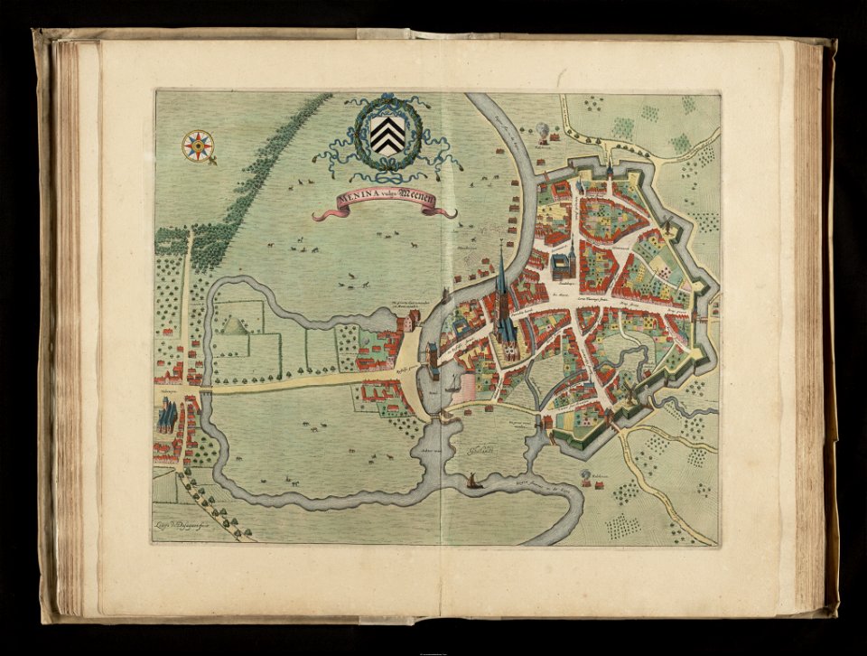
old maps of menen
maps of emden by braun & hogenberg
große kirche (emden)
orbispictus - extracted images
1650s maps of the world
cartes de franz schrader
1894 maps of france
old maps of rovigo
francesco zucchi
maps of the hague by braun & hogenberg
1666 in the hague
old maps of rade de brest
cartes de franz schrader
cartes de franz schrader
maps of canals in france
paper
maps
maps
flag
maps
flag
parchment
paper
old maps of north rhine-westphalia
maps of betuwe
early netherlandish painting
t and o map
maps from the earth and its inhabitants, vol. xiii
africa in the 1890s
maps by alain manesson-mallet
history of galle fort
maps of the battle of shiloh
memoirs of henry villard
gemeente atlas van nederland - north holland
old maps of hoorn, north holland
gemeente atlas van nederland - north holland
bennebroek
maps of edinburgh by braun & hogenberg
18th-century maps of scotland
maps by isaak tirion
1753 maps
17th-century maps of istanbul
baroque
chicago and the midwest, newberry library
rand mcnally
the loyal west in the times of the rebellion (ohio)
maps of the cuyahoga river
gemeente atlas van nederland - north holland
maps of broek in waterland
maps from the earth and its inhabitants, vol. x
1890 maps of egypt
chicago and the midwest, newberry library
rand mcnally
maps from the earth and its inhabitants, vol. x
1890 maps of egypt
maps from the earth and its inhabitants, vol. xi
africa in the 1890s
maps from the earth and its inhabitants, vol. x
pyramids of meroe
maps from the earth and its inhabitants, vol. xi
old maps of oran province
maps of the french invasion of russia
emery walker
maps from the earth and its inhabitants, vol. xii
people of africa in 2009
maps from the earth and its inhabitants, vol. xi
africa in the 1890s
eran laor cartographic collection
tranquillo mollo
eran laor cartographic collection
tranquillo mollo
1800s maps of the americas
maps by john cary
celeberrimi fluvii albis nova delineatio by willem janszoon blaeu
old maps of germany from deutsche fotothek
sanson maps of the netherlands
1700s maps of the netherlands
1782 maps of the caribbean
maps by juan lopez
portrait paintings by james tissot
japonisme,realism
maps of the dutch east india company - sri lanka
maps of fort fredrick
maps of the dutch east india company - sri lanka
maps of fort fredrick
maps by jodocus hondius
maps by john speed
maps by jodocus hondius
maps by john speed
geographia universalis (1545) in the british museum
german renaissance,northern renaissance
17th-century maps of pembrokeshire
old county maps of pembrokeshire
maps of paris from the stanford libraries
1784 maps of france
old maps of haarlem
ideal city
eran laor cartographic collection
renaissance
eran laor cartographic collection
william hughes (geographer)
eran laor cartographic collection
alexander anderson (illustrator)
eran laor cartographic collection
william hughes (geographer)
grandville (caricaturist)
symbolism
eran laor cartographic collection
joan blaeu
eran laor cartographic collection
joris hoefnagel
eran laor cartographic collection
william hughes (geographer)
eran laor cartographic collection
joan blaeu
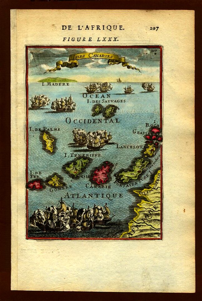
17th-century maps of the canary islands
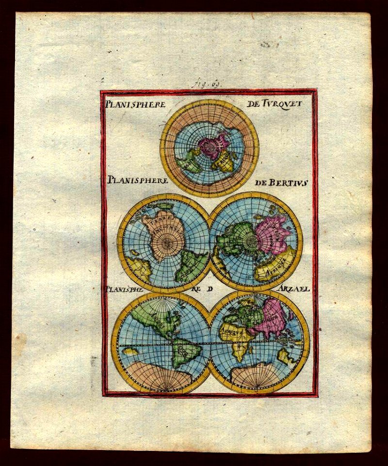
description de l'universe
description de l'universe
1710s maps of the world
maps of the spanish-american war
1890s maps of the philippines
description de l'universe
1680s maps of egypt
maps of the spanish-american war
1890s maps of the philippines
maps from géographie illustrée de la france et de ses colonies
orientalist painting
maps from géographie illustrée de la france et de ses colonies
orientalist painting
old maps of 's-hertogenbosch
details of old maps
maps from university of amsterdam special collections
atlas der neederlanden
maps from university of amsterdam special collections
atlas der neederlanden
8601 - 8700 of 27,441
Next page
/ 275