Log in
All resources
Create a design
27,441 Free Images of Maps
bibliothèque nationale de france
tresor des cartes geographiques (1659)
beschreibung und contrafactur der vornembster stät der welt, liber primus civitates orbis terrarum
eran laor cartographic collection
maps from the earth and its inhabitants, vol. iv
géographie générale; physique, politique et économique (1876)
maps from the earth and its inhabitants, vol. x
scripture sites and scenes, from actual survey (1849)
latin-language maps
1784 fleurons
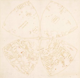
map of the northern hemisphere in four segments (rcin 991393)
high renaissance,renaissance
history of university of amsterdam
old maps of amsterdam
images of venice by jacopo de' barbari in the cleveland museum of art
details of images of venice by jacopo de' barbari
eran laor cartographic collection
willem albert bachiene
le antichità romane (piranesi)
neoclassicism
1806 maps of the united states
maps by john cary
1806 maps of the united states
maps by john cary
a voyage to abyssinia, and travels into the interior of that country, executed under the orders of the british government in the years 1809 & 1810
john outhett
maps from university of amsterdam special collections
atlas der neederlanden
high renaissance,renaissance
old maps of milan
a.de la motraye's travels through europe, asia, and into part of africa (1723) by la mottraye
realism
maps from encyclopædia britannica
emery walker
maps by willem and johannes blaeu
old maps of gelderland
maps of venlo by willem and johannes blaeu
joan blaeu
paintings in the rijksmuseum amsterdam
han van meegeren
maps in the stadsarchief amsterdam
prints by dirk jurriaan sluyter
media from regionaal archief alkmaar
maps of wieringerwaard
voyage pittoresque autour du monde (1822) by louis choris
old maps of the pacific ocean
demolished churches in de barbari map
san boldo (venice)
ceiling of the terrace of the geographical maps (uffizi gallery, florence)
mannerism
nouvelle géographie universelle, vol. ii
schematic maps of france
plenilunii lumina austriaca philippica
maps from gallica
portsmouth earthworks maps
squier and davis images
1560s maps of cyprus
giacomo franco
merian plan of paris - derivative files
baroque
turgot map of paris, kyoto university library – derivative files
enclos saint-lazare
atlas to accompany the official records of the union and confederate armies
everett d. graff collection of western americana
maps of cefala by braun & hogenberg
fort são caetano
lithographs in the rijksmuseum amsterdam
conrad leemans
arctic expeditions from british and foreign shores - from the earliest to the expedition of 1875 (1875)
1870s maps of canada
through the subarctic forest (1896) by pike
1890s maps of alaska
maps from the earth and its inhabitants, vol. xiv
maps of the southern ocean
the land of the monuments (1896)
old maps of the suez canal
scripture sites and scenes, from actual survey (1849)
1840s maps of palestine
description de l'universe
alain manesson mallet
scripture sites and scenes, from actual survey (1849)
maps of the temple mount
description de l'universe
alain manesson mallet
through the subarctic forest (1896) by pike
1890s maps of alaska
scripture sites and scenes, from actual survey (1849)
1840s maps of jerusalem
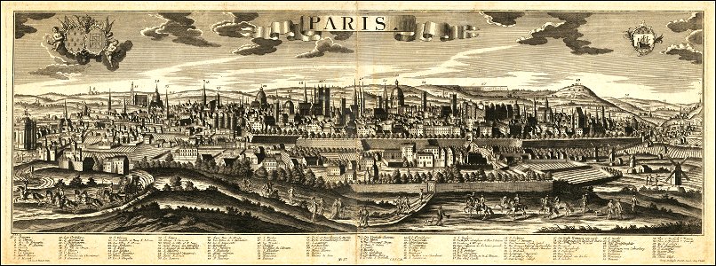
historical views of paris
1755 in paris
map of maastricht by willem and johannes blaeu (1649)
statenkwartier (maastricht)
maps of besançon by braun & hogenberg
eran laor cartographic collection
the antiquities of england and wales (1773)
1784 fleurons
algiers in the 19th century
old maps of algiers
the antiquities of england and wales (1773)
1784 fleurons
media from regionaal archief alkmaar
maps of barsingerhorn
1771 maps of asia
andrew dury
the earth and its inhabitants, vol. xii: africa, vol. iii
canary islands in the 1890s
gemeente atlas van nederland - south holland
maps of moerkapelle
eran laor cartographic collection
maps of prague by joris hoefnagel
the antiquities of england and wales (1773)
1784 fleurons
atlas des anciens plans de paris by imprimerie nationale, 1880 from bhvp
plan de roussel
gemeente atlas van nederland - north holland
maps of bussum
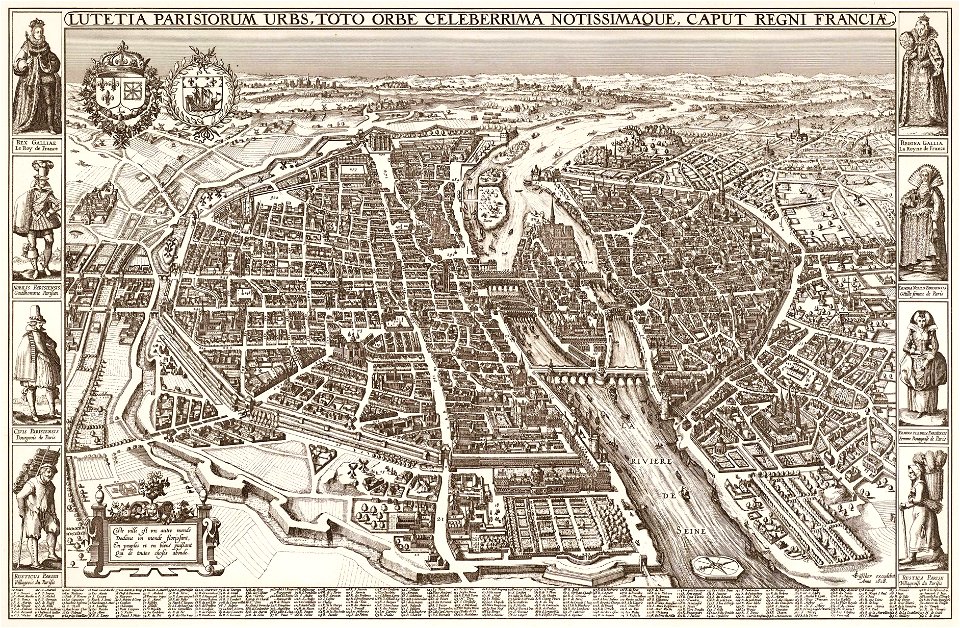
map of paris by claes jansz. visscher
bird's eye view maps of paris
map of paris by claes jansz. visscher
bird's eye view maps of paris
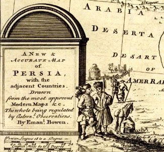
1747 persia map by emanuel bowen
cartouche (cartography)
maps from the earth and its inhabitants, vol. iv
old maps of cardiff
maps from the earth and its inhabitants, vol. x
1880s maps of egypt
maps from the earth and its inhabitants, vol. iv
19th-century maps of surrey
géographie générale; physique, politique et économique (1876)
1876 maps of germany
géographie générale; physique, politique et économique (1876)
1876 maps of germany
géographie générale; physique, politique et économique (1876)
old maps of the pyrenees
géographie générale; physique, politique et économique (1876)
1876 maps of india
géographie générale; physique, politique et économique (1876)
1870s maps of liguria
the history and antiquities of the parish of lambeth, and the archiepiscopal palace (1827)
1820s maps of london
19th-century maps of somalia
1876 maps of africa
maps from the earth and its inhabitants, vol. iv
maps of penzance
maps from the earth and its inhabitants, vol. x
1880s maps of egypt
19th-century maps of nicaragua
1870s maps of central america
maps from the earth and its inhabitants, vol. iv
1880s maps of london
maps from the earth and its inhabitants, vol. x
1880s maps of egypt
old maps of finnmark
1890s maps of norway
maps from the earth and its inhabitants, vol. x
1886 maps of africa
maps from the earth and its inhabitants, vol. iv
maps of balmoral castle
maps of the west-indische compagnie
1750 maps
het zegepralent kennemerlant
hendrik de leth
maps of country estates in the netherlands
het zegepralent kennemerlant
eran laor cartographic collection
claes jansz. visscher (ii)
eran laor cartographic collection
guillaume sanson
eran laor cartographic collection
michel van lochom
antoine-françois tardieu
jean-baptiste poirson
plan de dheulland - derivatives files
ruisseau de ménilmontant
carte des côtes de malabar et de coromandel (1723)
philippe buache
tresor des cartes geographiques (1659)
1650s maps of iran
bibliothèque nationale de france
sanson map of lorraine
beschreibung und contrafactur der vornembster stät der welt, liber primus civitates orbis terrarum
maps of genoa by braun & hogenberg
beschreibung und contrafactur der vornembster stät der welt, liber primus civitates orbis terrarum
maps of rhodes by braun & hogenberg
beschreibung und contrafactur der vornembster stät der welt, liber primus civitates orbis terrarum
maps of montpellier by braun & hogenberg
tresor des cartes geographiques (1659)
1650s maps of portugal
beschreibung und contrafactur der vornembster stät der welt, liber primus civitates orbis terrarum
maps of lübeck by braun & hogenberg
tresor des cartes geographiques (1659)
1650s maps of the americas
tresor des cartes geographiques (1659)
1650s maps of denmark
tresor des cartes geographiques (1659)
1650s maps of ethiopia
tresor des cartes geographiques (1659)
1650s maps of china
bibliothèque nationale de france
sanson map of lorraine
beschreibung und contrafactur der vornembster stät der welt, liber primus civitates orbis terrarum
maps of toledo by braun & hogenberg
tresor des cartes geographiques (1659)
1650s maps of france
beschreibung und contrafactur der vornembster stät der welt, liber primus civitates orbis terrarum
maps of écija by braun & hogenberg
tresor des cartes geographiques (1659)
1650s maps of asia
beschreibung und contrafactur der vornembster stät der welt, liber primus civitates orbis terrarum
maps of wittenberg by braun & hogenberg
11101 - 11200 of 27,441
Next page
/ 275