Log in
All resources
Create a design
27,441 Free Images of Maps
bibliothèque nationale de france
eran laor cartographic collection
latin-language maps
tresor des cartes geographiques (1659)
beschreibung und contrafactur der vornembster stät der welt, liber primus civitates orbis terrarum
maps by willem and johannes blaeu
maps in the rijksmuseum amsterdam
paper
british museum
italian-language maps
beschreibung und contrafactur der vornembster stät der welt, liber primus civitates orbis terrarum
maps of vienna by braun & hogenberg
tresor des cartes geographiques (1659)
1650s maps of italy
beschreibung und contrafactur der vornembster stät der welt, liber primus civitates orbis terrarum
maps of kassel by braun & hogenberg
beschreibung und contrafactur der vornembster stät der welt, liber primus civitates orbis terrarum
maps of würzburg by braun & hogenberg
tresor des cartes geographiques (1659)
1659 maps of africa
tresor des cartes geographiques (1659)
1659 maps of europe
beschreibung und contrafactur der vornembster stät der welt, liber primus civitates orbis terrarum
maps of dresden by braun & hogenberg
beschreibung und contrafactur der vornembster stät der welt, liber primus civitates orbis terrarum
maps of brouwershaven by braun & hogenberg
tresor des cartes geographiques (1659)
1650s maps of greece
tresor des cartes geographiques (1659)
1650s maps of turkey
tresor des cartes geographiques (1659)
1650s maps of hungary
tresor des cartes geographiques (1659)
1650s maps of the americas
beschreibung und contrafactur der vornembster stät der welt, liber primus civitates orbis terrarum
maps of nîmes by braun & hogenberg
maps of the dutch east india company - sri lanka
1787
old maps of the strait of gibraltar
maps in the rijksmuseum amsterdam
maps from university of amsterdam special collections
atlas der neederlanden
the comprehensive history of england (1876)
english-language maps showing history
1877 maps of the united states
1870s maps of utah
historical collections of the state of new jersey (1852)
1850s maps of new jersey
atlas der neederlanden deel ix: algemeene kaarten & coloniën
maps from university of amsterdam special collections
old maps of galicia (spain)
1834 in galicia (spain)
bibliothèque nationale de france
maps of goa by linschoten
maps of flensburg by braun & hogenberg
johannistor (flensburg)
personifications of iran
britannia
old maps of the kingdom of naples
giovanni antonio rizzi zannoni
old maps of the strait of gibraltar
hendrik de leth
dutch 17th-century prints in the rijksmuseum amsterdam
maps by daniel stoopendaal
maps of hunsrück
jean hardy
old maps of delhi
catalan atlas
topographischer atlas der schweiz
eiger
old maps of the canton of zürich
türlersee
korte beschryvinghe (1686)
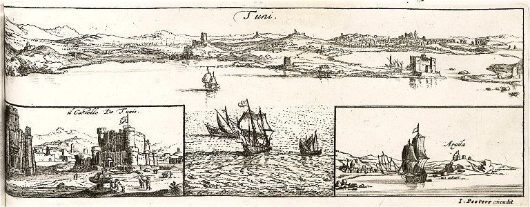
old maps of tunis
18th-century maps of istanbul
1771 maps of turkey
17th-century maps of the spanish empire
maps of the spanish netherlands
old maps of atlantis
island of california
prints from manesson travaux de mars at the peace palace library
old maps of brest from musée de bretagne
accademia delle scienze di torino - fondo millon
media from accademia delle scienze di torino
adriaan schoonebeek
emajõgi
postcards by erwin spindler
postcards of meißen
maps of uithuizermeeden
oldenzijl
bibliothèque nationale de france
maps by thomas kitchin
maps of mexico city by braun & hogenberg
maps of cusco by braun & hogenberg
maps by willem and johannes blaeu
1630s maps of asia
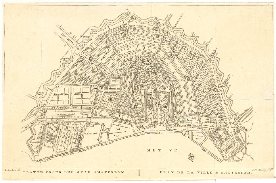
old maps of amsterdam
evert maaskamp
maps in the rijksmuseum amsterdam
1690s maps of the netherlands
corsica in the 20th century
guido colucci
san nicola in arcione
renaissance
maps of the iberian peninsula by mercator-hondius
maps by pieter van der keere
maps of the iberian peninsula by mercator-hondius
maps by pieter van der keere
maps of braga by braun & hogenberg
ceiling of the terrace of the geographical maps (uffizi gallery, florence)
maps by christian sgrothen
old maps of zeeland
ceiling of the terrace of the geographical maps (uffizi gallery, florence)
mannerism
ross township, butler county, ohio
hill forts in the united states
maps by willem and johannes blaeu
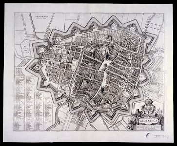
old maps of groningen (city)
curt teich postcard archives
leather postcards
maps by willem and johannes blaeu
old maps of friesland
second geological survey of pennsylvania report of progress ppp
james hall
curt teich postcard archives
map postcards
cartouche (cartography)
cornelis de jode
maps by willem and johannes blaeu
old maps of friesland
maps by willem and johannes blaeu
old maps of friesland
old maps of southeast asia
maps by isaak tirion
maps of aden by braun & hogenberg
aden
eran laor cartographic collection
giovanni maria cassini
library of congress artist posters collection
harper's magazine posters, 1895
claes jansz. visscher (ii)
atlas van stolk
eran laor cartographic collection
giovanni maria cassini
eran laor cartographic collection
francesco lamarra
eran laor cartographic collection
giovanni maria cassini
19th-century maps of groningen (province)
old maps of groningen (city)
maps in the library of congress
civitates orbis terrarvm
lawrence h. slaughter collection of english maps, charts, globes, books and atlases
covens en mortier
maps in the library of congress
civitates orbis terrarvm
maps in the library of congress
civitates orbis terrarvm
geographia universalis (1545) in the british museum
german renaissance,northern renaissance
maps of emden by braun & hogenberg
coats of arms of cirksena family
eran laor cartographic collection
willem blaeu
eran laor cartographic collection
gottfried hensel
eran laor cartographic collection
william henry toms
eran laor cartographic collection
gerard valck
eran laor cartographic collection
william hughes (geographer)
gemeente atlas van nederland - south holland
maps of nieuwerkerk aan den ijssel
eran laor cartographic collection
willem blaeu
eran laor cartographic collection
william hughes (geographer)
eran laor cartographic collection
hendrik hondius the younger
eran laor cartographic collection
pieter van der keere
broadsheet prints from koninklijke bibliotheek - maps
broadsheet prints from koninklijke bibliotheek
eran laor cartographic collection
pieter van der keere
eran laor cartographic collection
joan blaeu
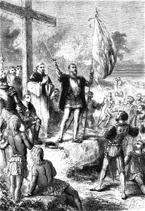
pedro álvares cabral in art
discovery of brazil
sanson map of the german empire (17th century)
sanson maps of the circles of germany
maps of london by braun & hogenberg
maps in the british museum
sanson map of the german empire (17th century)
sanson maps of the circles of germany
pieter verbiest (ii)
maps from gallica
la virginea pars
paper
maps in the library of congress
1718 maps of north america
maps of london by braun & hogenberg
maps in the british museum
maps by alexis-hubert jaillot
old maps of duchy of cleves
la virginea pars
secotan
11201 - 11300 of 27,441
Next page
/ 275